Ticker for August 16, 2018
MESONET TICKER ... MESONET TICKER ... MESONET TICKER ... MESONET TICKER ...
August 16, 2018 August 16, 2018 August 16, 2018 August 16, 2018
Round 2??
Remember two nights ago when all May broke out in mid-August? Well, apparently
it ain't over just yet. More severe weather is *possible* later today into
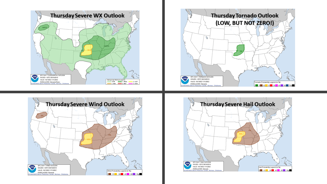
tonight, and as you can see from the Storm Prediction Center maps above, it could
get dicey across most of the state, but especially into the NE quadrant. The
tornado threat isn't zero, but it's not the big worry today. More of a
wind/hail/heavy rain thingamajig.
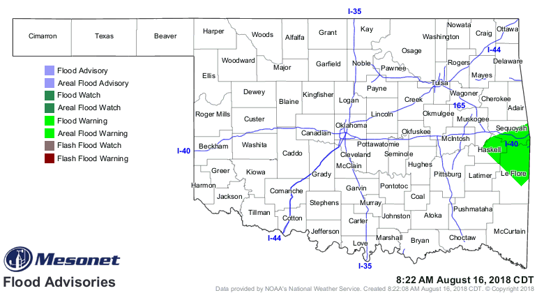
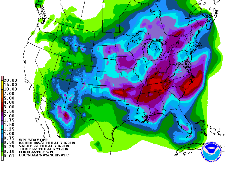
And parts of NE OK do need that heavy rain (but some parts don't!):

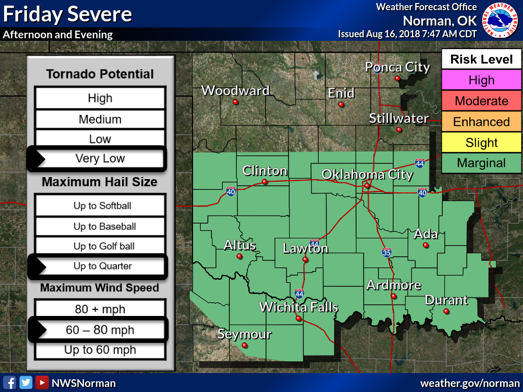
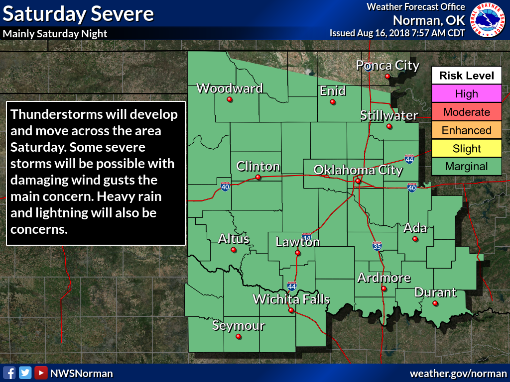
That's not the only chance, either. Those rain (and storms and svr wx) chances
will extend into the weekend.
Severe weather aside (as if that was even possible!)...more rain as well.
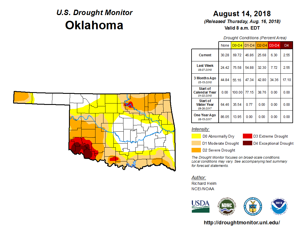
Today's Drought Monitor report, taking into account the rain that fell through
Tuesday morning, does show some improvements across southern and NW OK.
Unfortunately, most of the heavy rain fell in areas not really hurting as bad
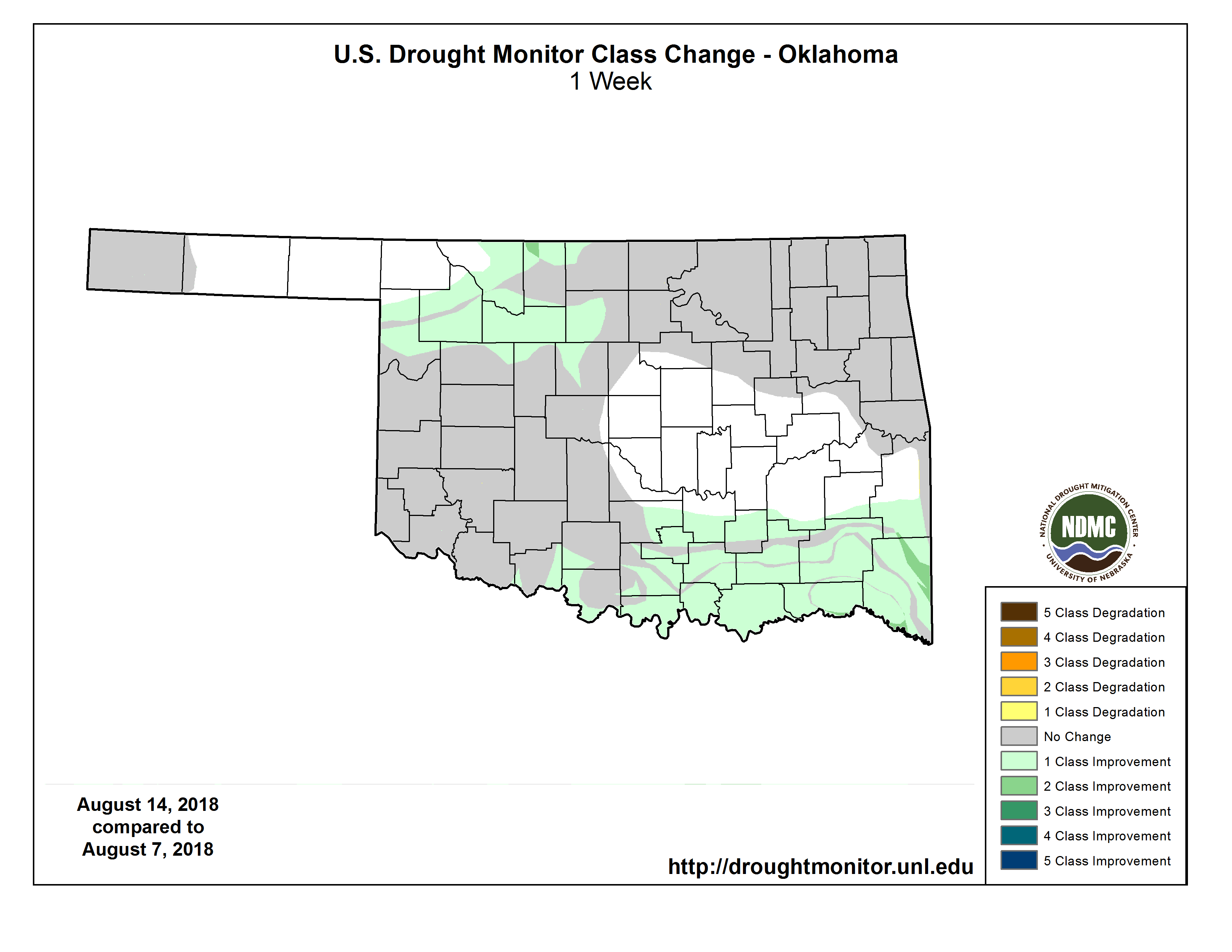
as those others. The 1-week DM change map shows where those improvements were.
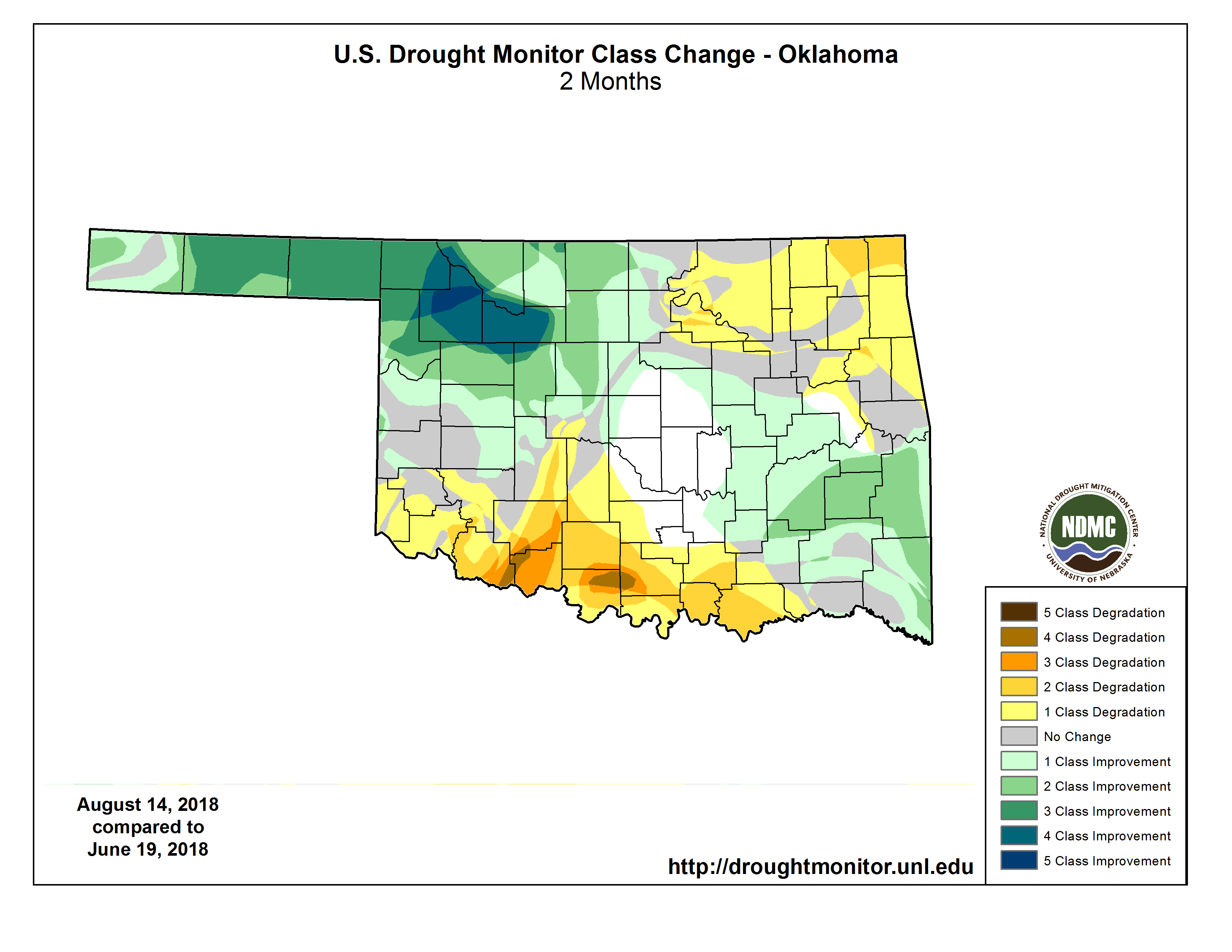
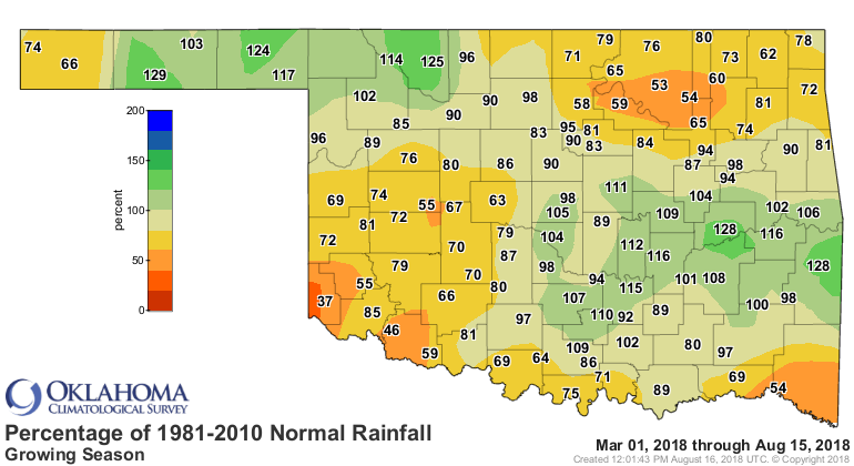
The reason we still have so much drought is detailed on the 2-month DM change
map. Lots of intensification across southern and NE OK over that time frame,
which matches up pretty well with the March 1-Aug. 15 pct of normal map from the
Mesonet.
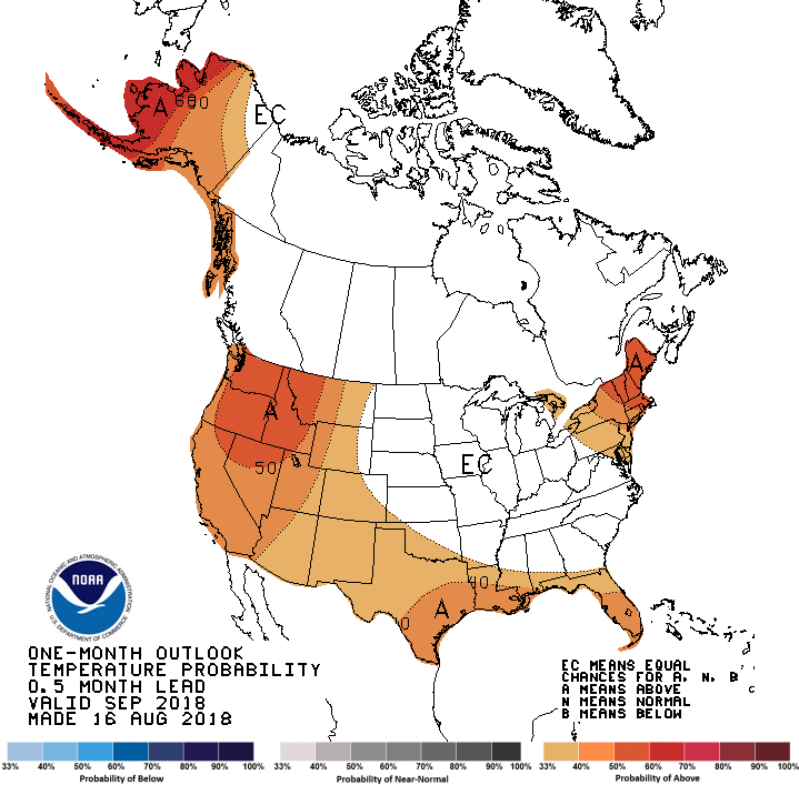
But how does September look, as we gaze 2-6 weeks out? Well, according to the
Climate Prediction Center, we have increased odds of above normal temperatures
across southern through northwestern OK and below normal precipitation across
western OK, but especially the western Panhandle.

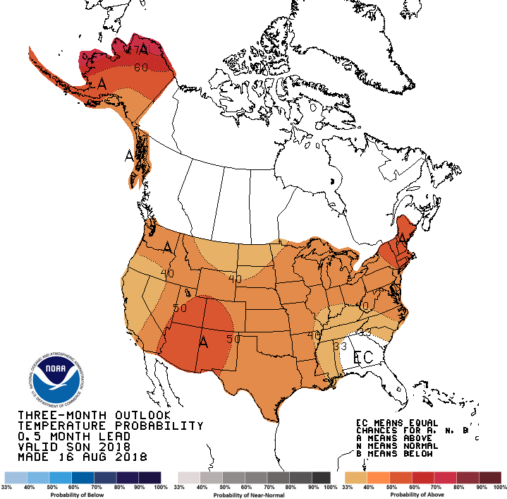
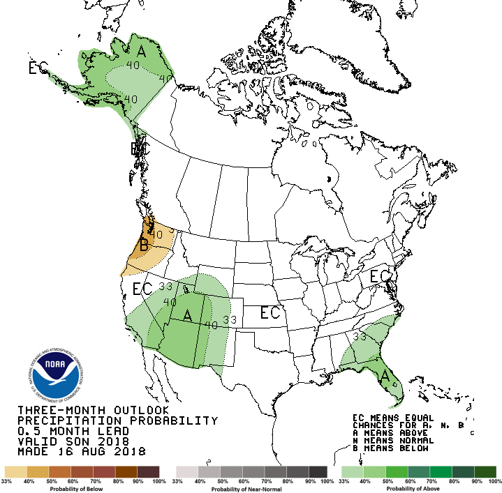
When we extend that out another couple of months to encompass the September-
November period, we see increased odds of above normal precipitation and equal
chances of above-, near- and below-normal precip. No, not "normal," but equal
odds of any of those three categories occurring. Regardless, that would be
what we saw looking back when we reach the end of November. Any weather extremes
would be smoothed out, so remember...day-to-day weather will still give us
the old Oklahoma Roller Coaster at times.
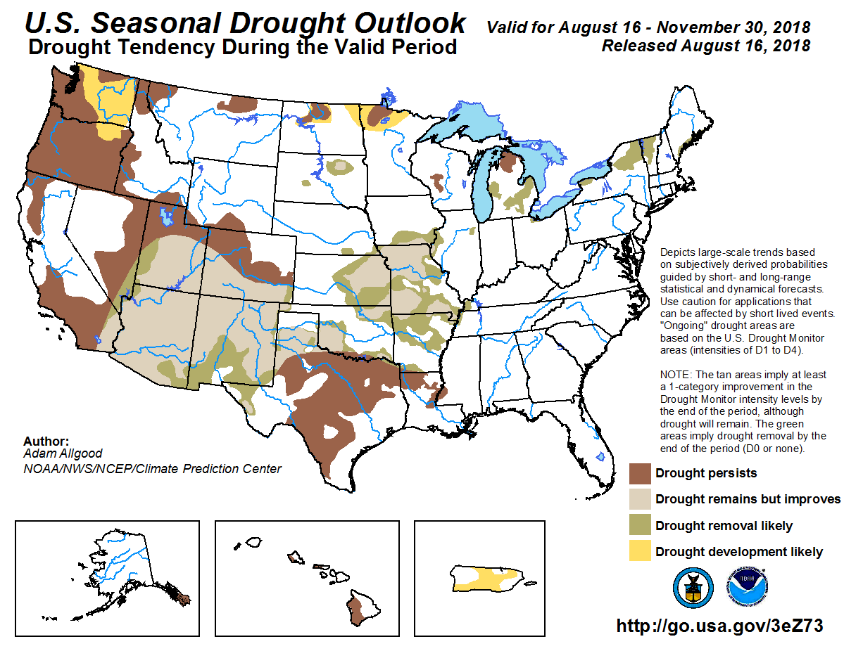
CPC's Seasonal Drought Outlook for today through November bears some good news
with drought expected to improve or even completely removed over much of the
state, with just the edge along the Red River expected to persist.
Let's get through the next few days first. Then we can worry about September,
and then October, and then November. Of course, by that time we'll be worrying
about December, then January, then February.
Heck, we should just get our winter coats out now!
Gary McManus
State Climatologist
Oklahoma Mesonet
Oklahoma Climatological Survey
(405) 325-2253
gmcmanus@mesonet.org
August 16 in Mesonet History
| Record | Value | Station | Year |
|---|---|---|---|
| Maximum Temperature | 108°F | MANG | 2024 |
| Minimum Temperature | 53°F | BRIS | 2016 |
| Maximum Rainfall | 3.48″ | KENT | 2010 |
Mesonet records begin in 1994.
Search by Date
If you're a bit off, don't worry, because just like horseshoes, “almost” counts on the Ticker website!