Ticker for April 22, 2021
MESONET TICKER ... MESONET TICKER ... MESONET TICKER ... MESONET TICKER ...
April 22, 2021 April 22, 2021 April 22, 2021 April 22, 2021
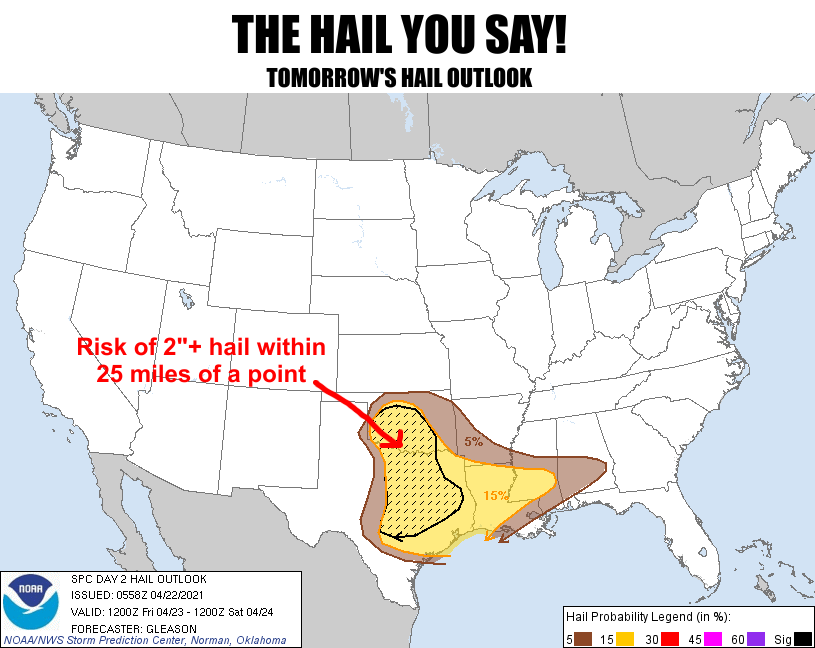
To hail with this
Yes, it's another Ticker where I substitute common words for curse words in a
display of sophomoric (more like junior high) humor. It was either that or a
Star Trek "HAILING FREQUENCIES OPEN" meme. Dang, I should have gone with that!
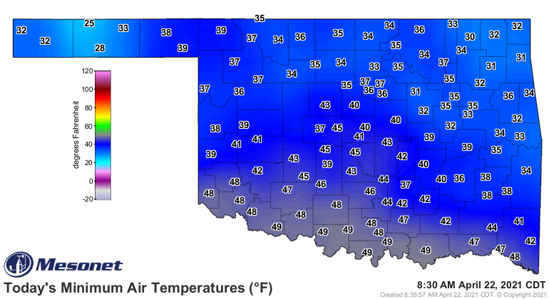
Anyway, fresh off our widespread freeze yesterday, we had a few holdovers this
morning. Eva decided to come in with a ridiculous 25 degrees, and various others
across NW and NE Oklahoma also fell to the freezing mark.
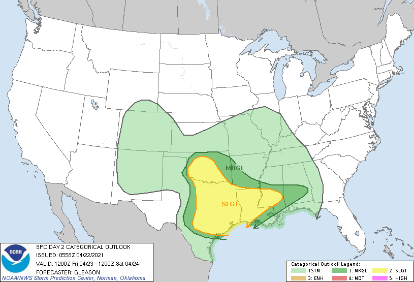
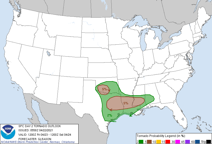
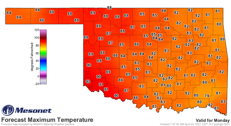
Now we go back to our regularly scheduled spring starting tomorrow with another
of THOSE days in Oklahoma. We'll have a dryline to our west and a surge of
moisture coming our way. With enough daytime heating, we will see the possibility
of storms developing tomorrow afternoon, and with that comes the chance for the
normal spring severe weather modes (including tornadoes, which looks like a
low chance for now, but not zero).
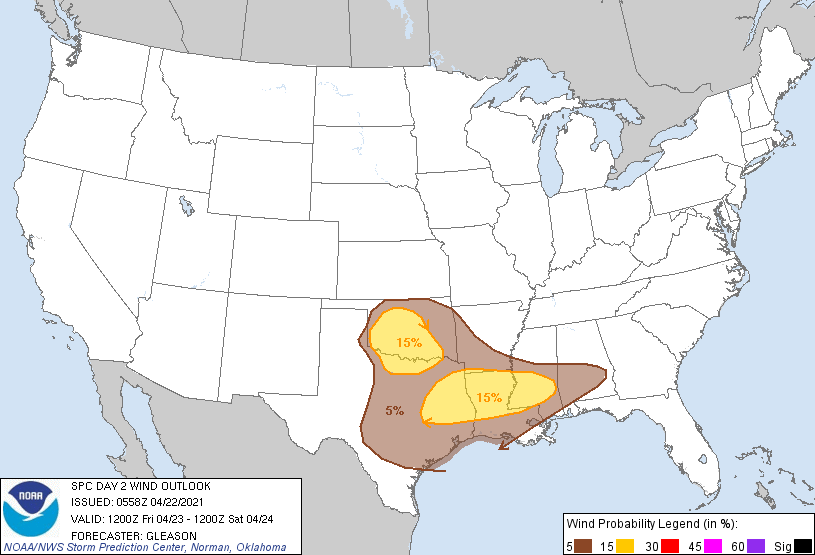
More than 24 hours out so of course you'll want to stay weather aware and check
with your favorite media and local NWS sources tomorrow leading up to the
possible event. Then we look ahead to a nice warm weekend (probably be windy...
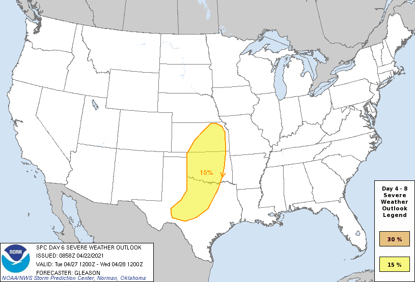
ain't it always?) and our next chance for severe weather next Tuesday. Not
to be alarming (OMG!!!...just kidding), but seeing SPC throw up a 15% risk
on day 6 is a BIT alarming. It could REALLY be one of THOSE days (where I
RANDOMLY capitalize WORDS in MY Ticker).
The cool weather has largely kept severe weather contained thus far this
spring, but as that cool weather goes away, we'll see more chances for big
severe days.
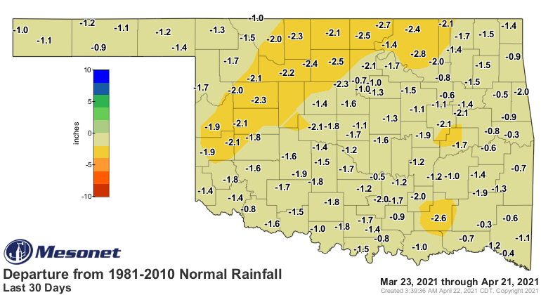
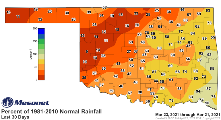
Speaking of severe, we still have problems with severe drought across south
central and central OK, as well as the far western Panhandle.
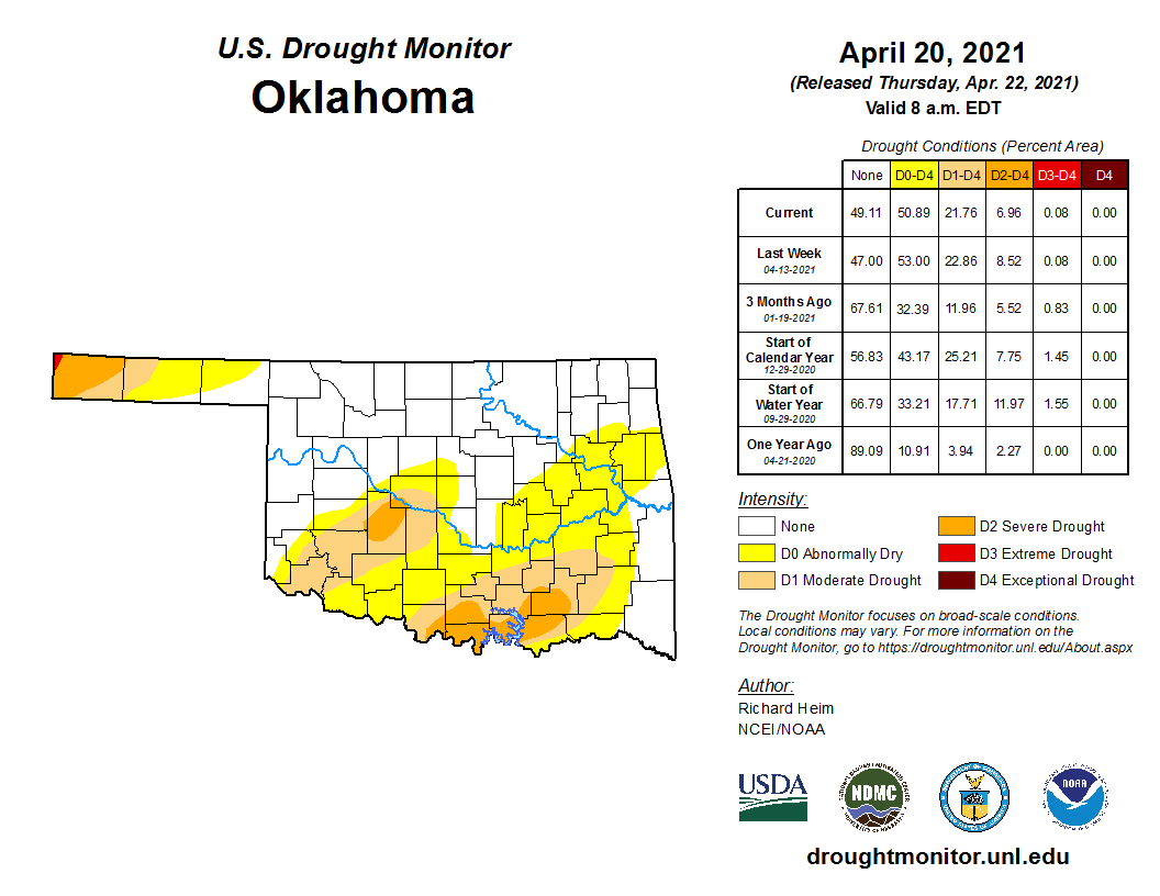
This is another area where the cool weather has aided us. If we had seen lots
of hot, windy days as we often do during April, the deficits we see over the
last 30 days or so would have meant more drought expansion and intensification.
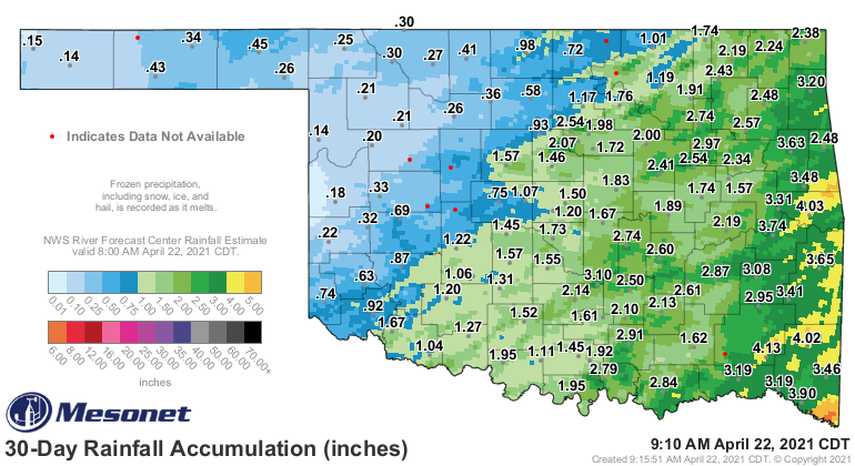
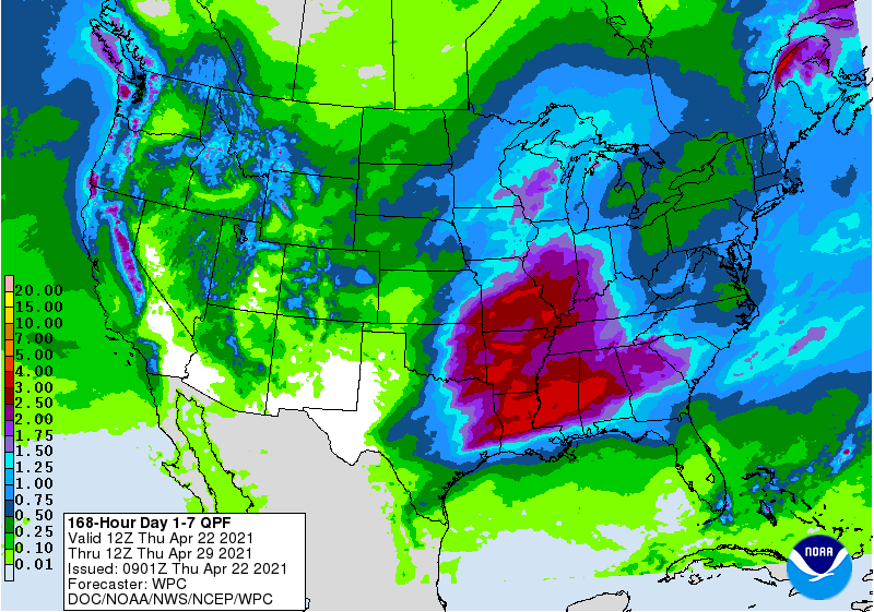
Since we are into late April by now, the chance for rain will come with storms
most of the time. So be it. There are some big rains forecast over the next
week with Friday and Tuesday's storm systems, but most of that will depend
on where the dryline is, where storms possibly initiate along that dryline (if
at all), and how soon those storms transform into a squall line (if at all),
filling in the gaps. As is often the case with these types of storms, western
OK will spend more time BEHIND the dryline than ahead of it, with more discrete
storms when they initiate, so less rain for them.
Lots can change between now and then...even tomorrow, but we will now need to
start watching northwestern OK where the moisture has become scarce over the
last month.
Watch for not only spring to come rushing back this weekend, but early summer
as well as we get into next week.
Who's ready?
I'm ready.
You ready?
Helen Reddy.
Helen's ready?
She better be...here comes spring!
Gary McManus
State Climatologist
Oklahoma Mesonet
Oklahoma Climatological Survey
(405) 325-2253
gmcmanus@mesonet.org
April 22 in Mesonet History
| Record | Value | Station | Year |
|---|---|---|---|
| Maximum Temperature | 98°F | WALT | 2011 |
| Minimum Temperature | 25°F | EVAX | 2021 |
| Maximum Rainfall | 6.48″ | MCAL | 1996 |
Mesonet records begin in 1994.
Search by Date
If you're a bit off, don't worry, because just like horseshoes, “almost” counts on the Ticker website!