Ticker for April 20, 2021
MESONET TICKER ... MESONET TICKER ... MESONET TICKER ... MESONET TICKER ...
April 20, 2021 April 20, 2021 April 20, 2021 April 20, 2021
How low can we go
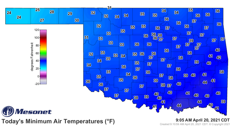
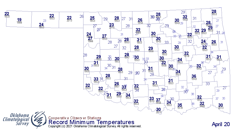
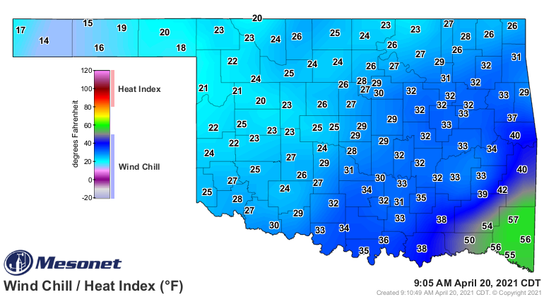
Just a quick Tick to Tock about this stupidly cold weather we're having. Not TOO
many broken records this morning, except up int he Panhandle probably. We got
a bit too close other places, but the hard freeze occurred up in the far far
northwest. Those 24s up there in Kenton and Boise City, in fact, tied for the
eighth lowest temperatures ever recorded for this date. Lowest ever was 19 degrees
at Boise City in 1966, but close behind was a 22 at Beaver back in 2013. So yes,
it was cold. And it's gonna stay cold. Our next chance at breaking records happens
later today as we see just how much we warm up. If the forecast highs hold true
to form, we'll see a lot more records for low maximum temperatures for this date.
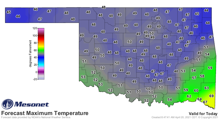
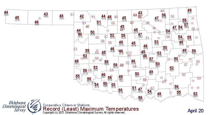
Other than that, as mentioned, just stupidly cold right now. WAYYYYYY too cold for
April 20 for sure.
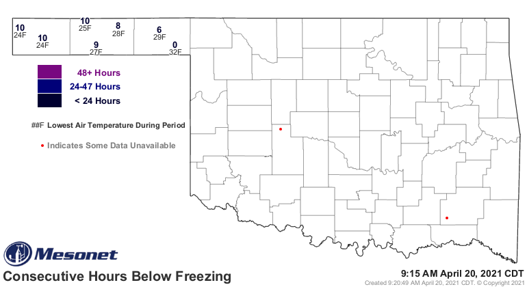
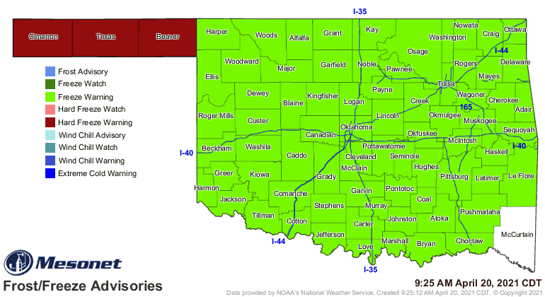
That freeze in the Panhandle was a doozy, too, at least 10 consecutive hours and
down to as low as the aforementioned 24 degrees.
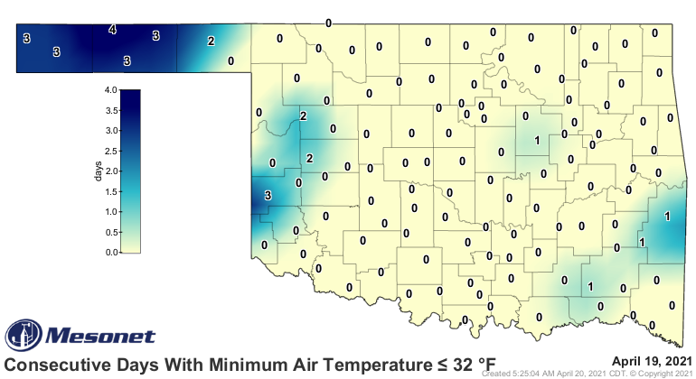
And for some stations up that way, that's the 4th or 5th day in a row with
freezing weather (this map updates at the end of the day, so add one).
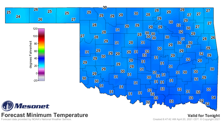
Tomorrow's another day, and that probably means a much more widespread freeze.
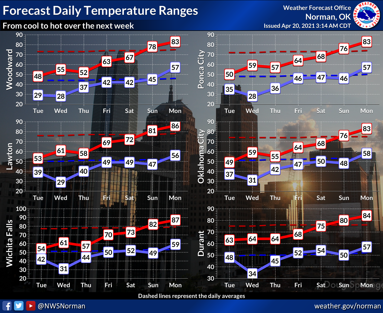
Let's look at the bright side. No, not the sky, that's gray! How about the
7-day temperature outlook? It's all upwards from here.
Gary McManus
State Climatologist
Oklahoma Mesonet
Oklahoma Climatological Survey
(405) 325-2253
gmcmanus@mesonet.org
April 20 in Mesonet History
| Record | Value | Station | Year |
|---|---|---|---|
| Maximum Temperature | 98°F | GRA2 | 2022 |
| Minimum Temperature | 24°F | BOIS | 2021 |
| Maximum Rainfall | 2.06″ | MEDF | 2004 |
Mesonet records begin in 1994.
Search by Date
If you're a bit off, don't worry, because just like horseshoes, “almost” counts on the Ticker website!