Ticker for January 5, 2016
MESONET TICKER ... MESONET TICKER ... MESONET TICKER ... MESONET TICKER ...
January 5, 2016 January 5, 2016 January 5, 2016 January 5, 2016
I guess winter is here to stay
It's true. I have made it through winter thus far with long-sleeved shirts,
sweatshirts, jackets and hooded pullovers (I have an extensive wardrobe, no?)
with no difficulty. In fact, some days in December I managed to make it through
the day in a t-shirt. This morning, however, I finally had enough and dug out
my winter coat for the first time since early March. So from mid-March through
Christmas day, I was coatless.
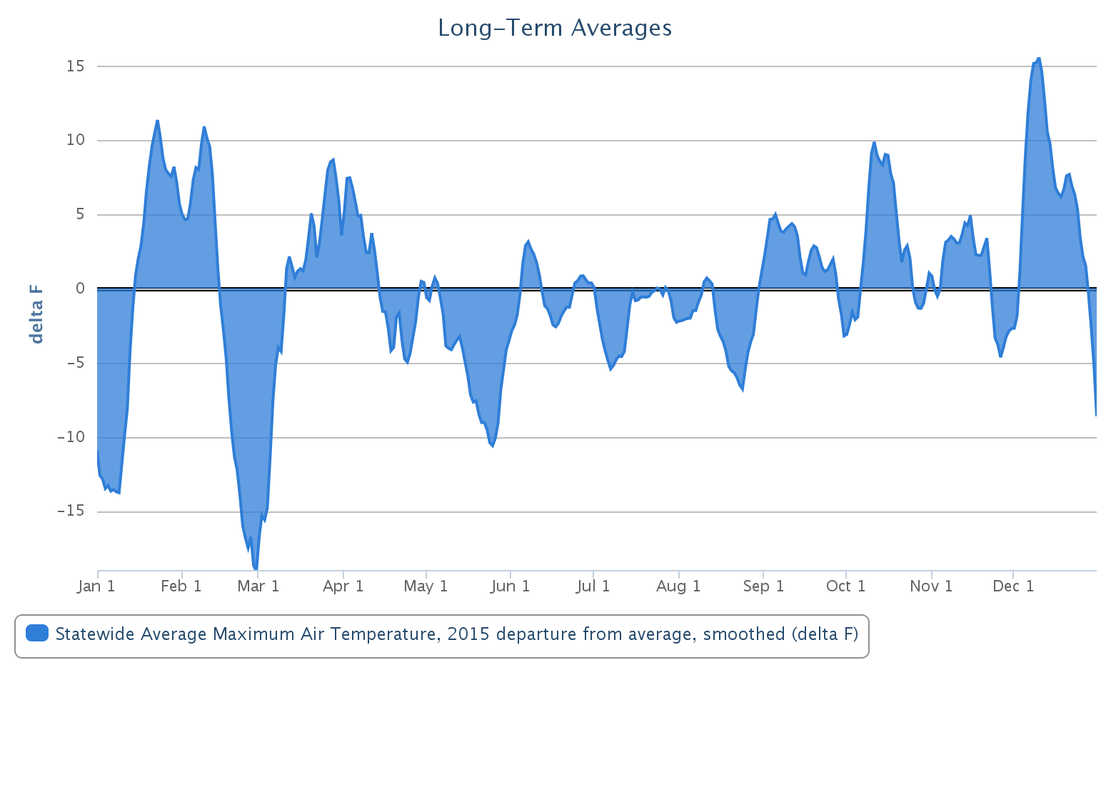
Check out the statewide average departure from average high temperature graph
from the Mesonet for 2015. Notice the extremely cold late February and
early March, then the transition into my coatless dreamland for the following nine
months.
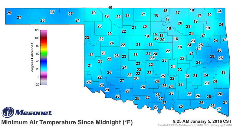
What's weird is that this wasn't even the coldest morning of the season thus far.
Sure, it was cold, and the thick frost makes it worse.
I think it's more of a realization that the 60s and 70s (and even an 80 or two!)
of December have faded into the calendar. Can you blame me, though? Look at the
comparison of high temps from Dec. 1-25 vs. Dec. 26-Jan. 4:
Period Statewide Avg. High Temp Depart from Normal
Dec. 1-25 59.9 degrees 9.2 degrees
Dec. 25-Jan. 4 43.4 degrees -4.9 degrees
It's not the number itself, obviously, since early December is normally
warmer than late December/early January, but the departure from normal figures
there are pretty striking.
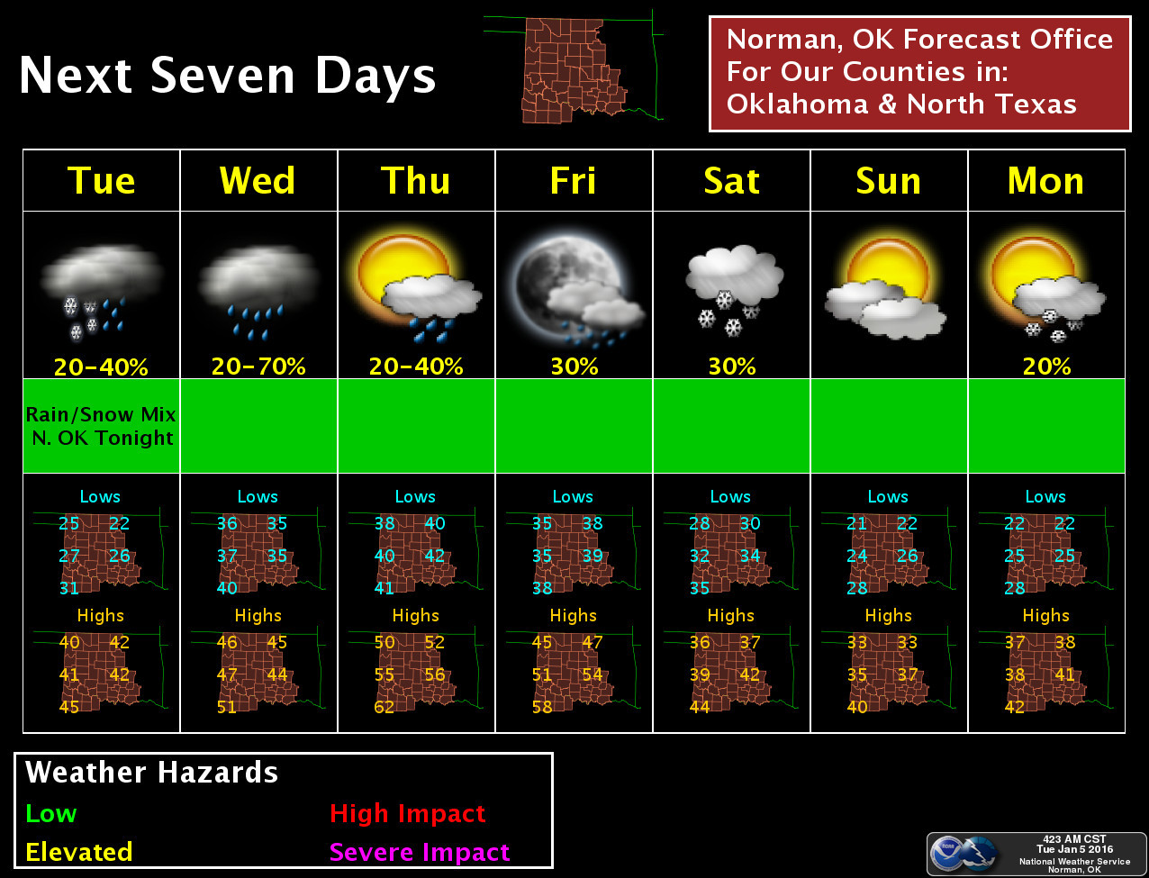
If you look at the 7-day planner from NWS Norman, you don't see many 50s
on there, other than Thursday and Friday (barely). Then another strong cold
front is poised to plunge through the state on Saturday with chances for more
frozen precip. Doesn't look like a barn freezer (as opposed to a barn burner),
but still wet and still frozen.
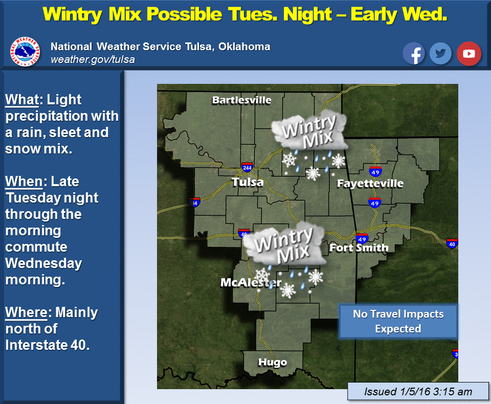
NWS Tulsa also mentions the chance for some snow overnight tonight. Again,
just light stuff.
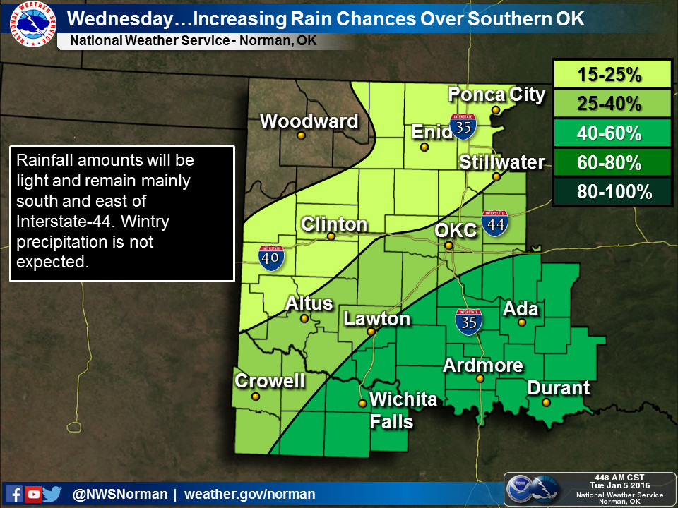
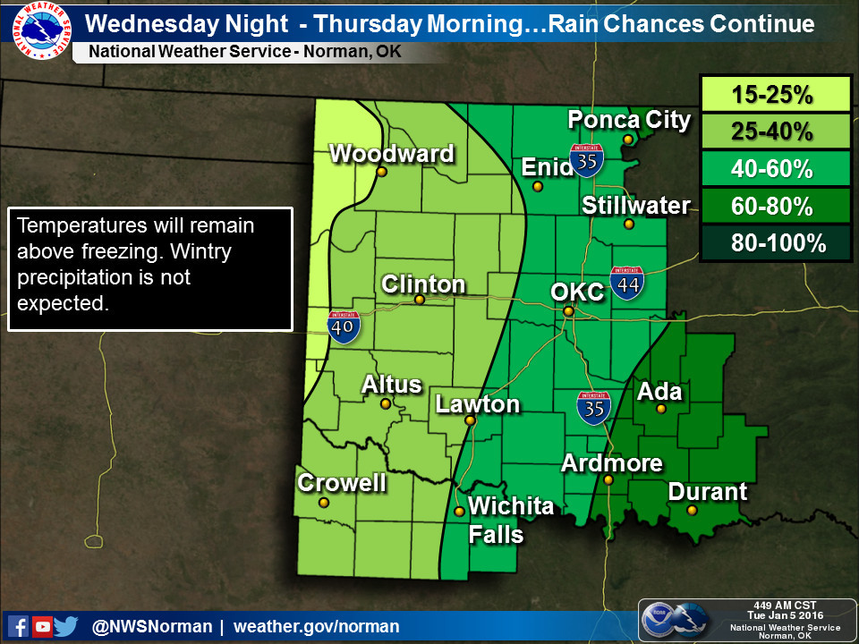
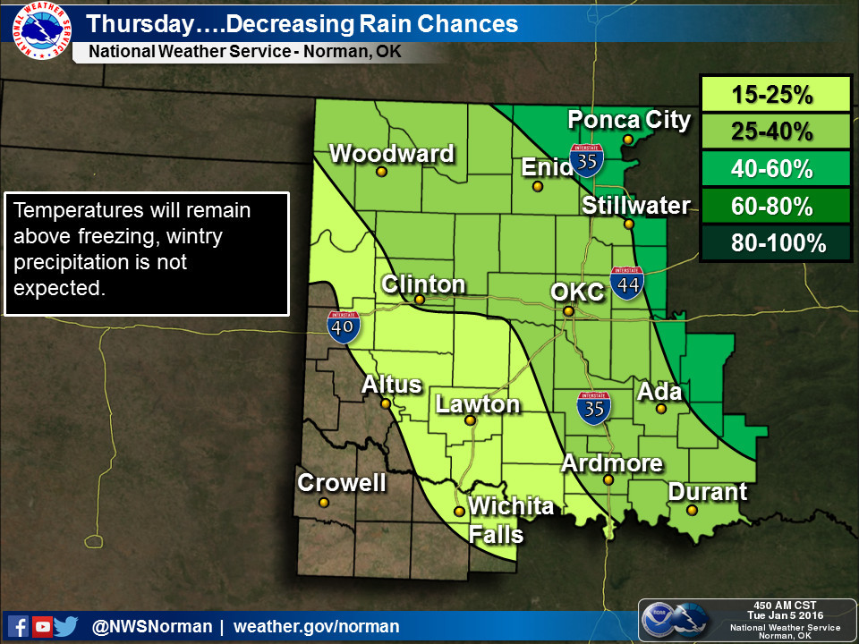
Other than that, there will be chances for a cold rain, with the most significant
precip chances coming on Wednesday across most of the state and into eastern
OK on Thursday.
Keep in mind we're still 5 days out from the weekend storm, so the amounts and
even precip types could change, but the hope is for light snow at this time
due to a limited chance for moisture return from the Gulf of Mexico. We're
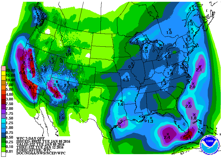
definitely not seeing a huge moisture producer this week, but check out the
moisture across California.
EL NINO MAGIC!!
Other than that, winter's here to stay for awhile. Stupid winter.
Gary McManus
State Climatologist
Oklahoma Mesonet
Oklahoma Climatological Survey
(405) 325-2253
gmcmanus@mesonet.org
January 5 in Mesonet History
| Record | Value | Station | Year |
|---|---|---|---|
| Maximum Temperature | 79°F | WAUR | 2008 |
| Minimum Temperature | -3°F | KENT | 2014 |
| Maximum Rainfall | 2.19″ | JAYX | 2005 |
Mesonet records begin in 1994.
Search by Date
If you're a bit off, don't worry, because just like horseshoes, “almost” counts on the Ticker website!