Ticker for August 31, 2020
MESONET TICKER ... MESONET TICKER ... MESONET TICKER ... MESONET TICKER ...
August 31, 2020 August 31, 2020 August 31, 2020 August 31, 2020
Latte Lunacy
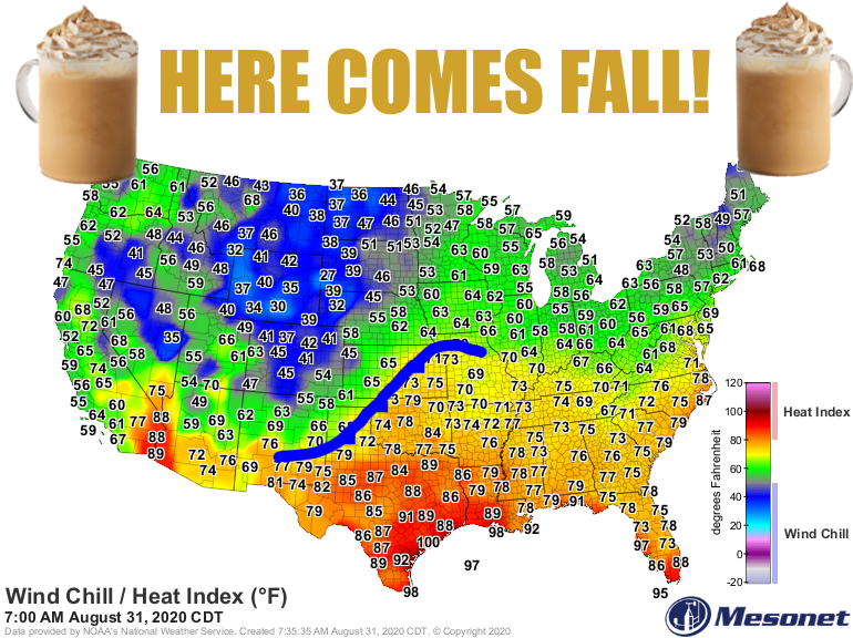
Darned if we don't get it right (errrrr, almost right?) sometimes. Amember this
graphic from last Monday, predicting a strong cold front through Oklahoma this
morning?
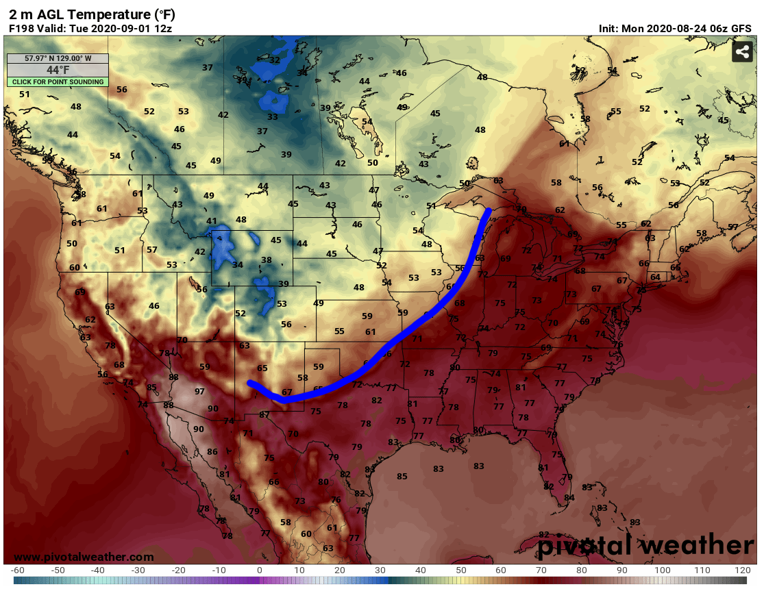
Well, like I said, we ALMOST got it right. The front is still up in Kansas, but
what's a few hundred miles amongst friends? Some friends area actually better that
way, but that's not the subject of this post. Also, the front isn't quite that
strong, but what's a few degrees amongst friends? Well, for the pumpkin spice
latte fanatics, that's likely to be enough to END friendships, but it is still a
nice cold front. The temperatures we see tomorrow after it's through should be
somewhat indicative of how things will go this week. AND, we could see this
extend into next week as well.
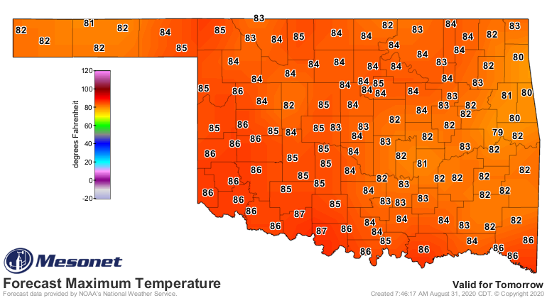
Okay, we hear ya. It's not highs-in-the-60s-break-out-the-sweaters weather, but
it isn't the 90s and 100s either, which we saw this weekend. But it will be
much cooler; below normal even, with lots of gray skies and rain around. Good
enough. And besides, you know you were going to start drinking those pumpkin
spice lattes anyway, because dang it (Okie-to-English translation: "damn it"...
I didn't want to get fired for cursing), don't we deserve it?
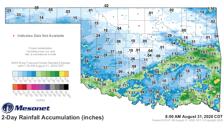
Oh yeah, the rain. Some of us need it desperately (west), while others definitely
don't (east)! What else is new, right?
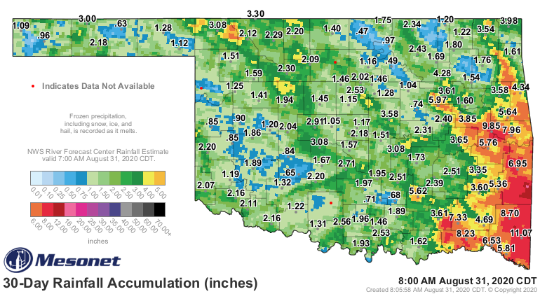
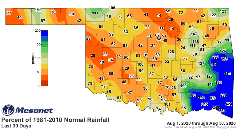
We've actually already seen some good rains along the Red River, where it was
needed pretty badly over in SW OK. And we can expect a lot more. Unfortunately,
a lot of that is going to fall across eastern OK, where they're not exactly
begging for it.
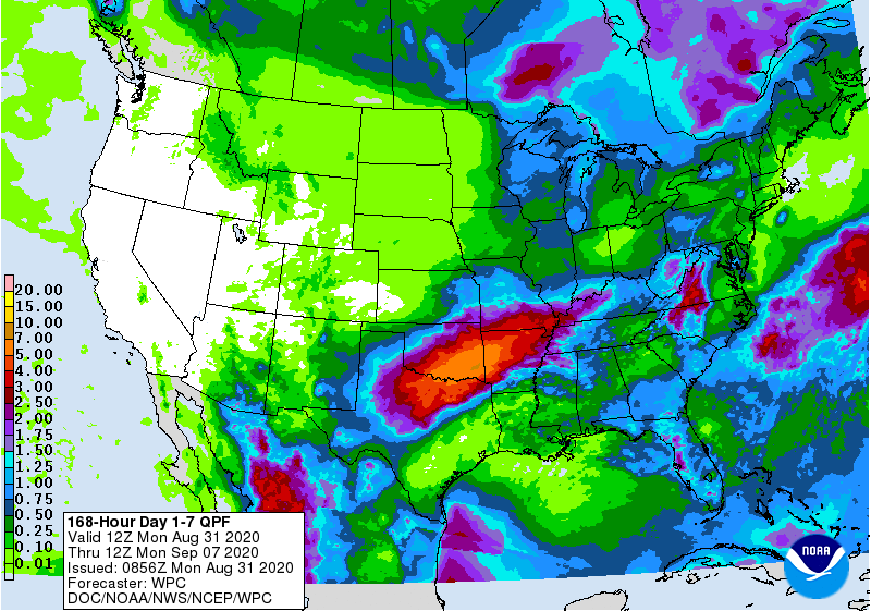
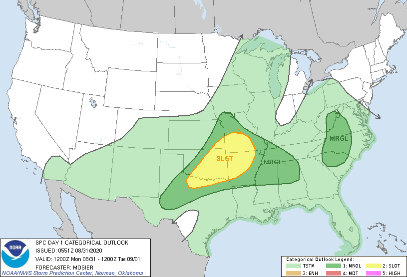
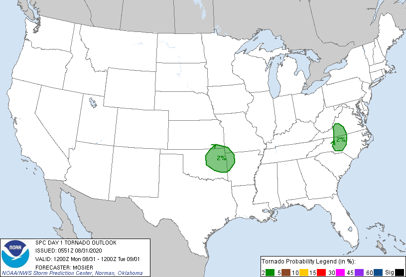
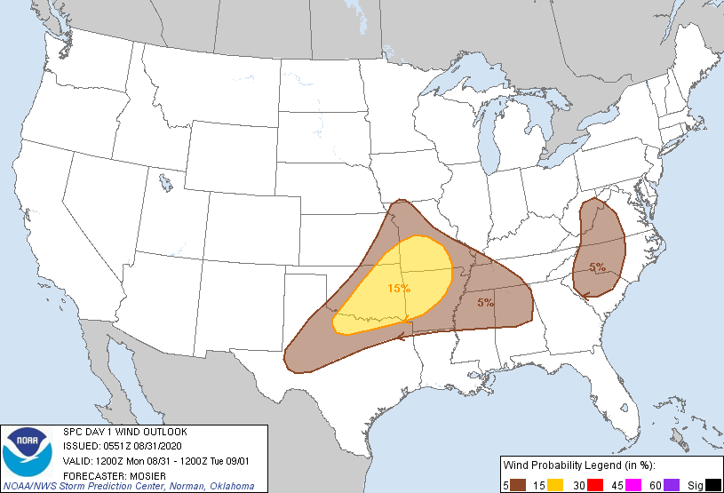
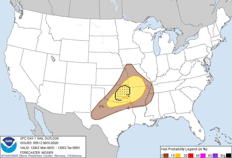
There could be some big storms today across eastern OK as well, and the
tornado threat is (come on, I know you know this already...say it with me)
LOW BUT NOT ZERO. The biggest threat will be large hail, however, and maybe
some wind.
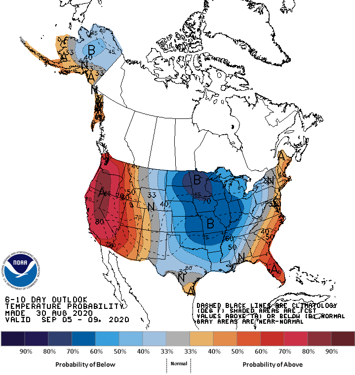
We should see several fronts over the next week or so, with maybe a bigger one
next week. That's pretty much how fall works around here, at least sometimes.
Each front takes a bit more out of the heat as the sun starts to get lower
in the sky, with more cold air to work with to our north.
Then...winter. Be afraid (of cold air). Be very afraid.
Gary McManus
State Climatologist
Oklahoma Mesonet
Oklahoma Climatological Survey
(405) 325-2253
gmcmanus@mesonet.org
August 31 in Mesonet History
| Record | Value | Station | Year |
|---|---|---|---|
| Maximum Temperature | 111°F | FREE | 2011 |
| Minimum Temperature | 45°F | NOWA | 2009 |
| Maximum Rainfall | 5.29 inches | YUKO | 2020 |
Mesonet records begin in 1994.
Search by Date
If you're a bit off, don't worry, because just like horseshoes, “almost” counts on the Ticker website!