Ticker for July 31, 2023
MESONET TICKER ... MESONET TICKER ... MESONET TICKER ... MESONET TICKER ...
July 31, 2023 July 31, 2023 July 31, 2023 July 31, 2023
Heat waving goodbye?
The way I see it, heat waves are necessary, otherwise we'd just be...San Diego?
And I'm not anxious to go watch the Padres play, unless it's some priests from
the local Monastery playing wiffle-ball out at Scissortail Park.
Jesuits 15, Franciscans 12.
Stay hydrated, fellas.
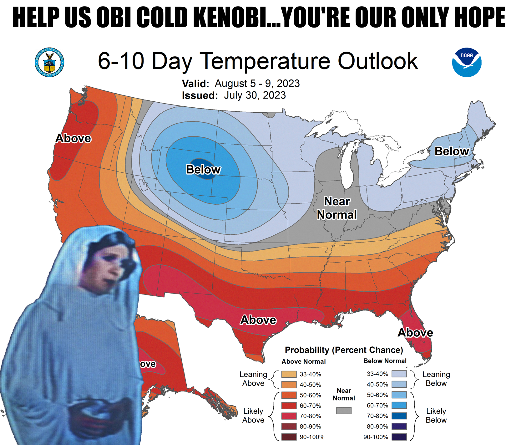
Some might think it'll take something miraculous to get this heat out of here.
Well keep wishing, because if miracles happened I'd own a hairbrush! Okay, maybe
ONE miracle coming up with a cold front sometime over the weekend, and a return
to our previous northwesterly flow--and rain chances from those storms building up
in the High Plains and moving down our way.
Rain and heat forecast for the next 5 days, bleak. Days 6 and 7? Looking up.
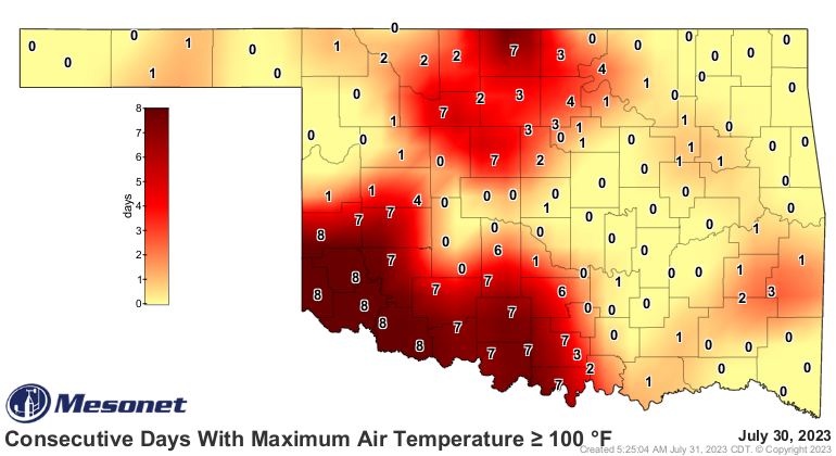
The current "heat wave" is just over a week old, although if you ask the folks
down in far SW OK, it's never gone away from when it started back in June.
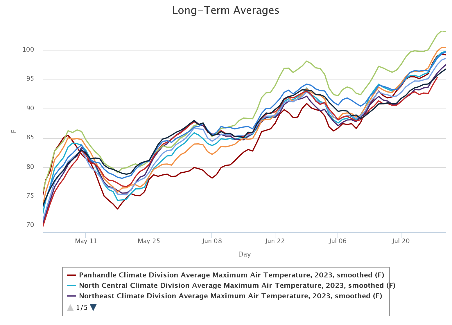
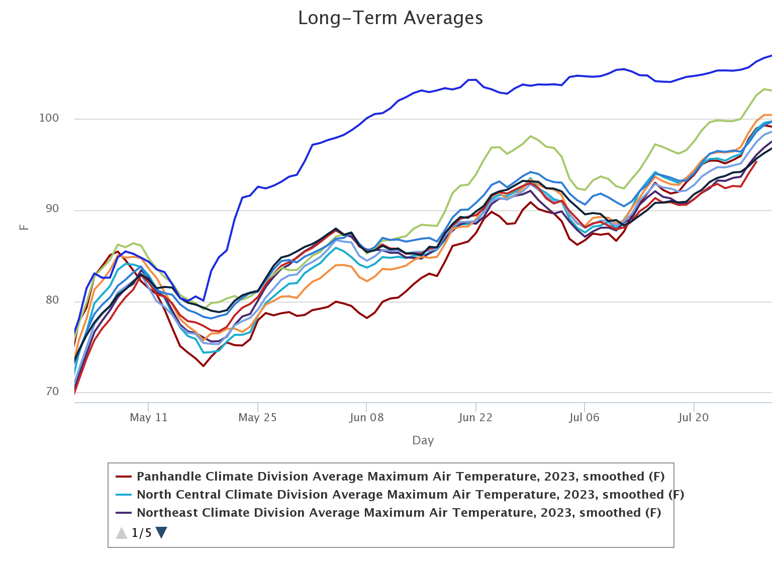
We can show southwest Oklahoma's experience even more clearly, with a graph that
ain't that clear. Yeah, that's nonsensical, but this IS the Ticker, after all,
where nonsensical is our middle name. These are the climate division averaged
high temps since May 1, as measured by the Oklahoma Mesonet, through yesterday.
Now the graph is rather nonsensical in that the lines are generally hard to
differentiate most of the time, but what I want you to concentrate on are the
Panhandle (maroon?) and Southwest (light green) climate divisions. Notice how
the Panhandle was much cooler than the rest of the state for much of May and
June? That's when they were getting inundated with those heavy rains, and
rain and clouds during the warm season generally mean mild weather. Now notice
how southwest Oklahoma's highs start to differentiate themselves from the other
climate divisions right around the beginning of June, and it's stayed that way
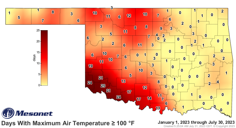
through most of the rest of summer. They HAVEN'T been getting the rain, and in
fact they've been more under the influence of that heat dome that has plagued
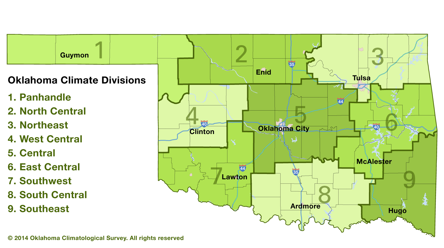
Texas for most of that period. I've thrown in a climate division map for
reference.
But hey, even this year hasn't been "as bad" as we've seen in the past. For
SW OK, this is a cakewalk compared to 2011 (same graph with 2011's SW OK line
thrown on in blue...don't worry, it's easy to pick out).
Still, heat is usually relative to your recent experiences. A recency bias, if
you will. That's why the current heat wave, even though it's short-lived, has
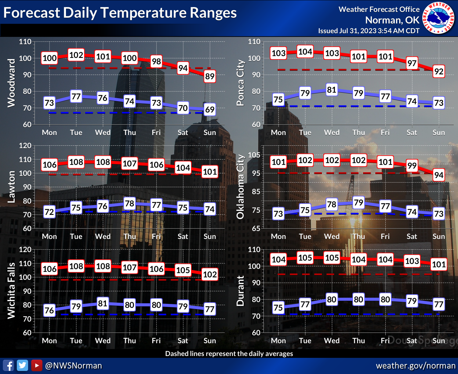
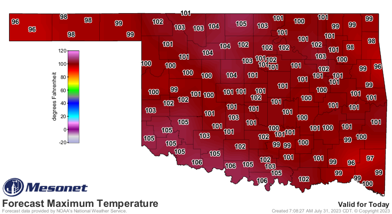
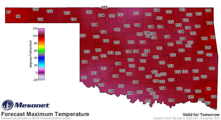
been so jarring. The worst of the heat should be today through Wednesday, then
we'll see it start to slowly wind down until the weekend.

What comes after this weekend's cool-down, a cool-down that will merely get us
mostly back to normal? Well, more of something or another. That's a forecast
for another day.
Gary McManus
State Climatologist
Oklahoma Mesonet
Oklahoma Climatological Survey
gmcmanus@mesonet.org
July 31 in Mesonet History
| Record | Value | Station | Year |
|---|---|---|---|
| Maximum Temperature | 112°F | MANG | 2012 |
| Minimum Temperature | 50°F | BOIS | 2018 |
| Maximum Rainfall | 5.02 inches | CLAY | 2014 |
Mesonet records begin in 1994.
Search by Date
If you're a bit off, don't worry, because just like horseshoes, “almost” counts on the Ticker website!