Ticker for November 30, 2020
MESONET TICKER ... MESONET TICKER ... MESONET TICKER ... MESONET TICKER ...
November 30, 2020 November 30, 2020 November 30, 2020 November 30, 2020
It just FEELS like the Rockies
With the power (none), vested in me (don't even know what "vested" means), as
the State Climatologist of Oklahoma (nobody else wanted the job), I hereby
proclaim this morning as officially "BRRR!"
Okay, I might be terrible at proclamations, but I'm only as bad as what I have to
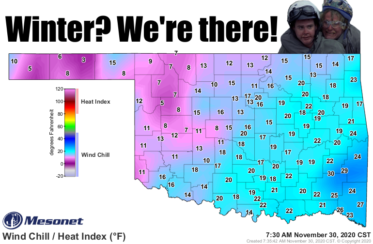
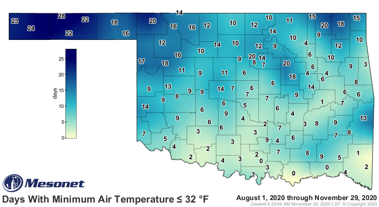
work with. Quite possibly the coldest morning of the year out there statewide,
I think we've finally arrived at official winter. The ice storm last month didn't
quite do it because we rose into the 70s and even some 80s afterwards throughout
November. Finally, on the last day, I think we've switched over to true winter
mode. So bring on the chapped lips, the flaky dry skin, the parched eyeballs...
wait, I'm being told you can "drink water" to help alleviate this. Okay, bring on
the chattering teeth, then. Our lows this morning dipped into the teens and 20s
across most of the state, and below freezing across the ENTIRE state.
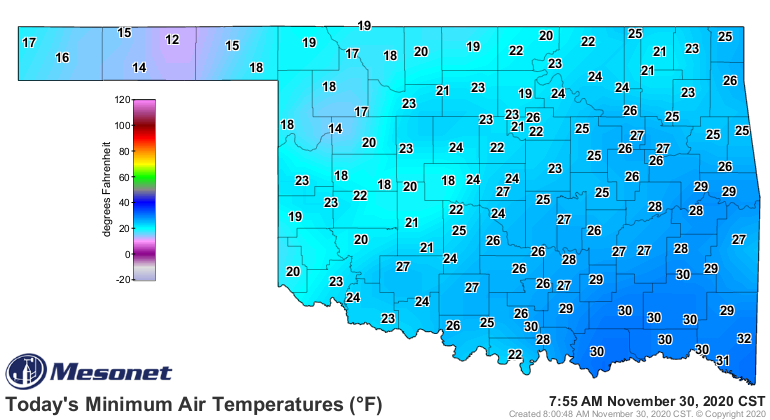
So heads up Durant, Ardmore and Hugo...you're about to lose your zeroes (and we
all know just how painful that can be).
We should rebound a little bit today and be a bit warmer tomorrow before we
take the plunge again on Wednesday.
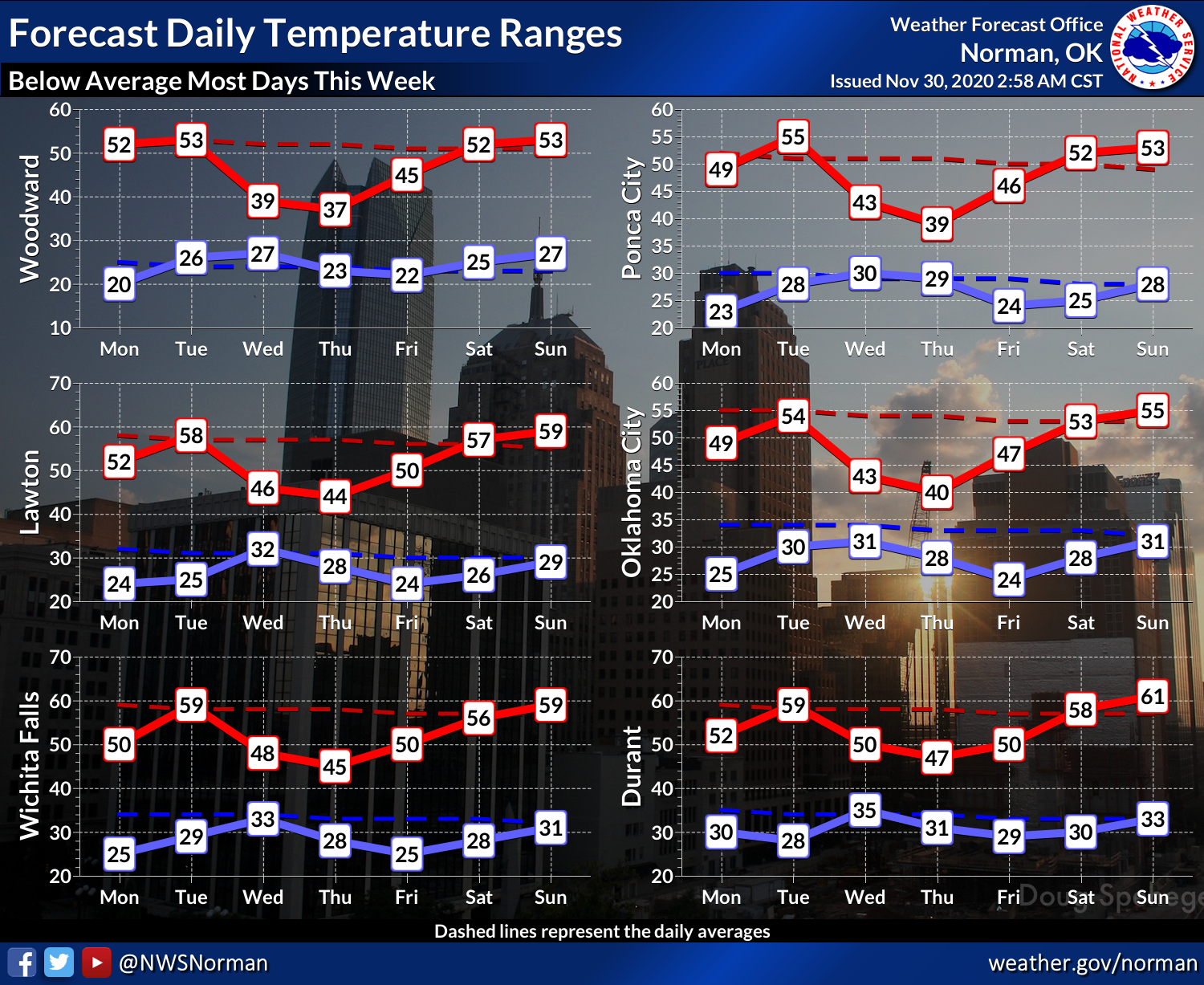
It's then that we could see some light snow with the arrival of the cold air
in addition to a bit of moisture return from the south. It's all in the timing,
but we could see a few flakes around. Snowflakes, too, once you're done
people-watching.
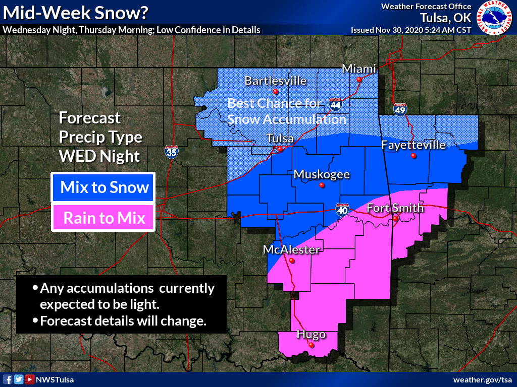
Quoting NWS Tulsa: "A strong upper level low will move into the southern
Plains on Wednesday, with increasing chances of rain during the day.
Temperatures may cool enough to support a rain/snow mix or all snow across
parts of the area Wednesday night into early Thursday. The best chances for
any light accumulations will be closer to the Oklahoma and Kansas border and
possibly into parts of northwest Arkansas as the system exits."
Extend that to the southwest for the rest of the state and you get the picture.
Well, I'll just give you the picture if you're going to be that way about it!
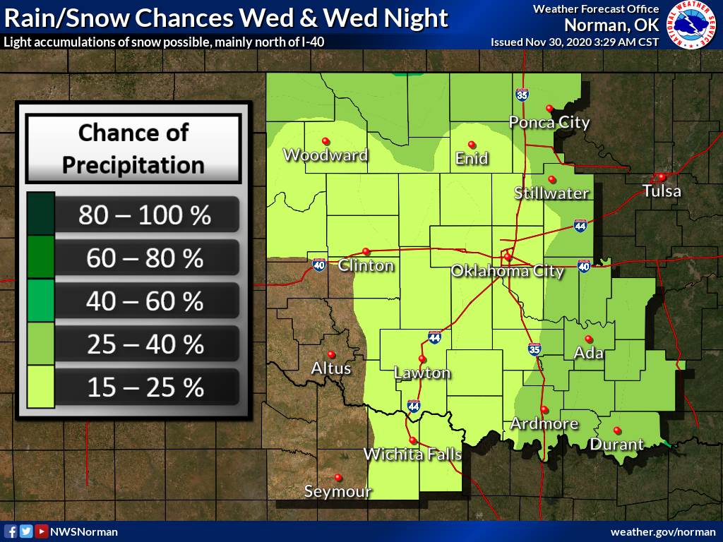
We definitely need the moisture, but I'm afraid we're not looking at much with
this storm, or the rest of the week.
Nothing too exciting happening just yet. That's a good thing, as I've said
before.
Gary McManus
State Climatologist
Oklahoma Mesonet
Oklahoma Climatological Survey
(405) 325-2253
gmcmanus@mesonet.org
November 30 in Mesonet History
| Record | Value | Station | Year |
|---|---|---|---|
| Maximum Temperature | 80°F | ALTU | 2021 |
| Minimum Temperature | 4°F | BOIS | 2004 |
| Maximum Rainfall | 3.13″ | IDAB | 2023 |
Mesonet records begin in 1994.
Search by Date
If you're a bit off, don't worry, because just like horseshoes, “almost” counts on the Ticker website!