Ticker for October 30, 2023
MESONET TICKER ... MESONET TICKER ... MESONET TICKER ... MESONET TICKER ...
October 30, 2023 October 30, 2023 October 30, 2023 October 30, 2023
Cool it!
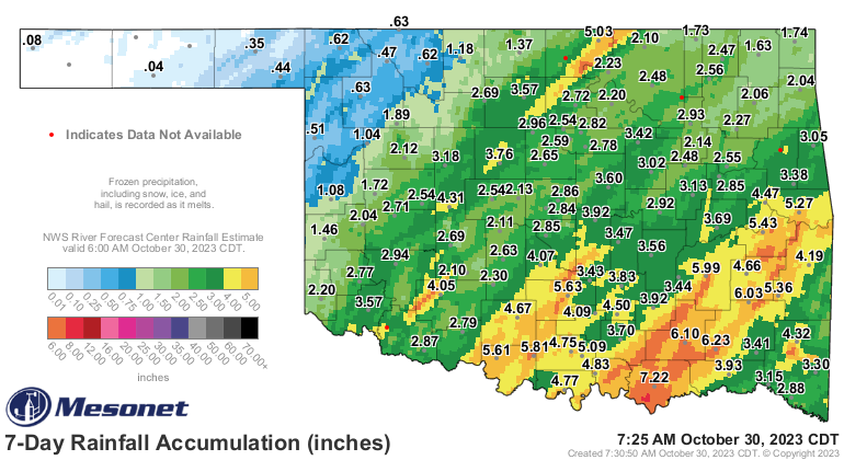
That's it. Excitement over. But what a time we had, no? Winter erupted, as well
as some gargantuan rains (which are not quite gorilla rains, nor are they
Herculean, but they're nothing to sneeze at either...more on sneezing later, and
don't call me more-on). This all started with the remnants of Hurricane Norma
last week at this time moving up over the state, and ended with the last vestiges
of our third (or fourth??) storm system moving by yesterday dumping a very cold
rain on the remnants of my hair.
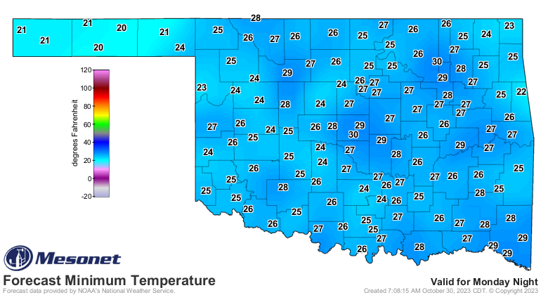
And of course, given that WINTER ERUPTED yesterday, or late Saturday night,
quite a bit of northern and western OK (and the Panhandle) dealt with freezing
rain and sleet through the weekend, with lots of accidents reported due to icy
roads. You can see that the wintry blast (nowhere near as good as a Sonic Blast,
I've determined) intensified overnight into this morning.
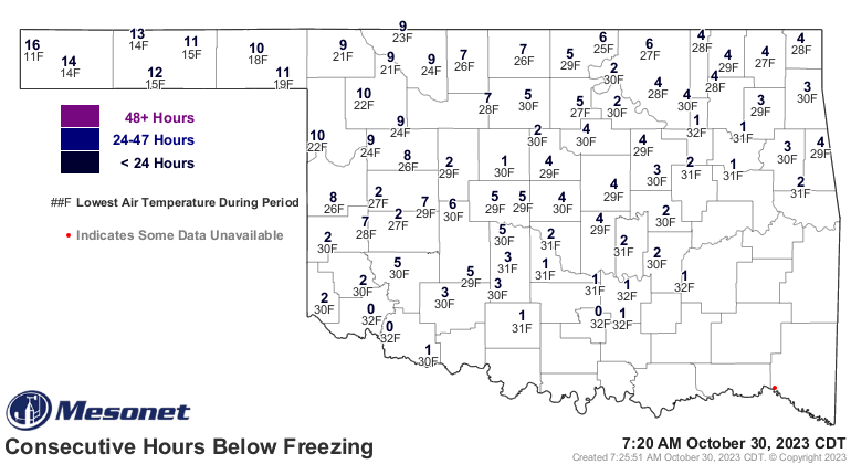
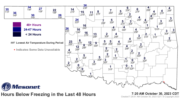
The pool of cold air was, uhhhhhhh...cold enough to set a record low in the
western Panhandle at Kenton, which is no easy feat! It's no easy feet either,
but let's not complicate matters. Kenton's low of 11 degrees broke the previous
record of 15 degrees set all the way back in 1925.
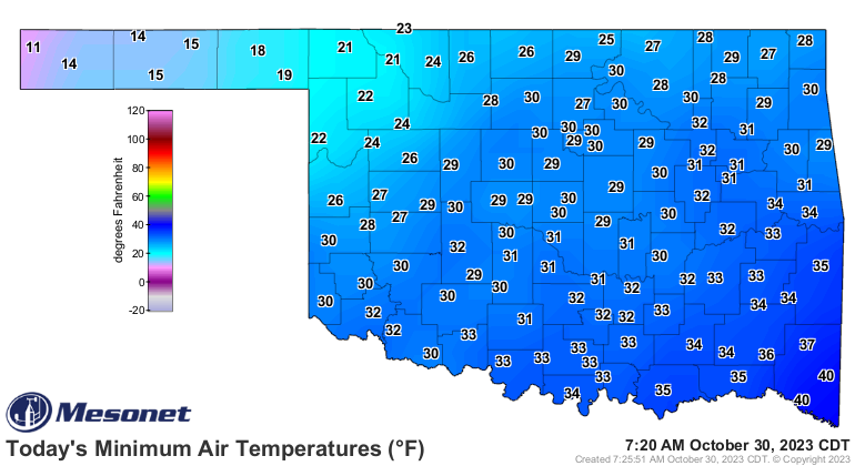
I don't see that we got close elsewhere, but if that bugs you take 10 degrees
from petty cash ("10 Degrees" was my band's name in the French Foreign Legion...
about 88 degrees worse than those upstarts that came later!). Maybe the
wind chill will satisfy you?
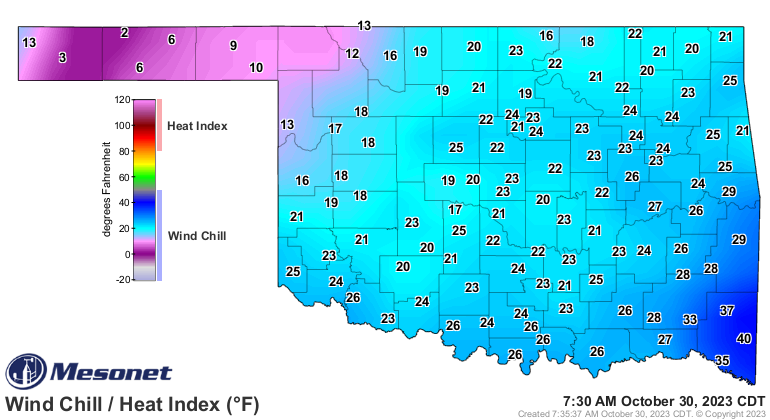
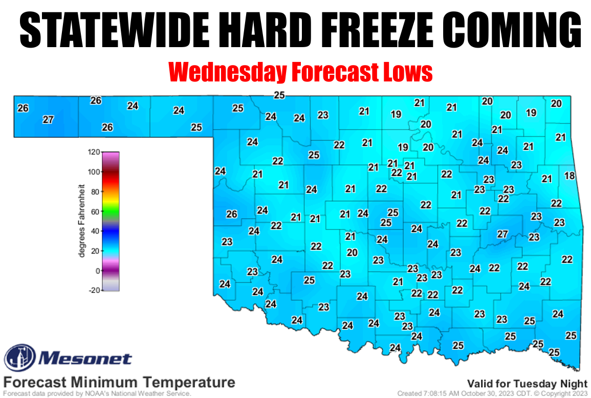
Or a near-statewide freeze warning?
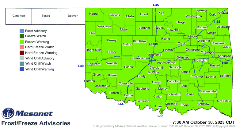
The Panhandle has already seen a hard freeze, so no need to warn them...and
some of this is for this morning, so more will drop off tomorrow (beware
of things dropping off due to the cold weather!). And some more will be taken
care of tomorrow morning with a bit more widespread freeze until that biggie
on Wednesday.
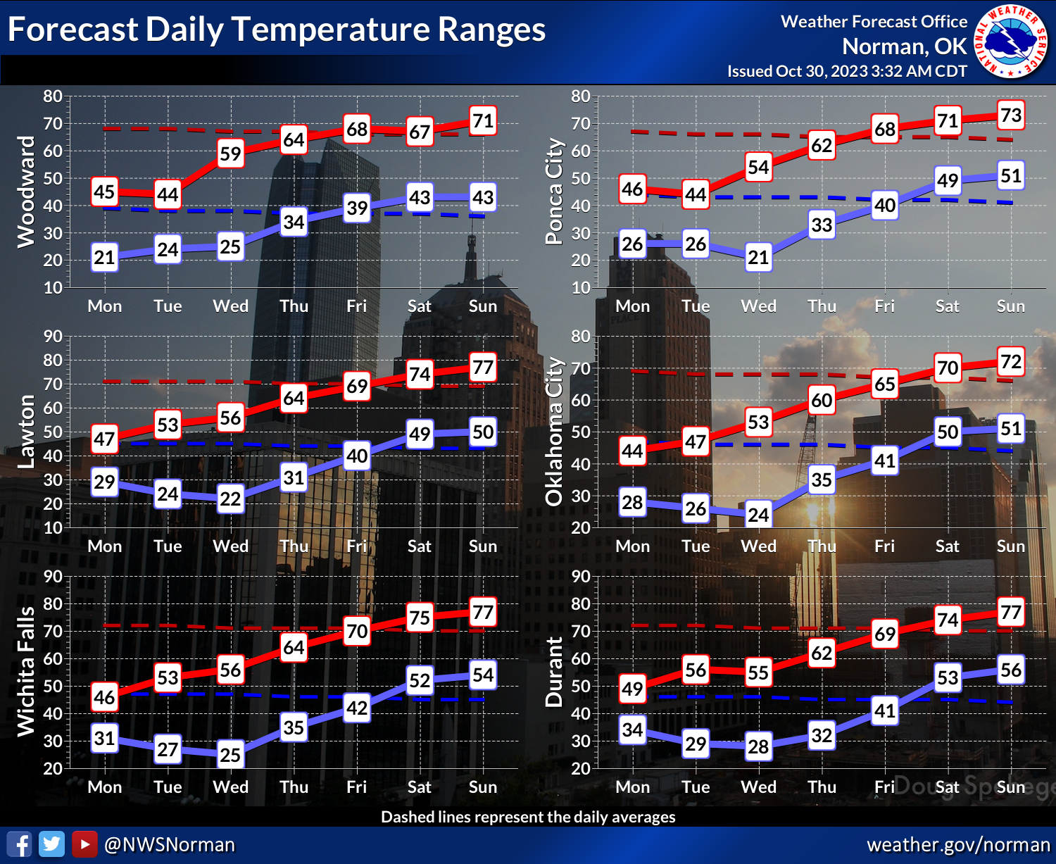
So the only excitement I see is warming back up to above normal temps as we
go through the week, with not much arctic air in site for now.

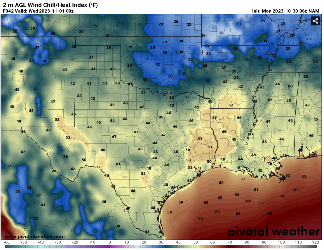
As for Halloween, still looks to be a frozen affair, with highs in the 40s
and wind chills down into the 30s mostly at trick-or-treat time. A cold front
with reinforcing cold air (leading to Wednesday's "coldest air of the season"
for most) will move through that morning. Here's the forecast wind chill for 7
p.m. Halloween night.
Hey, you know why the skeleton wore a coat on Halloween?
Because he didn't have the guts to go without it!
BWAHAHAHAHAHAHAHA!!
HAHAHAHAHAHA!
HAHA!
haha
ha
Oh.
Gary McManus
State Climatologist
Oklahoma Mesonet
Oklahoma Climatological Survey
gmcmanus@mesonet.org
October 30 in Mesonet History
| Record | Value | Station | Year |
|---|---|---|---|
| Maximum Temperature | 92°F | TIPT | 2003 |
| Minimum Temperature | 4°F | KENT | 2019 |
| Maximum Rainfall | 3.95″ | PORT | 2013 |
Mesonet records begin in 1994.
Search by Date
If you're a bit off, don't worry, because just like horseshoes, “almost” counts on the Ticker website!