Ticker for August 30, 2012
MESONET TICKER ... MESONET TICKER ... MESONET TICKER ... MESONET TICKER ...
August 30, 2012 August 30, 2012 August 30, 2012 August 30, 2012
Out of the frying pan...
The cumulative effect of the last two weekend's rainfall events was enough to
draw some of the state out of exceptional drought. Unfortunately, those that
missed out on those two rainfall events were drawn into the U.S. Drought Monitor's
worst drought category. This morning's U.S. Drought Monitor report showed that
parts of northeastern and central Oklahoma improved from exceptional drought to
extreme drought, including the state's two most populous cities in Oklahoma
City and Tulsa.
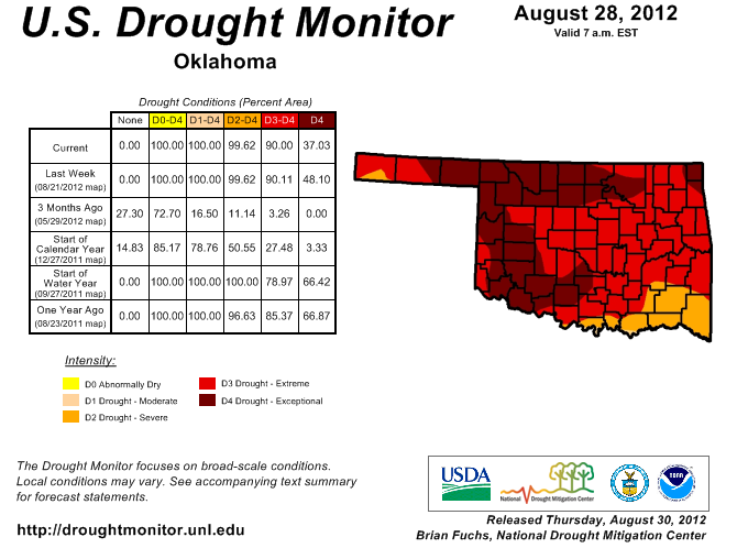
Exceptional drought shrunk from 48 percent of the state to 37 percent. The area
of extreme/exceptional drought remained at 90 percent,however. The entire state
remains in at least severe drought. That's the same extent as this time last
year, but at that time 67 percent of the state was in exceptional drought. The
severe/exceptional and extreme/exceptional drought areas were less one year ago
at 79 percent and 85 percent, respectively.
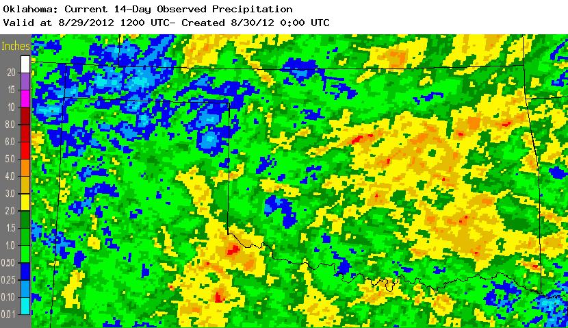
The two rainfall events that allowed for the improvements this week combined to
bring 3-5 inches of rain though those areas.
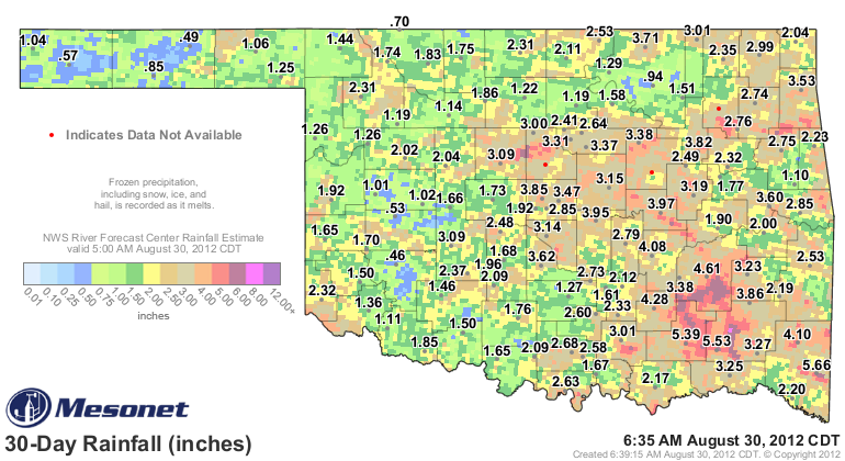
Rainfall out to 30 days has added just a tad more to those totals, and helped
a bit more in other areas.
It is also plain to see those areas that missed out on appreciable rainfall
through the last month, and therefore increased in intensity from extreme to
exceptional ... north central and southwestern Oklahoma, particularly. The
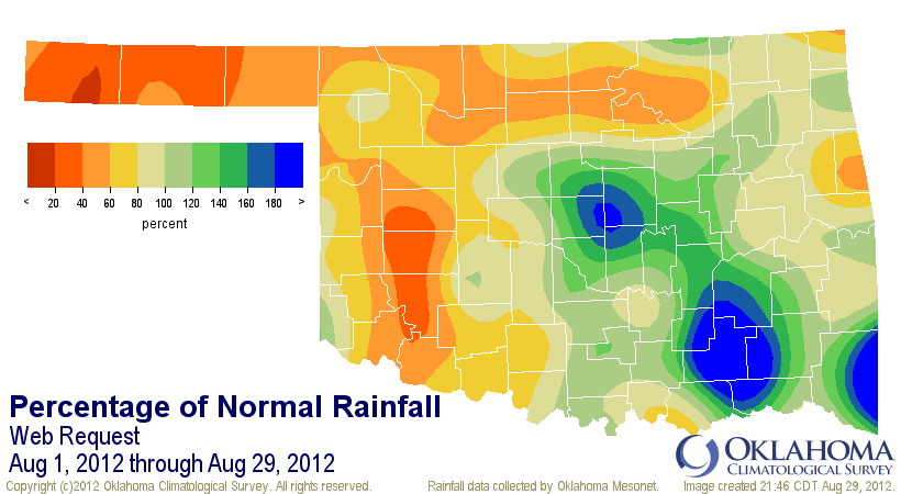
western two-thirds of the Panhandle have also been dry. This is readily
apparent in the percent of normal map from the Mesonet for the month's first 30
days. Dry weather in the Panhandle is reaching a critical point rather quickly
as well. Without additional moisture, drought will continue to worsen in that
area.
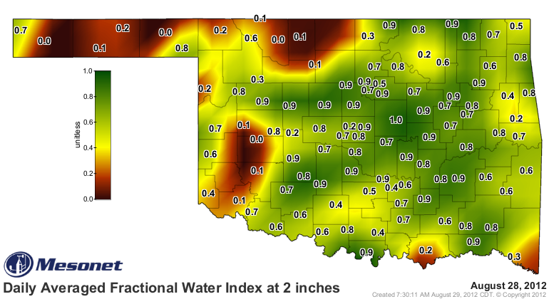
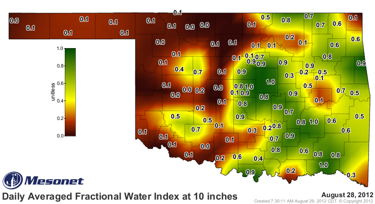
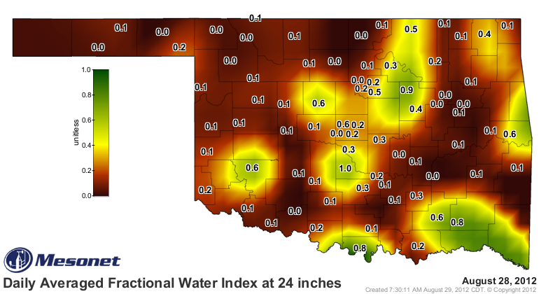
Soil moisture responded quite well to the rains down to the 10-inch level on
the Mesonet. The topsoils across the state moistened up quite nicely. More
importantly, the soil down to 10 inches moistened up at 10 inches across central
and northeastern Oklahoma. Typical during significant droughts, the lower soil
levels still remain unsatisfied.
There is still the hope for moisture from the remnants of Hurricane Isaac, but
the forecasts still show the best chance is in far eastern Oklahoma. Should
Isaac shift to the west, that heavier rainfall will also shift more in our
direction.
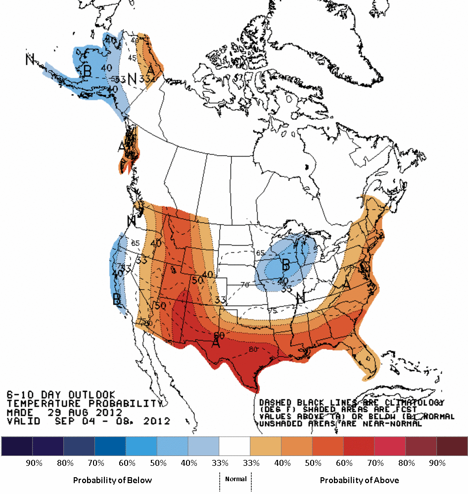
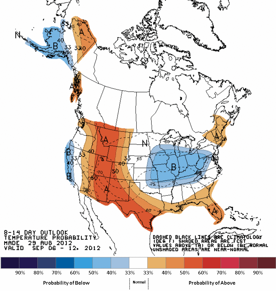
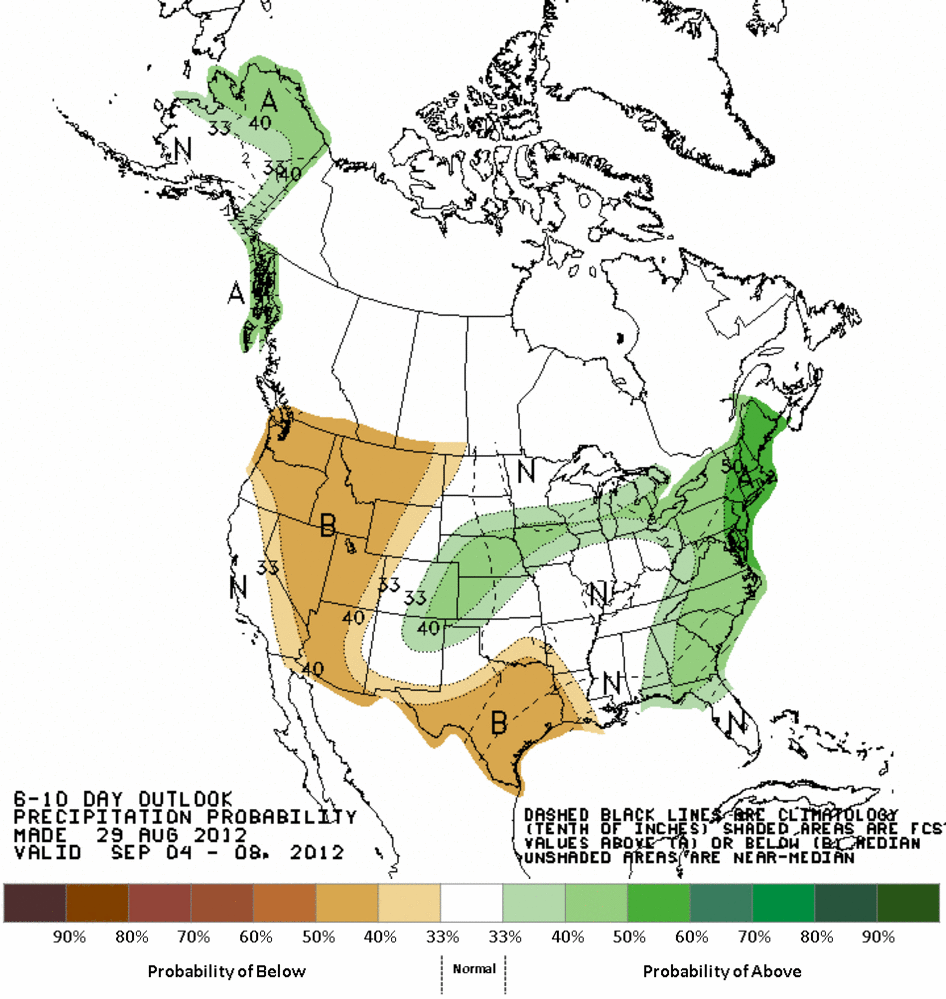
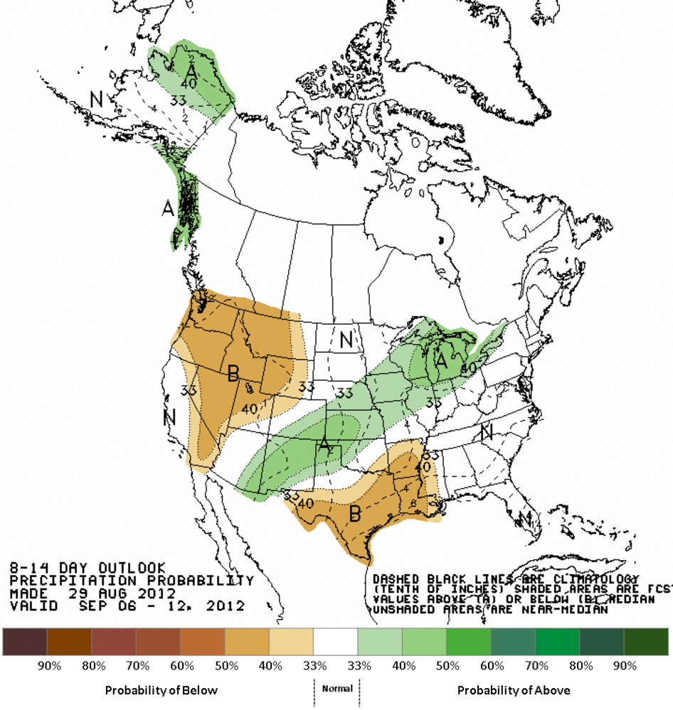
A bit farther out, the prospects for another cold front and associated rainfall
are just beginning to show up on CPS' 6-10 and 8-14 day outlooks with increased
odds of above normal rainfall and near normal temperatures in the offing.
CPC Temperature outlooks
CPC Precipitation outlooks
Gary McManus
Associate State Climatologist
Oklahoma Climatological Survey
(405) 325-2253
gmcmanus@mesonet.org
August 30 in Mesonet History
| Record | Value | Station | Year |
|---|---|---|---|
| Maximum Temperature | 112°F | ALTU | 2011 |
| Minimum Temperature | 49°F | KENT | 2017 |
| Maximum Rainfall | 7.93″ | MEDF | 2003 |
Mesonet records begin in 1994.
Search by Date
If you're a bit off, don't worry, because just like horseshoes, “almost” counts on the Ticker website!