Ticker for October 29, 2020
MESONET TICKER ... MESONET TICKER ... MESONET TICKER ... MESONET TICKER ...
October 29, 2020 October 29, 2020 October 29, 2020 October 29, 2020
Is that all ya got??
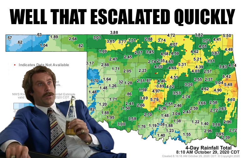
We're finally above freezing and so we're
getting a better tally on the liquid equivalent storm totals from arguably the
most impactful October winter storm in our history. We did have that blizzard of
up to 15 inches of snow in Cimarron County and killed as many as 15,000 head of
cattle across the Panhandle back on Oct. 25-26, 1997. Then there was the 13 inches
of snow at Arnett last Oct. 24-25. Those were more localized, however. The
footprint of this storm rivaled even the biggest storms of ANY winter storm,
regardless of month.
We had 4-8 inches of snow across the Panhandle, which was momentous in its own
right. The biggest impact, however, was obviously the ice. Sleet we can handle,
although it didn't help this time since leaves still contained most of their
leaves. Those full branches helped capture sleep this time, which would normally
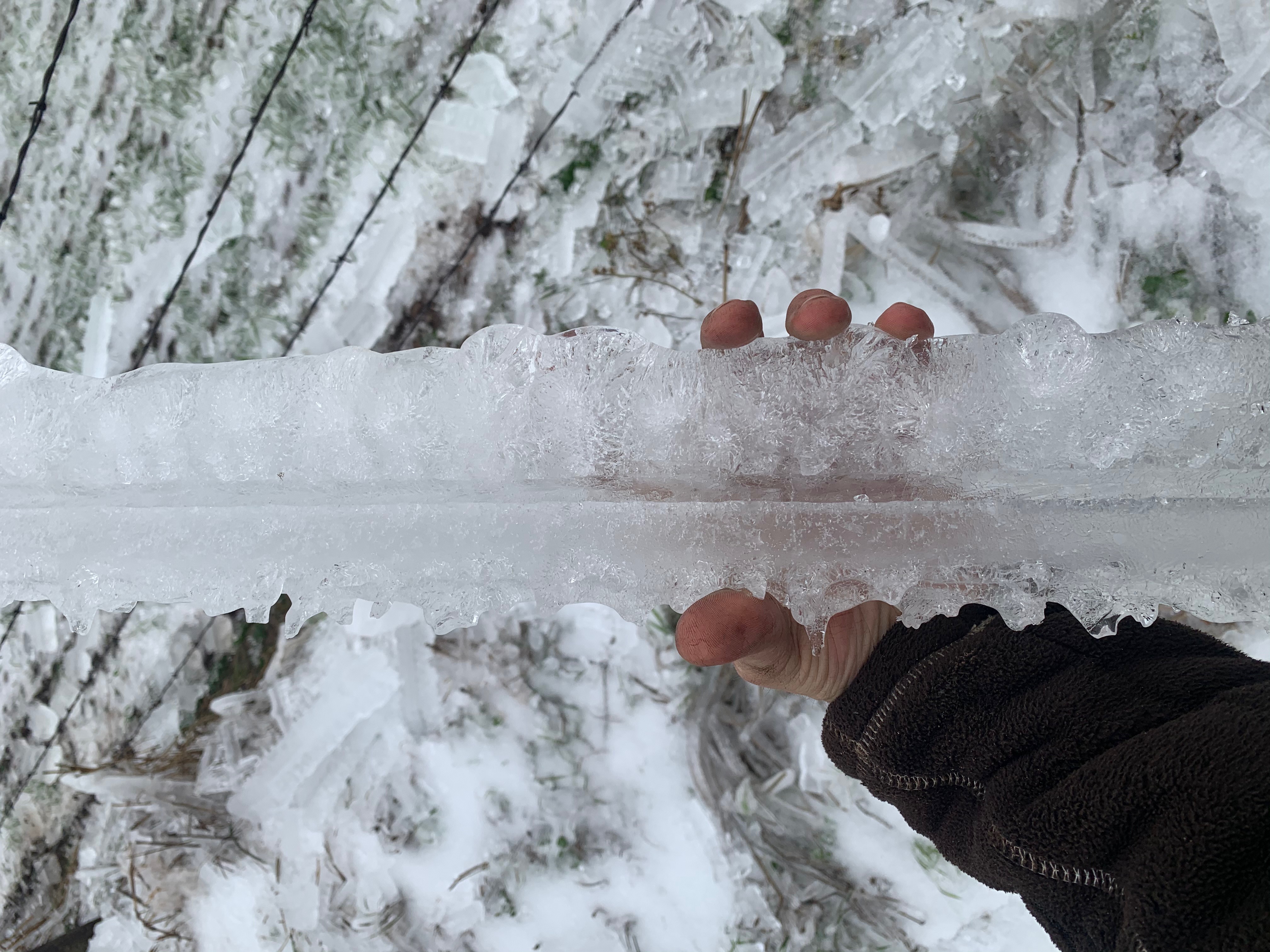
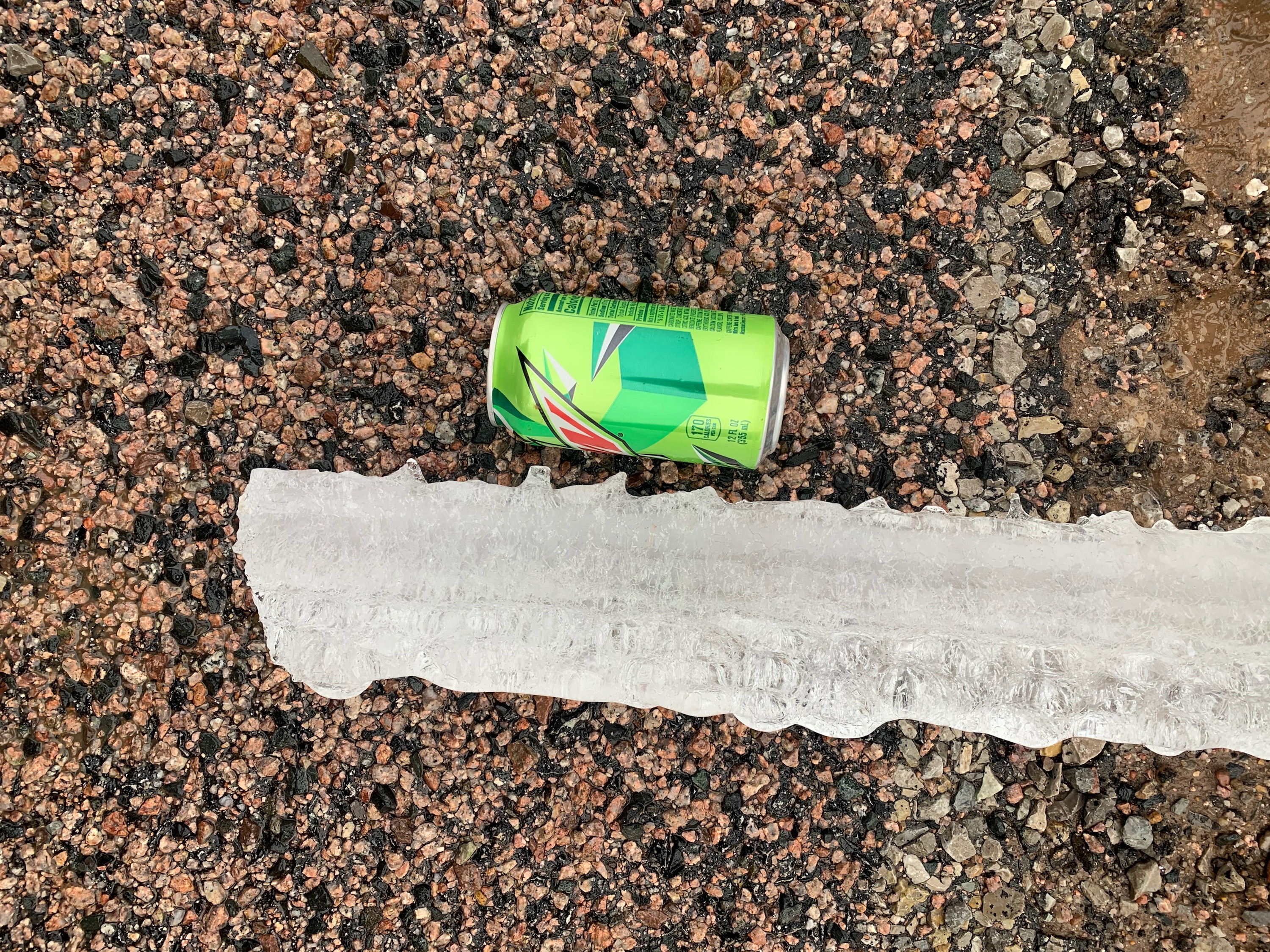
just be a driving hazard. Then the freezing rain came down by the bucketful,
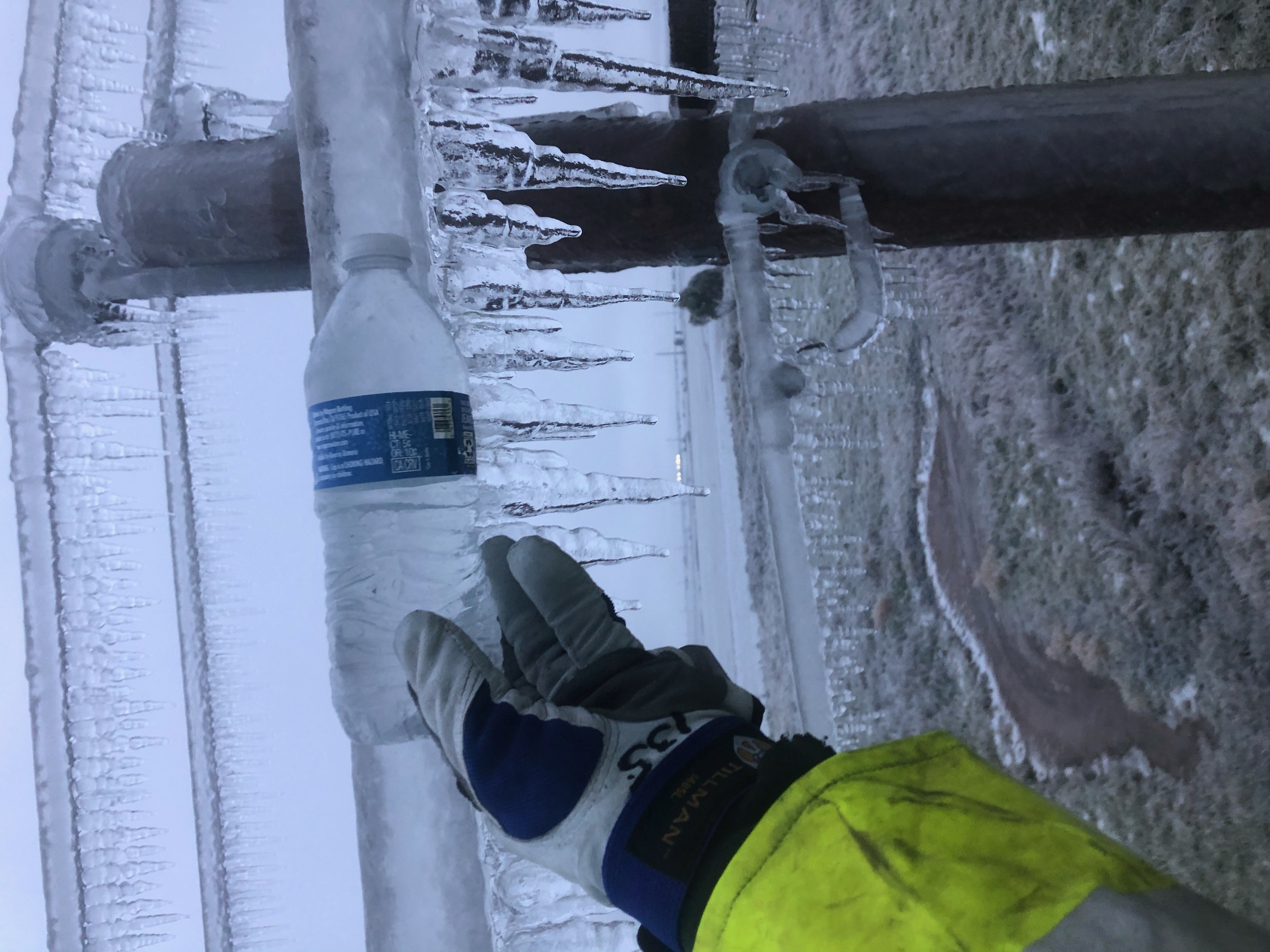
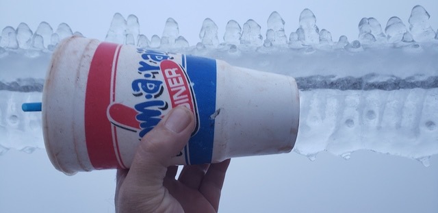
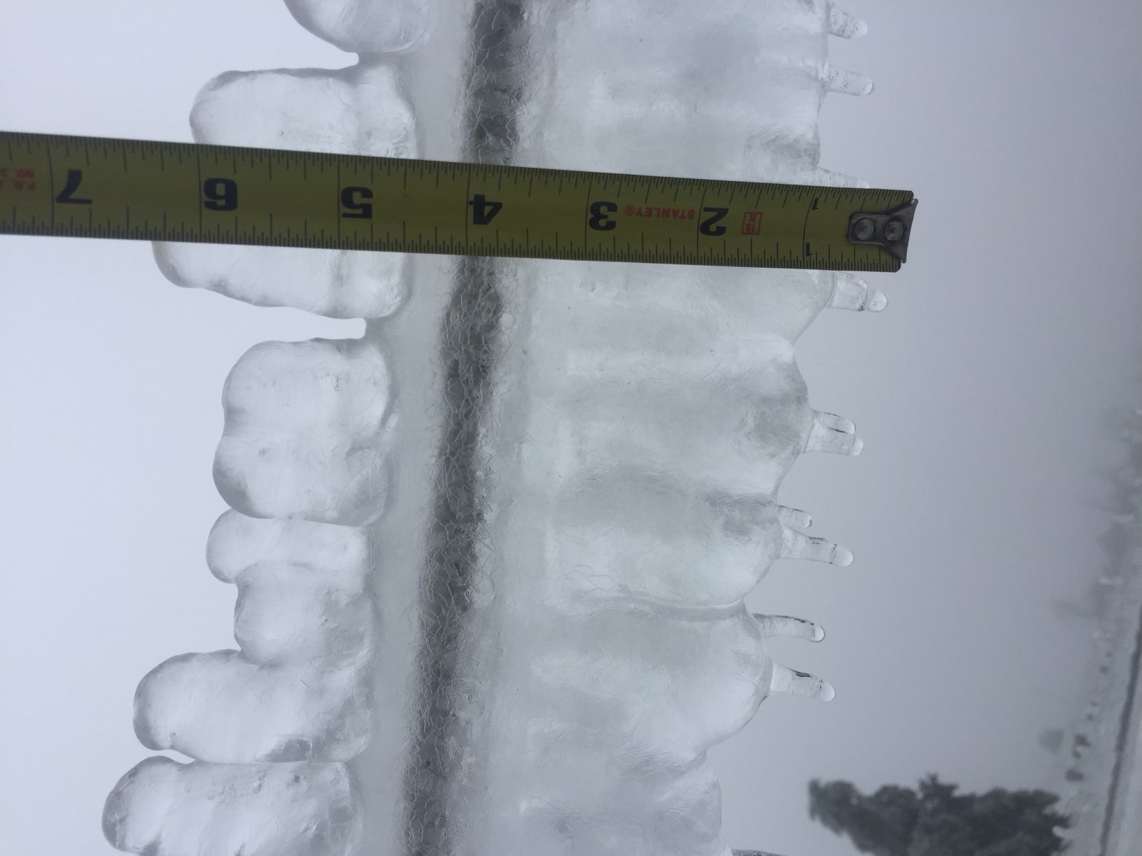
leaving us with radial ice amounts of up to 3", which means up to 6" of ice on
power lines, trees and fences. Here are some pics from our friends at the Oklahoma
Association of Electric Cooperatives. These pics come from what could be considered
the epicenter of the ice storm, the area around Calumet and Geary areas.
Pic credits, in order:
Photo 1: Mike Burge, TCEC
Photo 2: B.J. Appleton, TCEC
Photo 3: Matt Crandall, Cimarron Electric Cooperative
Photo 4: Eric Roberts, Cimarron Electric Cooperative
Photo 5: Michelle Mowdy, Member, Cimarron Electric Cooperative


And these are from the Binger area, taken by Clint Pack, CEO of CKenergy.
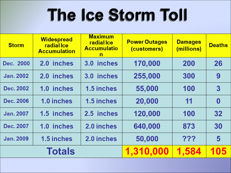
These pics are all courtesy of Sid Sperry of the OAEC, and also creator of
the SPIA (Sperry-Piltz Ice Accumulation) index, which categorizes the threat
of ice storm damage to power utility infrastructure due to ice accumulation and
winds. Sid, who knows more about the physical manifestation of ice storm damage
to power infrastructure than just about anybody on earth, tells us the ice
accretion amounts on power lines with this storm rivaled or beat those of the
"Mother of all Oklahoma ice storms," which hit the northwestern half of the
state back in January 2002. You can read about that storm here:
http://climate.ok.gov/summaries/event/Oklahoma_Ice_Storm_01_2002.pdf
The only thing missing from this storm was the high winds that would have
created even more catastrophic damage to the power utility infrastructure, like
power poles. That January 2002 storm left 255,000 without power, some for
several weeks, and the utility companies lost over 50,000 poles and over 1,550
miles of destroyed power supply capabilities, enough to stretch from
Oklahoma City to New York City. The December 2007 I-44 Corridor storm left
almost 700,000 customers without power, however, for the largest power outage
footprint from that 2000-2010 period, otherwise known in Oklahoma as "The Ice
Storm Decade."
Even with the lower sustained wind speeds, power across all the different
utility companies in Oklahoma amounted to 388,792 electric customers without
power according to the OK Dept. of Emergency Management and Homeland Security,
which undoubtedly comes close to a million Oklahomans without power. The tree
damage from the storm was catastrophic in its own right, and we will be seeing
evidence of that for years to come.
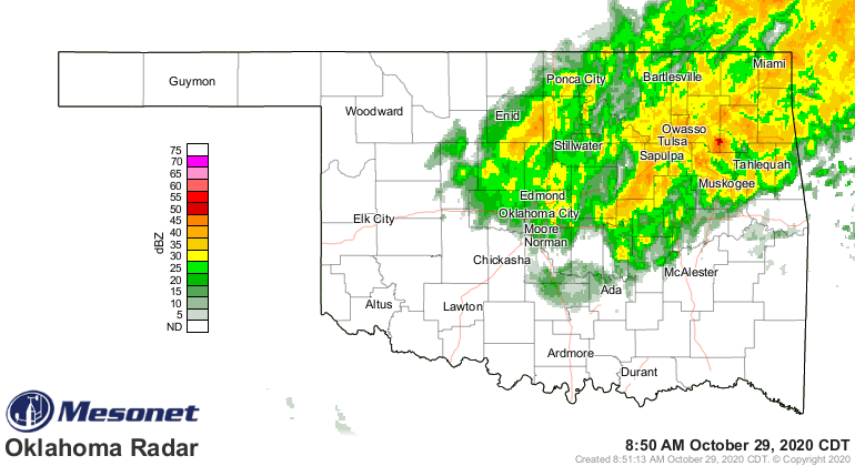
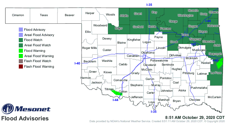
We're STILL dealing with heavy rainfall across the NE quarter of the state,
which is creating a flooding hazard in those waterlogged areas. But at least
temperatures are well above freezing.
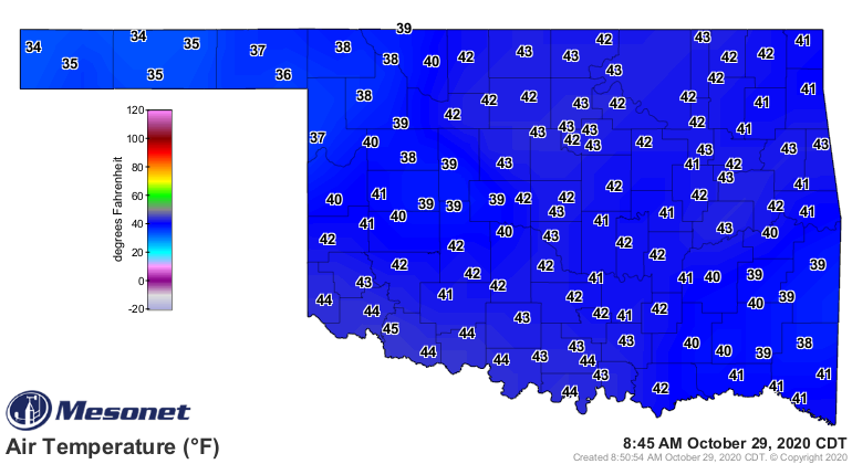
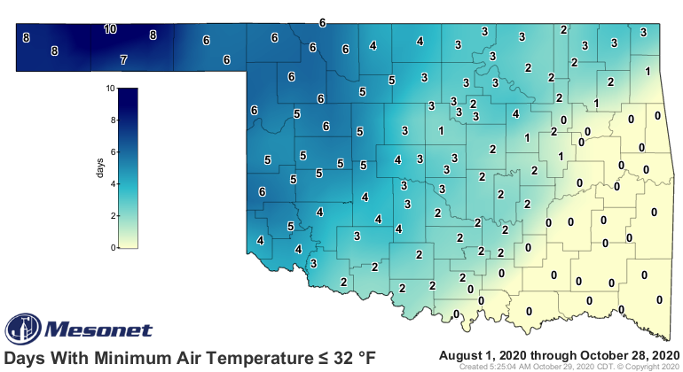
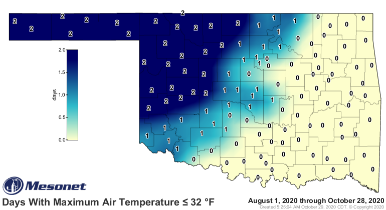
Speaking of freezing, most of the state (save for the SE corner) has not had
at least a couple days of a freeze, with some areas across the northwest
astoundingly having a couple of days with HIGHS below freezing. It's October
for crying out loud!
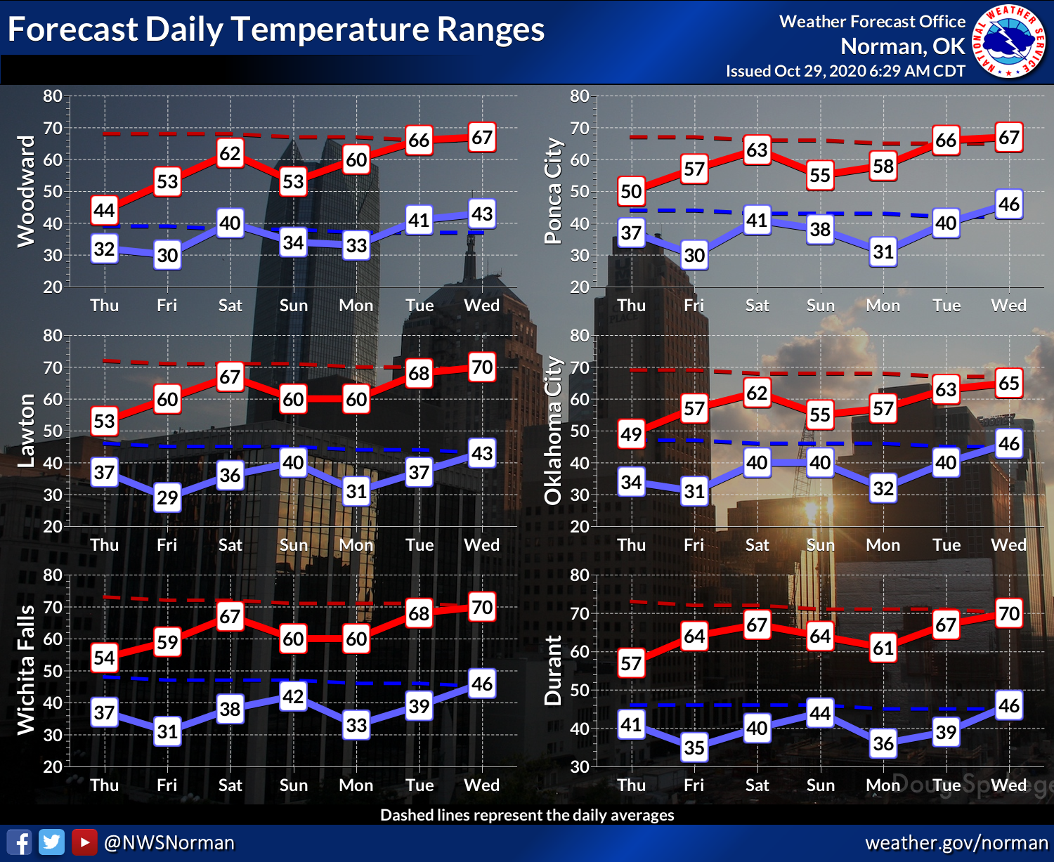
Now we get a nice warm up back into October/November territory, with a good
chance to dry out as well.
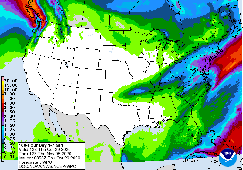
A bunch of the precip fell after the Tuesday, 7am cutoff point for moisture
to be considered in the new Drought Monitor map, but we did see big improvements
to the southeast of I44.
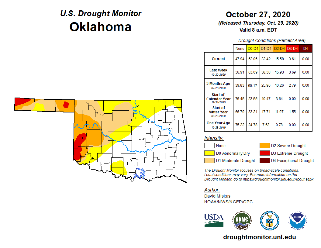
I'm fairly confident we'll see more improvements in the map next week when the
rest of the storm's moisture is able to be considered. Until then, let's start
gathering those tree limbs and making sure everybody that needs power gets
power, with some help along the way until they do.
La Nina. HA!
Gary McManus
State Climatologist
Oklahoma Mesonet
Oklahoma Climatological Survey
(405) 325-2253
gmcmanus@mesonet.org
October 29 in Mesonet History
| Record | Value | Station | Year |
|---|---|---|---|
| Maximum Temperature | 94°F | BUFF | 2016 |
| Minimum Temperature | 13°F | BEAV | 2019 |
| Maximum Rainfall | 2.84 inches | PAWN | 2009 |
Mesonet records begin in 1994.
Search by Date
If you're a bit off, don't worry, because just like horseshoes, “almost” counts on the Ticker website!