Ticker for September 29, 2022
MESONET TICKER ... MESONET TICKER ... MESONET TICKER ... MESONET TICKER ...
September 29, 2022 September 29, 2022 September 29, 2022 September 29, 2022
Drought roars back
In a shock to no one, drought is once again on the prowl in Oklahoma, emboldened
by a largely disappointing secondary fall rainy season thus far. I would have told
you this yesterday, but the Drought Monitor is embargoed until its release Thursday
morning, AND I was busy trying to tie Roger Maris' American League record for
home runs in a single season at 61. Somebody beat me to it so I decided I should
just stick to the Ticker (and we all know just how painful that can be).
Anyway, as you were saying...no, *I* was saying (that's pretty presumptuous of
you), our secondary rainy season in the fall has "fallen" well short of its mark.
"Fallen"..."secondary fall rainy season. Get it?
I'll wait.
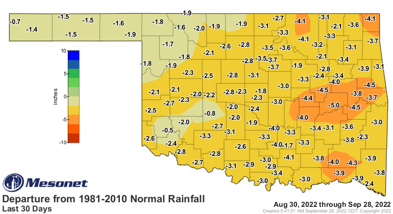
Okay, so we look at the September rains thus far and other than a few areas with
somewhat close to normal values, it has been a huge disappointment.
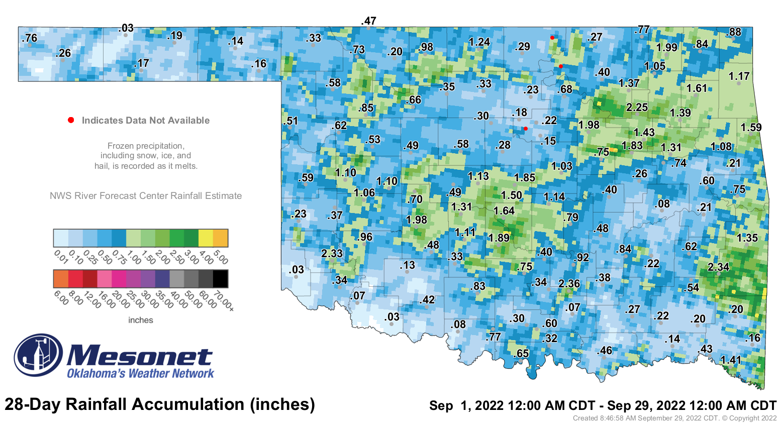
And while they include the last couple of days of August, the 30-day rain
departure and pct of normal maps give us a good idea of what we're up against
here.

The statewide average rainfall total of 0.7 inches for Sept. 1-29 place it as
the 5th driest September on record for the state dating back to 1895, which
is no small feat.
-***-
Top-5 Driest Septembers
1956 0.25"
1939 0.33"
1948 0.51"
1952 0.68"
2022? 0.70"
1928 0.81"
1910 1.07
2021 1.09"
-****-
I threw 2021 in there because the current drought has two parts:
1. The long-term drought that started August 2021 but accelerated in Sept. 2021.
B. The flash drought that started June 11, 2022.
So we're working on two different timescales. And I put a question mark after
2022 in the list because we still have tomorrow to get through in order to stay
at 0.7" across the state. I think we're safe, unfortunately.
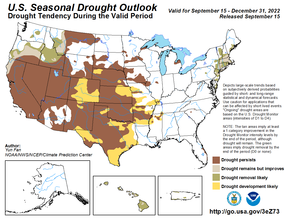
In fact, we're probably safe through mid-October'ish, save for the western
Panhandle, which could get caught up in some action from the Desert Southwest.
Sounds dangerous, especially if from Vegas.

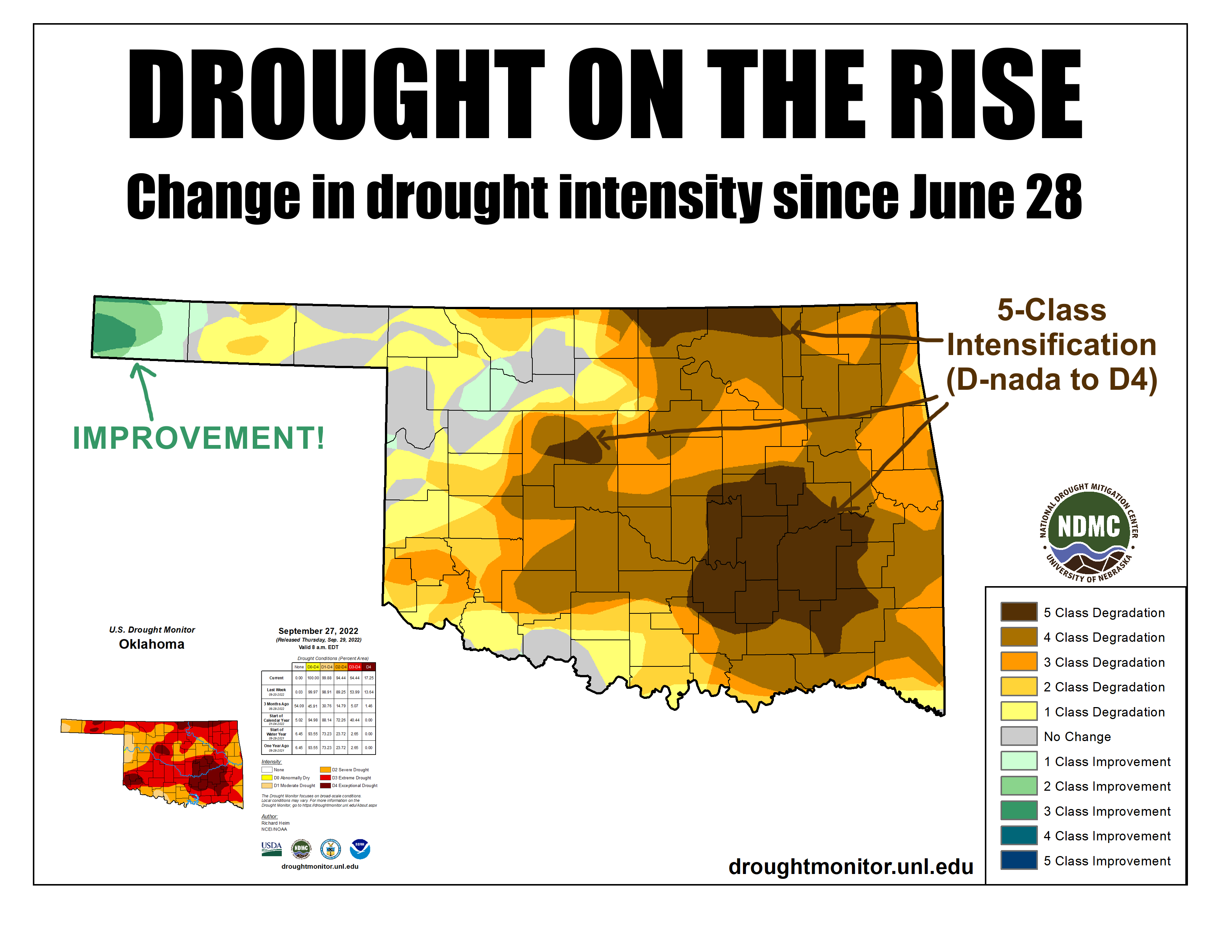
The current Drought Monitor tells the story.

The 17% of D4 (Exceptional drought) is the highest level we've seen since May
2018. And the 64% in at least D3 (Extreme drought) is the highest levels since
Feb. 19, 2013.
2013!!!
When you're in the same conditions as the depths of 2013, you know you're in
bad shape. And it only looks to get worse as we deal with continued above normal
temperatures and below normal rainfall, in addition to our transition to the
driest part of the year as we get into November through the winter months. And
even though we might be looking at temperatures in the mid-80s, that is still
10 degrees above normal as we get into October. That puts additional pressure
on our surface and soil moisture supplies due to enhanced evaporation. The lack
of clouds doesn't help either, because the sun's unencumbered rays are able to
evaporate at max levels.
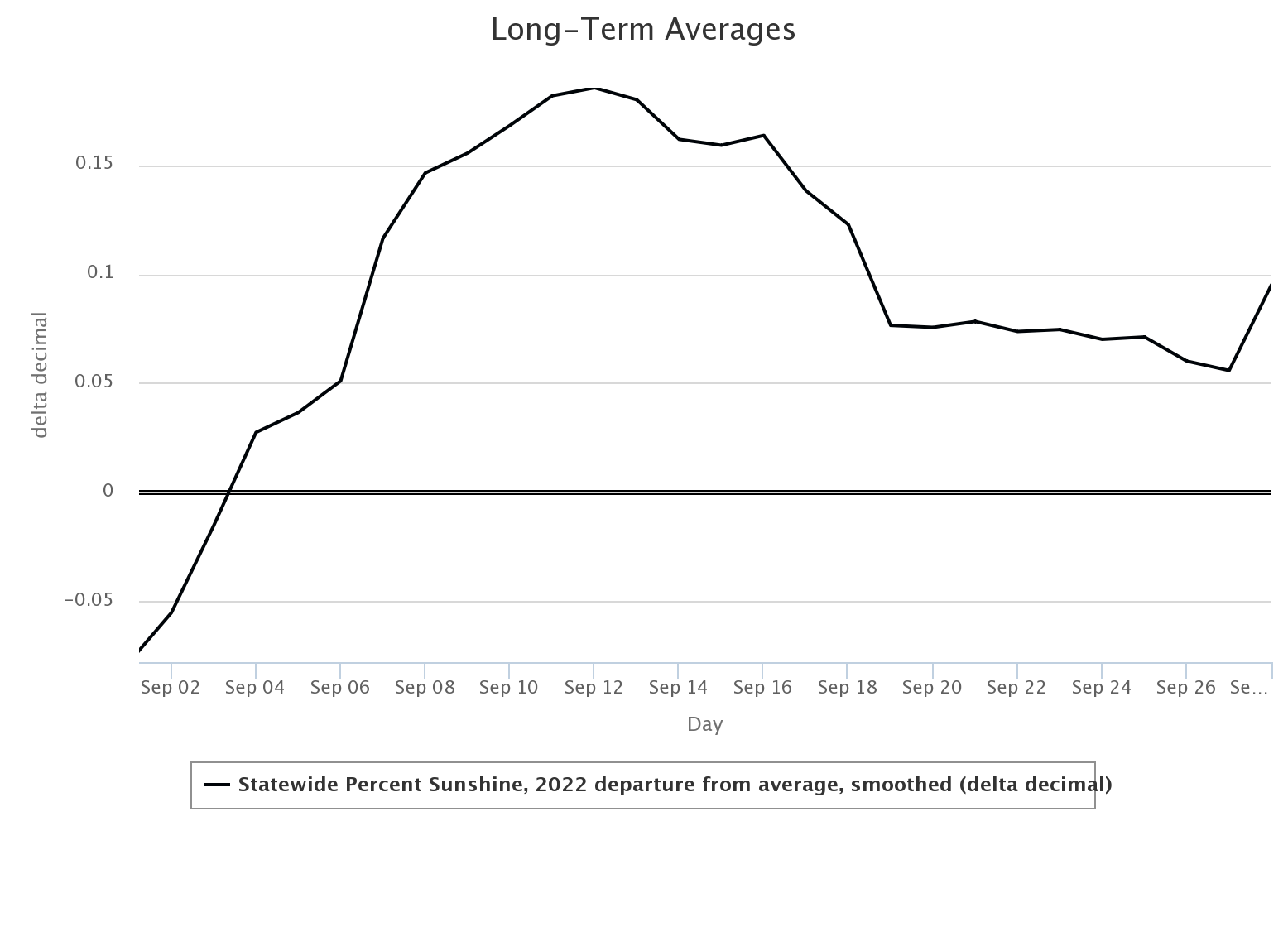
And that's what we've had in September...few clouds, let along rain, and lots
and lots of sunshine.
As we go out into the rest of the year, the odds are tilted towards dryness
with our third straight cool season La Nina. We're already in La Nina conditions,
but they are expected to continue at least through the early part of 2023.
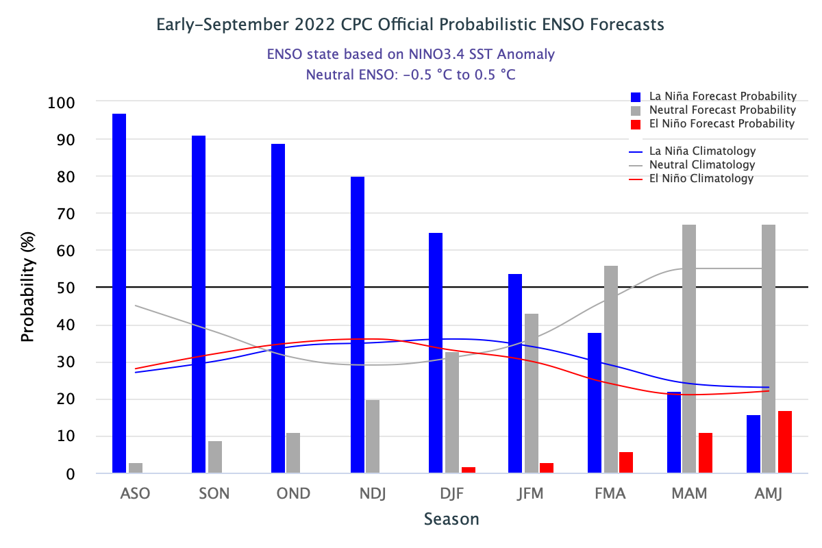

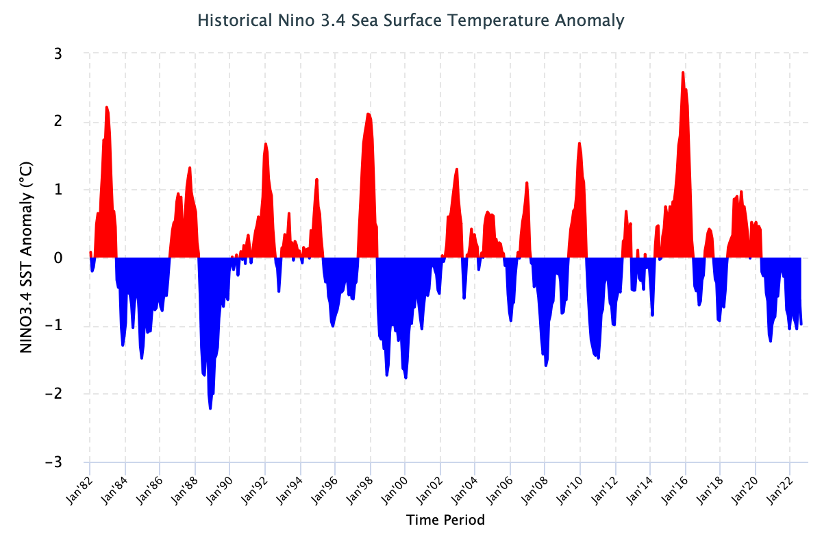
When you match the ONI (Oceanic Nino Index) or the cool SST (La Nina) episodes
to our historical Drought Monitor depiction, you can see the influence La Nina
has on our drought episodes. It's not EVERY La Nina...but the odds do tilt
towards dry and warm...and drought. As the old cautionary tale goes, not all La
Ninas (or El Ninos) impact us the same way. There are other natural influences,
of course. I could name you a handful of other important acronyms for oceanic
and atmospheric teleconnections, but ENSO (El Nino-Southern Oscillation) is one
of the most important.

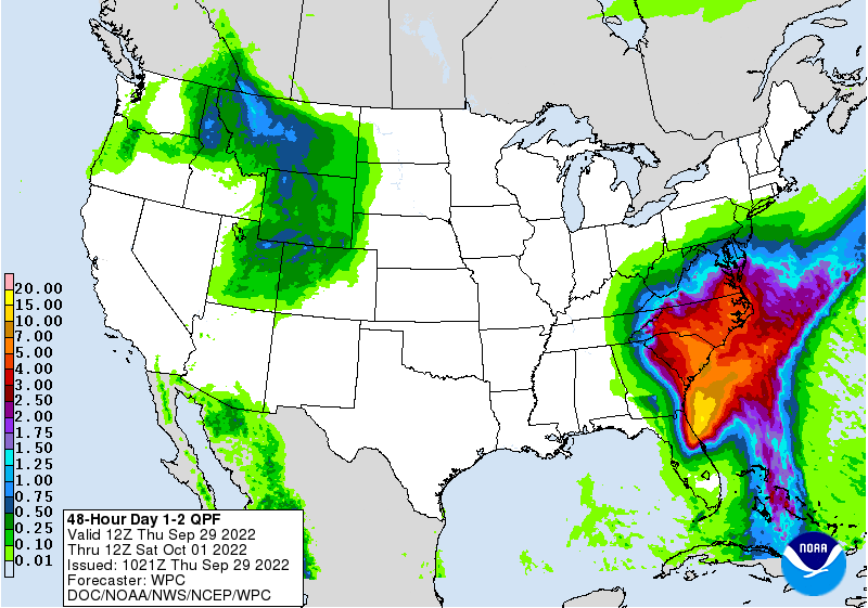
At any rate, we'll take some good news anytime. Someday soon, rain will start
appearing on that 7-day rainfall map. Then it has to actually happen, of course.
Gary McManus
State Climatologist
Oklahoma Mesonet
Oklahoma Climatological Survey
gmcmanus@mesonet.org
September 29 in Mesonet History
| Record | Value | Station | Year |
|---|---|---|---|
| Maximum Temperature | 102°F | BURN | 2011 |
| Minimum Temperature | 31°F | KENT | 1999 |
| Maximum Rainfall | 4.93″ | STIG | 2012 |
Mesonet records begin in 1994.
Search by Date
If you're a bit off, don't worry, because just like horseshoes, “almost” counts on the Ticker website!