Ticker for July 29, 2020
MESONET TICKER ... MESONET TICKER ... MESONET TICKER ... MESONET TICKER ...
July 29, 2020 July 29, 2020 July 29, 2020 July 29, 2020
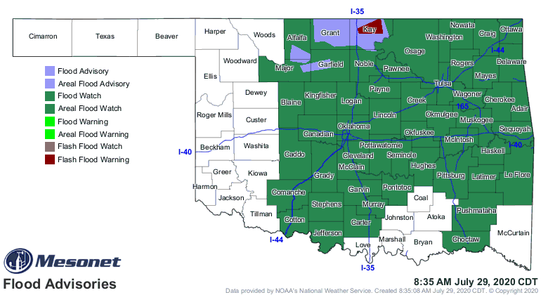
Do ya enjoy water rescues?
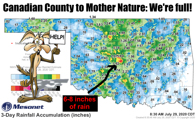
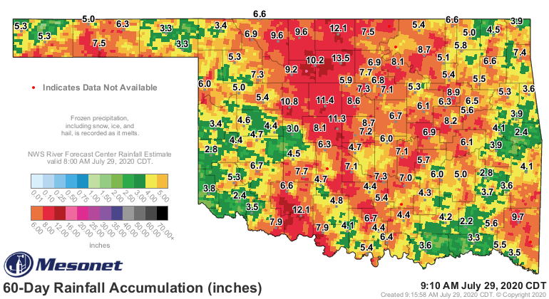
Here's the obligatory caveat at the beginning of any reports of heavy rains in
Oklahoma: "Yeah, we know some of you didn't get nearly enough, whilst some (a lot)
may have gotten way too much." The latter was the case for eastern Canadian and
far western Oklahoma counties overnight into the early morning yesterday. Other
hotspots would include the Ames area in eastern Major County, and various other
parts of north central into central Oklahoma where 2-4 inches fell over a wide
swath.
I was just thinking...what's up with that Wile E. Coyote, anyway? In one Roadrunner
cartoon he's a mad genius, speaking with a Frasier Crane voice, the next he's
a silent imbecile. What gives, Looney Tunes??
Back to more important matters...the problem we see now is lots more rain is
possible over the next three days. The forecast calls for the possibility of
over 3 inches across parts of eastern Oklahoma, with 1-2 inches possible into
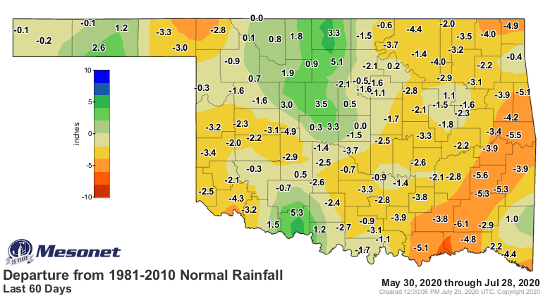
the already saturated areas in central OK. Make no mistake about it, east central
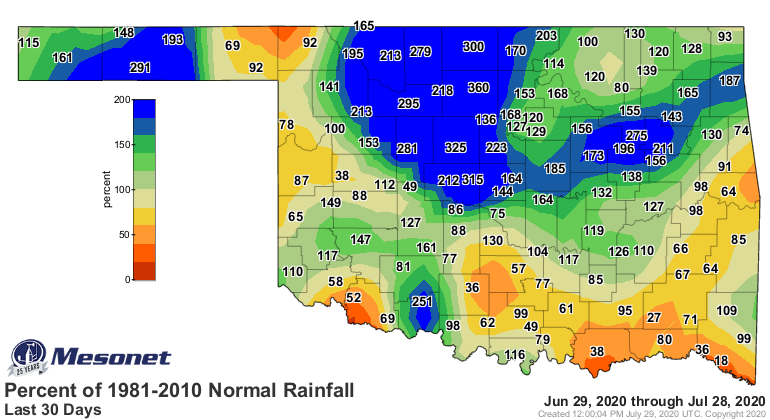
into southeastern OK needs some rain. They have started to creep into drought
territory over the last month or so. Looking at this map, easy to see somebody
in Custer County in western OK has ticked Mother Nature off as well.
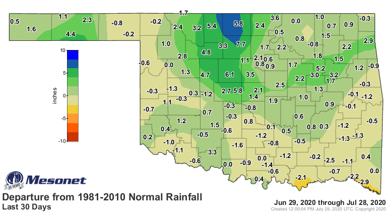
The deficits aren't huge, but they ain't insignificant either (remember the
rule: "aren't before ain't except after c"). When you push out to 60 days, then
you start to see the trouble.
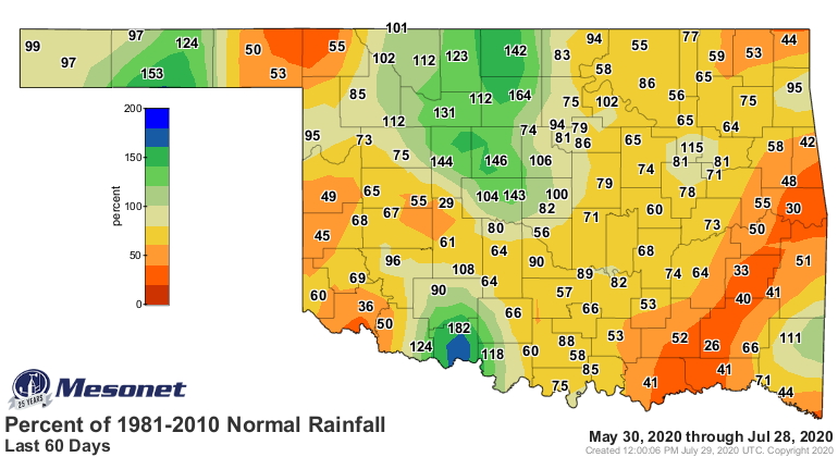
So we are getting some much needed relief over parts of the state, but other
areas obviously need more. And we'd sure like it if we didn't have the flooding,
but of course, that comes with the territory here in Oklahoma.
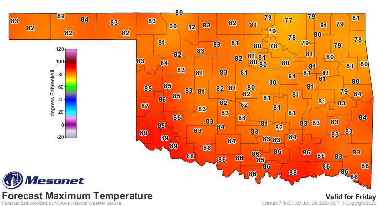
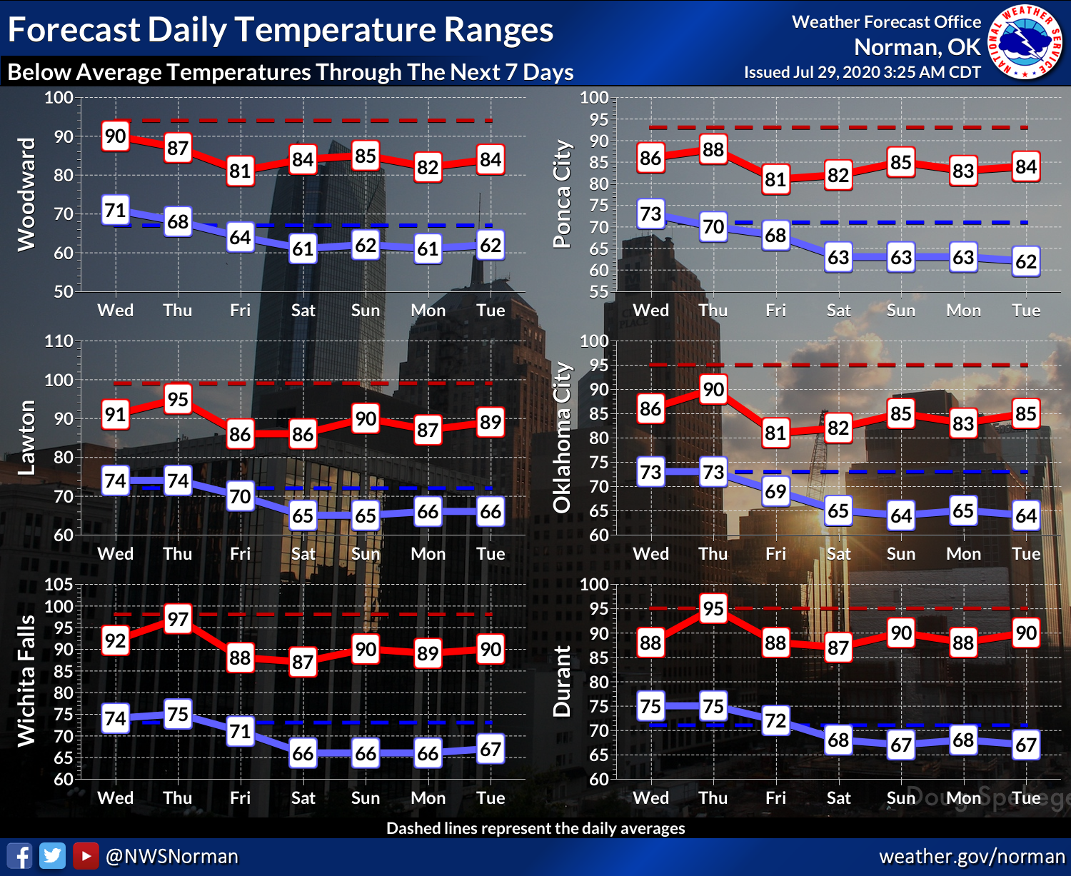
On a cooler note, we're going to be seeing mid-September weather coming soon
as more cool air (along with clouds and rain) spill into Oklahoma in this
nortwesterly flow regime. Check out the highs for Friday into the weekend. Are
you kidding me?
It won't be the coolest end of July ever. Remember back in 2014?
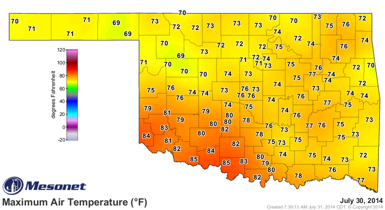
Hmmm, 2014 is looking pretty good about now.
By the way, I rooted for the coyote. Once, just once, I'd like to have seen that
dumb bird paint a train tunnel on that rock and have it run over HIM! The
coyote at least shopped local, buying all his stuff mail order through the
Acme Company.
Gary McManus
State Climatologist
Oklahoma Mesonet
Oklahoma Climatological Survey
(405) 325-2253
gmcmanus@mesonet.org
July 29 in Mesonet History
| Record | Value | Station | Year |
|---|---|---|---|
| Maximum Temperature | 110°F | INOL | 2012 |
| Minimum Temperature | 51°F | BEAV | 2005 |
| Maximum Rainfall | 4.67 inches | OKMU | 2020 |
Mesonet records begin in 1994.
Search by Date
If you're a bit off, don't worry, because just like horseshoes, “almost” counts on the Ticker website!