Ticker for June 29, 2023
MESONET TICKER ... MESONET TICKER ... MESONET TICKER ... MESONET TICKER ...
June 29, 2023 June 29, 2023 June 29, 2023 June 29, 2023
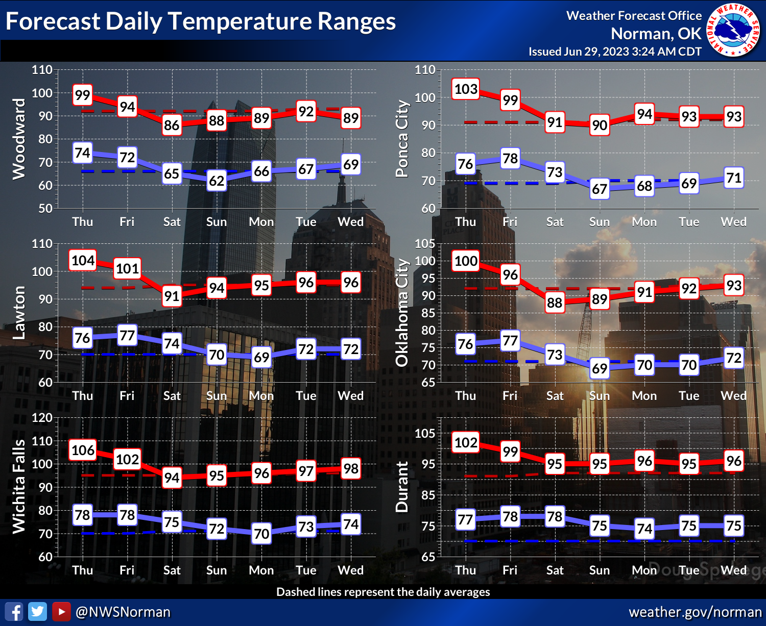
The heat continues
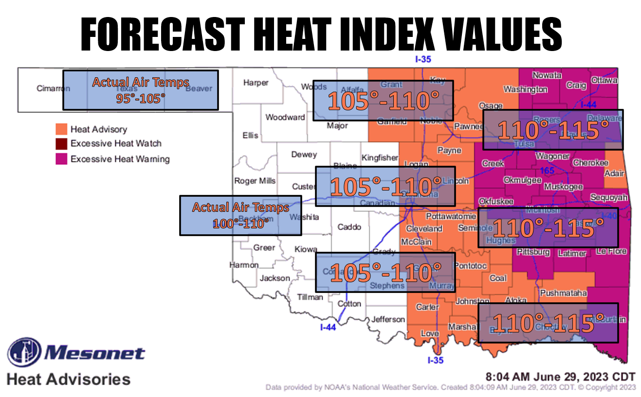
Yeah, that looks pretty bad, right? But here's the deal...it probably won't be as
bad as yesterday, and tomorrow will be even a little bit cooler. So we're on the
downhill slide (and we all know just how painful that can be) until we really
cool off over the weekend and through much of next week. Not exactly cool (that
was my nickname in college, by the way), but seasonable at worst.
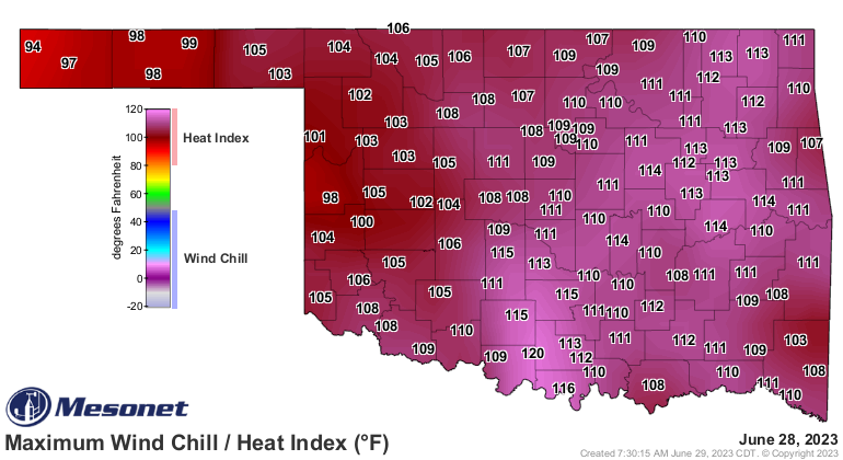
But speaking of yesterday, when all our troubles seemed so close, check out that
heat index of 120 at Ringling! And the widespread 110+ values! And the actual air
temps weren't too much better.
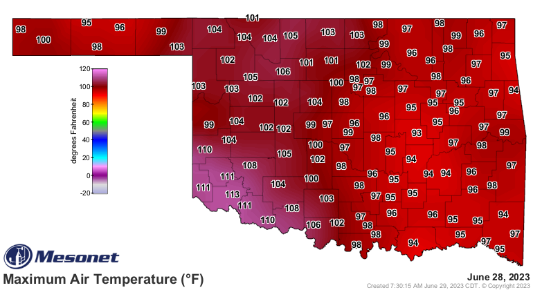
Yikes, 113 degrees at Altus?!? That's the highest temperature we've seen in the
state since July 19 of last year when Mangum hit 115 and several other sites
reached 114. So it could always be worse (that was my nickname in high school...
I was quite popular!).
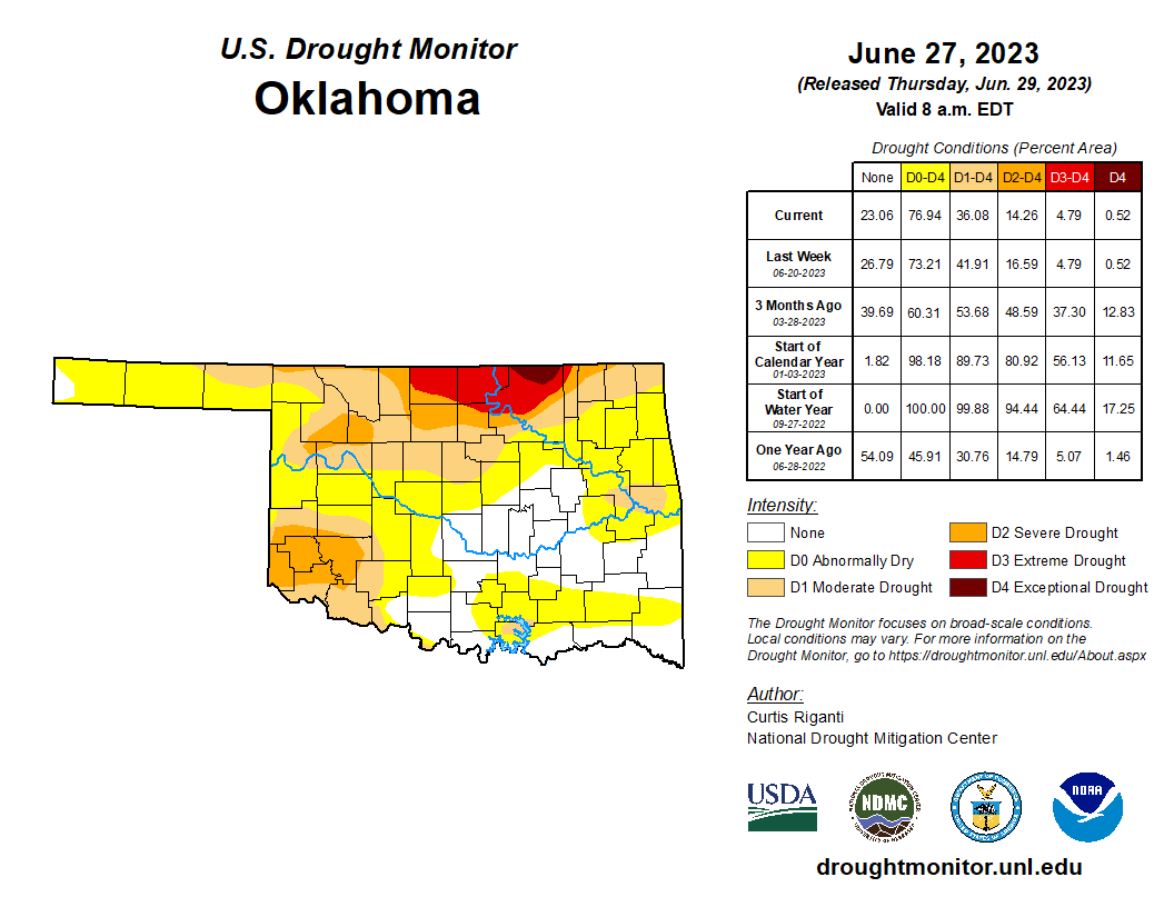
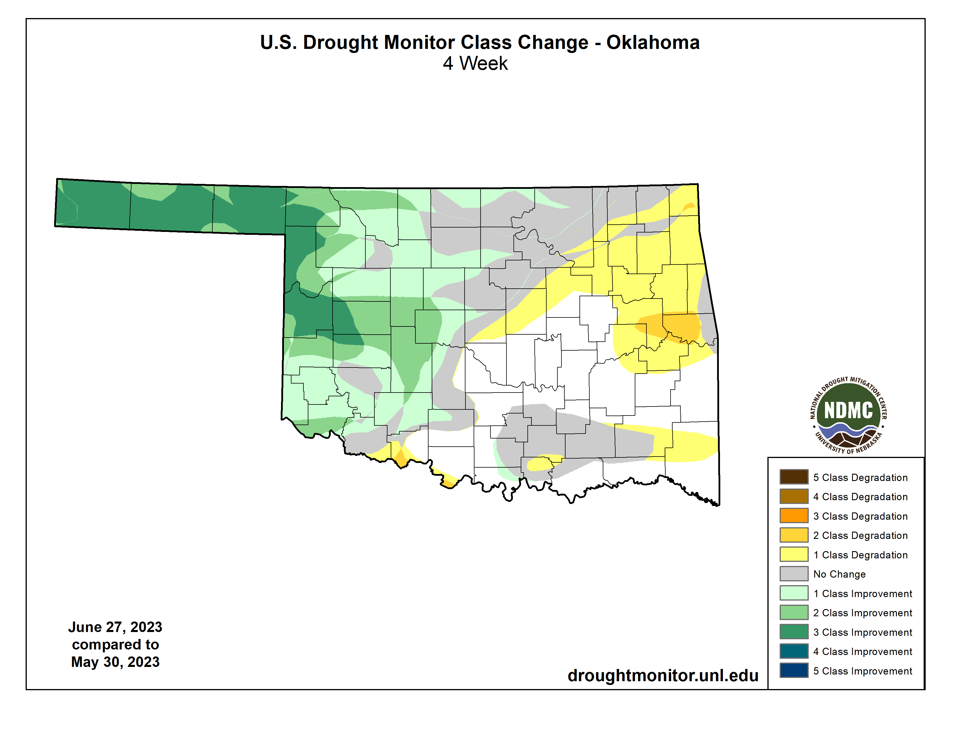
Speaking of worse, drought is sort of a mixed bag of that AND better. We're
down to about 36% of the state in drought, which is our lowest level ("lowest
level" was my nickname in elementary school!) since July 5 of last year. But
it is sort of an Even Stevens deal where we see big improvements in the NW half
of the state but worsening in the SE half. Check out the changes over the last
month and you can see how we've flip-flopped the experiences in the two halves.
Now the good news is that our rain chances should start to go up over the
weekend into early next week. We're not talking massive amounts here, but at
least it's moisture. AND it comes with cloudiness, which helps keep us from
sweltering in the July sun.

Nothing wrong with a good swelter, but best taken in moderation.
Gary McManus
State Climatologist
Oklahoma Mesonet
Oklahoma Climatological Survey
gmcmanus@mesonet.org
June 29 in Mesonet History
| Record | Value | Station | Year |
|---|---|---|---|
| Maximum Temperature | 111°F | HOOK | 1998 |
| Minimum Temperature | 47°F | GOOD | 2007 |
| Maximum Rainfall | 4.34″ | CLAR | 1995 |
Mesonet records begin in 1994.
Search by Date
If you're a bit off, don't worry, because just like horseshoes, “almost” counts on the Ticker website!