Ticker for September 28, 2023
MESONET TICKER ... MESONET TICKER ... MESONET TICKER ... MESONET TICKER ...
September 28, 2023 September 28, 2023 September 28, 2023 September 28, 2023
Mittens not provided
Summer in the Fall is like eating Reese's Pieces and expecting M&Ms. I mean, the
Reese's Pieces have the candy coated shell and all, but that peanut butter instead
of chocolate? No. That's what Reese's CUPS are for, for crying out loud (heck no,
it's not raining)! I might have bestowed (and we all know just how painful that
can be) the virtues upon FALL summer yesterday, but the sweat at the end of
September?
Again, just no.
Pleasant enough at night, but if you have to walk more than 5 feet outside in the
middle of the day, you'll once again end up making your own gravy. This is why
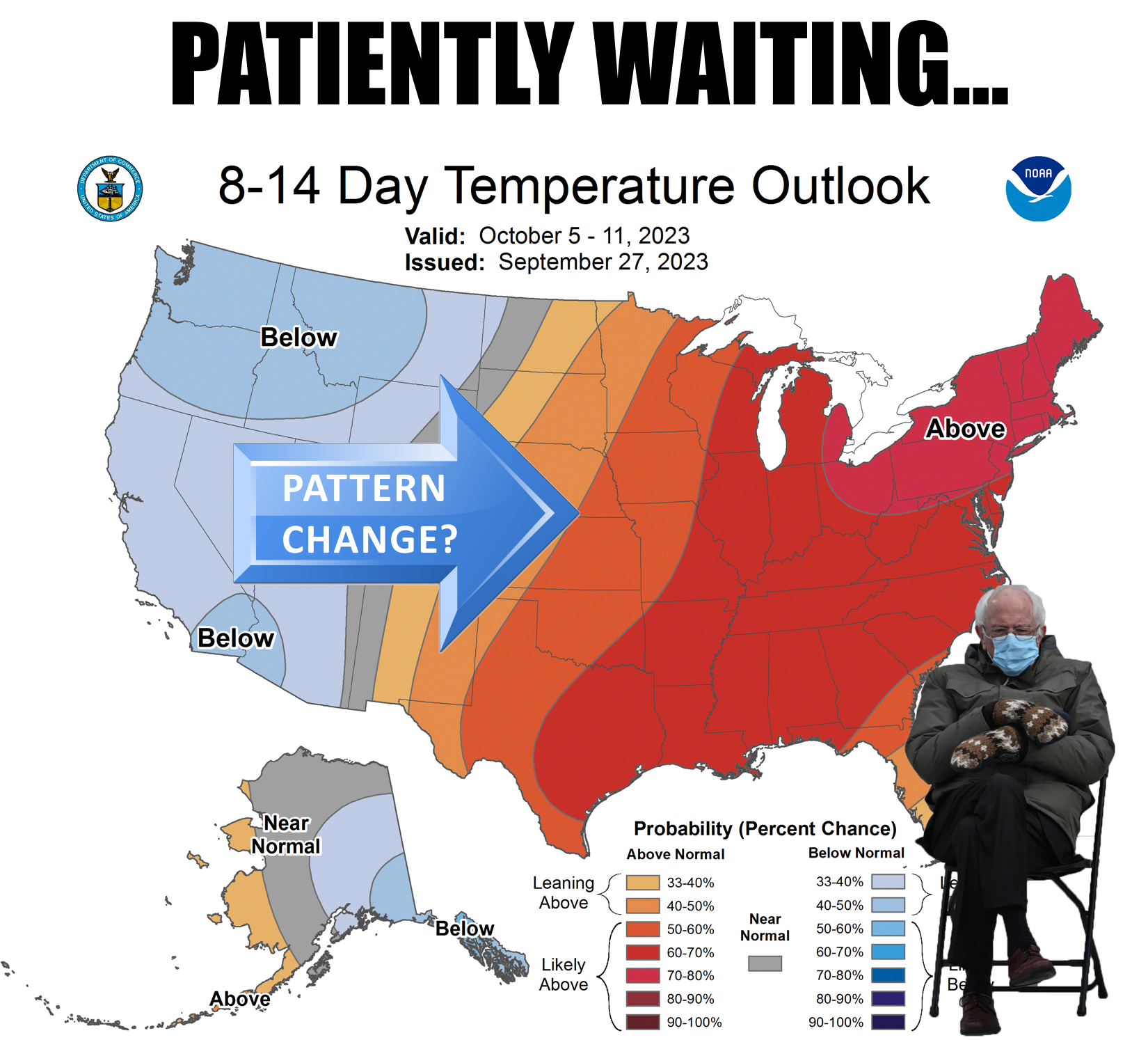
we are patiently waiting our next pattern change. That COULD (not SHOULD, not
WOULD) come late next week with an upper-level low pressure system moving our
FALL summer death ridge out of the way and usher in some northerly flow around
these parts. AND some rain before that, although it might come with the
possibility of a few nasty storms mid-week.
It SHOULD (also COULD, not WOULD) cool down next week as we get those storm
chances in here. More clouds, more moisture, and the beginning bump of the
heat dome.
Buy some biscuits before then, because there'll be lots more gravy.
(Pause for your nausea to pass).
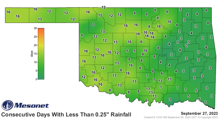
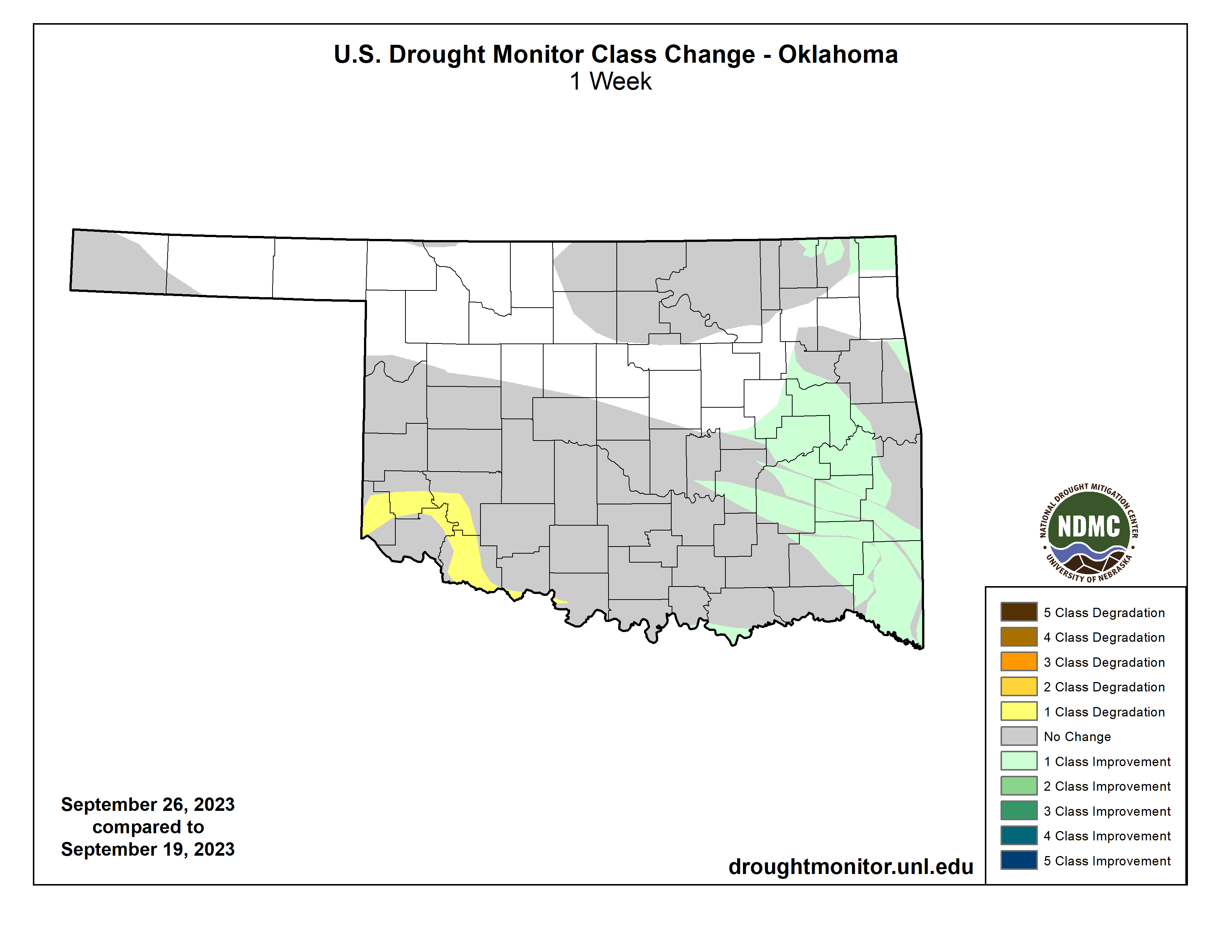
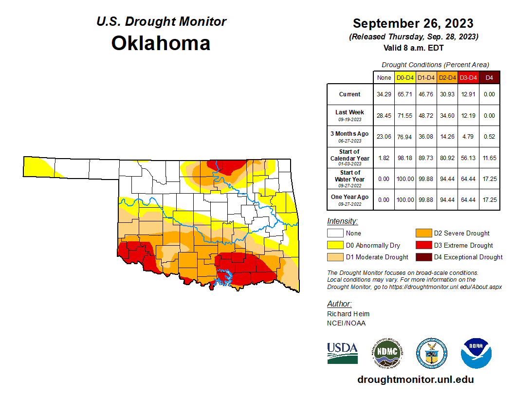
How about the new Drought Monitor map? Well, as we've seen in the past few weeks,
the good rains keep hitting where the drought ain't. I mean, kudos to those folks
that got the bigger rains, but we're currently in another growing dry spel. Yes,
I know how to spell "spell," but the Reese's Pieces fans told me to hurry up and
get the L out of here. We see some areas going more than two weeks without
significant rains, and that could grow to 3 weeks for many.
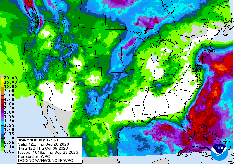
But take a look at the rains we had to work with for today's Drought Monitor
map.
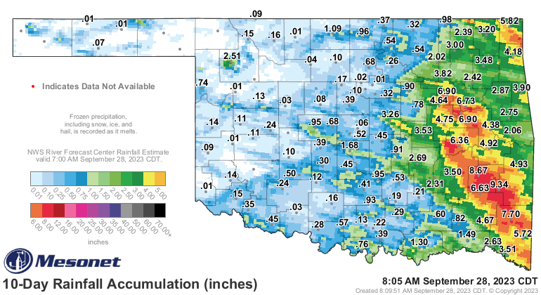
Those heavy rains across eastern OK yielded some good changes over that way,
but most of the southwestern half of the state was dealt a dry hand, and the
same for north central OK. The area of extreme (D3) drought in southern OK
continues to spread.
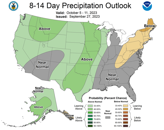
Unfortunately, we're not seeing big rains coming, but more of those convective
type of storms that leave a lot of folks wanting. We see increased odds of
above normal precipitation, but "normal" for this time of year is getting
smaller and smaller.
So I've angered the Reese's Pieces caucus, gravy fans (still gross), and
spelling bee nerds (Spelling Bee Nerds was my band's name in Kindergarten!).
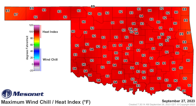
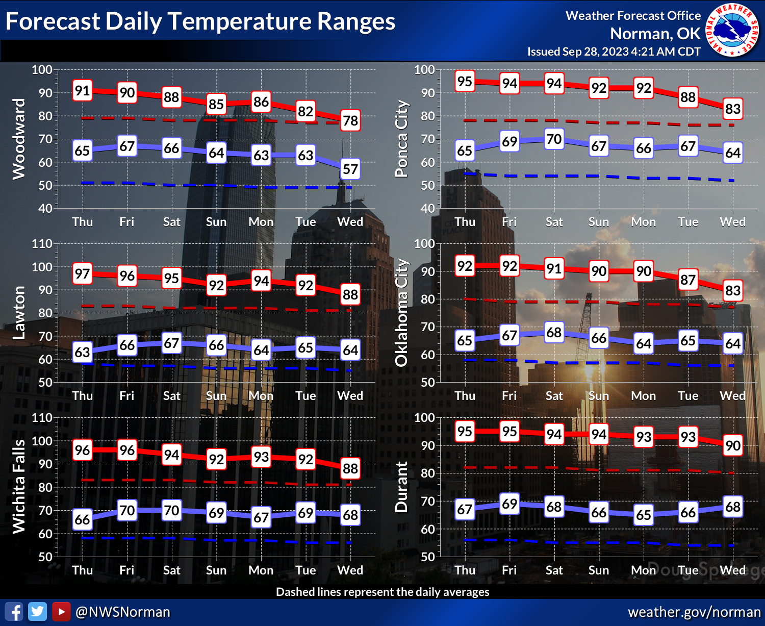
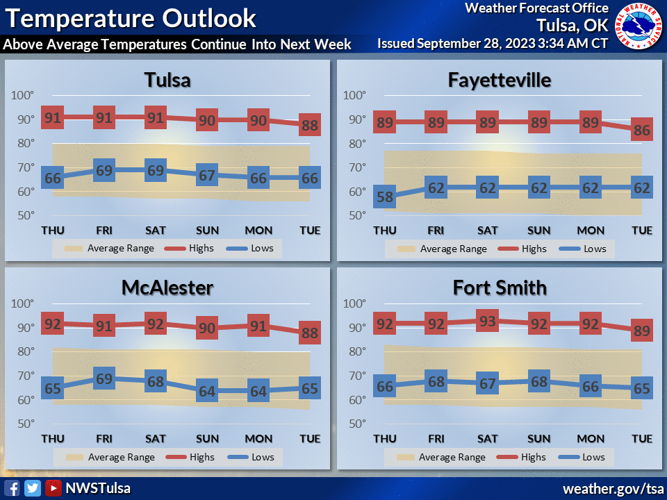
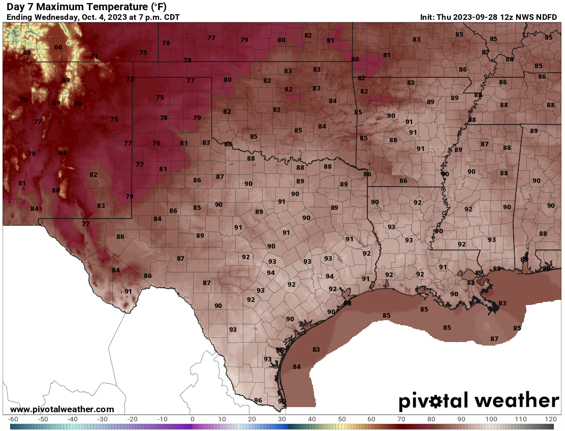
I leave this map of forecast high temperatures for next Wednesday as a peace
offering (WOULD, COULD, SHOULD...whatever it takes).
Gary McManus
State Spelling Bee Nerd
Oklahoma Mesonet
Oklahoma Climatological Survey
gmcmanus@mesonet.org
September 28 in Mesonet History
| Record | Value | Station | Year |
|---|---|---|---|
| Maximum Temperature | 100°F | WALT | 1998 |
| Minimum Temperature | 35°F | KENT | 2006 |
| Maximum Rainfall | 3.03 inches | SEIL | 2013 |
Mesonet records begin in 1994.
Search by Date
If you're a bit off, don't worry, because just like horseshoes, “almost” counts on the Ticker website!