Ticker for May 28, 2024
MESONET TICKER ... MESONET TICKER ... MESONET TICKER ... MESONET TICKER ...
May 28, 2024 May 28, 2024 May 28, 2024 May 28, 2024
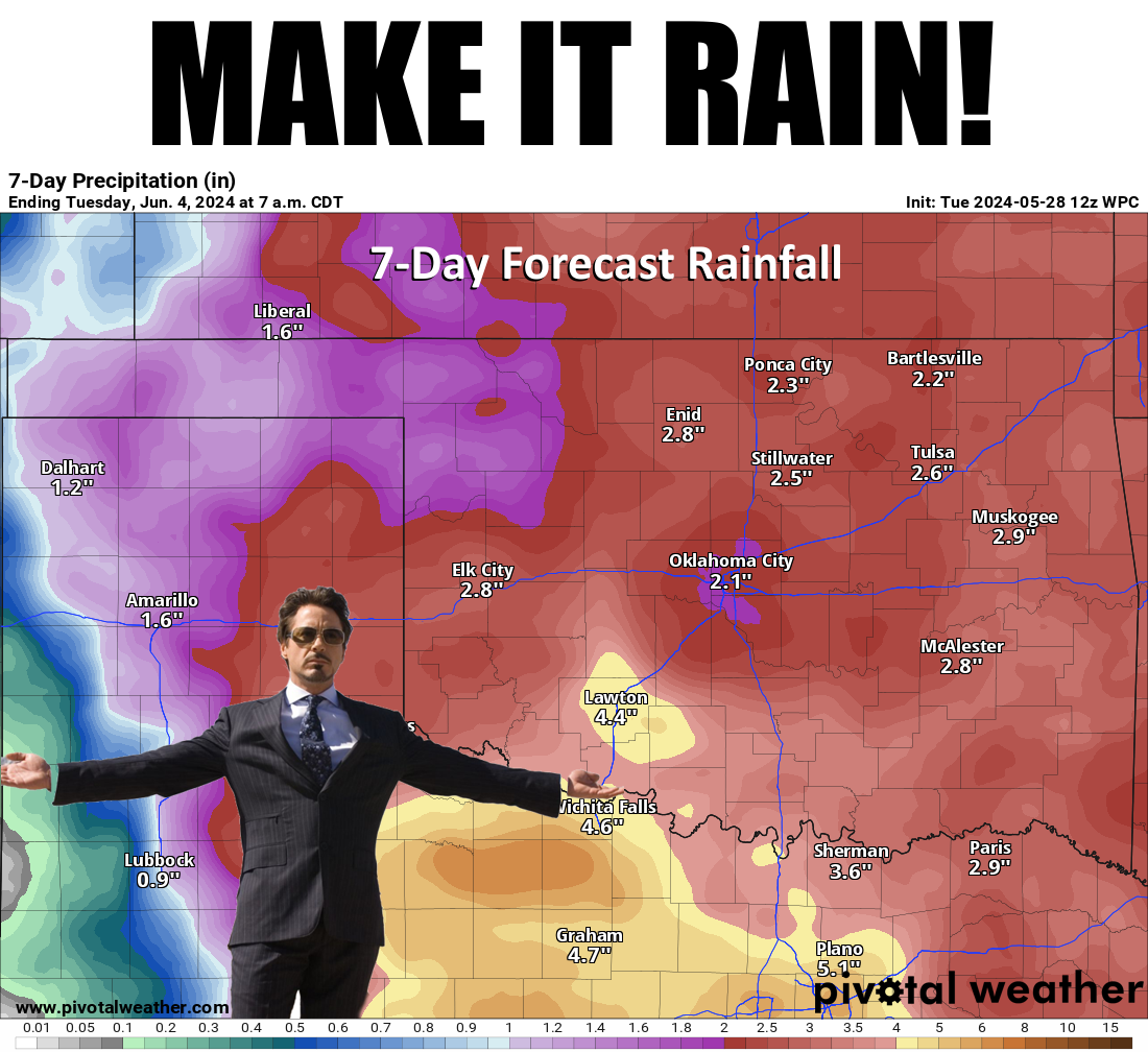
Make it rain!
Sometime in early-to-mid June, our atmosphere undergoes a transformation from
spring storms that generally form out west and march to the east-northeast,
bringing classic supercell shenanigans, to summer storms. These form out in the
High Plains and march to the south-southeast and can bring bigtime rains and
lots of wind. Sort of like how you turn 40 and all the magic in your life dies
(experiences may vary...those with hair don't know!). But don't worry, 50 is the
new 40, supposedly, and this year it appears late-May is the new mid-June, because
that's what we're gonna see (generally) over the next week or so.
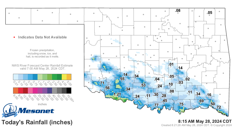
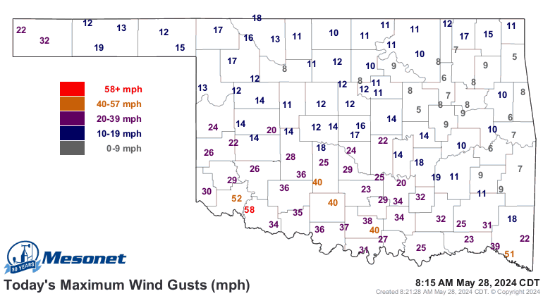
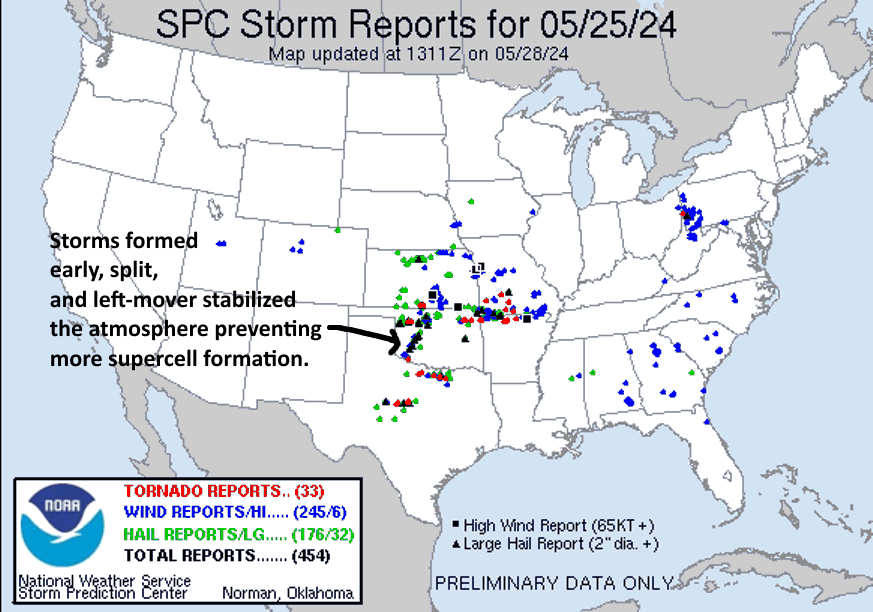
We already had our severe storms this morning that brought (ahem!) lots of rain
and severe winds across the southern third or so of the state.
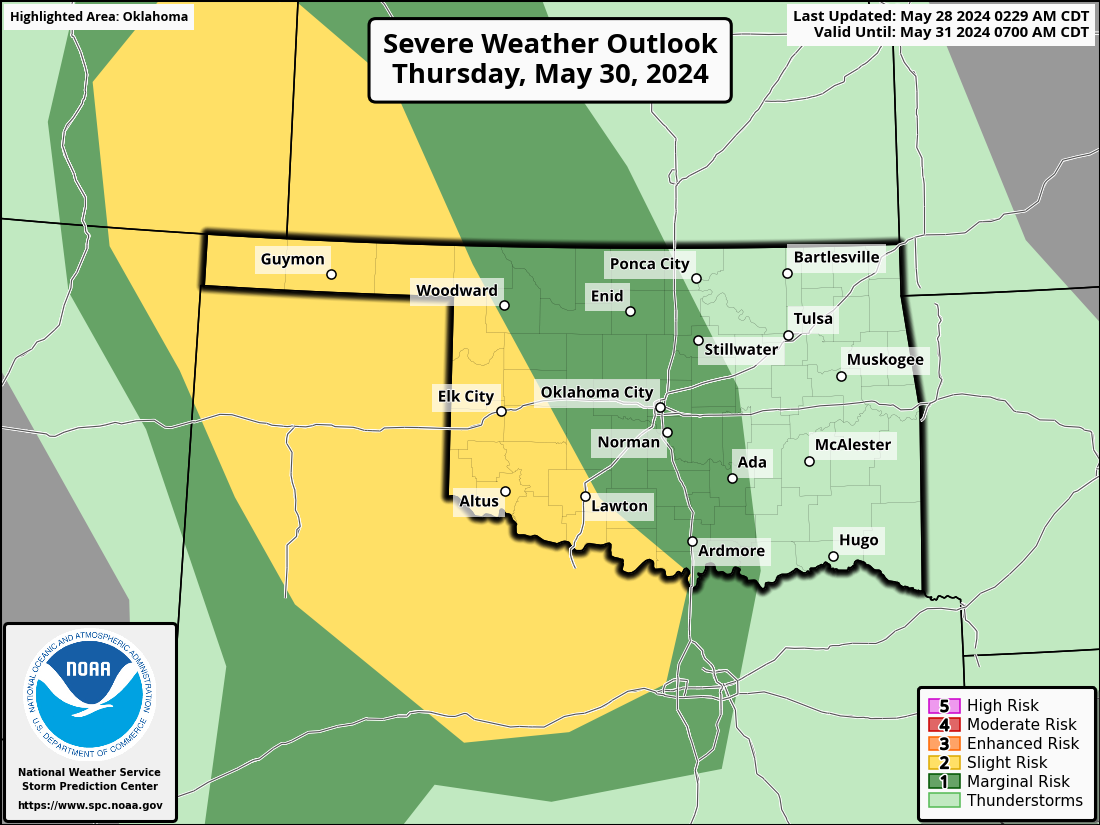
You can see this action coming up later tonight and again on Thursday in the SPC
outlooks, with the northwest/Panhandle through SW OK swaths of enhanced severe
weather risks.

Of course it would be best to have NO severe weather, but that's not how things
work if you want rain in Oklahoma. But it's a large size better than what we've
seen over the last 6 weeks or so. Our tornado count, preliminary as it may be,
is up to around 98 with the addition of storms from Saturday, including another
EF3 monster up near Claremore. That makes 2024 9th on the all-time annual
tornado count (since accurate records began in 1950). Oops...tied for 8th, that
is. I AIN'T BACKSPACING!
Year Annual Tornado Count
2019 149
1999 145
2011 119
2015 111
1957 107
2010 103
1982 101
1960 98
2024 98
2024's numbers will go up with further investigation, probably, so 1960 shouldn't
rest on its laurels just yet. AND we still have 7 months to add to those numbers.
As of today's preliminary count of 98 January-May tornadoes, that puts 2024 in
THIRD place in that category behind 2019's 127 and 1999's 116.
The worst count is the 7 fatalities that have been confirmed with these twisters
in 2024, and the hundreds injured. Saturday definitely could have been much
worse. Looks to me and those smarter than me (I heard that!) like the early
storm formation to the SW and a left-mover from a split storm saved much of
the southern half of the state that we saw across northern OK. Splitting storms
shoot out a left-mover that can be severe (with very low tornado risk) and
right-mover that brings the bad stuff.
Still...bad enough. Aren't we all just ready for summer and watching those
triple-digit temperature counts instead? WHO'S WITH ME!! Okay, who's SORTA with
me?? High 90s, maybe (hey, "High 90s" was my band's name in the French Foreign
Legion! And I was high on life, if you are thinking the other thing.)? Our
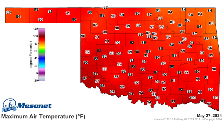
hundred map for the year thus far looks pretty sparse.
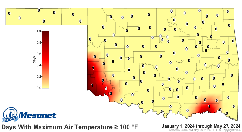
Nothing like that showing up for the rest of the week, at least, after
yesterday's scorcher with Hugo hitting 100.
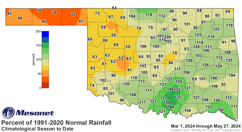
We still need lots of rain across the NW quarter of the state, so this transition
to a High Plains summer rain pattern might be just the fix.
All that rain with summer heat added in later on? Ugh.
Gary McManus
State Climatologist
Oklahoma Mesonet
Oklahoma Climatological Survey
gmcmanus@mesonet.org
May 28 in Mesonet History
| Record | Value | Station | Year |
|---|---|---|---|
| Maximum Temperature | 105°F | BEAV | 2022 |
| Minimum Temperature | 39°F | KENT | 2016 |
| Maximum Rainfall | 4.53 inches | MANG | 2023 |
Mesonet records begin in 1994.
Search by Date
If you're a bit off, don't worry, because just like horseshoes, “almost” counts on the Ticker website!