Ticker for September 27, 2018
MESONET TICKER ... MESONET TICKER ... MESONET TICKER ... MESONET TICKER ...
September 27, 2018 September 27, 2018 September 27, 2018 September 27, 2018
Uhhhh, BRRR?
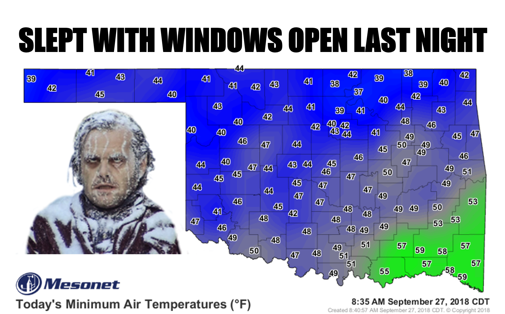
Now those aren't the lowest temperatures we've seen this season. I know you see
a few 30s on there scattered around northern Oklahoma. But Eva hit 36 degrees on
the 22nd, and we had a few other Panhandle stations dip below 40 around that time
as well. But last night was probably the first time we've seen WIDESPREAD
temperatures in the lower 40s -- with a few 30s and 50s thrown in for good
measure. So those folks brave enough to sleep with their windows open up north
possibly froze their Jack Nicholson off. But hey, those electric bills are gonna
be half of what they were last month.
The rains we saw yesterday were unwelcome to some, especially in south central
Oklahoma, but great for everybody else. So these rains won't count for this
week's Drought Monitor depiction, given that they fell after the Tuesday morning
cutoff for consideration. But they will be used to make more possible
improvements on next week's map.
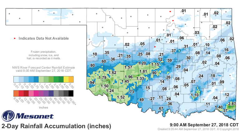
And you can see the enormity of the rains over the last week, and what we've seen
so far this month.
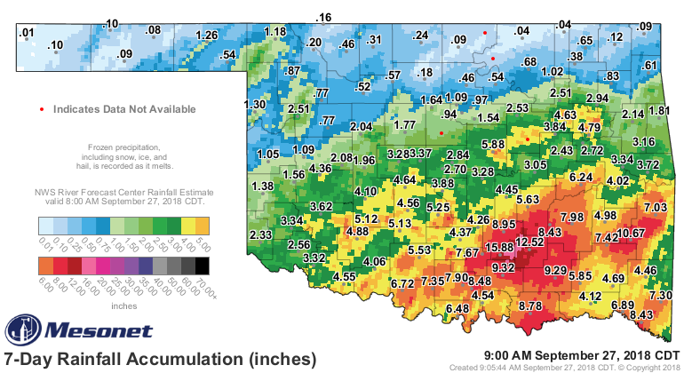
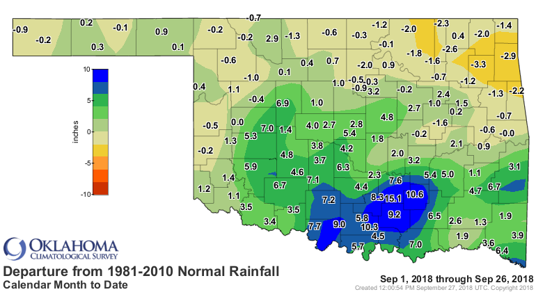
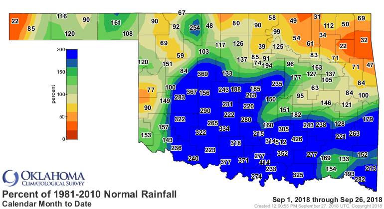
Yep, 18.8 inches thus far in southern Pontotoc County at the Fittstown Mesonet
site, 15.1 inches above normal. That's going a bit overboard. And there are
quite a few confirmed-but-not-official rainfall totals from that are in the 16
to 20 inches range. But a large part of southern Oklahoma is due to finish the
month 2-6 inches above normal. For south central Oklahoma, 7-10 inches above
normal with the extreme outlier at Fittstown. And for south central Oklahoma,
that is easily the wettest September on record for that part of the state.
EASILY. It doesn't matter that there are 4 days left in the month, doesn't
matter those stats only say through 1921...this will finish as THE wettest
September on record for south central Oklahoma since records began in 1895. The
previous record for the entire month was 9.69 inches from September 1936. Who
says it didn't rain during the Dirty Thirties?
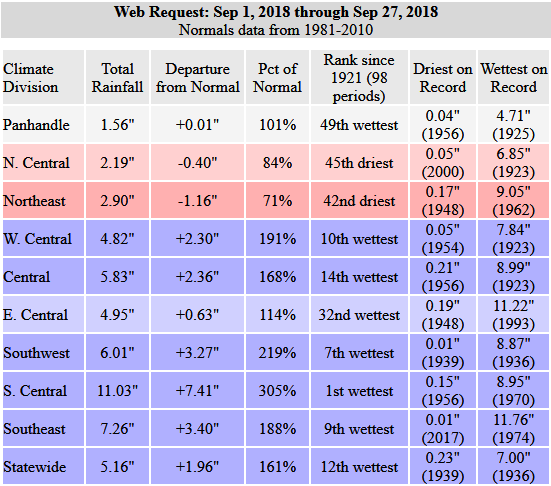
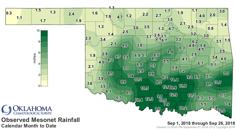
As you can see there, the northeast is still quite dry for September, at least
in spots, with deficits of 2-3 inches from Osage to Adair County.
So what's coming up? It looks like we're going to get back into a more September
rather than October pattern for a bit after our current cooldown. Highs will
return to the 80s with lows in the 60s. There will be a few rain chances over
the weekend, but nothing too drastic.
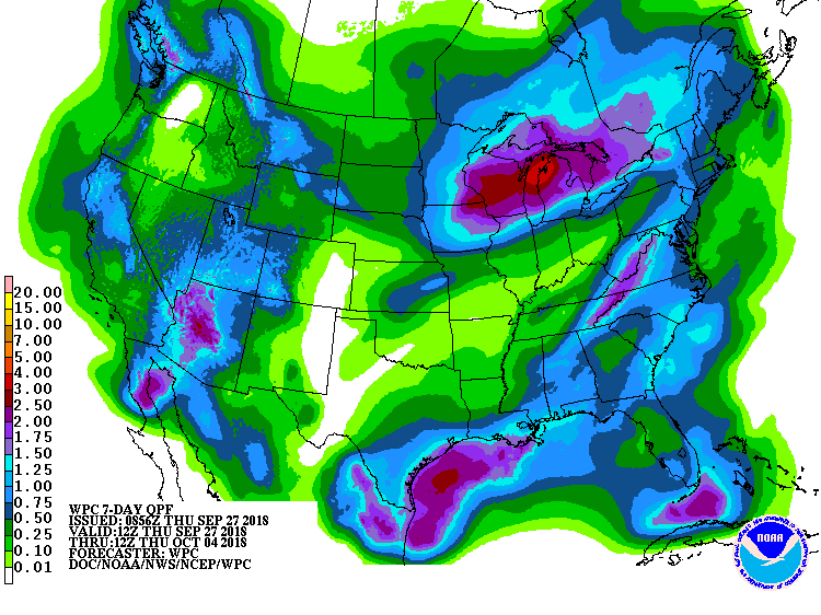
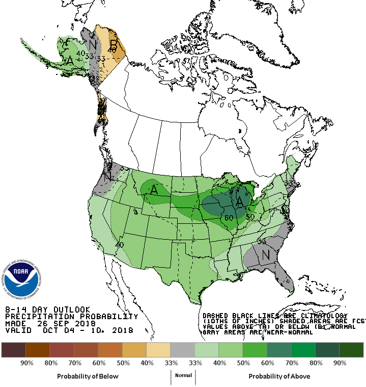
After that, maybe more rain chances, but also staying on the warm side. If you
look at this temperature outlook, however, you see the beginnings of another
possible cold front after next week.

Hard to say this far out. Personally, I like the 80s and 60s (in that order).
Fall has knocked, entered, and is moving into the extra bedroom. Before long,
winter will be kicking it out. Then spring rings the doorbell.
How many months 'til summer again?
Gary McManus
State Climatologist
Oklahoma Mesonet
Oklahoma Climatological Survey
(405) 325-2253
gmcmanus@mesonet.org
September 27 in Mesonet History
| Record | Value | Station | Year |
|---|---|---|---|
| Maximum Temperature | 101°F | BUFF | 2019 |
| Minimum Temperature | 36°F | OILT | 2010 |
| Maximum Rainfall | 2.86 inches | CLAY | 2012 |
Mesonet records begin in 1994.
Search by Date
If you're a bit off, don't worry, because just like horseshoes, “almost” counts on the Ticker website!