Ticker for August 26, 2020
MESONET TICKER ... MESONET TICKER ... MESONET TICKER ... MESONET TICKER ...
August 26, 2020 August 26, 2020 August 26, 2020 August 26, 2020
Reversal of fortunes
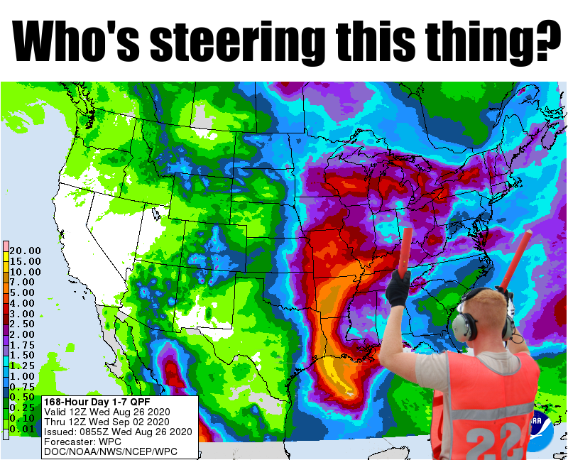
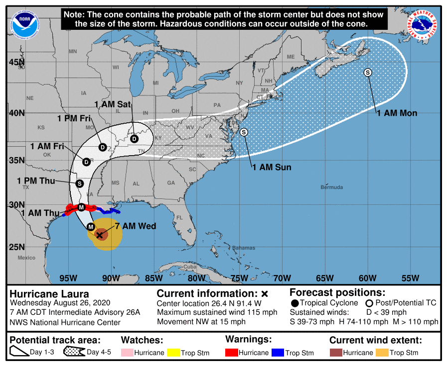
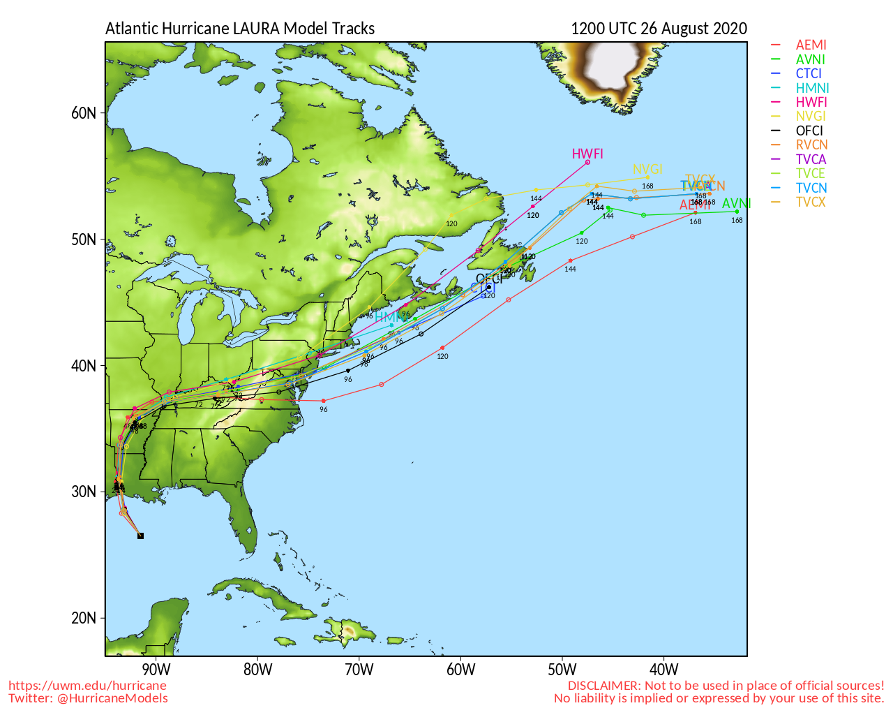
Man, I held out almost ZERO hope that Laura would take a dramatic swing to the
west and bring some rainfall to western Oklahoma. It's gonna brush MAYBE the far
eastern edge of the state, then add that precip to more rain chances later this
week into next week and you see the forecast above you. Yeah, it's above me, too,
but I still have to report it, and the remnants of Hurricane Laura's miss to
the east.
I can deal with that. I mean, I'll HAVE to deal with that when it comes to the
Drought Monitor work for next week...if western Oklahoma doesn't see good rains.
That forecast above looks "okay," but not great for those prospects. OKAY, like
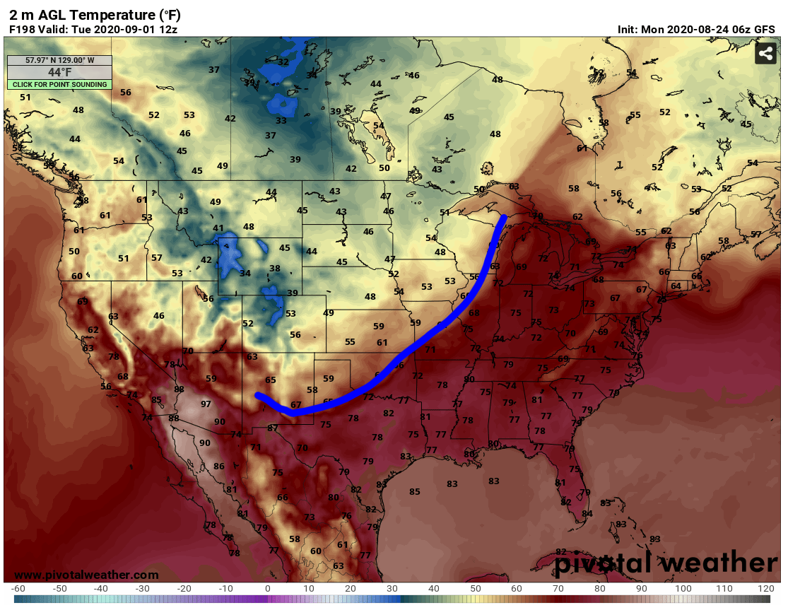
I said, I can deal with that. But now the models are putting the kibosh on our
cold front for next week. I looked for it late last night and wondered aloud to
my family "Hmmmmm, remember that cold front I said was going to blast us early
next week? Not looking so good now."
As is usual in my house, I was met with boos and hisses...and I wasn't even
cooking! Then this morning I read the forecast discussions of all the NWS
offices and NWS Norman splats this onto the page:
"The strong cold front seen in previous model runs appears less
certain with the latest iteration. While the GFS/ECMWF were in
remarkable agreement with yesterday morning`s package, they are no
longer. The GFS/Canadian do have the front pushing through on
Monday. However, cooler temperatures appear to be relatively
short-lived with these models having highs rebounding on Tuesday
into the 90s. The ECMWF struggles to push this front into our
area at all. Interestingly, the GFS/Canadian indicate yet another
frontal passage middle of next week. The GFS is quicker with the
front (Tuesday) with cooler daytime highs (80s) on Wed, whereas
the Canadian suggests arrival of the front to be Wednesday. The
ECMWF keeps temperatures hot all of next week (boo). Will be
interesting to see future model updates and trends."
Interesting indeed! Sometimes these things can disappear for a run (or two) in
the model output then come back stronger than ever the next run. We'll just have
to wait until the new model runs come out to see if it's back, or if they
back off even more. There wills still be a chance of showers and storms OUTSIDE
of Laura's arrival and departure with a cold front over the weekend and then
possible systems next week.
In memoriam of next week's front (if you're wondering how you can have a
memoriam for something that's never happened...work with me), let's take a look
back at a look forward that was much nicer, when we saw a strong cold front
blasting through the state next Monday morning.
But hey, don't feel so bad! Remember this day last year? Heat indices hit 110
in the east and high temps hit 100 in the west.
So hopefully I've anti-jinxed the jinx of the cold front I caused yesterday
by writing about it, by writing about how it's NOT going to happen now.
See how complicated forecasting is, what with all this jinx stuff?
Gary McManus
State Climatologist
Oklahoma Mesonet
Oklahoma Climatological Survey
(405) 325-2253
August 26 in Mesonet History
| Record | Value | Station | Year |
|---|---|---|---|
| Maximum Temperature | 110°F | WAUR | 2023 |
| Minimum Temperature | 46°F | SEIL | 2010 |
| Maximum Rainfall | 5.24″ | BROK | 2020 |
Mesonet records begin in 1994.
Search by Date
If you're a bit off, don't worry, because just like horseshoes, “almost” counts on the Ticker website!