Ticker for June 26, 2024
MESONET TICKER ... MESONET TICKER ... MESONET TICKER ... MESONET TICKER ...
June 26, 2024 June 26, 2024 June 26, 2024 June 26, 2024
Well THAT escalated quickly!
Infamous under-forecast events...
Me, 30 years ago: "Hmmmm, I think I'm losing a bit of hair..."
Me, yesterday: "It might storm tonight, with a chance of severe winds..."
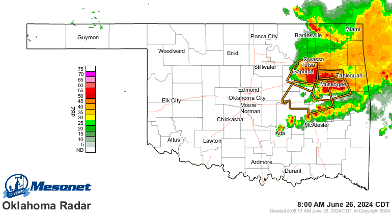
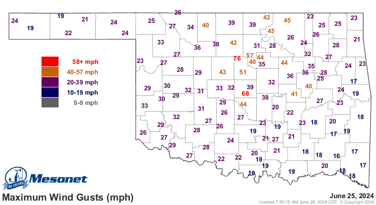
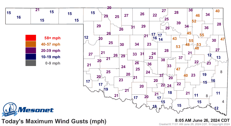
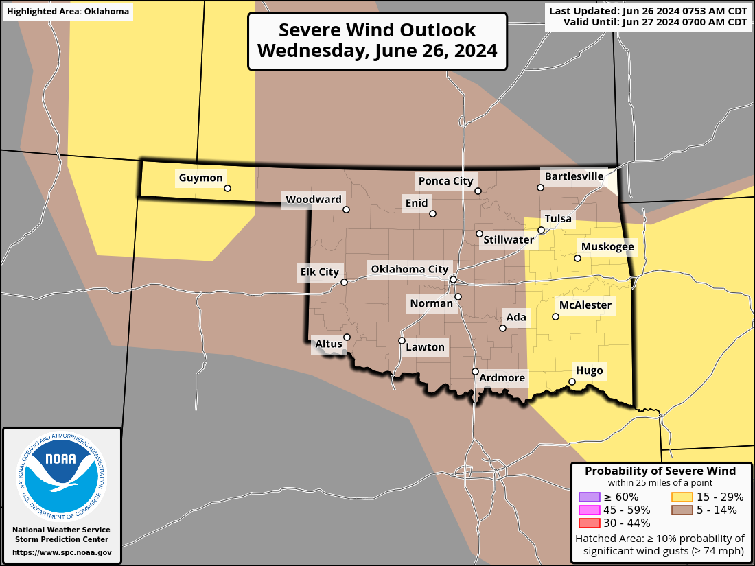
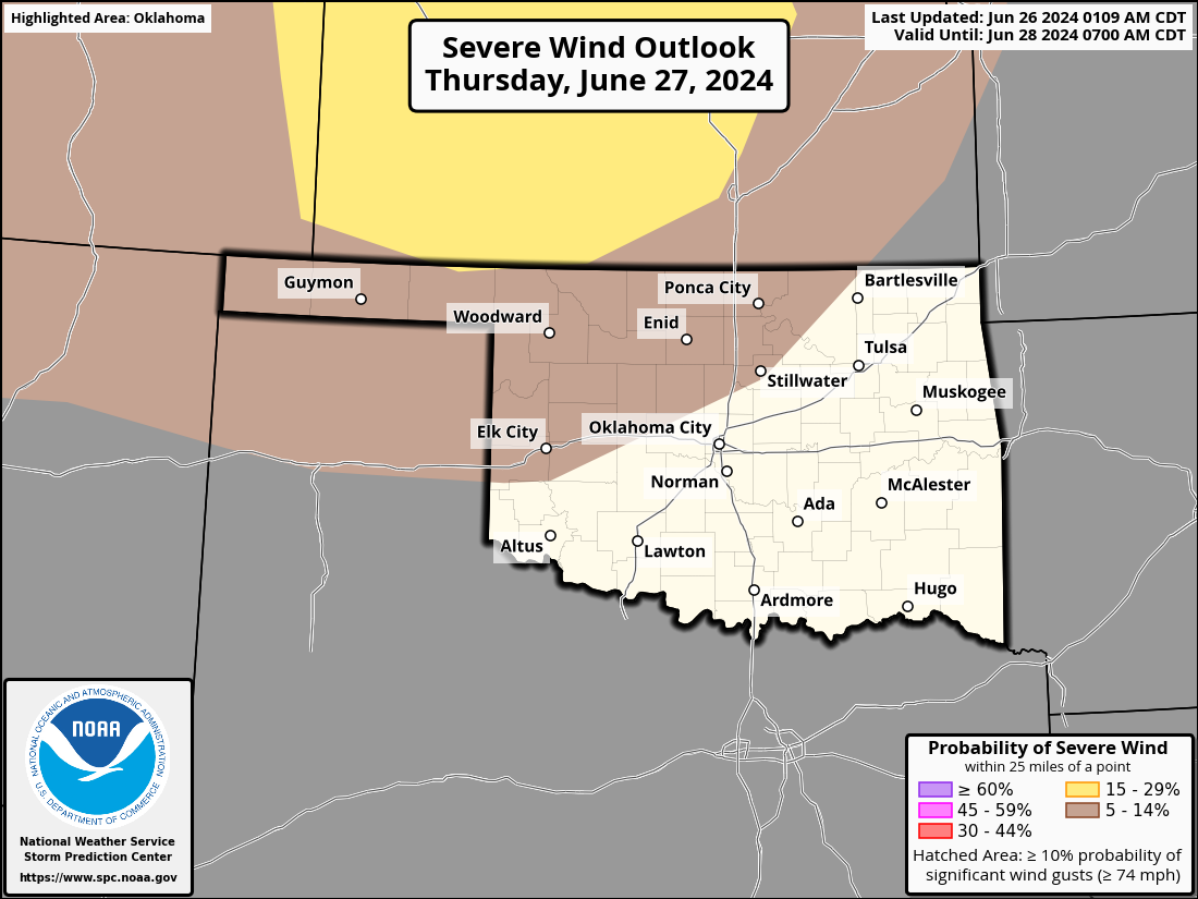
Ya think!! 60-90 mph wind gusts left a trail of destruction from north central
through central Oklahoma, and left tens of thousands without power. As utility
crews rush to the rescue, the scope of the disaster might not be totally
alleviated today. Heck, it's storming right now for crying out loud, exacerbating
the problem!
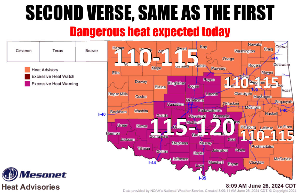
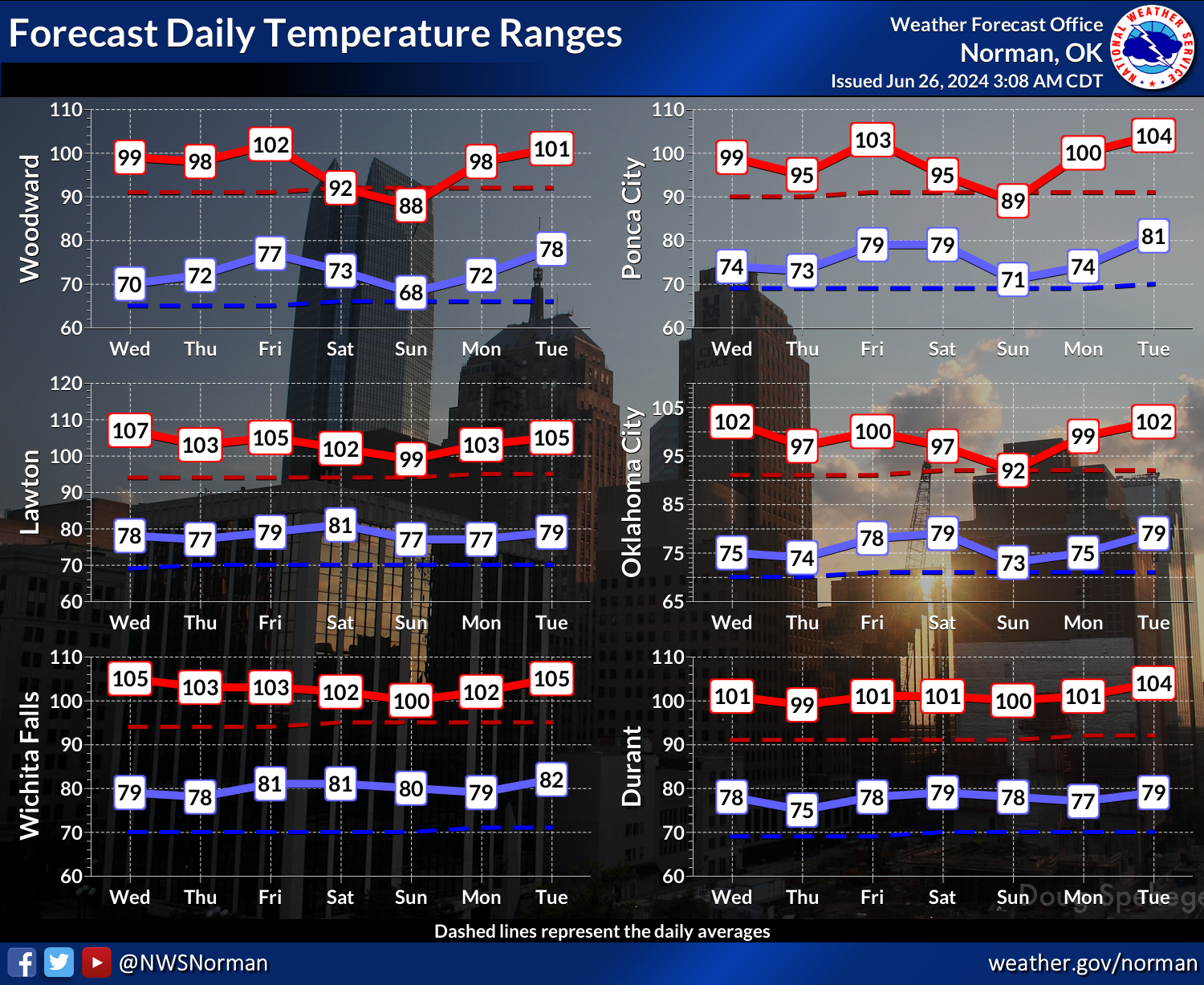
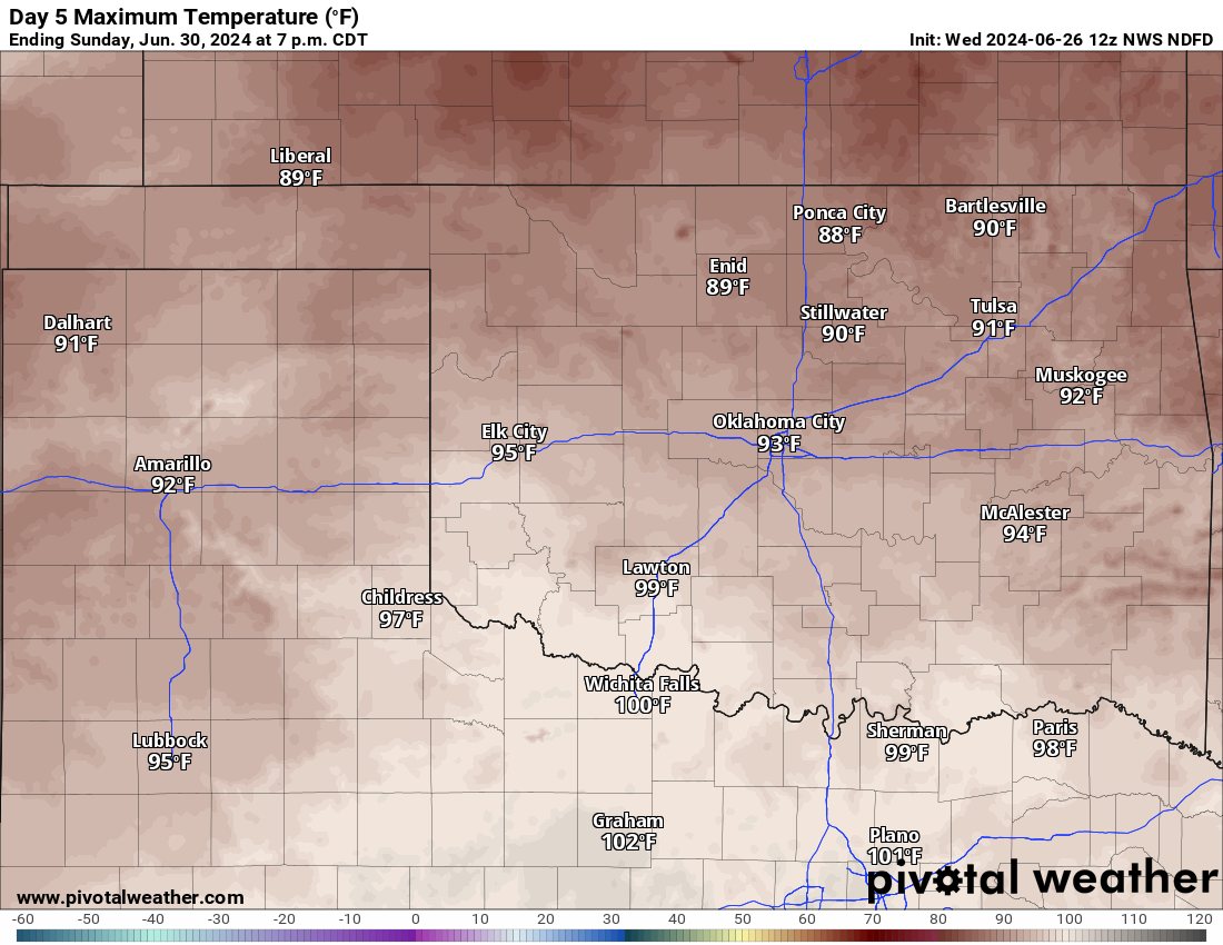
All of those power outages, should they last through the afternoon, leave us with
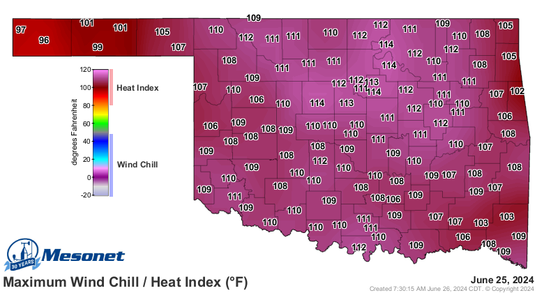
a very dangerous situation. Heat index values of 110-120F, very uncommon for
June, will place those without proper cooling in danger of heat illnesses.
Hopefully the power is back for most as we go through the morning. Lord knows
our power crews are some of the best in the world...they've simply had too much
practice, unfortunately.
I keep seeing in our Facebook comments (Facebook comments, where intelligence
goes to die) about how "it's just summer" and "this is normal." This, when
temperatures are 10-15 degrees ABOVE NORMAL, as if it makes any sense at all
how above normal--the very definition of NOT NORMAL--is normal. And here's
another deal...in the last 10 years worth of Junes in Oklahoma (that'd be 300
days if we count forward through this June), there have only been 12 days with
heat index values of 114F or higher in the state, and two of those are yesterday
and today (presumably). So only 4% of days, and nearly all of those were in
2016 and 2023. The problem to some degree (do NOT pardon the pun) is that folks
just aren't as acclimated yet, as if anybody COULD acclimate to a heat index of
115-120 like we could see today.
But you just knew all that heat and humidity yesterday was gonna cause a bit of
mayhem if storms went up.
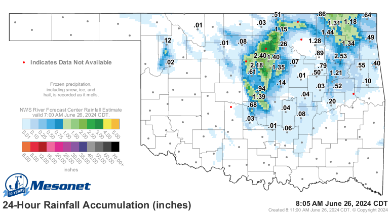
The good news? Rain. With flash drought upon us, we did manage to interrupt some
of its spread last night and then still today. Some had too much, of course. It
is Oklahoma, after all.
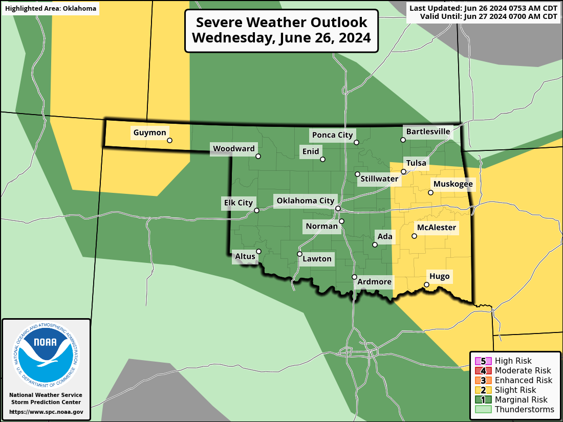
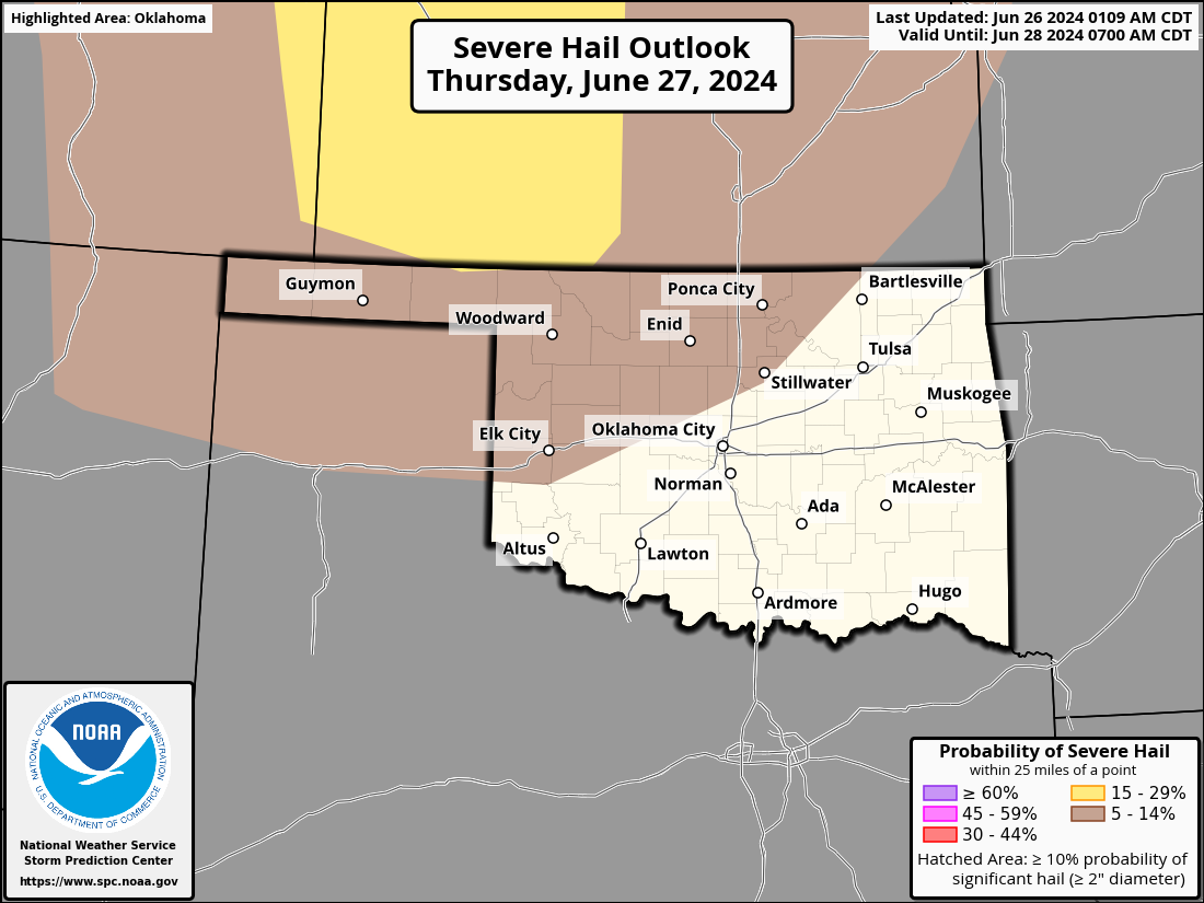
There will be another chance of severe storms today, which is somewhat of a DUH
statement, considering there are severe storms happening as we type.
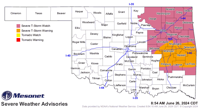
Again, all that heat and humidity...mayhem is possible. Same threats as yesterday.
And tomorrow.
More rain, which will cut into that flash drought a bit more. Just with less
90 mph winds, please. More heat's coming. Maybe a bit of a cool down during
the weekend? Just depends on how far south the cool front can make it. Your
experience may vary.
Gary McManus
State Climatologist
Oklahoma Mesonet
Oklahoma Climatological Survey
gmcmanus@ou.edu
June 26 in Mesonet History
| Record | Value | Station | Year |
|---|---|---|---|
| Maximum Temperature | 115°F | HOLL | 2011 |
| Minimum Temperature | 52°F | KENT | 2006 |
| Maximum Rainfall | 5.51″ | MIAM | 2021 |
Mesonet records begin in 1994.
Search by Date
If you're a bit off, don't worry, because just like horseshoes, “almost” counts on the Ticker website!