Ticker for August 24, 2023
MESONET TICKER ... MESONET TICKER ... MESONET TICKER ... MESONET TICKER ...
August 24, 2023 August 24, 2023 August 24, 2023 August 24, 2023
Double trouble
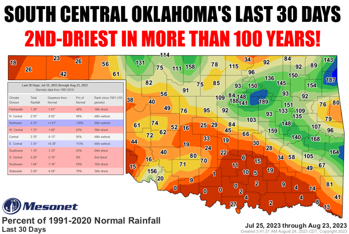
And just like that, drought more than doubles in Oklahoma, going from around 13%
a month ago to more than 28% on this week's new map.
(Does math...wait, I was told there would be no math!)
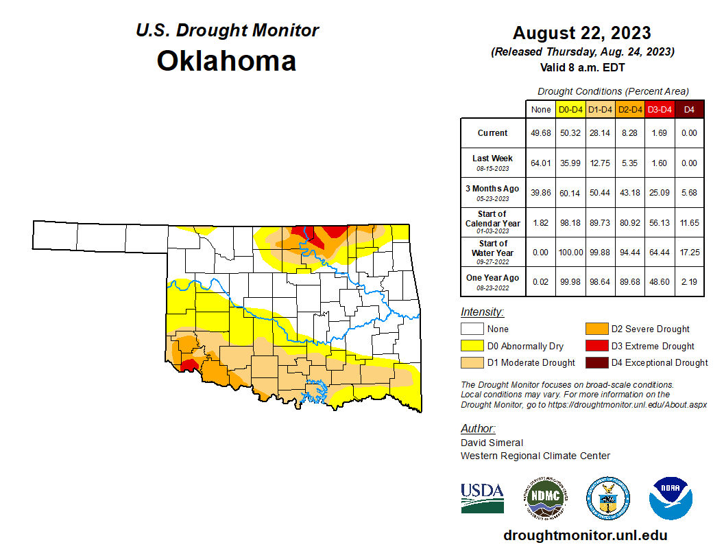
Yes, there is math involved, and unfortunately, a Summer of 2022-style flash
drought. Driven by the extreme temperatures we've had in the last month-plus, lots
of sun, and not lots of rain, we asked the U.S. Drought Monitor's national author
to add a large swatch of moderate drought (D1) across south central Oklahoma, and
an expansion of abnormally dry (D0) conditions surrounding that, signalling a
larger area in danger of drought expansion/intensification. We asked for a
doubling of hair on my scalp as well, but that was unfortunately denied by
genetics. You can see those obvious changes from this week, and then over the
last month.
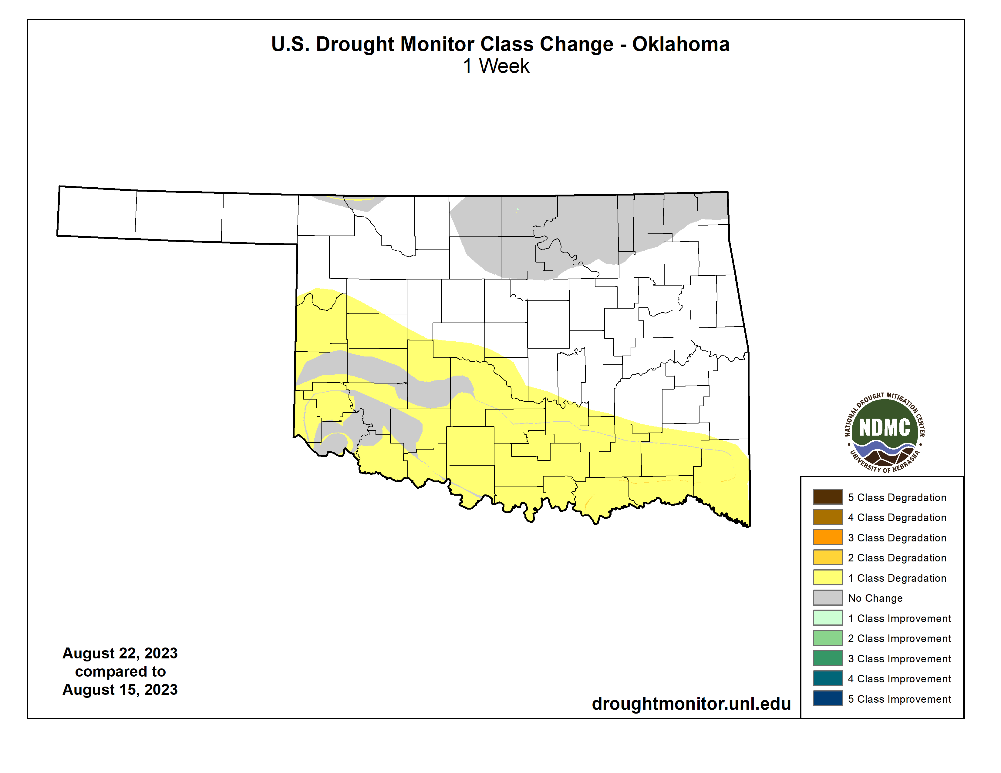
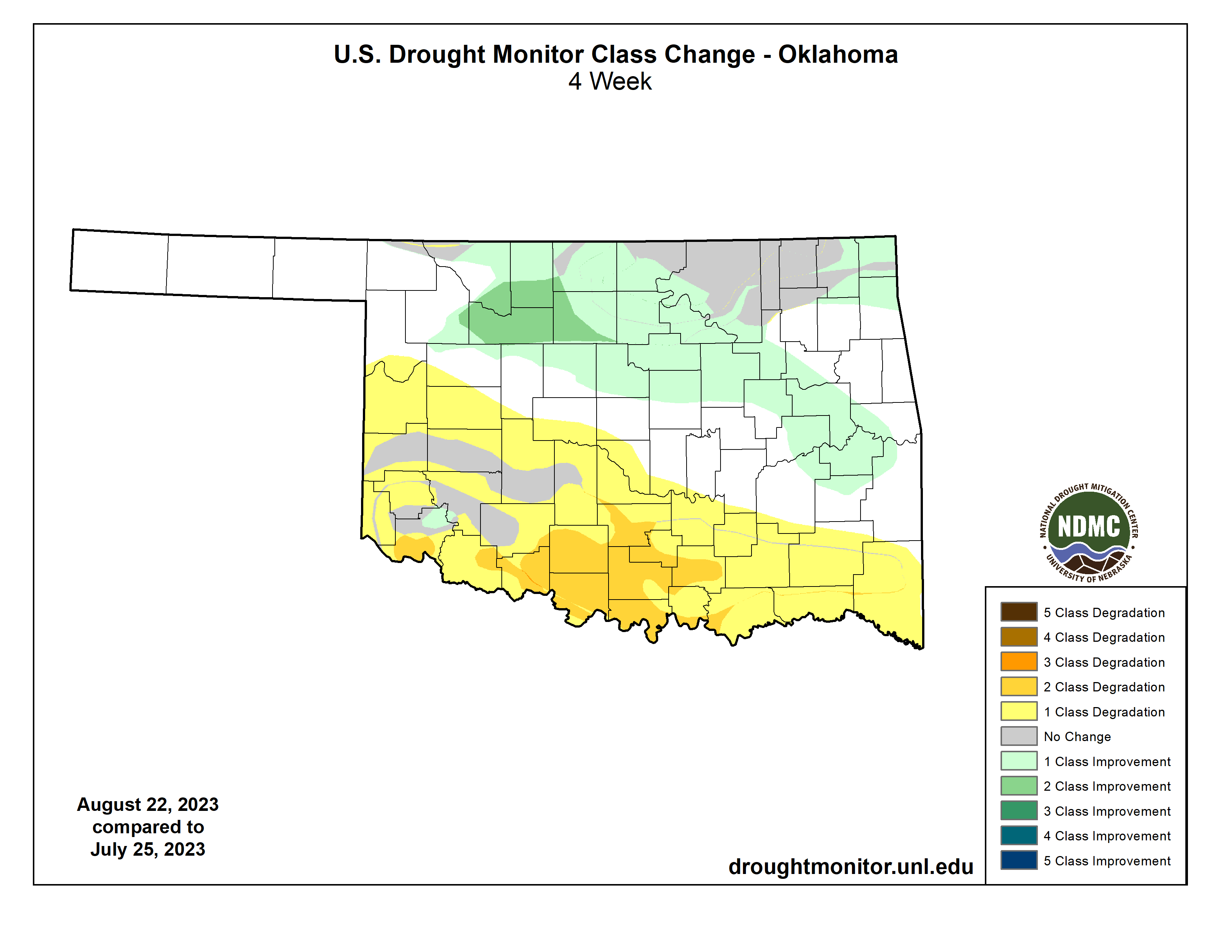
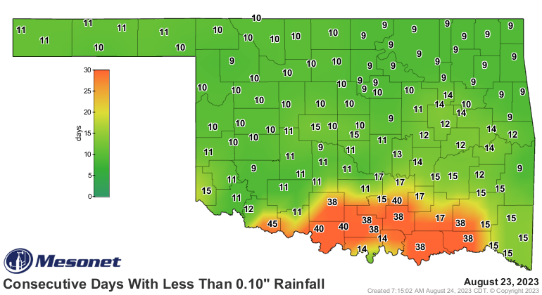
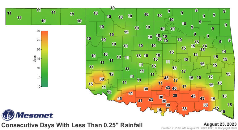
But make no mistake, the near-historic dryness in south central Oklahoma (and
extremely dry areas covering most of the southwestern one-half of the state)
doesn't stop at 30 days. That's an arbitrary construct of climate tools that
hinders us at times. No, this dry spell goes back a a month and a half to over
40 days.
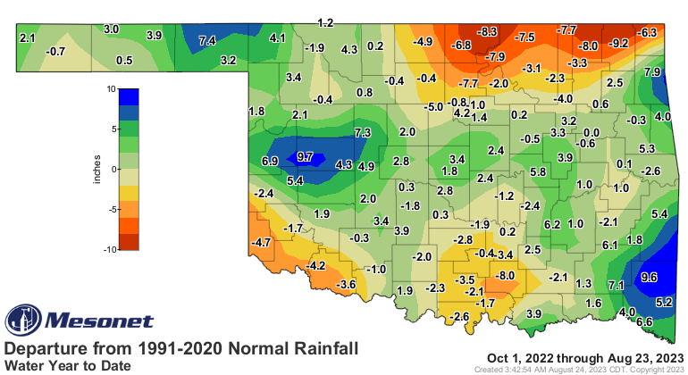
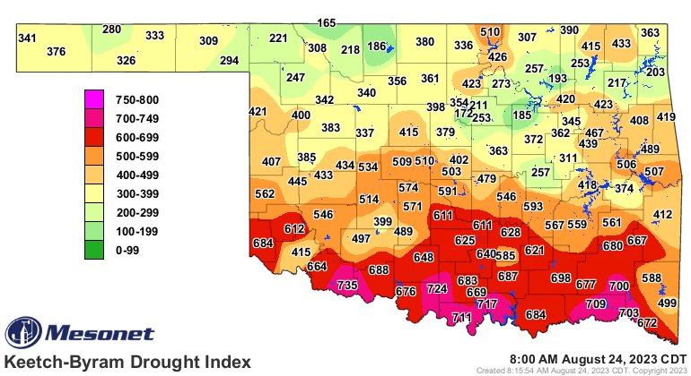
And then again there is the long-term dryness fueling those extreme (D3) drought
areas in north central and far southwest Oklahoma.
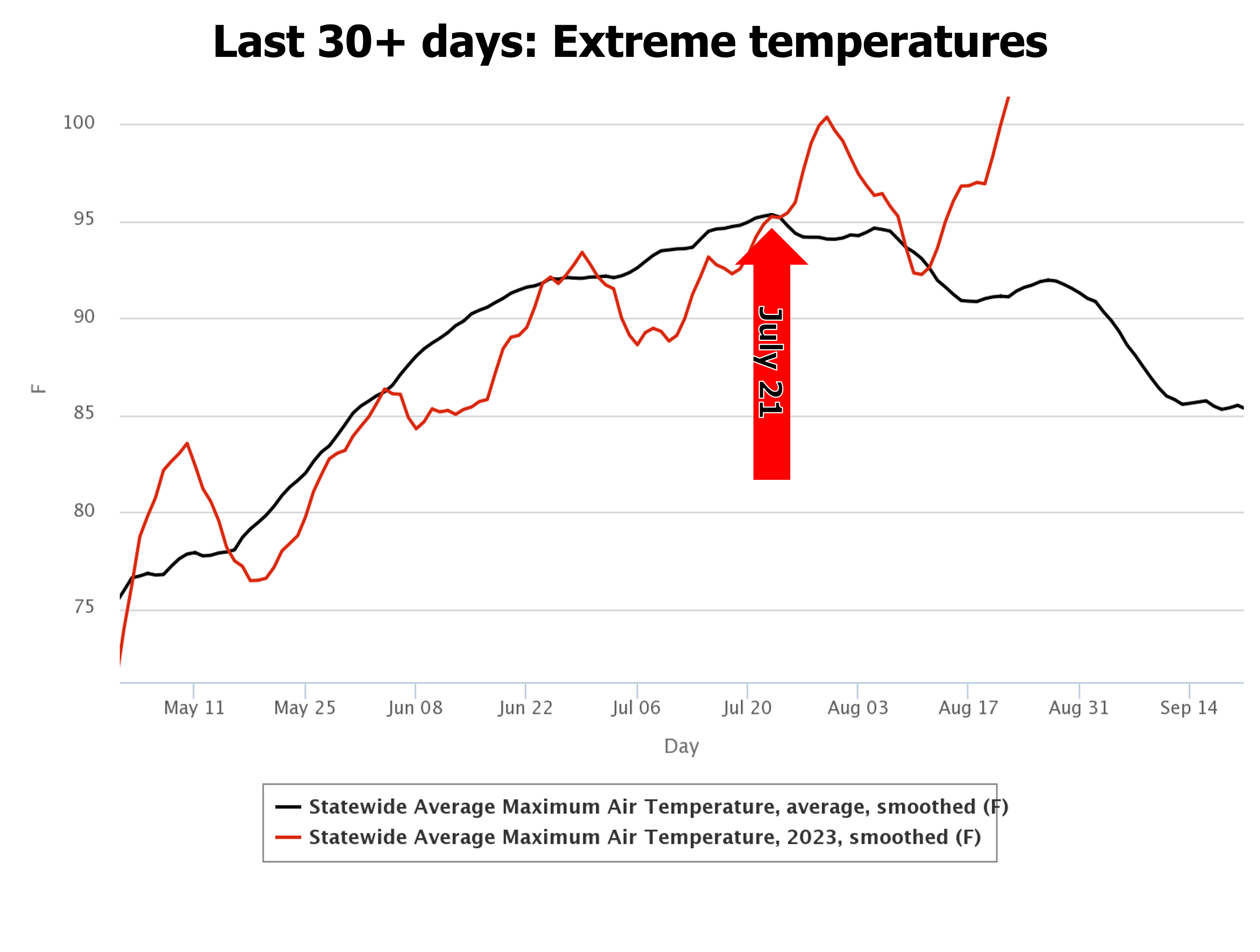
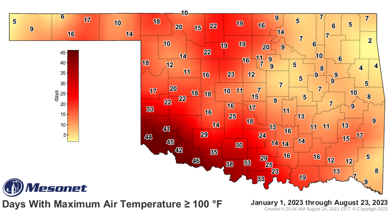
The heat wave fueling this here flash drought is fairly obvious as well, dating
back (much like the heat of last summer started on June 11 very abruptly) to
July 21. Now for southwest OK, it goes back to the beginning of summer and
before, but for our burgeoning 100s across the rest of the state, that's the
date. Rhyme unintended, I pretended.
The changes in the last month or so all point to worsening conditions, leading
to our current flash drought.
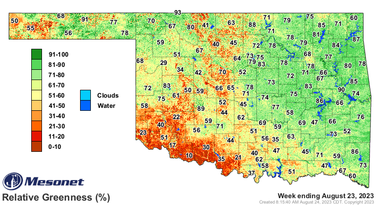
Soil moisture, dwindling.
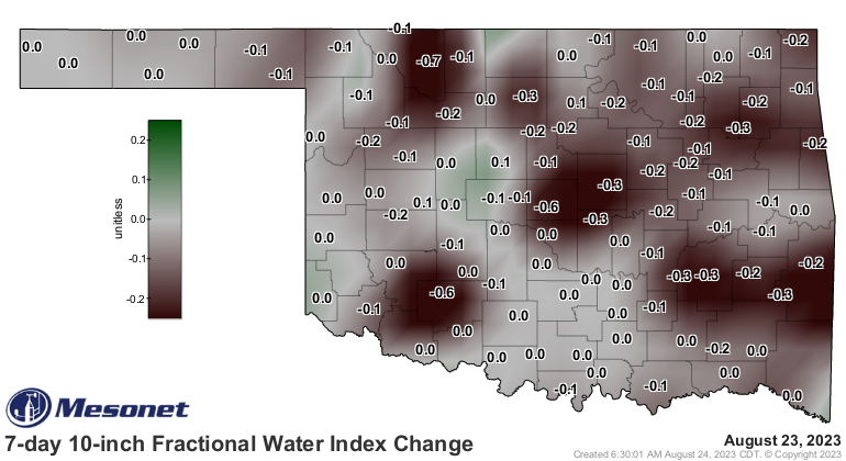
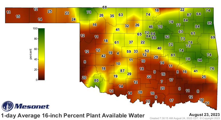
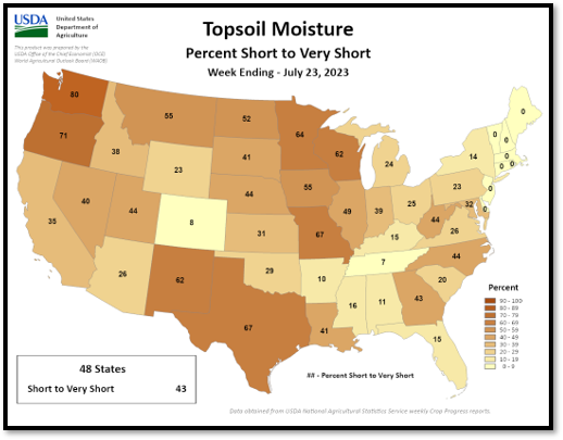
Even on the USDA's "short-to-very short" maps, the change in the last month is
evident, with the percentage of the state with those conditions basically
doubling over that period.

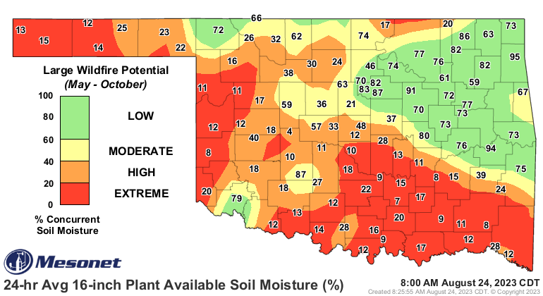
Fire danger has increased dramatically across southern OK as well as the
vegetation has died or gone dormant.
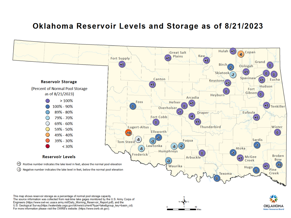
Current lake levels also reflect the long-term dryness with low levels in
SW, south central, and NE OK.
Now for the good news...
Waiting...
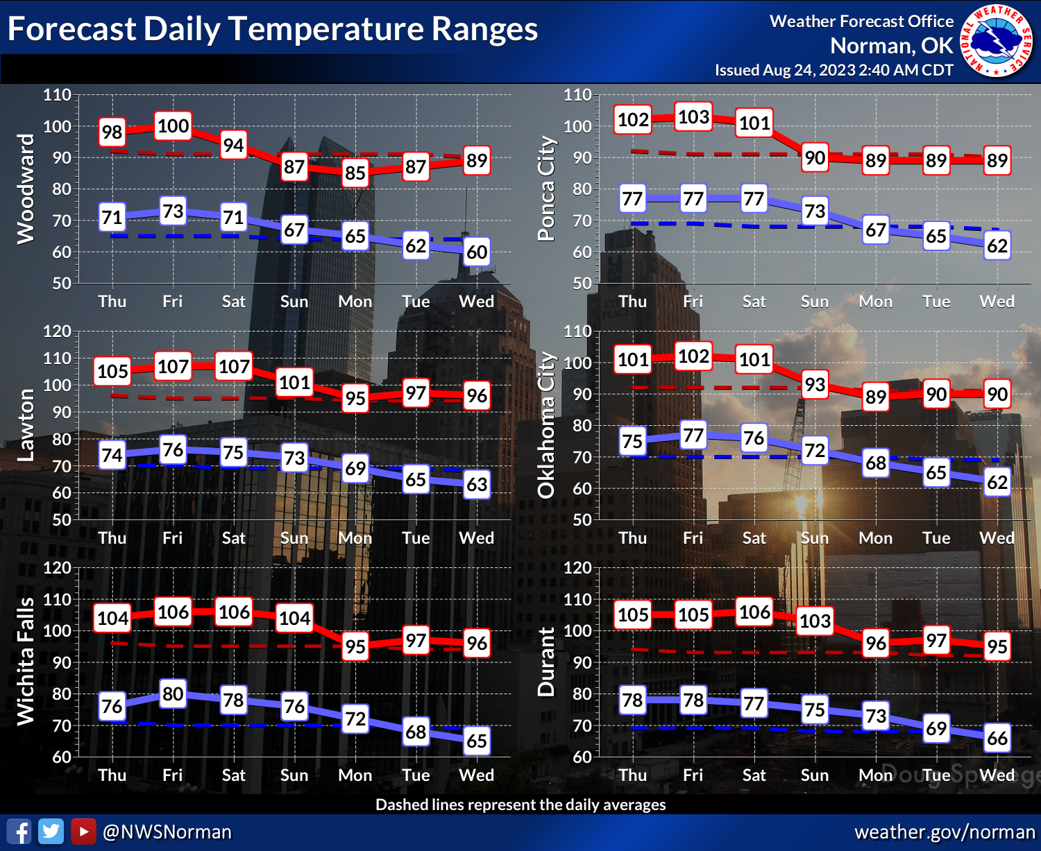
Oh yeah, we're gonna remain hot for the next few days, then sometime on Saturday
or Sunday, depending on where you are, a cold front will pass through the area
and bring us cooler weather for a few days. And maybe a chance of rain. Not
drought-busting rain, but at least some dust-settlers and cloudiness.

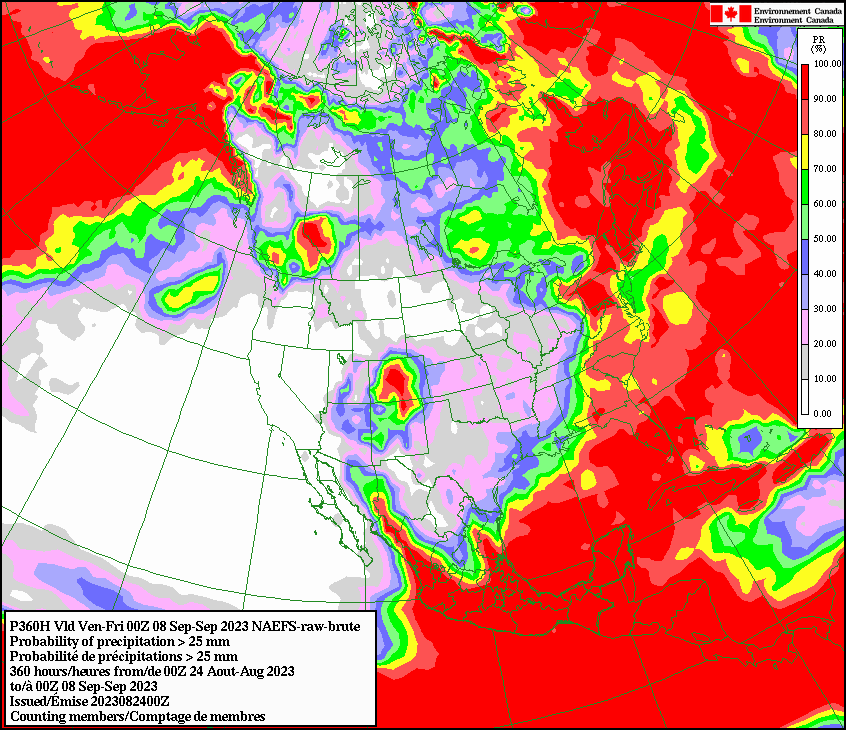
Yeah, that's not a lot of rain at all. Maybe somebody will surprise us with
a bit more, but the rainfall outlook is not pretty. Check out this here
Canadian model's output, showing the chances we will accumulate at least an
inch of rainfall through Sept. 8. Mostly less than 20%.
And our heat wave will return later next week. Look for upper-90s and low-100s
by the weekend. It doesn't look like we'll see the crushing humidity giving
us these record heat indexes (indices?), so a bit more manageable. But that lack
of humidity comes with a lack of rainfall.
So the damage to our soils, surface water, and vegetation will continue through
another couple of weeks, it appears, thus propelling the flash drought forward.
The good news is that this flash drought isn't starting in early June like last
year's version. And we still have hope with a bit of a moisture boost from
El Nino later in the fall through the winter. We ARE currently seeing El Nino
conditions down there in the equatorial Pacific, and it's almost a certainty
those conditions will extend through the winter into early spring. However,
the atmospheric portion of the El Nino is still a bit weakly connected to the
sea surface anomaly. And that's important because the atmospheric changes are
what drives the enhanced sub-tropical jet to extend farther east and enhance
the southern storm track. If that doesn't respond more strongly, we might not
see as robust of a change in our precip that we've seen in previous strong
and very strong El Nino episodes.

Lots of possibilities to turn this thing around in a hurry. I'm betting we see
a bit more manageable weather as we get deeper into September.
Until then...I'm hitting the pop-tarts and chocolate milk hard.
Gary McManus
State Climatologist
Oklahoma Mesonet
Oklahoma Climatological Survey
gmcmanus@mesonet.org
August 24 in Mesonet History
| Record | Value | Station | Year |
|---|---|---|---|
| Maximum Temperature | 113°F | FREE | 2024 |
| Minimum Temperature | 52°F | EVAX | 2022 |
| Maximum Rainfall | 4.59″ | SHAW | 2010 |
Mesonet records begin in 1994.
Search by Date
If you're a bit off, don't worry, because just like horseshoes, “almost” counts on the Ticker website!