Ticker for August 24, 2020
MESONET TICKER ... MESONET TICKER ... MESONET TICKER ... MESONET TICKER ...
August 24, 2020 August 24, 2020 August 24, 2020 August 24, 2020
Laura if you will
Sorry. Much like Ray in "Ghostbusters," I went with the first Laura that popped
into my head. Now who among you (of a certain age) can forget Half-Pint and Ma
and Pa, and those other two sisters whose names I can't think of right now? But
most of all, this was a chance to finally meme Nellie Olson, who was right up
there with the Malachi Brothers (how dare they use the Malachi Crunch on Pinky
Tuscadero in that demolition derby...Google it, youngsters!) as my most hated
childhood TV villians. I rooted for JR, by the way. Oh, that smug Bobby Ewing and
his lustrous head of hair.
Okay, now that I've totally lost anybody born after the 1980s, let's get into the
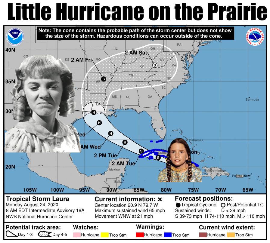
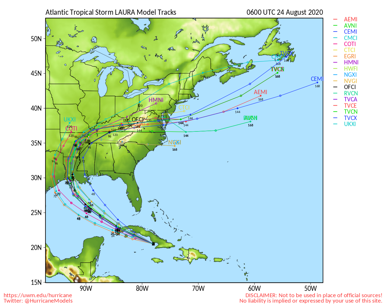
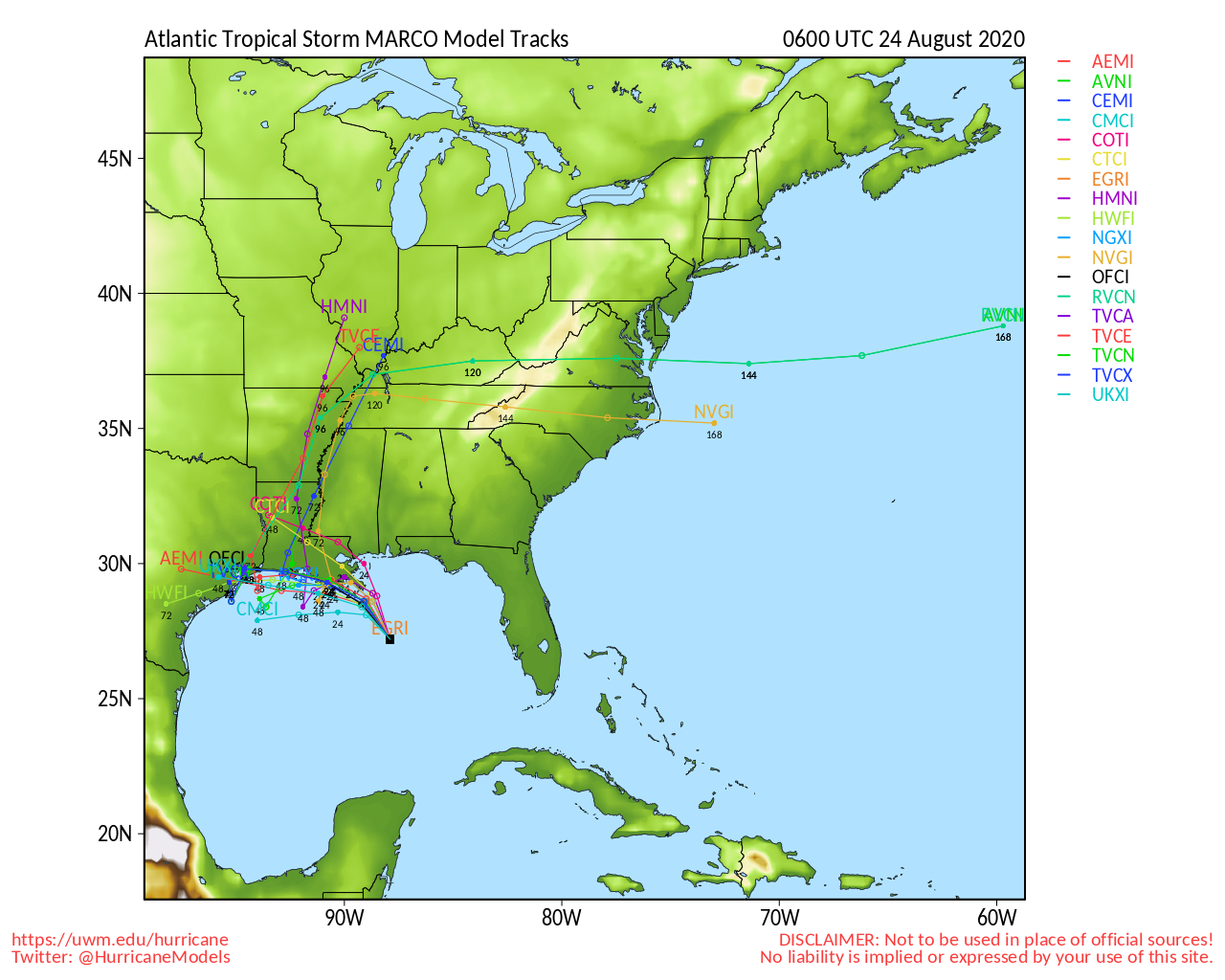
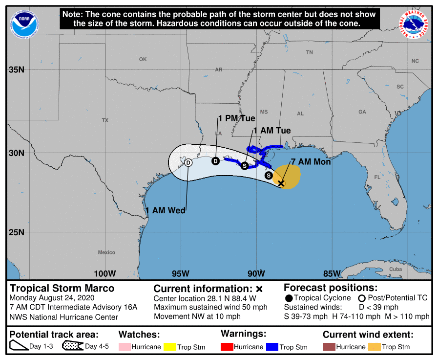
meat of the matter. It now appears that even with a somewhat historic brush with
two near-simultaneous tropical systems impacting the Gulf region over the next
several days, the impacts to the bulk of Oklahoma will be minimized. The
southeastern edge of Oklahoma could definitely see some impacts from tropical
storm Laura (forecast to become a hurricane), but tropical storm Marco's chances
appear nil.
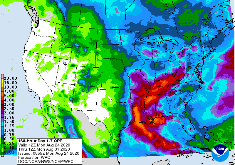
The 7-day rain forecast reflects the abrupt cutoff of the tropical impacts from
east to west, with far southeastern OK possibly seeing 3+ inches of rain, and
drought plagued western OK seeing just above a sprinkle.
Yeesh. Yeah, that's gonna leave a mark. We already have drought intensifying
across western OK, and the heat is going to remain with us for at least the
rest of this week. Now there is some hint of some relief with our first fall
cold front next week. I say first FALL front because for us weather types, fall
starts on September 1. There have definitely been some fall-ish type fronts
earlier in August, of course, but let's get technical for no apparent reason for
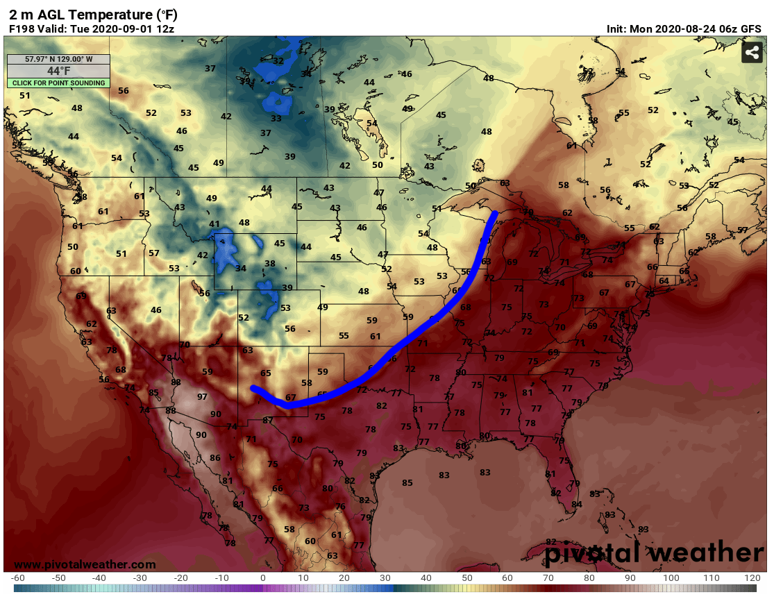
a bit. This front could possibly enter the state a week from now and bring
our temperatures down to below normal once again, and bring some much needed
rain chances. This is just now starting to show up on the long-range forecasts.
That's both good and bad...good that it's at least showing up, but bad because
that gives the pattern lots of time to change.

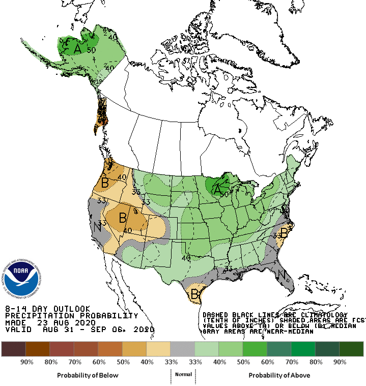
Some of the long-range models are starting to reflect this as well.
Keep in mind the chances that a cold front is draped across the state at exactly
7am on Sept. 1 are about the same as me buying a new comb, but you at least
get the idea. No, not that I'm bald! The idea is the pattern might finally
be changing again and we can get a nice cold front and increased precip chances
for more of the state.
I think there's a chance. Even Nellie Olson reformed and became nice later on.
Gary McManus
State Climatologist
Oklahoma Mesonet
Oklahoma Climatological Survey
(405) 325-2253
gmcmanus@mesonet.org
August 24 in Mesonet History
| Record | Value | Station | Year |
|---|---|---|---|
| Maximum Temperature | 113°F | FREE | 2024 |
| Minimum Temperature | 52°F | EVAX | 2022 |
| Maximum Rainfall | 4.59 inches | SHAW | 2010 |
Mesonet records begin in 1994.
Search by Date
If you're a bit off, don't worry, because just like horseshoes, “almost” counts on the Ticker website!