Ticker for July 24, 2023
MESONET TICKER ... MESONET TICKER ... MESONET TICKER ... MESONET TICKER ...
July 24, 2023 July 24, 2023 July 24, 2023 July 24, 2023
Oklaheimer
I can hear the responses already..."But Gary, while you look like Brad Pitt, this
is a really ugly forecast." Oh, you flatter me! Okay, you flattered me against
your will, but the latter part of that statement is true. And while folks are
going to say "It's summer, it's supposed to be hot!"
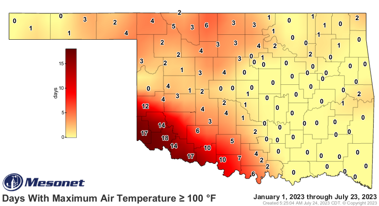
True! But again, as we've noted earlier, we haven't had extended heat this year,
at least not to the extent we're going to see it for the next 7-10 days (trying
to hedge there because something could definitely change in that extended forecast
soon). Check out what we've seen this summer (including May, because it can be
hot, too) for our statewide average high temps (shaded area) vs. out long-term
averages (black line).
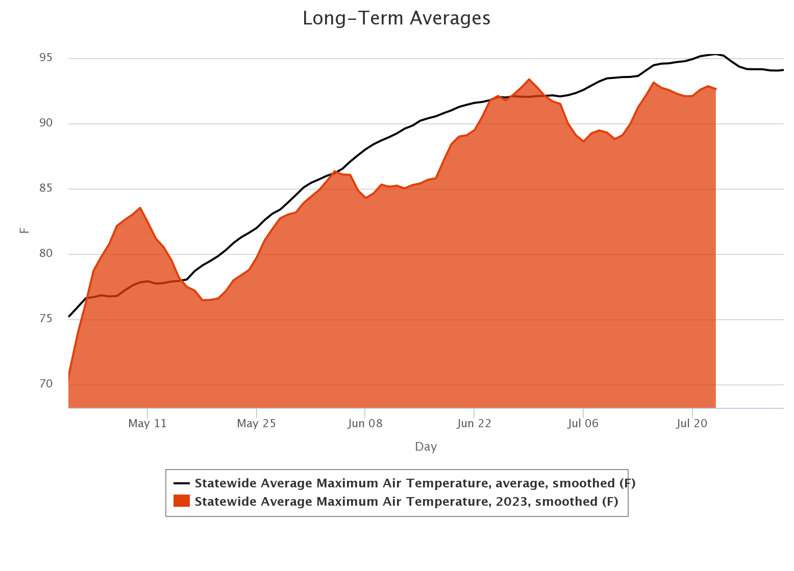
Now that's not to say we haven't been hot this summer at all. We've had spurts
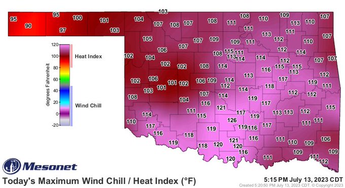
of extreme heat, especially on the heat index side. Remember Pauls Valley and
its heat index of 126 degrees (Mesonet record) back on July 13?
So short, violent explosions of extreme heat, but again...nothing extended. Well
now we get into a true heat wave, one that will last a good (bad) 7-10 days,
and possibly beyond that.
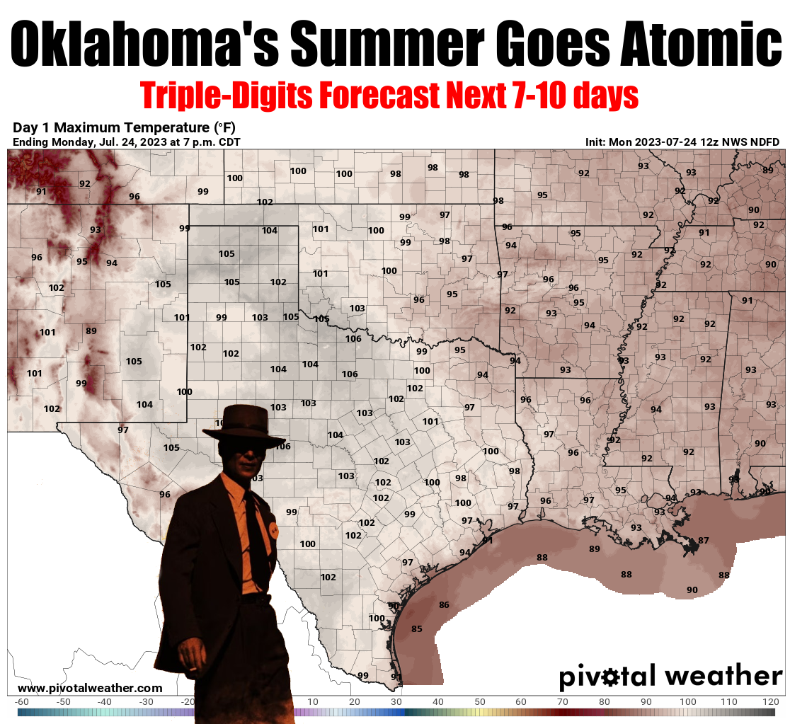
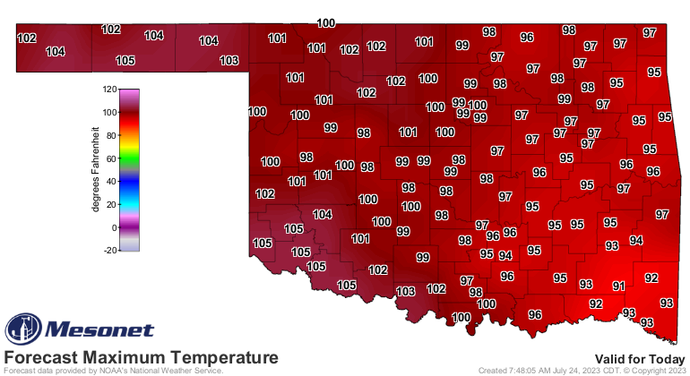
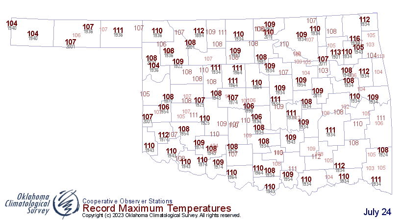
And while these temps don't appear to be thermonuclear, we do see the Panhandle
possibly breaking some record highs today, originally set back in 1936.
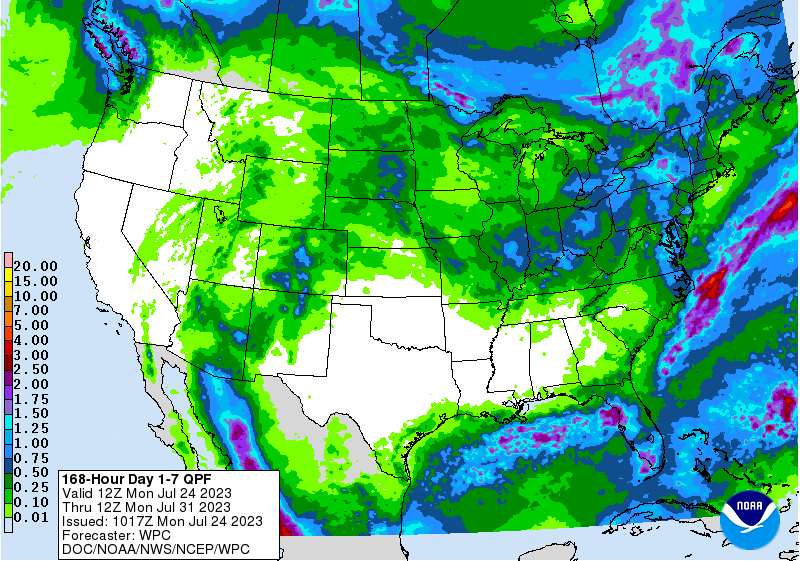
With all the rain they've had out that way, it could be nasty hot when you think
of that soil moisture evaporating into the lower levels! Speaking of rain, that's
done for awhile, which might not be a bad thing considering the mosquito levels
we've seen as a result.
Some folks still needed rain to alleviate long-term drought conditions, so an
unfortunate break for them.
Get out your erasers...this map is gonna need some work soon!
Gary McManus
State Climatologist
Oklahoma Mesonet
Oklahoma Climatological Survey
gmcmanus@mesonet.org
July 24 in Mesonet History
| Record | Value | Station | Year |
|---|---|---|---|
| Maximum Temperature | 110°F | MARE | 2011 |
| Minimum Temperature | 48°F | CAMA | 2019 |
| Maximum Rainfall | 4.43″ | COOK | 2004 |
Mesonet records begin in 1994.
Search by Date
If you're a bit off, don't worry, because just like horseshoes, “almost” counts on the Ticker website!