Ticker for August 23, 2012
MESONET TICKER ... MESONET TICKER ... MESONET TICKER ... MESONET TICKER ...
August 23, 2012 August 23, 2012 August 23, 2012 August 23, 2012
Take a good look at this drought map
This might be the last time it looks this bad for a long time. Yes, we did see
a bit of improvement in the southeast, and we also saw intensification in the
northeast. Exceptional drought now covers 48% of the state, up from 39% last week.
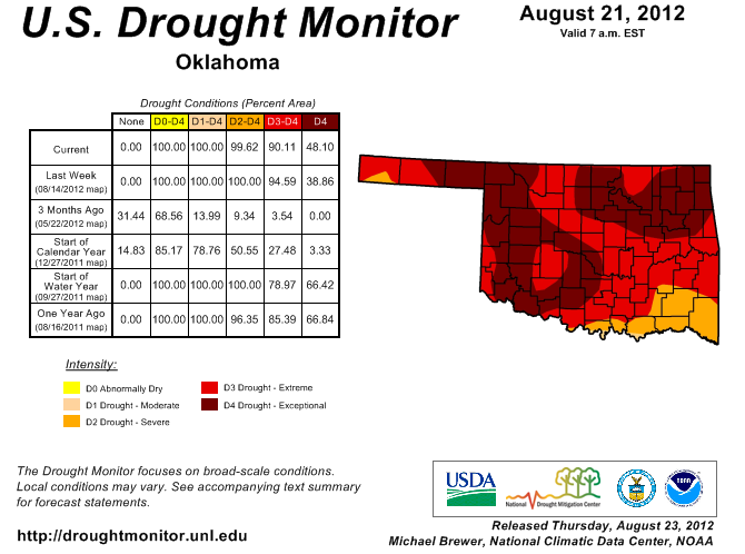
That's the highest such percentage since Oct. 25, 2011, when the coverage was at
55%. Back then, the coverage was on its way down, and that appears to be what
will occur in the next week as well with a nice fall-like soaker moving across
the state this weekend. But first, the reasoning behind the improvement and
degradation was centered on where the best rains fell with the last storm
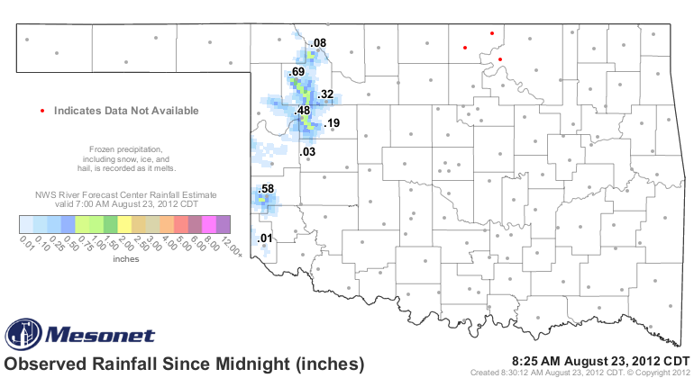
system. This map from the Oklahoma Mesonet (including the radar-estimated overlay
from the RFC in Tulsa) spells it out. I'll show the 10-day map just to make sure
we catch everything.
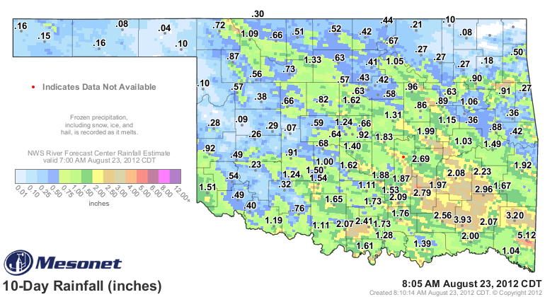
That glob of yellow and brown down in the southeast, indicative of where 3-4
inches of rain fell, was the area that saw the improvements, backpedaling from
extreme drought to severe. Elsewhere, the rainfall amounts of 1-2 inches
combined with the much cooler temperatures were enough to keep drought
intensification at bay and the status unchanged. The areas in the northeast that
missed appreciable moisture from yet another storm system were degraded to
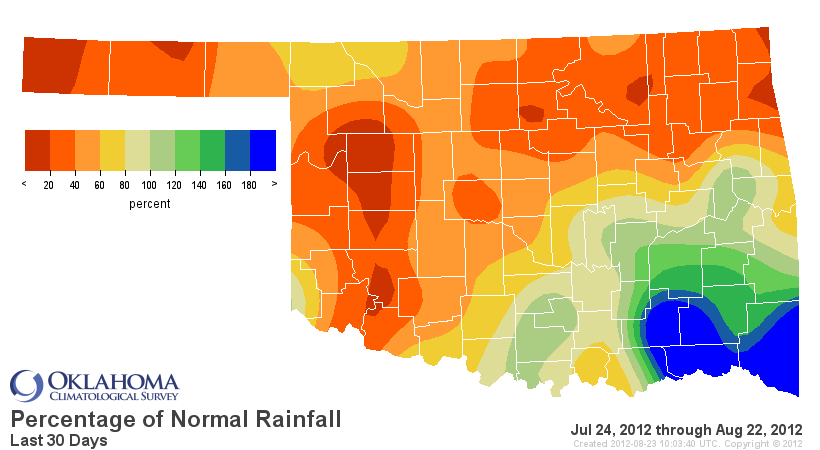
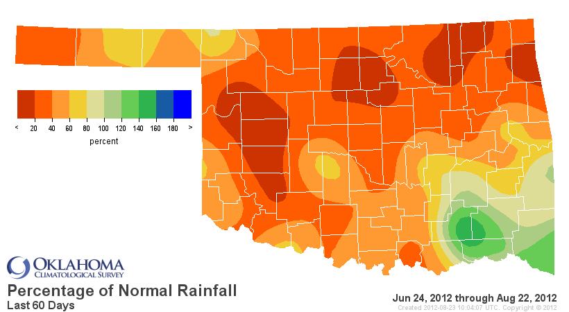
exceptional drought. Most of the state is still dealing with significant
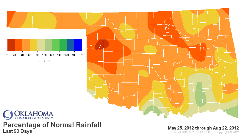
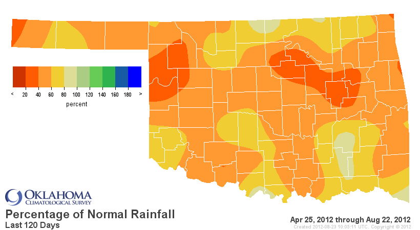
deficits from the 30-day to 120-day time frame, in addition to lingering effects
from last year's drought. The percent of normal rainfall maps from those periods
show just how bad we are hurting for moisture.
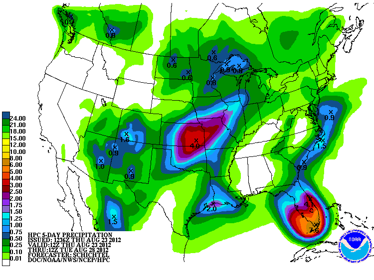
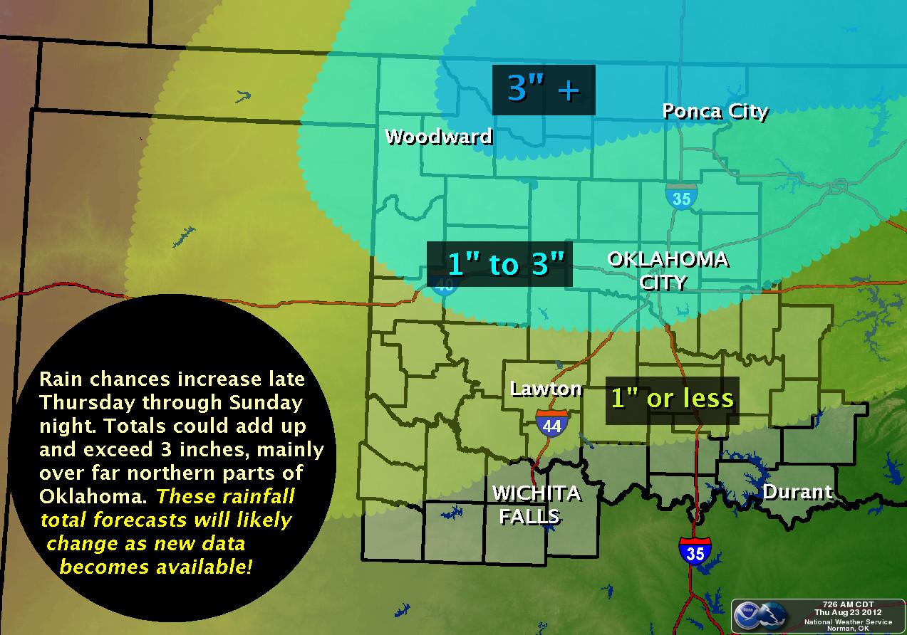
So now onto the good news. A series of upper-level disturbances will move over
the state in the next few days, giving us a great chance for soaking rainfall.
From what I've gleaned from our friends at the NWS on the state and federal
level, up to 3" can be expected from this storm, especially along the hard-hit
northern tier of counties (NOTE: in the event of failed forecasts, I was never
here).
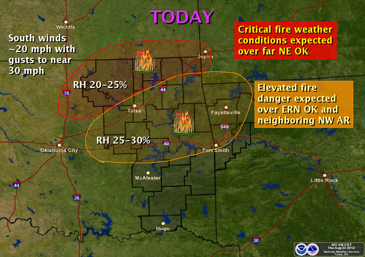
However, also please remember that until that rain gets here, the wind it will
kick up will also elevate the fire danger, as our friends at the Tulsa NWS
office remind us. Parts of northeastern Oklahoma are in a Red Flag Fire
Warning today with relative humidities of 20-25% and winds gusting to 30 mph.
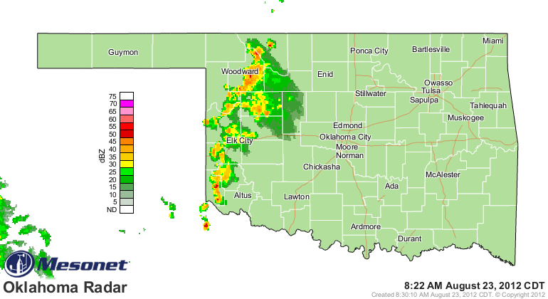
As I type this, rain continues to fall in western Oklahoma. As good old Fred
Norman used to say, "A preview of coming attractions!"
Gary McManus
Associate State Climatologist
Oklahoma Climatological Survey
(405) 325-2253
gmcmanus@mesonet.org
August 23 in Mesonet History
| Record | Value | Station | Year |
|---|---|---|---|
| Maximum Temperature | 113°F | ALTU | 2024 |
| Minimum Temperature | 52°F | NOWA | 2009 |
| Maximum Rainfall | 5.40″ | BEAV | 2019 |
Mesonet records begin in 1994.
Search by Date
If you're a bit off, don't worry, because just like horseshoes, “almost” counts on the Ticker website!