Ticker for July 23, 2020
MESONET TICKER ... MESONET TICKER ... MESONET TICKER ... MESONET TICKER ...
July 23, 2020 July 23, 2020 July 23, 2020 July 23, 2020
Going south
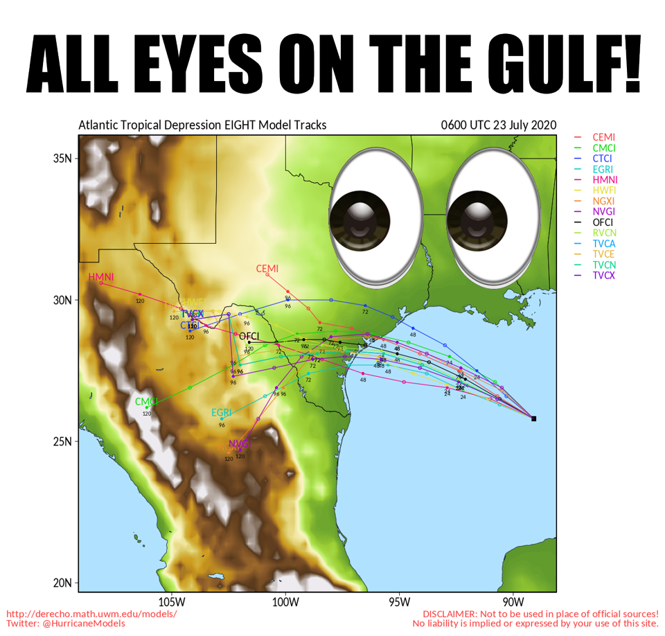
Oh boy, here we go. Tropical Depression 8, possibly soon to be Tropical Storm
Hanna, is now churning its way through the Gulf of Mexico headed towards the
Texas Gulf Coast. Here's another view of what's going on from the National
Hurricane Center, with forecast strength thrown in as well.
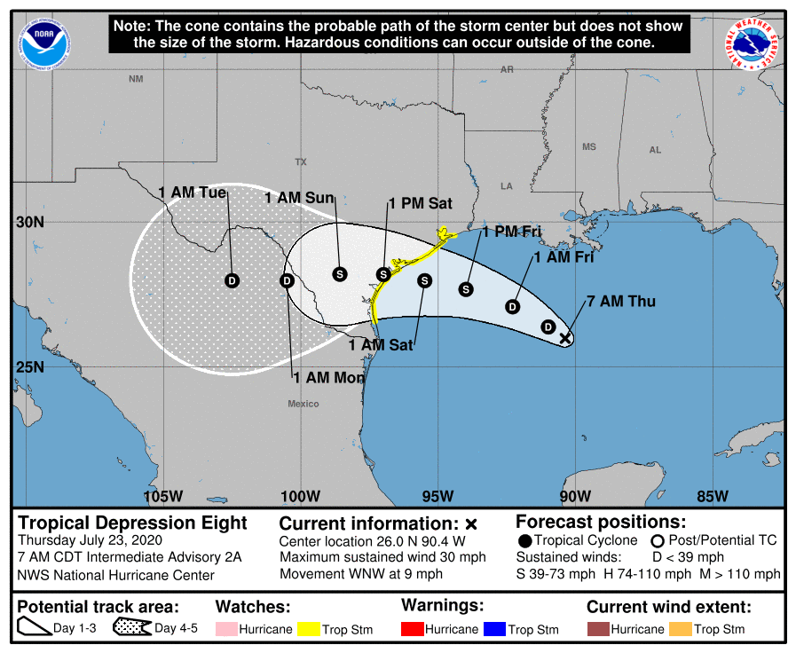
The forecast cone clearly has the remnants of Hanna traveling straight across
south Texas into northern Mexico. Where it goes from there is the key. Does it
continue to the west until it goes *POOF* after getting disrupted by the high
terrain, or does it curve back to the northeast into our area? Or, does it miss
us altogether but allow some of that rich Gulf moisture to be pulled into the
High Plains region? I'm betting on that latter scenario. There is also the
possibility of a cold front entering the area as we get into early next week,
so with that enhanced tropical moisture, maybe...just maybe, we can get some
decent rains out in the panhandles of Texas and Oklahoma.
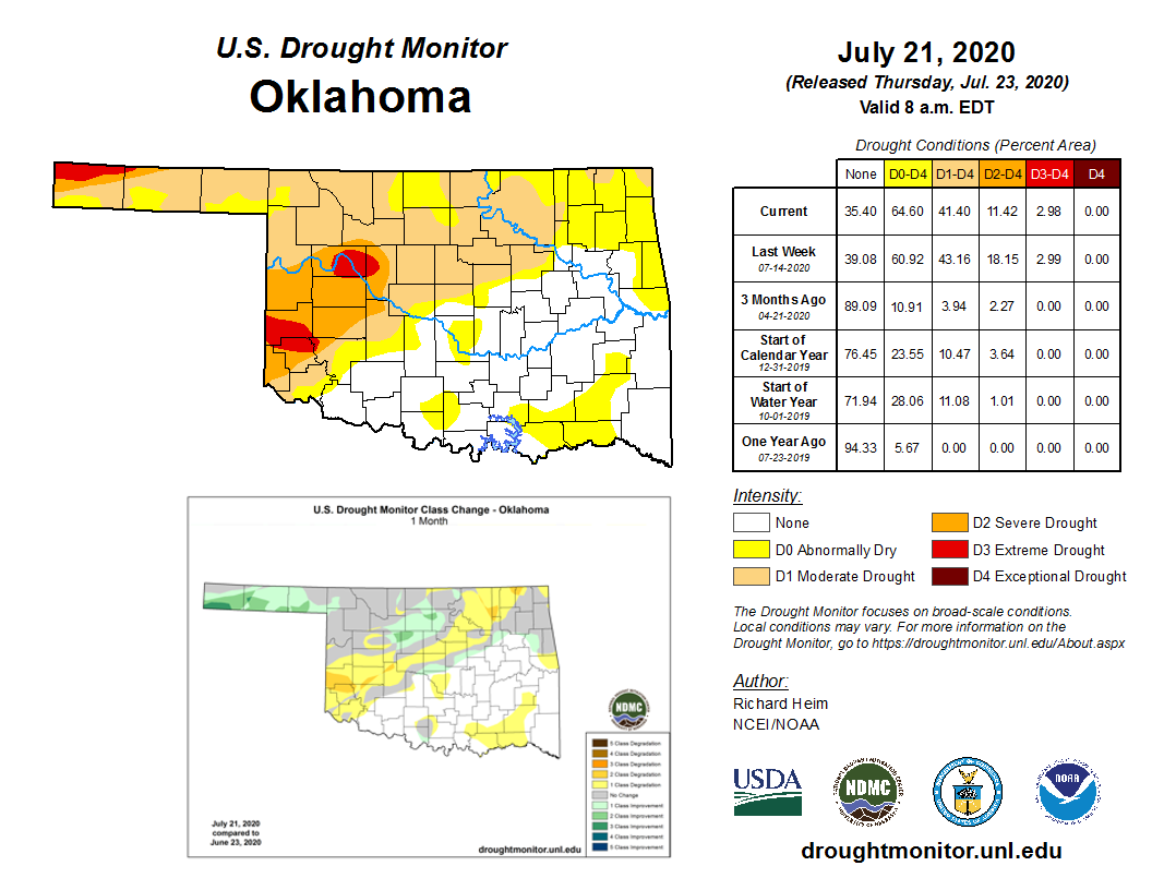
A lot has to happen to get that magic to occur, but hey, it's better than it
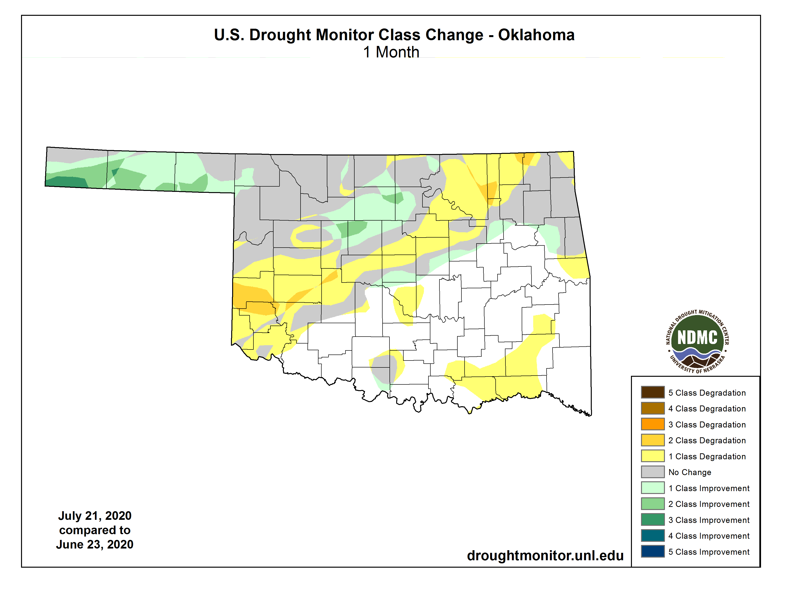
looked a month ago, right? And so does the drought picture out that way. Check
out the improvements in the Panhandle and parts of northern Oklahoma.
Unfortunately, we also see plenty of reasons for concern in west central and
southwestern Oklahoma, which saw a surge of severe-to-extreme drought over the
last month.
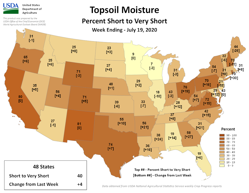
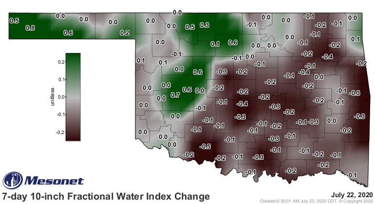
After a quick improvement in soil moisture across the state, we suddenly see
those areas of improvement replaced by worsening conditions. I called it
whack-a-drought" yesterday, as we see improving impacts in the north replaced
by worsening conditions to the south.
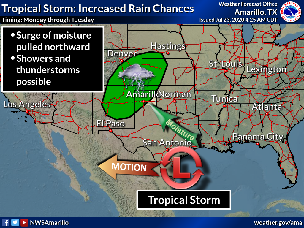
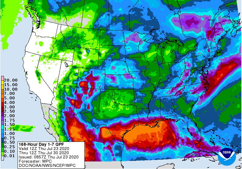
The 7-day rain forecast again shows the inundations expected from the impact of
Tropical Storm Hanna, and the possibility of some of that moisture surging to
the north and northwest, strengthening the monsoonal flow over the inter-
mountain region.
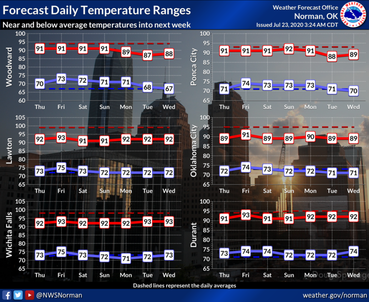
But all in all, we're in a rather mild summer pattern. Temperatures should
remain close to if not below normal, especially with that front approaching
next week.
With the humid conditions we have, and summer heat, AND the lack of that
strong high pressure dome directly over us, we should see pulse thunderstorms
go up and rain a ton and then die out here and there over the next 7 days and
maybe even longer. Whether you get rain depends on the vagaries of Mother Nature
and where those storms go up, because they ain't gonna move much once they do.
Gary McManus
State Climatologist
Oklahoma Mesonet
Oklahoma Climatological Survey
(405) 325-2253
gmcmanus@mesonet.org
July 23 in Mesonet History
| Record | Value | Station | Year |
|---|---|---|---|
| Maximum Temperature | 109°F | CHER | 2001 |
| Minimum Temperature | 54°F | ELRE | 2019 |
| Maximum Rainfall | 4.28″ | TAHL | 2013 |
Mesonet records begin in 1994.
Search by Date
If you're a bit off, don't worry, because just like horseshoes, “almost” counts on the Ticker website!