Ticker for September 22, 2022
MESONET TICKER ... MESONET TICKER ... MESONET TICKER ... MESONET TICKER ...
September 22, 2022 September 22, 2022 September 22, 2022 September 22, 2022
OOF!
We can all go "OOF!" later, I'm trying to make the Guthrie luge team but I'm
having a heck of a time getting the water to freeze on my driveway for practice.
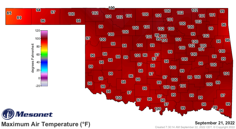
You got your cold front, and just in the nick of time because yesterday was the
hottest day all week. Records fell in droves across northern Oklahoma. Ever seen
a droves? It's not a pretty sight.
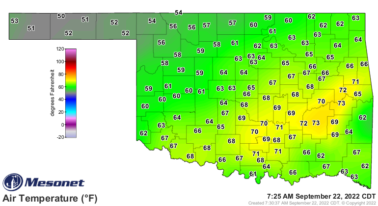
So we're starting out with a nice fall day across the northern half of the state,
where highs will struggle to get out of the 60s, but southern Oklahoma will take
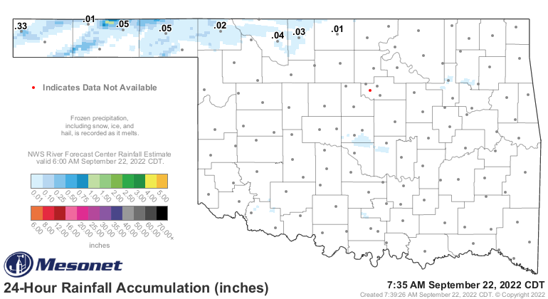
a bit longer. Certainly a change from yesterday. Keep eyes on the 24-hour
temperature change maps today across the north...they're gonna be doozies.

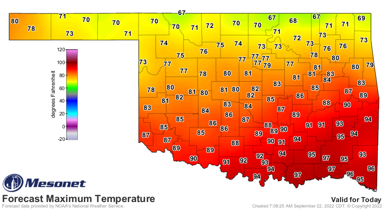
Now after that, we will have two days of summer again, then all of next week
we'll be back in seasonable weather. Somewhat above normal, but not enough to
make you curse your favorite (and only!) state climatologist. Feel free to
curse all you want on Friday and Saturday, however...it's gonna be hot!
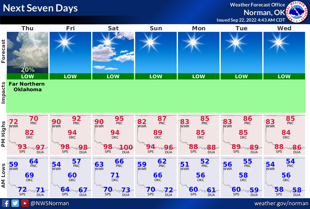
After next week, I wouldn't count a THIRD return to summer out just yet, but
that's not really our biggest problem. As I said, you got your cold front, but
what you DIDN'T get is your rainfall. Another mostly dry front, as will be the
one on Sunday as well.
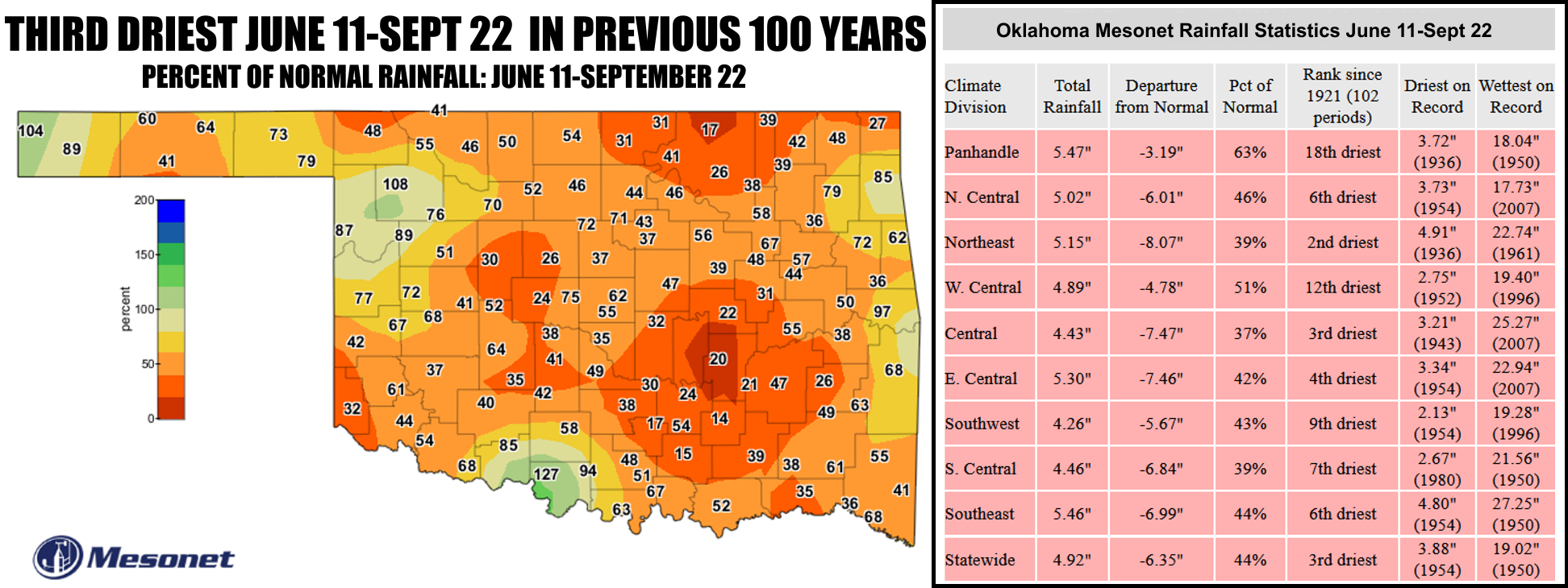
OOF! Yeah, there we go again. So as you can see from the top graphic, we're in
near-historic dry conditions since that flash (now just plain old drought)
drought began on June 11, but also dating back to mid-August 2021. Over the
last 103 days or so, we've managed to start hanging out with 1936, 1954, and
1980 (1943 for central OK) when it comes to our stats. Those aren't years you
want to be hanging out with. You know how it works, you tell your parents you're
going to spend the night with 2015, and when you get outside you change your
clothes from your raincoat to a tank top and jump in the car with 1954,
notorious bad year known for drought of record for the main body of the state.
Your mom warned you!
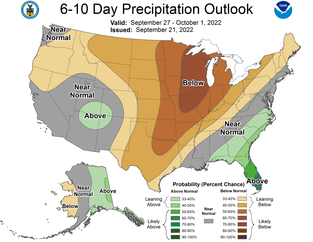
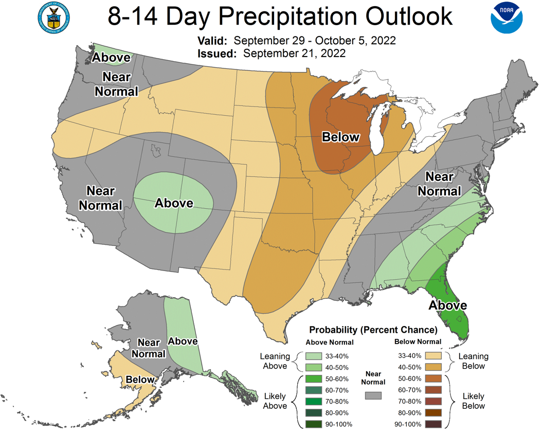
So we know the forecast for the next 7 days is pathetic, but how about farther
out? Well, not so good either. CPC's 6-10 day and 8-14 day precip outlooks
both show increased odds of below normal precip for Oklahoma, so that takes us
out to the first week of October.
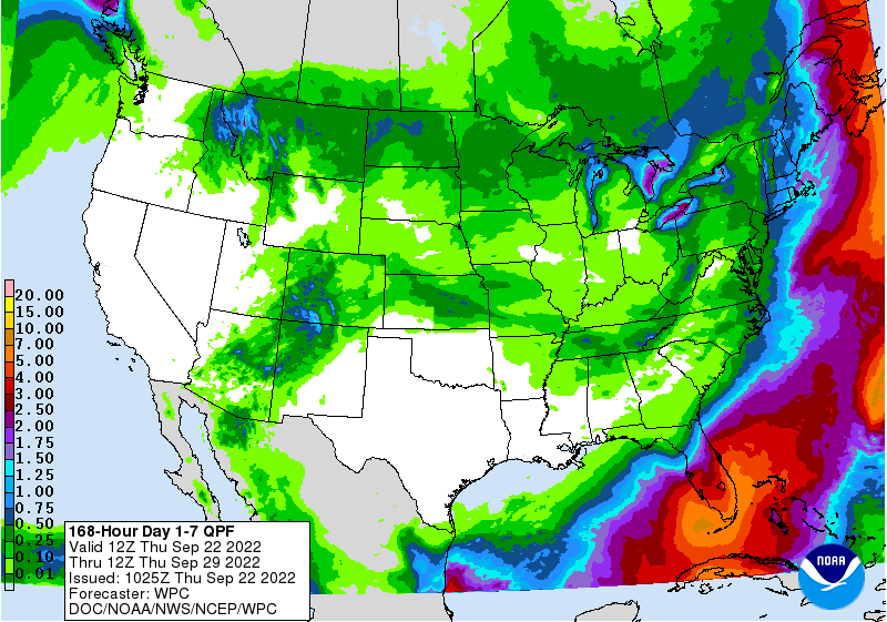
But even the longest run of the American GFS model has a big ZILCH (mostly) for
Oklahoma through Oct. 8.
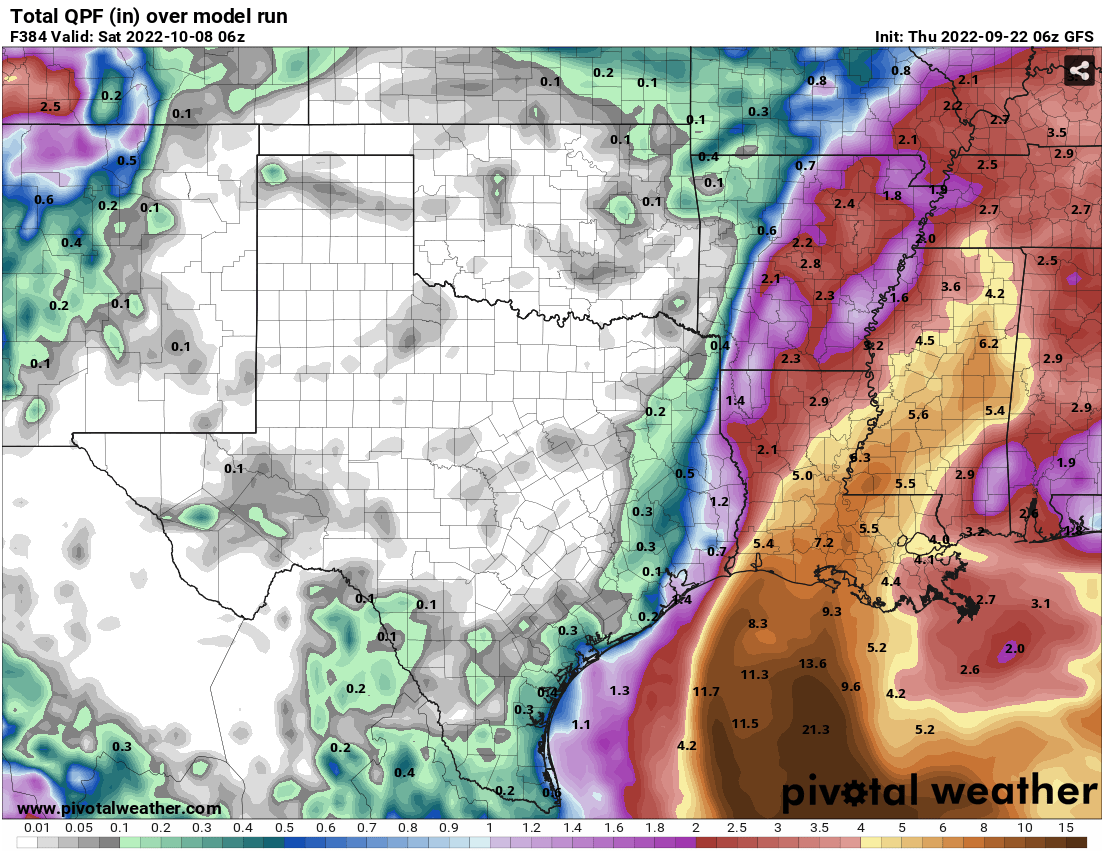
BTW (NO, not Booker T. Washington...By The Way), the same model also has us
back under the dreaded heat dome with highs in the 90s and even a triple-digit
thrown in there, but that's fantasy-cast stuff. I can believe the heat dome,
maybe not the 100. And all these GFS forecasts are a single deterministic model
run, so...meh.

I do think we might possibly could see a possible return to our third summer,
if we consider the next week "fall." Was that weaselly enough for ya? However,
it all adds up to trouble right here in Drought City. Today's map? Not good.
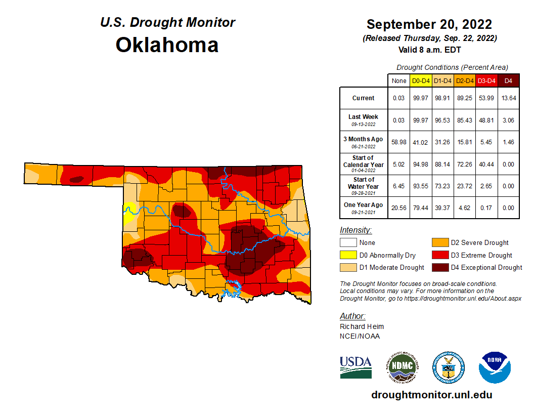
We now have new areas of Exceptional drought (D4--1 in 50/100 year event) across
a significant portion of the area east of OKC, in addition to new areas across
NE OK along the KS border, in addition to up in Blaine/Kingfisher counties. At
14%, those levels are back where we were in early March. As for the just plain
old "really bad drought" levels of at least D2 or D3, we're back again flirting
with levels not seen since early 2013, DEFINITELY not a good drought year to
be hanging out with. Do I have to call your mother??
Now those new D4 areas aren't a shock. Remember, during all this heat of the
summer, and second summer (and maybe 3rd summer?), those areas have simply
missed out on rainfall after rainfall opportunity.
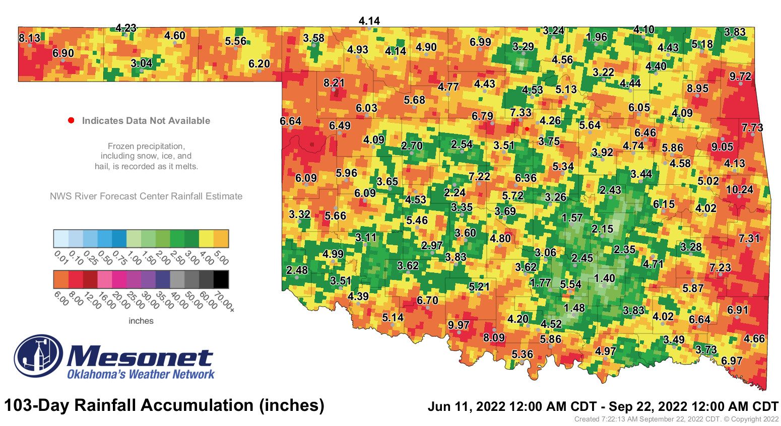
Centrahoma has had 1.4 inches of rain in the last 103 days! That's like less
than 1.5 inches! Four other sites (Tishomingo: 1.48", Seminole: 1.57",
Sulphur: 1.77", Foraker: 1.96") have had less than 2 inches for that period,
and an additional 34 sites have had less than 4 inches.
It's a very very bad situation we're in right now, and it only looks to get
worse over at least the next couple of weeks. After that?
COME ON HURRICANES!
Gary McManus
State Climatologist
Oklahoma Mesonet
Oklahoma Climatological Survey
gmcmanus@mesonet.org
September 22 in Mesonet History
| Record | Value | Station | Year |
|---|---|---|---|
| Maximum Temperature | 102°F | HOLL | 2023 |
| Minimum Temperature | 36°F | EVAX | 2018 |
| Maximum Rainfall | 7.63 inches | SEIL | 1997 |
Mesonet records begin in 1994.
Search by Date
If you're a bit off, don't worry, because just like horseshoes, “almost” counts on the Ticker website!