Ticker for August 22, 2012
MESONET TICKER ... MESONET TICKER ... MESONET TICKER ... MESONET TICKER ...
August 22, 2012 August 22, 2012 August 22, 2012 August 22, 2012
Annie Lennox was onto something
Yes, here comes the rain again, in perfect timing to take advantage of our last
batch of wet stuff. The latest 5-day precipitation forecast from the NWS'
hydrometeorolololological Prediction Center (I'll just say HPC from now on) has
great news for some of the worst hit areas of the state.
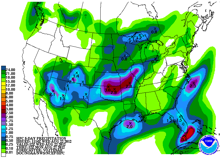
A great splash of 2-3 inches across the northern half of Oklahoma will be possible
thanks to a series of upper-level storms crossing the state from the west. Now
keep in mind that this is a national product so its prognostications are meant
to be fuzzy. But the trend is clear, there will be some generous rains in the
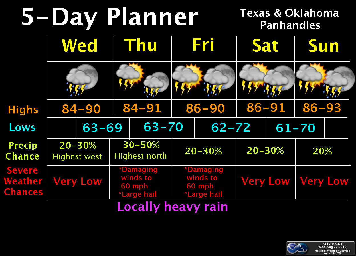
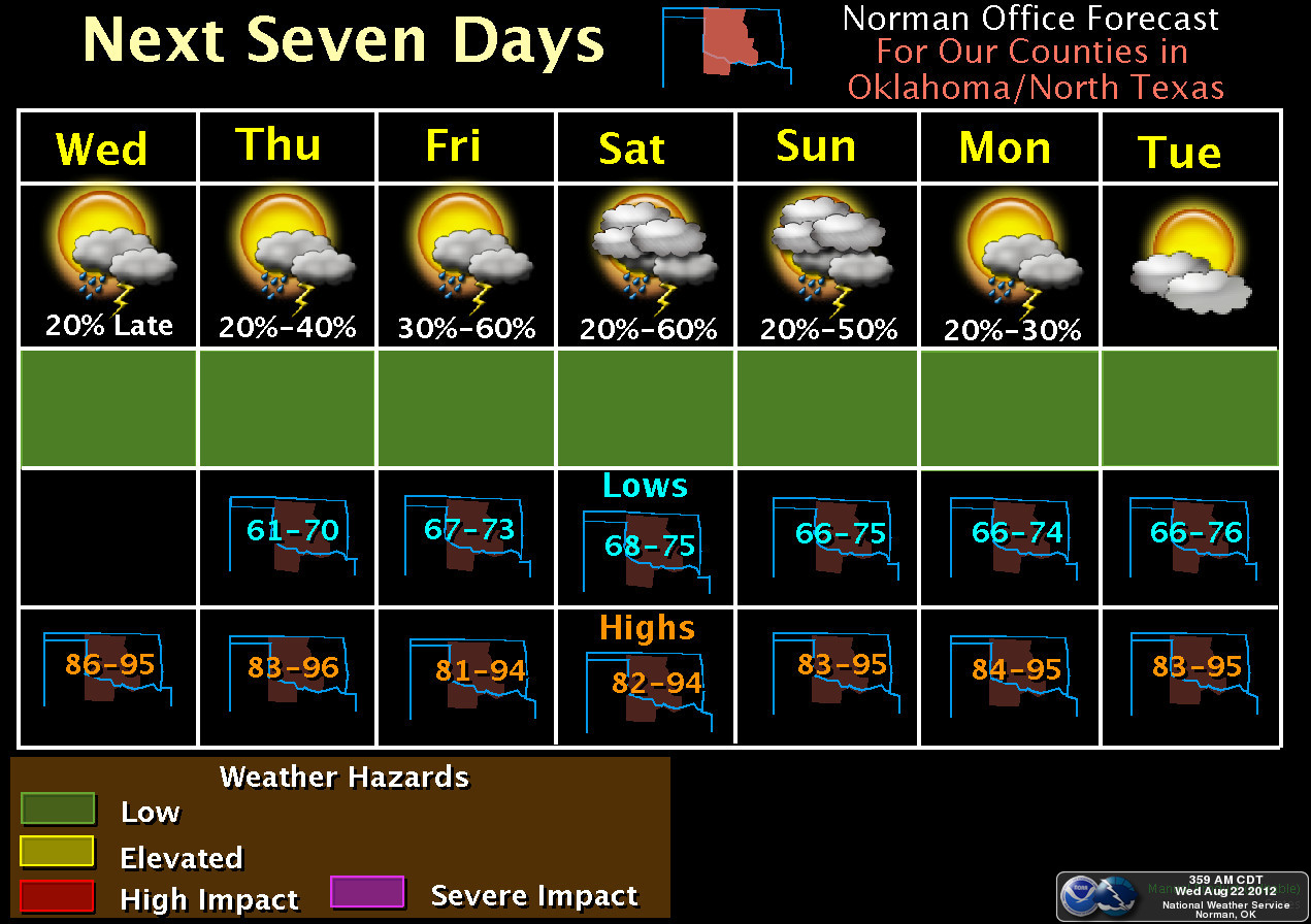
state over the next 4-5 days. Our friends in the NWS offices from Norman and
Amarillo show the hopeful outlook for the next few days.
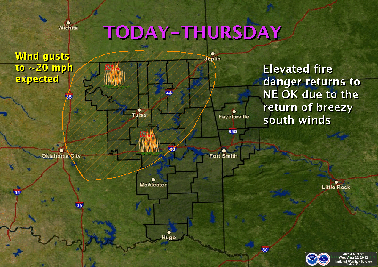
NWS-Tulsa also reminds us that until that rain arrives, the drought and fire
danger are still front and center.
After that, it appears that the upper ridge of high pressure that gave us so
much fun during July and August might try and build back this way. The 6-10
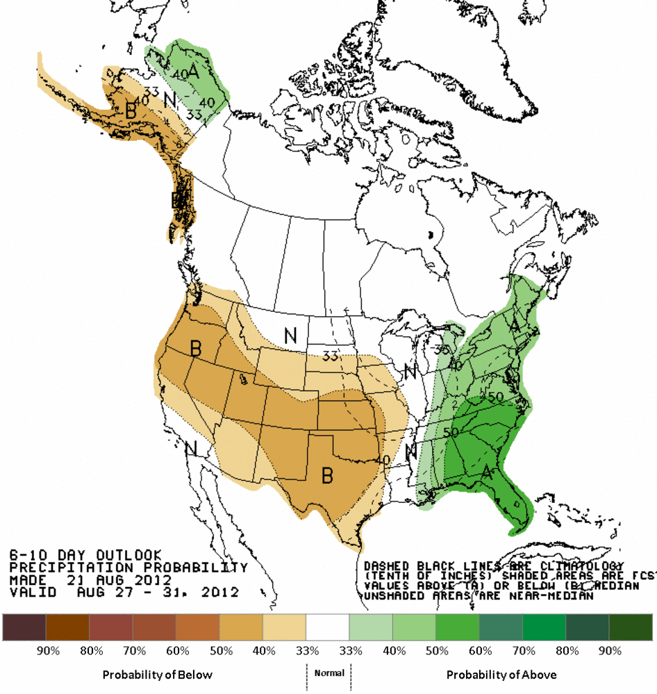
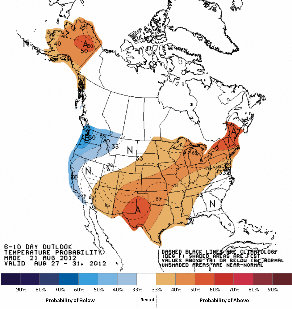
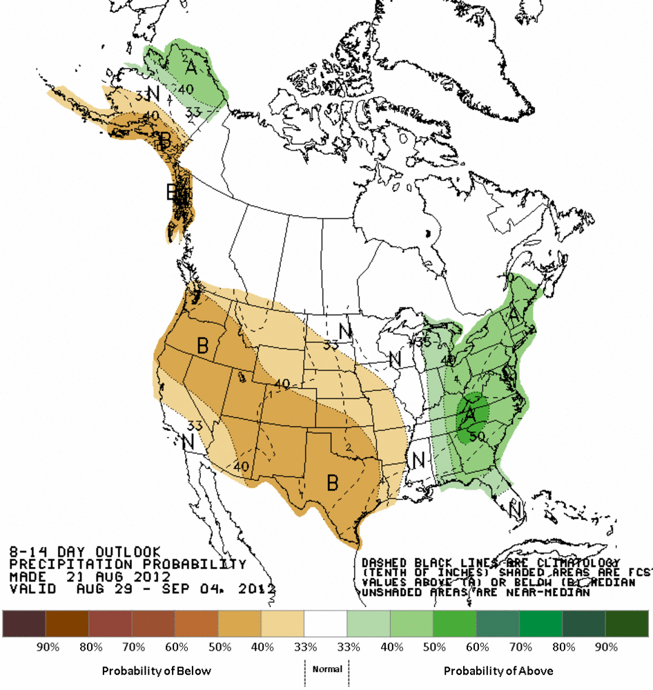
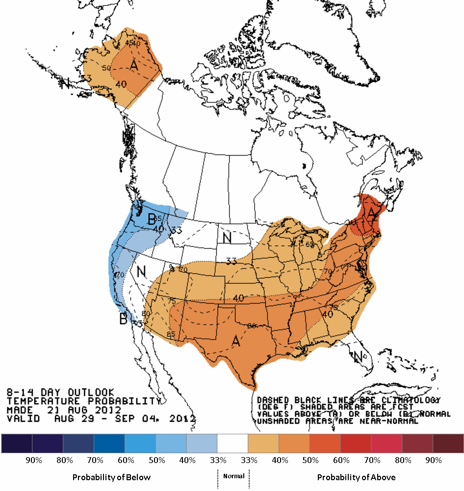
and 8-14 day outlooks from the CPC have us once again in that familiar old
pattern ... increased odds of below normal precip and above normal temperatures.
6-10 day outlooks
8-14 day outlooks
That doesn't necessarily mean a return to triple-digits, but it will still be
August, and there will still be a drought of varying intensity throughout the
Southern Plains. Summer ain't over until Mother Nature says its over, and it
should be pretty clear we don't have her on speed dial for all the clues.
-------------------------------------------------------------------------------
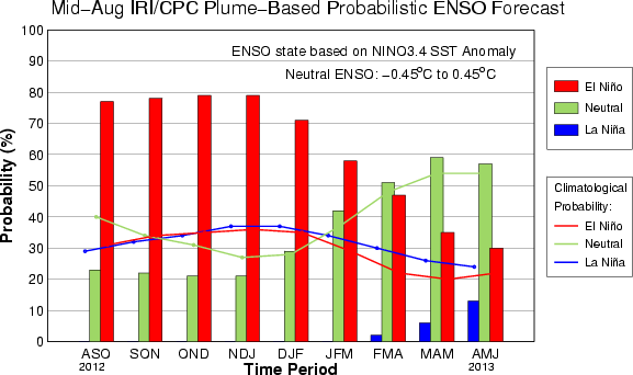
Another thing that is clear is that El Ni?o is almost a certainty now. Heck,
it might have already developed down there in the equatorial pacific. The
temperature anomalies were close to the tipping point already, waiting for one
final warm nudge to put us in El Ni?o conditions. The mid-August ENSO plume
in conjunction with IRI (International Research Institute for Climate and
Society) and the CPC has that El Ni?o progressing through the winter until
it fades in the spring (a normal life cycle for an El Ni?o episode).
Remember, these ENSO states are covering 3-month periods.
An El Nino state in the pacific and often does have an impact on weather in the
U.S. For the southern tier of states, that can mean increased odds of cooler-
and wetter-than-normal weather during the cool season (think October-March).
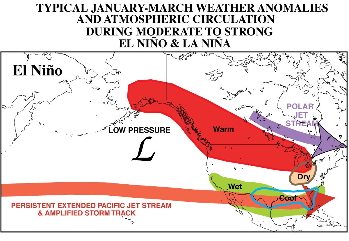
Here's the kicker ... these impacts are usually much more significant for points
south of Oklahoma. Texas is normally the big winner. But, Oklahoma can get drawn
into that bigger pattern. In some work we did a few years ago here at OCS, we
found that the strength of the El Nino is an important factor. To put it in
a nutshell, the stronger the El Nino, the greater chance we have to be wetter
than normal here in Oklahoma. A weak El Nino would not be a good thing, on the
other hand. Here's a better explanation in pictures with the precipitation
anomalies spelled out by climate division and El Nino intensity. This work was
done using past El Nino events as indicated by the CPC at the time. We've had
an El Nino or two since this work is done so we'll try and get these updated.
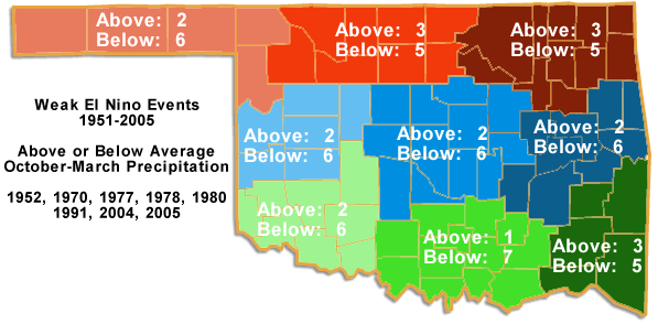
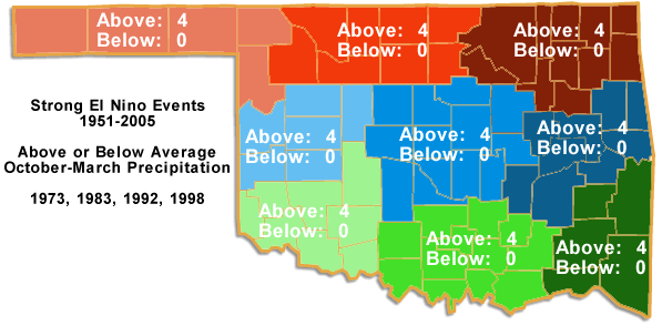
Of the 20 El Ni?o episodes, four were considered ?strong?, while the remaining
16 events were broken down into eight of both ?moderate? and ?weak?
classifications. The influence of the four strong events was easily seen, with
above average rainfall in all areas of the state. In fact, the wettest
October-March since 1951 occurred in east central Oklahoma with the strong El
Ni?o of 1998, along with the 2nd wettest such period in the southeast
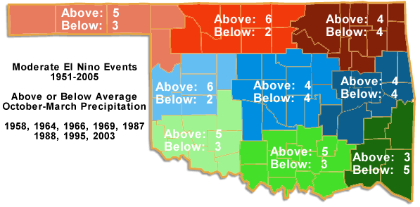
Moderate El Ni?o events appear to influence the weather differently across the
state. Western Oklahoma has in increased chance of above average rainfall in
the case of a moderate event, while the results for eastern and central
Oklahoma are nondescript. Of the eight moderate events tracked, north central
and west central Oklahoma had above average rainfall in six of those instances,
while the Panhandle, southwest, and south central areas observed above average
precipitation five times.
The prospects for drought relief become bleak during weak events. All areas of
the state experienced below average precipitation during weak El Ni?os. Of the
eight weak events tracked, all regions were below average at least five times.
South central Oklahoma fared the worst with seven below-average periods.
As always, the caution when dealing with ENSO-impacts are to be kept at the
forefront. Each ENSO episode is different, and there is certainly no guarantee
that they will act the same way each time. Other factors can also influence
their impact on our weather, and all of these things must be looked at together
when trying to determine that impact.
Gary McManus
Associate State Climatologist
Oklahoma Climatological Survey
(405) 325-2253
gmcmanus@mesonet.org
August 22 in Mesonet History
| Record | Value | Station | Year |
|---|---|---|---|
| Maximum Temperature | 108°F | GRA2 | 2023 |
| Minimum Temperature | 48°F | BRIS | 2016 |
| Maximum Rainfall | 4.25 inches | MRSH | 2005 |
Mesonet records begin in 1994.
Search by Date
If you're a bit off, don't worry, because just like horseshoes, “almost” counts on the Ticker website!