Ticker for July 21, 2023
MESONET TICKER ... MESONET TICKER ... MESONET TICKER ... MESONET TICKER ...
July 21, 2023 July 21, 2023 July 21, 2023 July 21, 2023
System of a rain
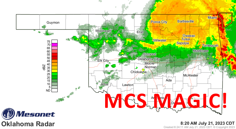
Just a quick Tick today so we can Tock about that big blob of thunderstorms that
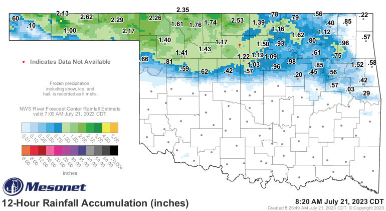
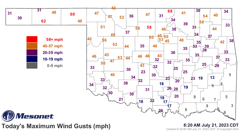
moved across the northern third of the state last night, bringing gobs of rain
and also some severe weather. It's what we call a Mesoscale Convective System,
which is, unscientifically speaking, an organized glob of thunderstorms. These
often form at night in the High Plains and then travel to the east (or wherever
the prevailing winds take them). The rain pattern, as well as the wind gusts
overnight, tell us its footprint.
The blob might also be a specialized MCS called a "Mesoscale Convective Complex."
It has to be a certain size and lasted for a specific duration, but I'm not going
to try and diagnose that this morning. Sure looks like one with its round shape
and track across Oklahoma. That could also describe me as I drive around the state,
but I assure you I am neither Mesoscale nor Convective!
However, it does look like it has an even more specialized feature called a
"Mesoscale Convective Vortex." It is definitely rotating around a center point
that you can see if you look at a radar loop.
https://www.mesonet.org/weather/radar?ref=1208
If the MCV can sustain itself, even if the thunderstorms around it fizzle, it
could generate more thunderstorms later. Sometimes these things can even form
into tropical storms and hurricanes when they move over water, but I think we're
safe as it moves over Grand Lake.
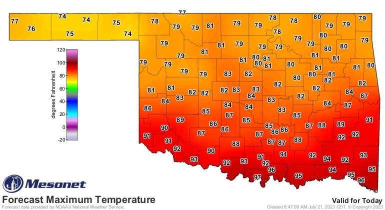
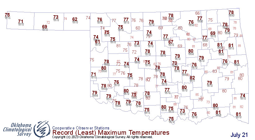
Enjoy the temperatures this weekend, especially today's 70s and 80s, because
summer roars back next week...and possibly beyond! Today's 70s up in far NW OK
might even set records for lowest maximum temperatures for July 21.
Gary McManus
State Climatologist
Oklahoma Mesonet
Oklahoma Climatological Survey
gmcmanus@mesonet.org
July 21 in Mesonet History
| Record | Value | Station | Year |
|---|---|---|---|
| Maximum Temperature | 111°F | GRA2 | 2018 |
| Minimum Temperature | 54°F | EVAX | 2021 |
| Maximum Rainfall | 5.92″ | SALL | 2022 |
Mesonet records begin in 1994.
Search by Date
If you're a bit off, don't worry, because just like horseshoes, “almost” counts on the Ticker website!