Ticker for September 20, 2023
MESONET TICKER ... MESONET TICKER ... MESONET TICKER ... MESONET TICKER ...
September 20, 2023 September 20, 2023 September 20, 2023 September 20, 2023
Wet Man Dry Man
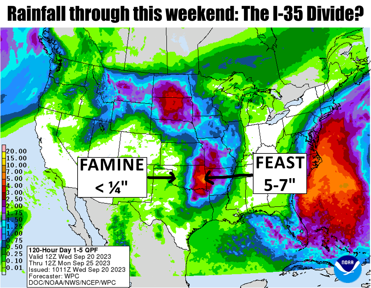
Hey, if we're going to have highways cause droughts, the answer is simple: QUIT
BUILDING HIGHWAYS!
Okay, we're either nuts or jesting or crazy, and two out of three dentists know
which, if you get my drift. No no, drifting comes later this year during our
arctic Halloween blast! Keep up! At any rate, in the last year we've had the I-44
divide, the Northwest Passage divide, and now the I-35 divide. However, unlike
those others, this one will probably be short-lived, like my need for a comb. But
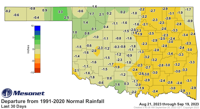
you can see on the 30-day rainfall maps that this one is starting to build.

The rain from last night should help.
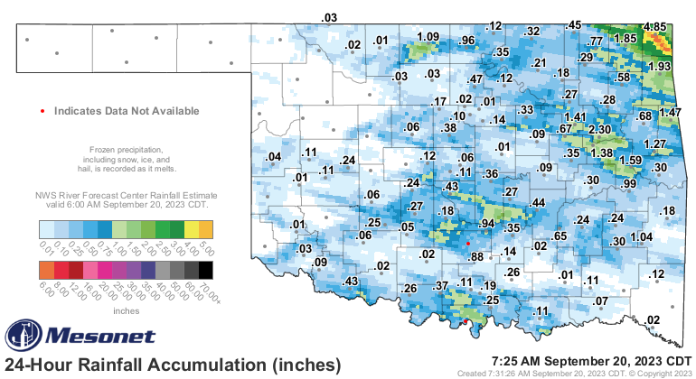
Heck, it's raining right now for crying out loud!
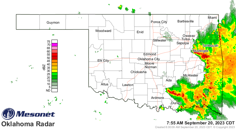
And how about those storms last night?
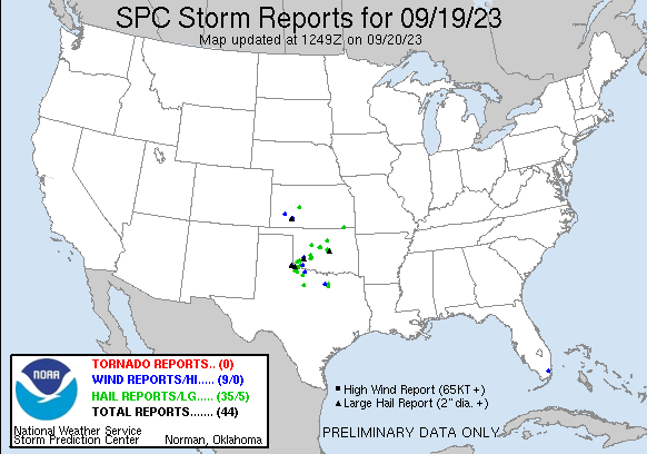
A few odd things happened last night with those storms. We had a storm split
to the SW of the OKC Metro and the left-mover survived all the way up the
turnpike, spinning clockwise all the way (image courtesy of former Ticker
writer/creator extraordinaire Deke Arndt) while the right-mover dissipated.

Typically those left-movers don't last as long as the right-movers, but this
one managed to survive a trip to the City (rural Okies know) throwing large
hail and big wind all the way.
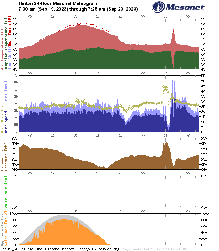
Then you had the heat burst out by Hinton that left them with their possible
high temperature for the day at 85 degrees...from 4:05 a.m. In this case a
collapsing storm released a burst of air towards the ground where it compressed
and heated up, with strong wind gusts to over 50 and a collapse of the humidity
as well. Not the sudden drop in dewpoint and rise in temperature, strong winds,
and quick rise in pressure on the Hinton meteogram!
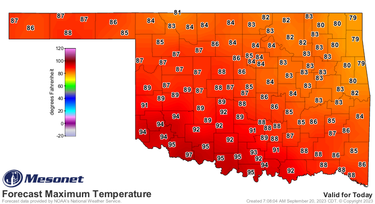
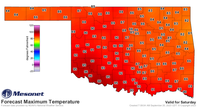
They'll probably rise above 85 today, but it'll be close!
We'll remain in this FALL summer pattern for a few more days, at least until
early next week when we get another cold front through on Sunday. Saturday
will approach SUMMER summer, but not too bad.
Don't look now, but FALL summer continues through the end of the month,
possibly.
(Begin Oscar moment)
I TOLD YOU NOT TO LOOK, YOU FOOLS! You've doomed us all!
(End Oscar moment)
That could change. If not, looks like our Fall lasted 7 days. Not bad!
Gary McManus
State Climatologist
Oklahoma Mesonet
Oklahoma Climatological Survey
gmcmanus@mesonet.org
September 20 in Mesonet History
| Record | Value | Station | Year |
|---|---|---|---|
| Maximum Temperature | 107°F | FREE | 2024 |
| Minimum Temperature | 41°F | NOWA | 2003 |
| Maximum Rainfall | 5.83″ | MTHE | 2019 |
Mesonet records begin in 1994.
Search by Date
If you're a bit off, don't worry, because just like horseshoes, “almost” counts on the Ticker website!