Ticker for July 20, 2023
MESONET TICKER ... MESONET TICKER ... MESONET TICKER ... MESONET TICKER ...
July 20, 2023 July 20, 2023 July 20, 2023 July 20, 2023
Send 'em again
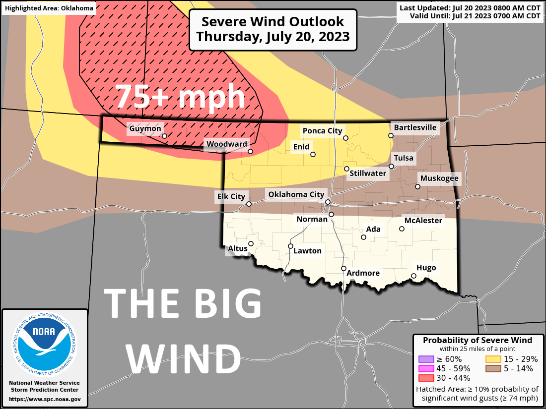
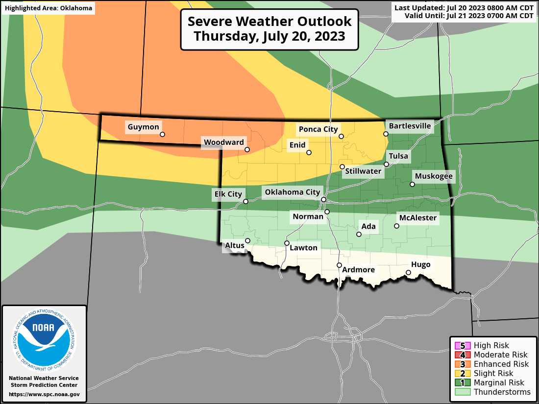
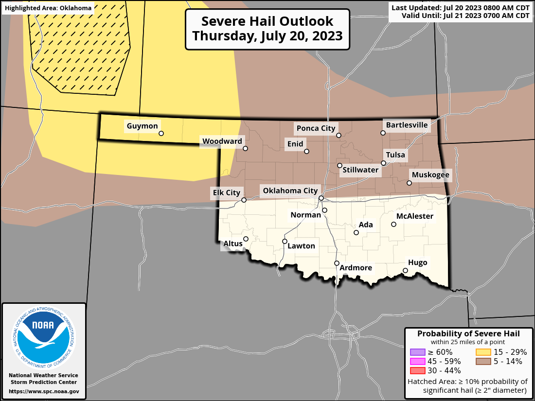
Stop me (please!) if you've heard this one before, but expect storms to initiate
up in the High Plains of Colorado and move southeast towards Oklahoma. They will
enter more favorable air along the OK/KS border and go severe, with big hail and
severe winds being the greatest threat, especially in far NW OK where those wind
gusts could exceed 75 mph. But the tornado threat ain't zero either.

So if you either live in those parts or know somebody who does (and I know plenty),
be sure to let them know of these shenanigans Mother Nature has concocted for
about the 43rd time this year. Times will be late evening into the early
overnight hours.
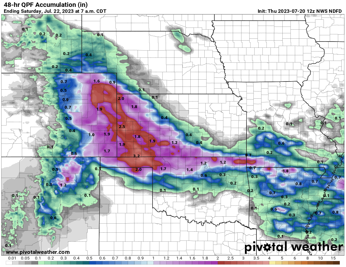
This will come with some significant rains across the northern third of the
state. How far south the storms are able to make it is still questionable as
they plunge towards less favorable air, but the northern half of the state needs
to be alert for those severe hazards, as well as flooding rainfall.
Other than my proclamation that Sonic ice could learn a thing or two from
7-Eleven ice, this might be the strangest thing I've ever said: the Panhandle
doesn't need much more rain.
(Waiting for the screaming to die down).
Oh, they'll take it, of course. But the rain is needed much more farther to the
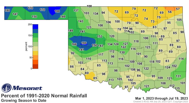
east in north central and northeastern OK. The growing season (March 1-forward)
rainfall bears that out.
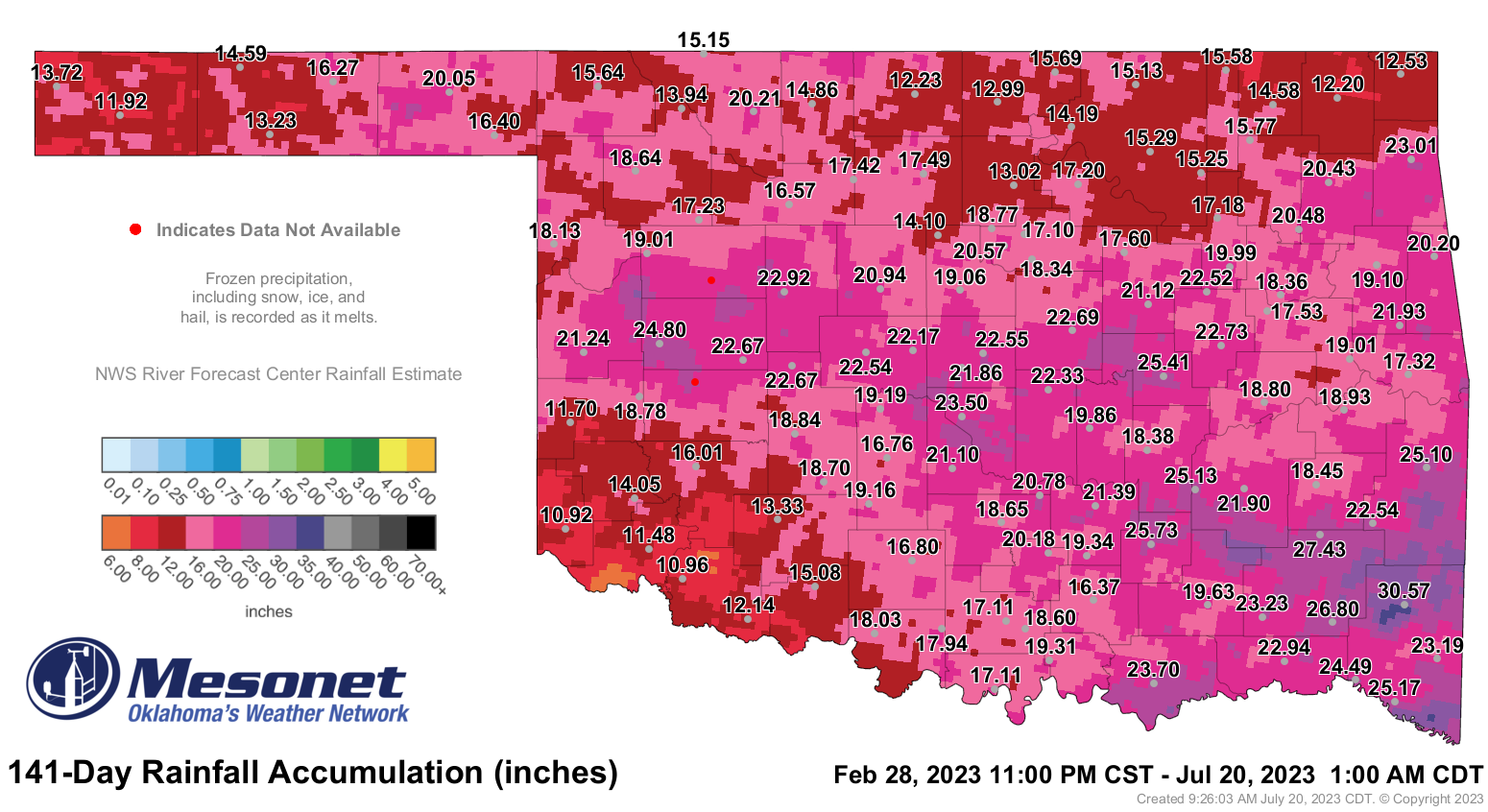
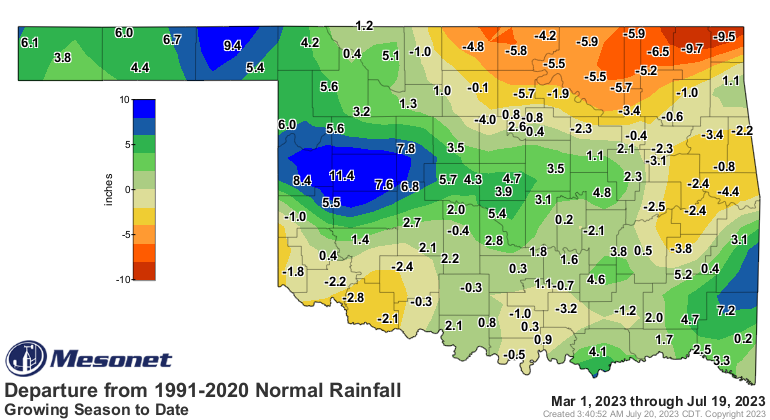
Over 9 inches above normal since March 1 in parts of the Panhandle? ARE YOU
KIDDING ME, PRIVATE PYLE! So we need to slide some of that east to where those
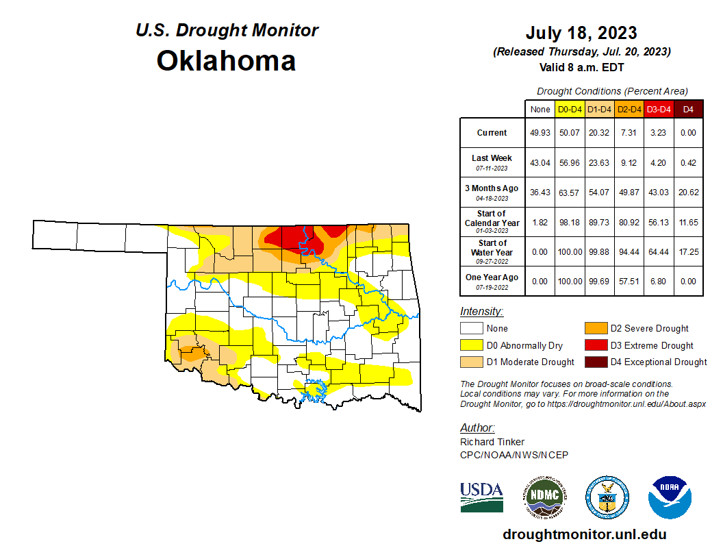
bigger deficits still remain, as does the worst of Oklahoma's drought (could use
some down south from there, too).
Folks continue to ask me if this continued rainy pattern well into Summer is
a consequence of El Nino. Well, in my opinion, the answer is still El No. Of
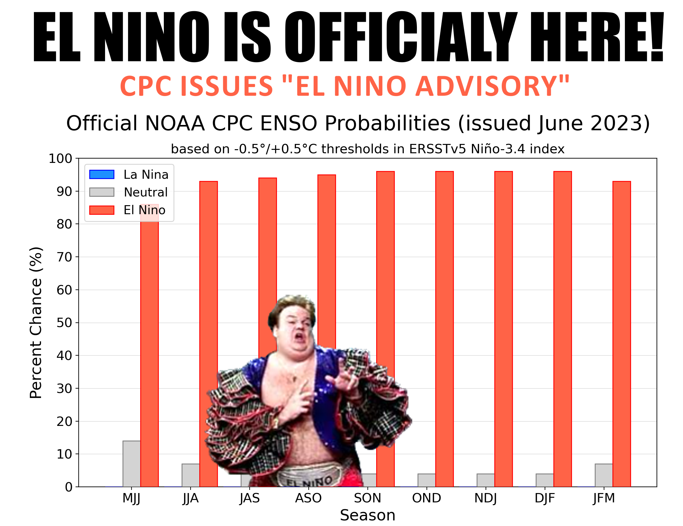
course, it is very conspicuous, isn't it? An El Nino advisory was announced by
CPC back in early June signalling the official arrival of the phenomenon.
Amember this?
So sure, very suspicious. But here's the deal...the ATMOSPHERIC RESPONSE part of
the El Nino has been fairly weak thus far. Remember, it takes more than just
sea surface temperatures changing to make an El Nino...we need the atmosphere
to change in response as well. I tried (much like the atmospheric response, very
weakly) to explain all that here:
https://ticker.mesonet.org/select.php?mo=06&da=08&yr=2023
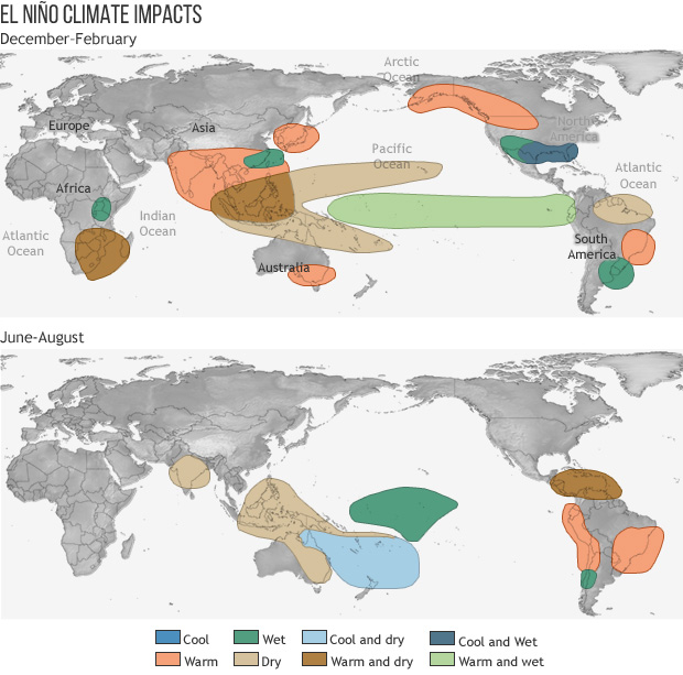
Remember, part 3, that the impacts due to the atmospheric response of El Nino
to North America are primarily in the cool season...say, October-March'ish.
Summer impacts are mostly in the Southern Hemisphere, where winter is currently
occurring. Check out this graphic of El Nino expected impacts for the winter
months (top) vs. summer months (bottom).
So if the atmospheric response has been weak thus far, then I'm not sure we can
conclude that El Nino has been a major player for us thus far. And if you look
at the rainfall patterns over the last 3 months, you can see that the High
Plains has had the highest rainfall surpluses, at least as a percentage of
normal, which is not a common El Nino response.
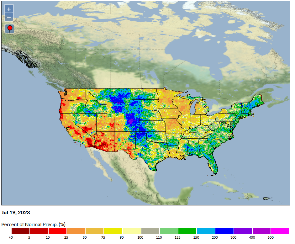
When I look at that rainfall pattern, I see a persistent high pressure ridge
over the Midwest causing SE flow of moisture into the higher elevations of
the Plains, and the repeated MCS events along the Lee of the Rockies which are
then directed SE from a high pressure ridge and it's clockwise flow in the
Desert SW, maybe. I'm just eyeballing there.
It does appear that the El Nino will grow to "Strong" to "Very Strong" by the
Northern Hemispheric winter, which will have big implications for us (as discussed
in that previous Ticker linked above). However, things are greatly complicated
by the fact that the world's oceans are smoking hot right now. The atmospheric
response is generated by those differences in oceanic temperatures in
certain areas...if you weaken those temperature differences, or dilute them,
if you will (and we all know just how painful that can be), then the atmospheric
response could end up being weaker.
But let's worry about that in the coming months, and just be thankful that
WHATEVER has caused all the rain for us was there to bring most of the state
out of horrendous multi-year drought.
Gary McManus
State Climatologist
Oklahoma Mesonet
Oklahoma Climatological Survey
gmcmanus@mesonet.org
July 20 in Mesonet History
| Record | Value | Station | Year |
|---|---|---|---|
| Maximum Temperature | 113°F | GRA2 | 2018 |
| Minimum Temperature | 56°F | EVAX | 2021 |
| Maximum Rainfall | 2.97″ | WATO | 2020 |
Mesonet records begin in 1994.
Search by Date
If you're a bit off, don't worry, because just like horseshoes, “almost” counts on the Ticker website!