Ticker for June 20, 2024
MESONET TICKER ... MESONET TICKER ... MESONET TICKER ... MESONET TICKER ...
June 20, 2024 June 20, 2024 June 20, 2024 June 20, 2024
How soon we forget
First off, that about covers the rain in the Panhandle for awhile, no? If you
didn't read yesterday's Ticker, you're lucky, but if you wanted to see us detail
yesterday's 500-to-1000 year rainfall, check it out here:
https://ticker.mesonet.org/select.php?mo=06&da=20&yr=2024
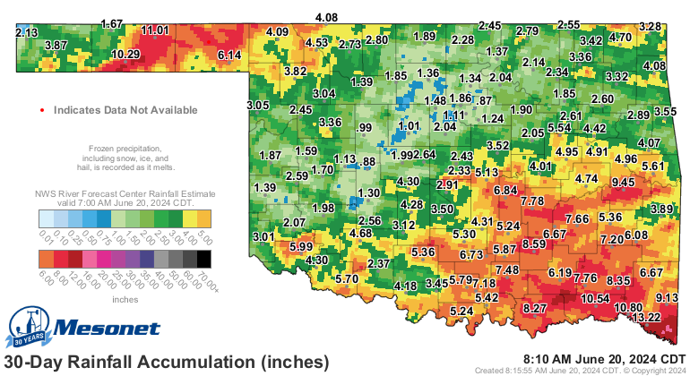
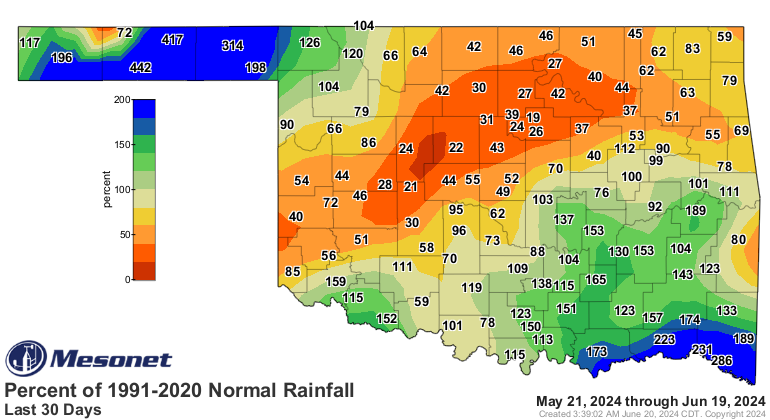
And here's how the rainfall ended up after it was all said and done.
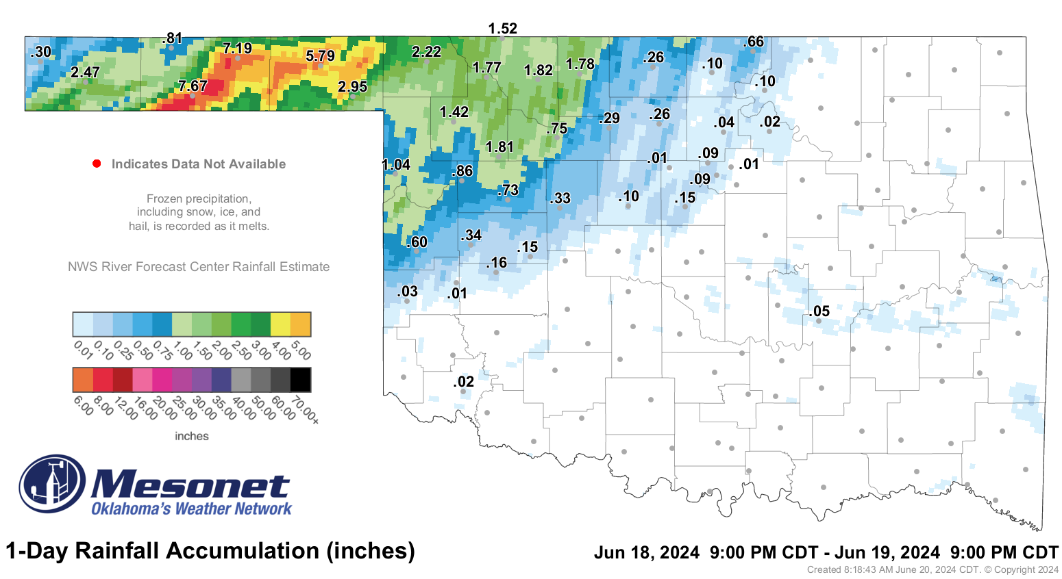
Quite a few folks have asked us when was the last time the Panhandle was this
wet. Well, does "Noah" ring a bell? NO NO, not that long ago...it was all the way
back to...LAST SUMMER!
How soon we forget.
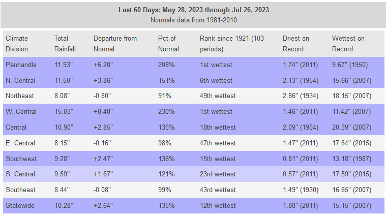
Right, last June and July combined were the wettest on record for the Panhandle
climate division, which encompasses the 3 Panhandle counties as well as Harper
and Ellis counties. The May-July period was alos the wettest on record. You may
be wondering what "alos" means...I am also. Yeah, too lazy to backspace. But
you can probably also remember the huge wildfires out in the Texas and Oklahoma
Panhadles, as well as far western OK, late this winter? That was in large part
due to the big rains of last summer in the area causing lots of overgrowth in
those parts, which left a lot of fuel for those wildfires.
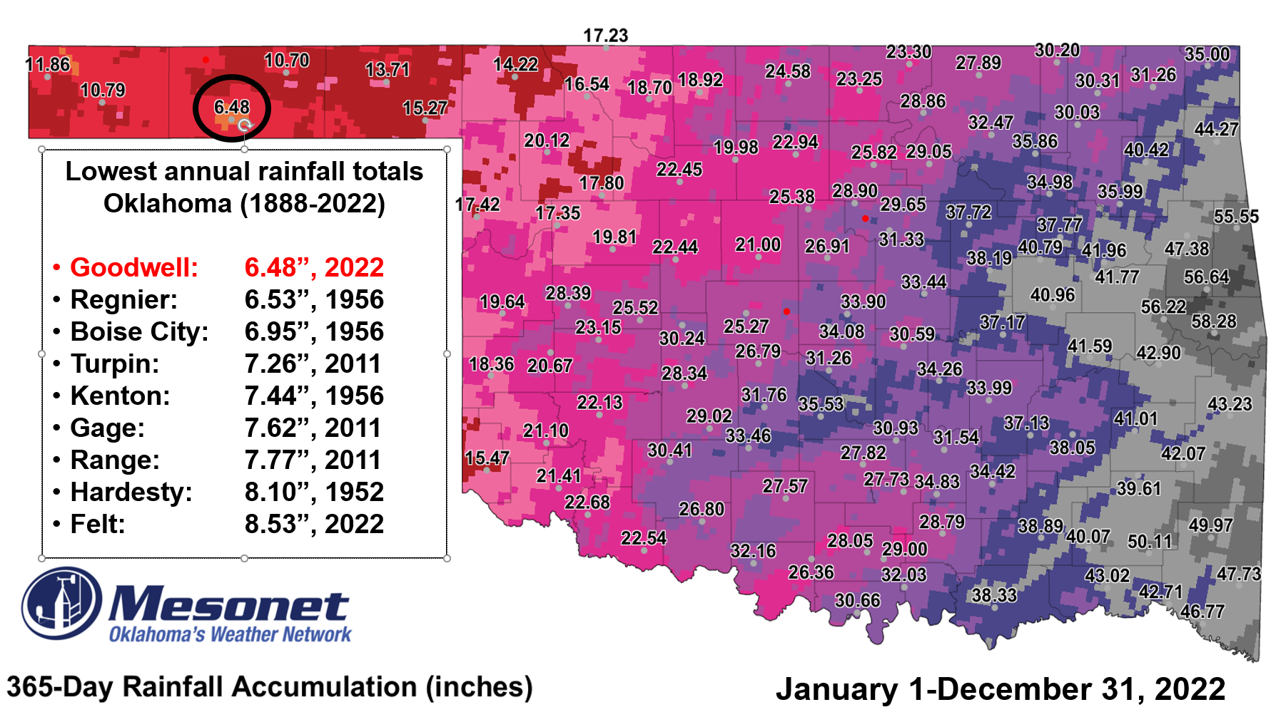
Here's another crazy stat from yesterday, from our Oklahoma Associate State
Climatologist, Dr. Mark Shafer. Goodwell's rainfall total of 7.67 inches was
more than the ANNUAL total of 6.48 inches from 2022, which is also the lowest
annual total ANYWHERE in Oklahoma on record.
Secondly (remember way back at the first, when we said "Firstly?"), there's
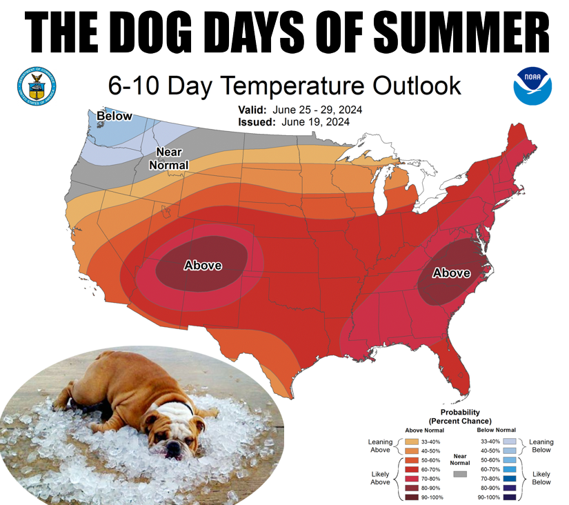
not much chance of more rainfall in the next week or two here in the state as
we're going into a classic summertime pattern under the DEATH RIDGE HEAT DOME OF
DEATH! A Ring of Fire, if you will. Yeah, we said "death" twice.
Depending on where that heat dome wanders too, we'll see chances of showers
along the periphery. From somebody who pretty much lives on the periphery of
societal norms...it's not a good place to be. Yep, here comes the heat!
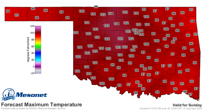
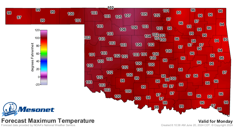
It'll be sorta hot today, but the real heat comes this weekend into early next
week (and beyond).

That heat is important because we're also seeing it start to dry out across all
BUT far NW OK, following yesterday's rain.
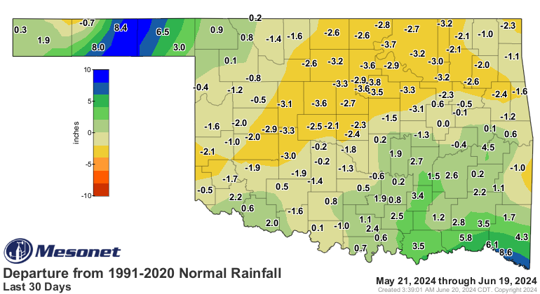
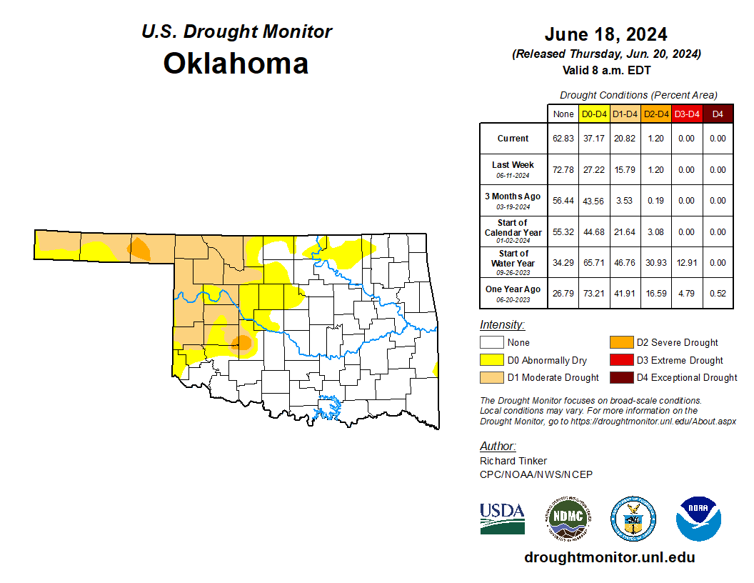
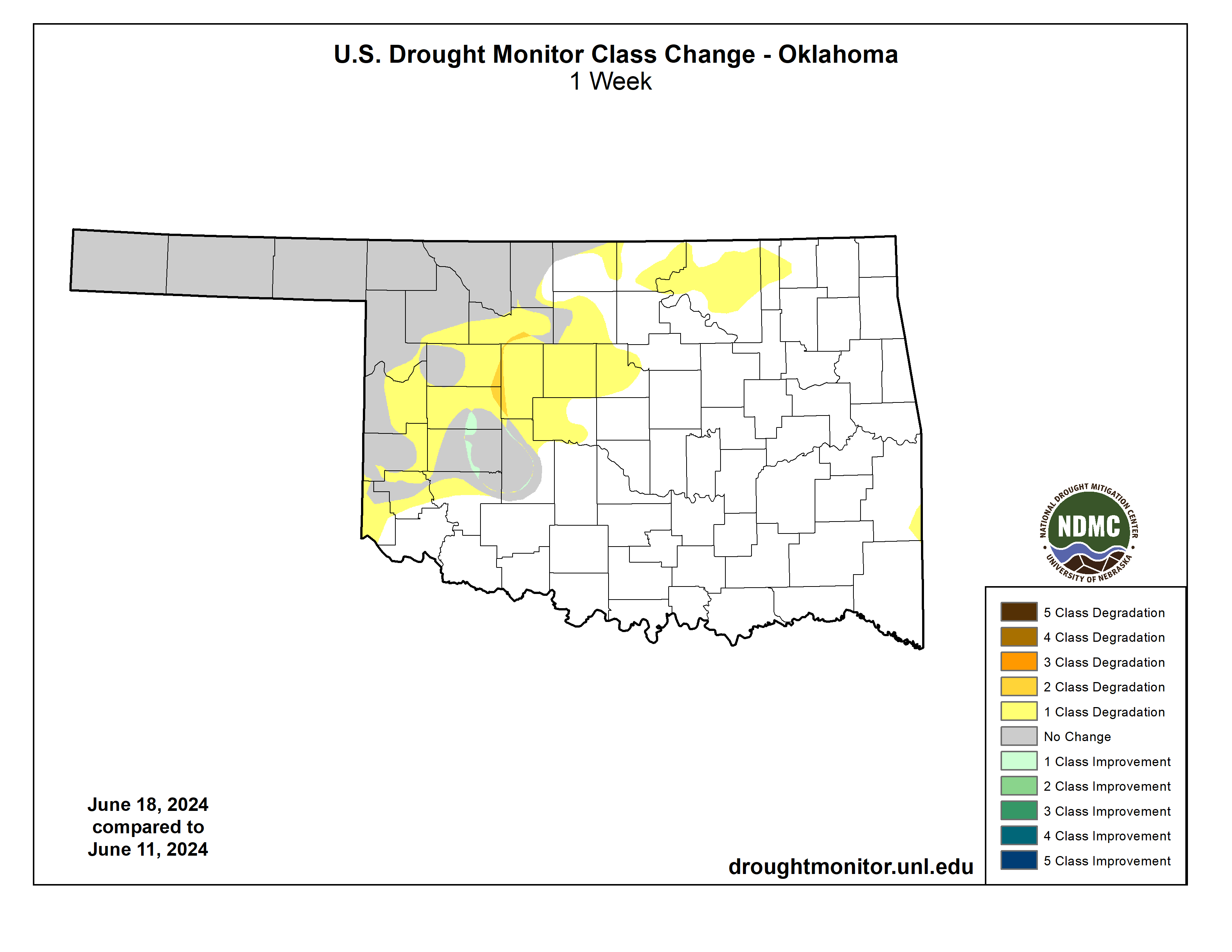
So new drought did develop to the south and east of that big rain in NW OK. Now
the new Drought map is out, but keep in mind any rain seen after 7 a.m. on
Tuesday morning goes to next week's map, so no changes in NW OK until next
Thursday's map. Obviously, drought is greatly reduced or obliterated in that
area. Outside of that region, flash drought is imminent.
Today's CPC outlooks for July and July-September also came out today, and it
would appear summer is gonna be a scorcher, and possibly dry, when averaged out
over those longer periods.
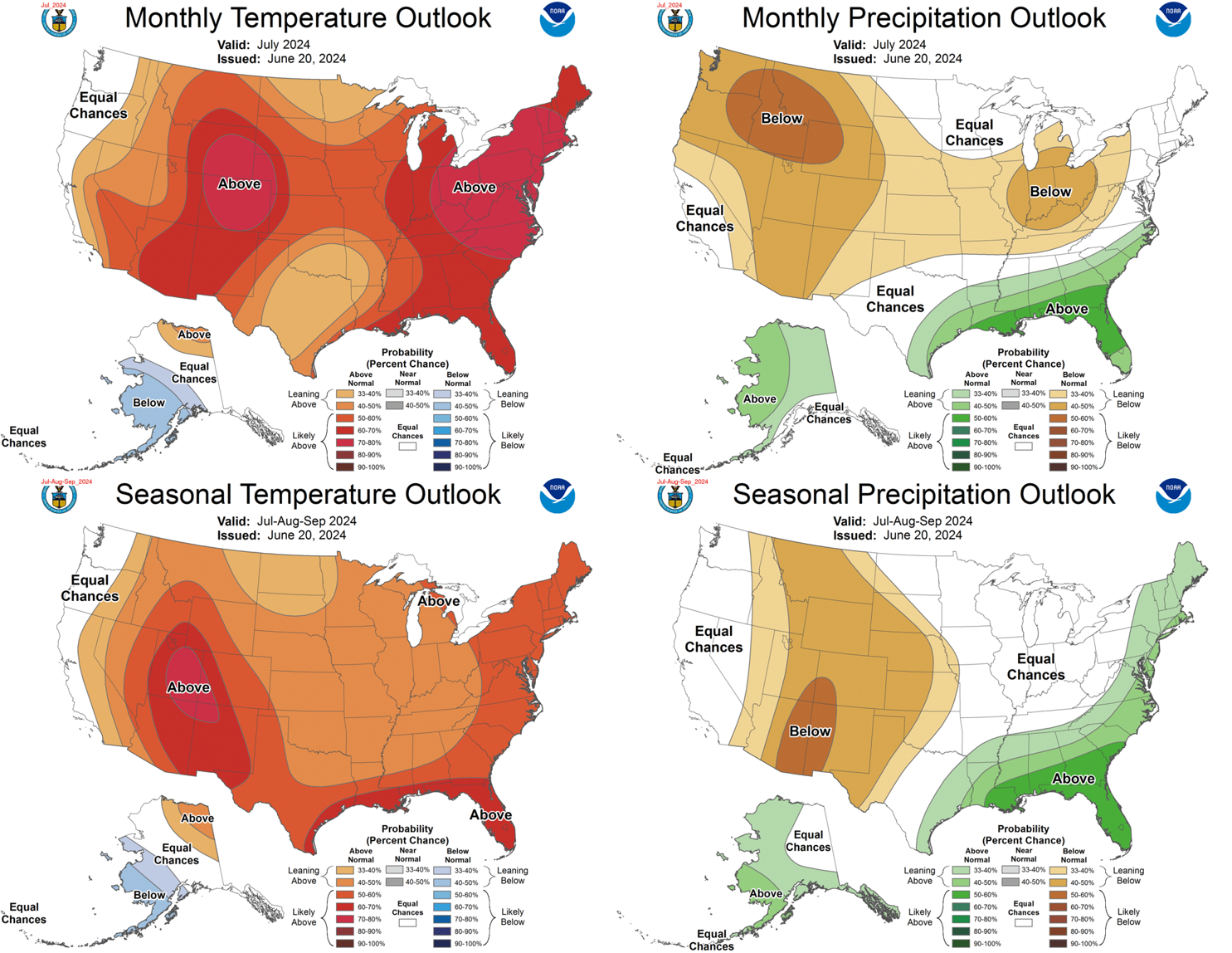
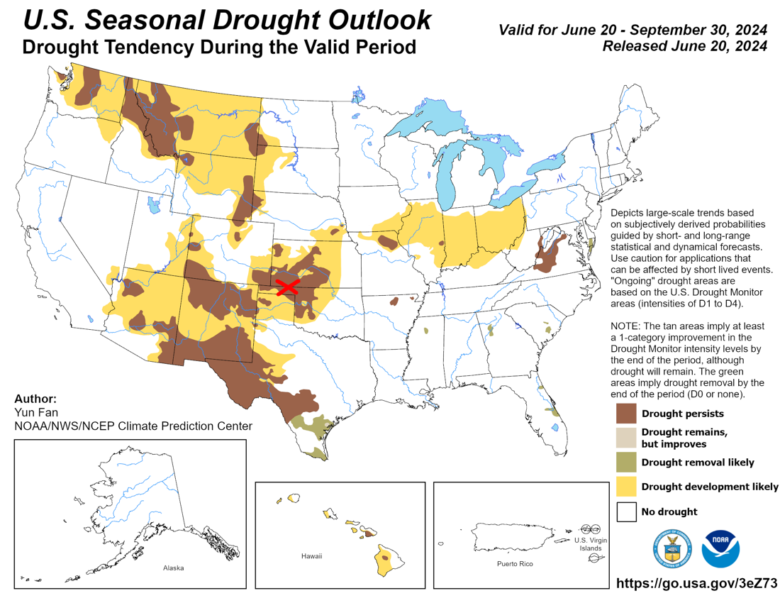
The Drought Outlook for the July-September period shows drought persistence and
development over much of NW OK through the period, but remember it suffers from
the same problem as this week's Drought Monitor, having been produced right
on the heels of that big rain in that area. However, keep in mind that drought
could still come back pretty quickly up there. This type of extreme rain event
up in the droughty area of the Panhandle doesn't necessarily relieve that longer-
term dryness. That rain no doubt helped, but with the ground baked hard, much of
it ran off pretty quickly, no doubt.
Lastly...I never mentioned the heat index. Yeah, it's coming!
Gary McManus
State Climatologist
Oklahoma Mesonet
Oklahoma Climatological Survey
gmcmanus@ou.edu
June 20 in Mesonet History
| Record | Value | Station | Year |
|---|---|---|---|
| Maximum Temperature | 112°F | MANG | 1998 |
| Minimum Temperature | 52°F | KENT | 2000 |
| Maximum Rainfall | 4.32 inches | BOWL | 2007 |
Mesonet records begin in 1994.
Search by Date
If you're a bit off, don't worry, because just like horseshoes, “almost” counts on the Ticker website!