Ticker for June 20, 2023
MESONET TICKER ... MESONET TICKER ... MESONET TICKER ... MESONET TICKER ...
June 20, 2023 June 20, 2023 June 20, 2023 June 20, 2023
The sun is angry today my friends
The only thing worse than the derecho we had Saturday night would be to go right
into the pressure-cooker style heat that we saw last summer. Well, other than
straight to winter. Well, other than straight to winter and then straight back
to a derecho. Yes, "DERECHO," a word so weird even my spell-check has given up.
Remember, a derecho (think "duration" with an O instead of un in the
pronunciation) is defined by the NWS as a very long lived and damaging
thunderstorm. A storm is classified as a derecho if wind damage swath extends
more than 240 miles and has wind gusts of at least 58 mph or greater along most
of the length of the storm's path.
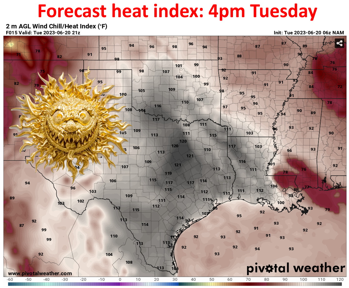
Right, we got that covered. But from wind to the frying pan. I swear at the
heat index values before forecast today, you can actually hear the sun. It's just
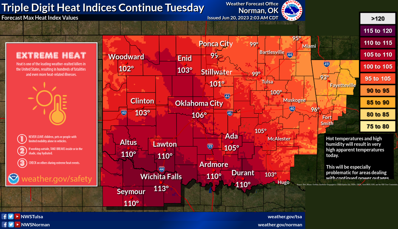
nasty enough to get us a heat advisory AND an excessive heat warning.
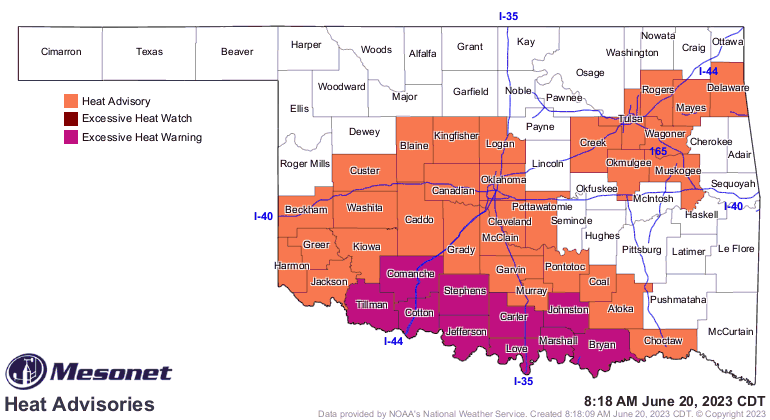
What's the difference? How quickly you have to change your sweaty underwear.
Well, that's MY scientific explanation...but to the folks the the NWS issuing
these advisories, the heat advisory will give you 105-110, and the excessive
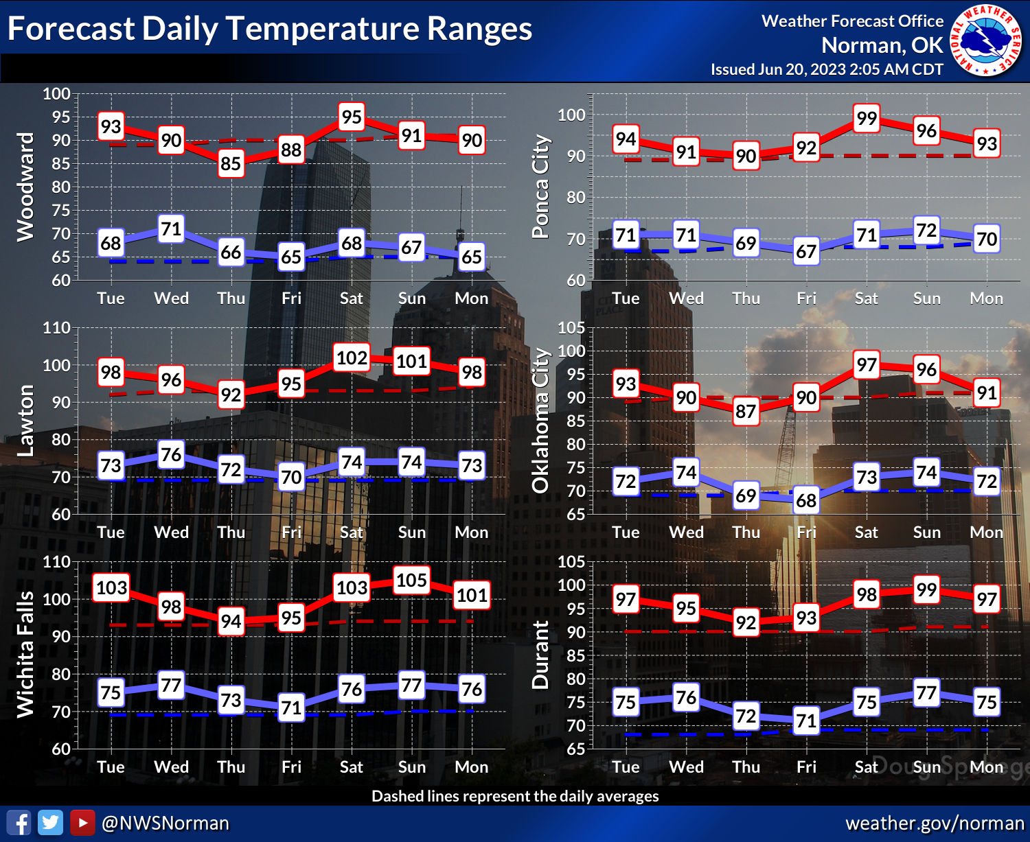
heat warning will get ya 110+. Here's a rough mashup of the predictions from
the Norman and Tulsa NWS offices for today's heat index values.
Yeah, it ain't pretty, either in prediction OR depiction (I do what I can with
the 24-box of Crayons I'm given...ooh, that 48-box, someday!). But we will have
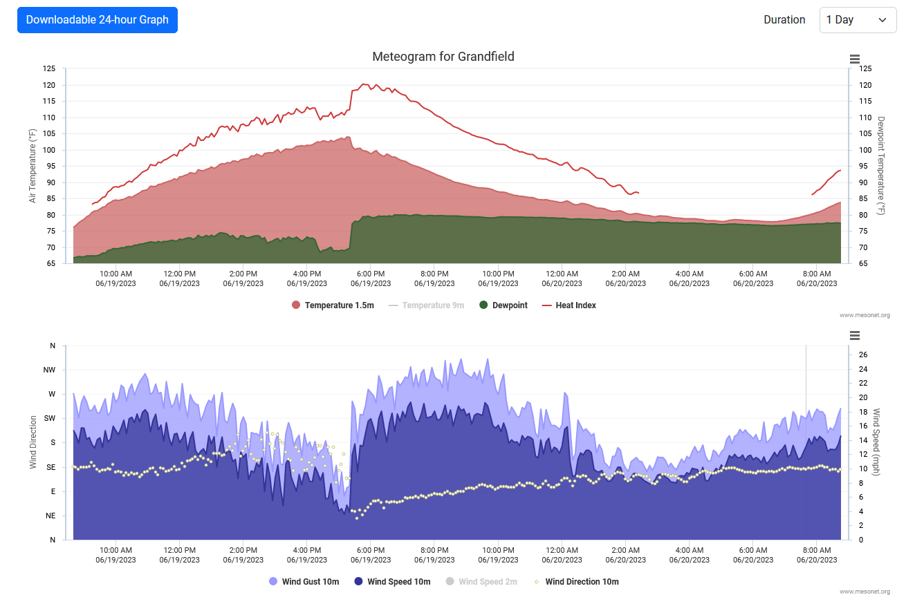
to wait and see. Yesterday's heat index at Grandfield hit 120 degrees.
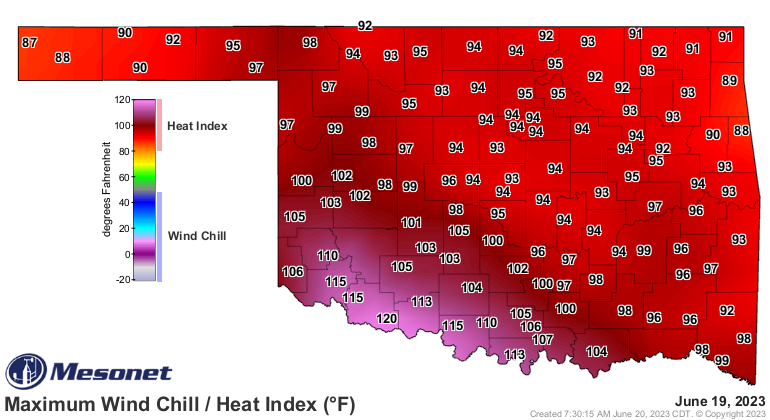
120.2 degrees, to be exact.
120.2 degrees!?!?! ARE YOU KIDDING ME? That matches the highest heat index
we saw all of last summer (Webbers Falls, June 12)! Not that it's odd to see
it that high this early, but it definitely is weird to see it in dry dry dry
southwestern Oklahoma. The crazy thing is that Grandfield was cruising along
with a nasty 110-115 heat index much of yesterday afternoon then they get hit
with a moisture-laden east wind and the heat index hit the fan.
Hopefully we don't see that again today, but we'll see. Temps will drop a bit
over the next few days, at least the actual air temperatures, before zooming up
once again this weekend.
Also watch out for severe weather rearing its ugly head once again tomorrow out
west. Nothing like Saturday, hopefully, but wind and hail will be the biggest
concerns once again.
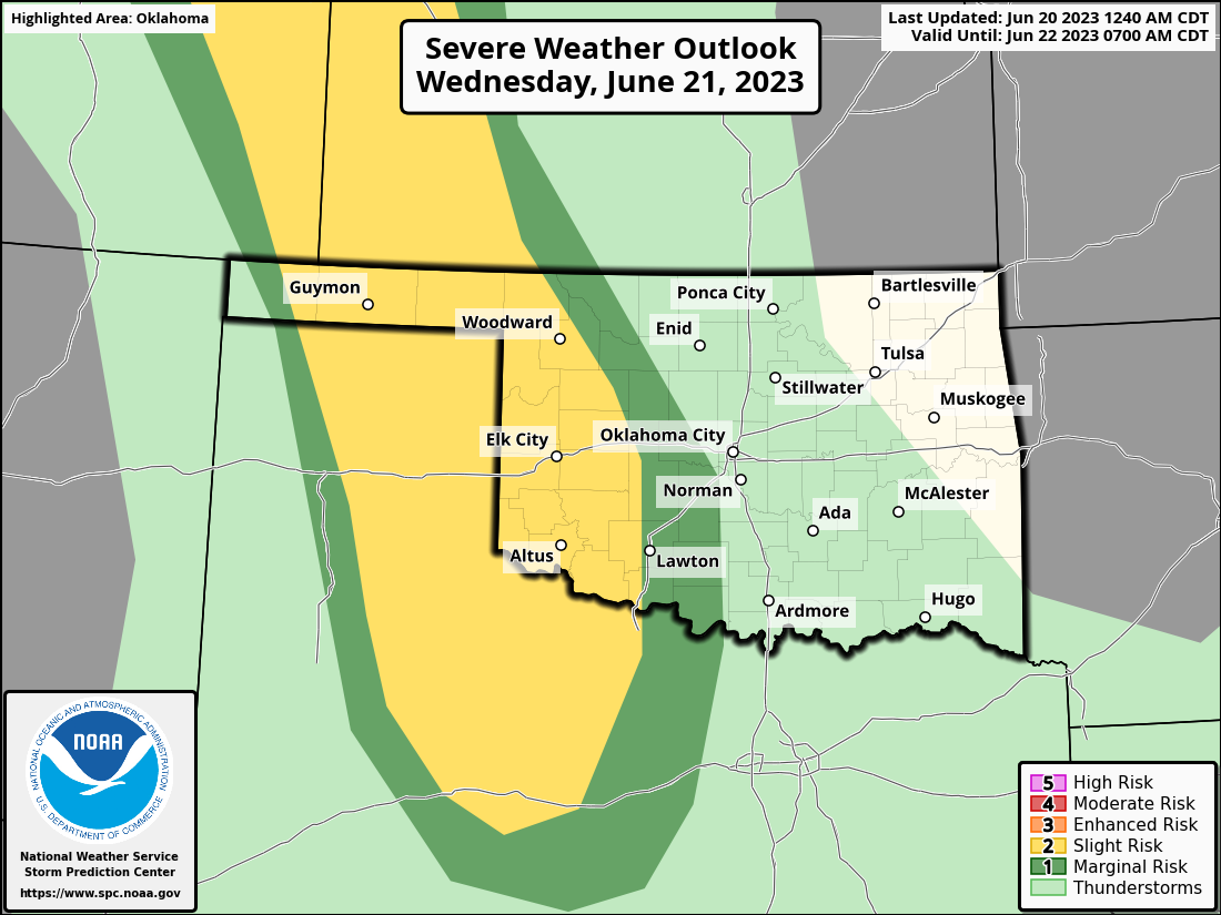
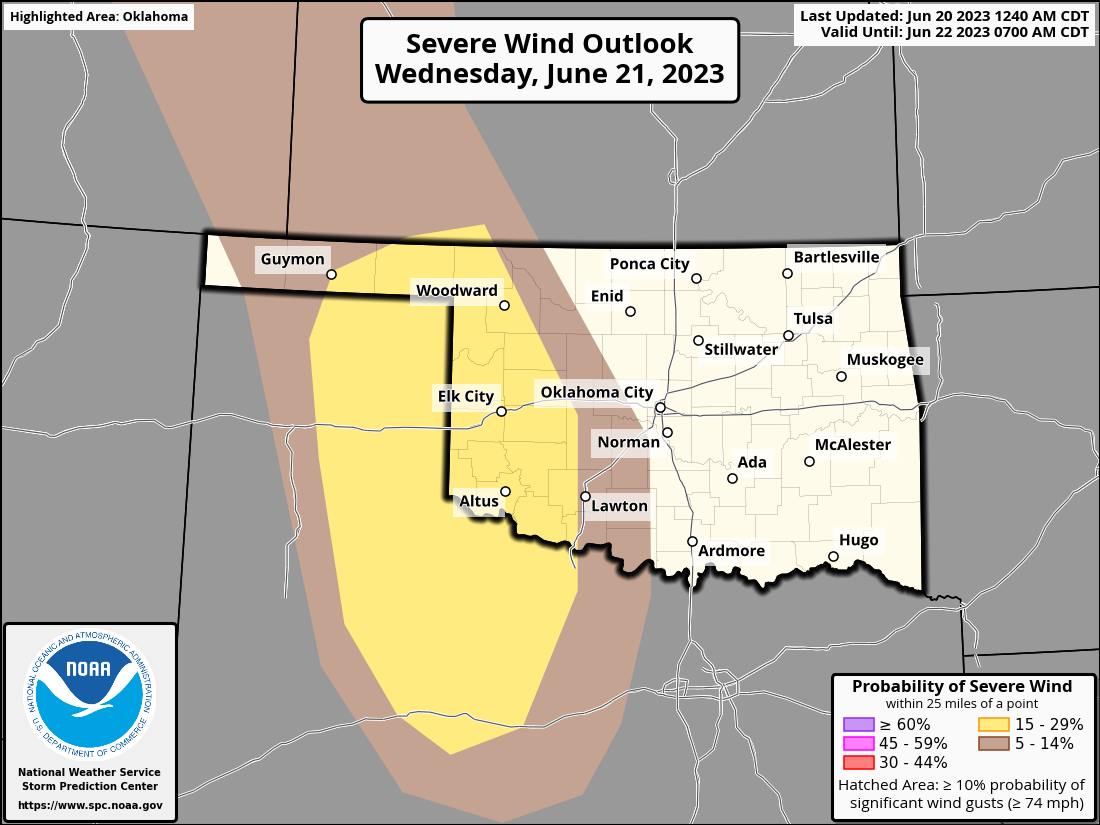
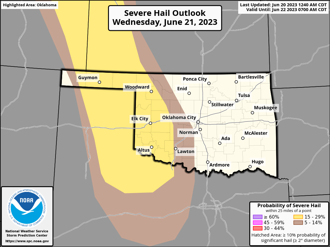
That could change, of course, for the better OR worse.
As for now, let's just worry about the heat since it is somewhat all of a
sudden. Check on the vulnerable, stay hydrated AND indoors, if possible.
It's only 4-7 months until our first freezing weather, after all.
Gary McManus
State Climatologist
Oklahoma Mesonet
Oklahoma Climatological Survey
gmcmanus@mesonet.org
June 20 in Mesonet History
| Record | Value | Station | Year |
|---|---|---|---|
| Maximum Temperature | 112°F | MANG | 1998 |
| Minimum Temperature | 52°F | KENT | 2000 |
| Maximum Rainfall | 4.32 inches | BOWL | 2007 |
Mesonet records begin in 1994.
Search by Date
If you're a bit off, don't worry, because just like horseshoes, “almost” counts on the Ticker website!