Ticker for May 20, 2019
MESONET TICKER ... MESONET TICKER ... MESONET TICKER ... MESONET TICKER ...
May 20, 2019 May 20, 2019 May 20, 2019 May 20, 2019
Believe
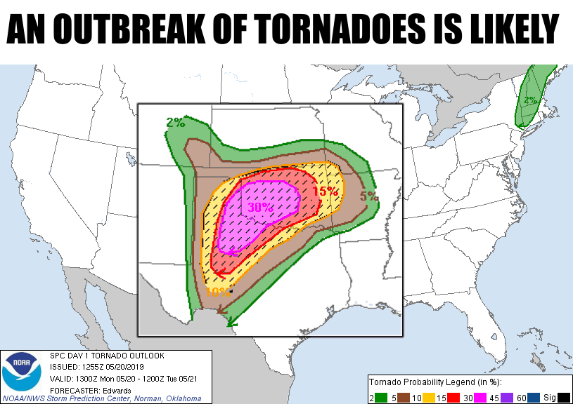
It's one of "those" spring days in Oklahoma. The ones we dread. The ones we
worry about. The ones where the hype doesn't seem enough. And the Ticker despises
hype. In case you long-term readers, much of our so-called hype is actually
parody of hype. But this one day. This May 20th day, I'm asking you to believe
the hype. Just this one day, so you can keep you and your family safe. Don't be
scared, don't be frightened...just be prepared. Boy Scouts already have this
down, and so should you. It's just one day. Be vigilant, be aware, stay keenly
attuned to what's going on in the weather. It might save your life, and the
people you hold dear.
Here's the setup. We have a strong storm system approaching from the west, and a
warm front laden with moisture approaching from the south. You can go outside
this morning and for most of you, it's not a "wow, it feels like it will tornado
today" feeling just yet. Wait for the warm front, then you'll get that classic
severe weather muggy feeling. Warm fronts are sometimes hard to pick out, but you
can see it on the Mesonet's wind as well as the dewpoint map. Southerly winds
and higher dewpoints are the key to its location.
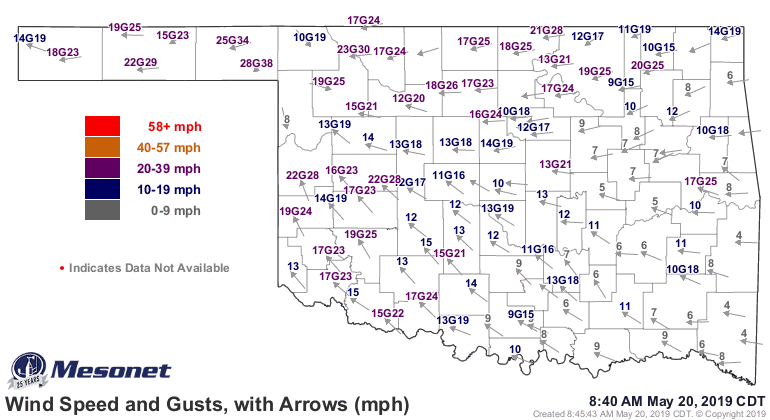
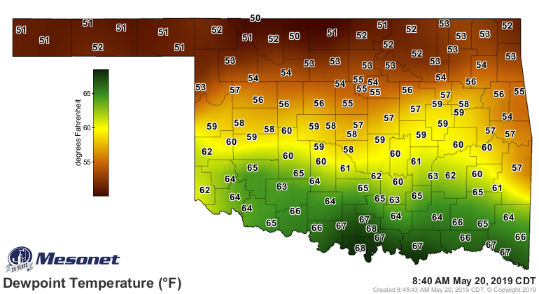
So if you're waking up in Burneyville, or Ardmore, or Tipton, you might be
thinking "feels like it could tornado today." Because it could. Some would say
"it will." In your particular location? Chances are infinitesimal. Somewhere
close to you? Small. Somewhere? Likely. More hype? How about this quote from
the Storm Prediction Center, the folks trained NOT to hype severe weather
events:
"A serious outbreak of destructive, tornadic supercells is likely
over parts of this region this afternoon into evening, especially in
the high- and moderate-risk areas. Given the expected fast storm
motions, especially mid-afternoon into evening, a few of the
best-organized supercells may reach an equilibrium with their
already very favorable mesoscale environments long enough to sustain
wide, long-track tornadoes."
Don't be scared. Be prepared.
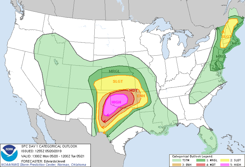
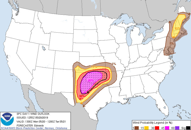
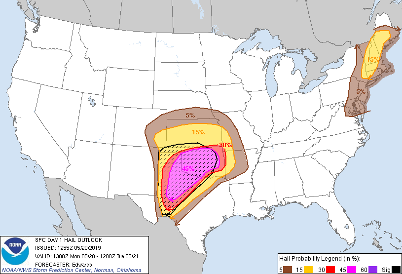
And the threat doesn't end with tornadoes. It also includes gigantic hail,
severe wind damage, and flooding. Here are all the latest outlooks from SPC.
Notice that they have issued a somewhat rare "high risk" for much of western
and central Oklahoma. But the moderate risk that surrounds that region is
serious in its own right. We shouldn't think of these lines as discrete areas
where risk diminishes rapidly. Fuzzy boundaries, remember that. And as for
the high risk, remember that there was not a high risk outlook issued for
May 20, 2013.
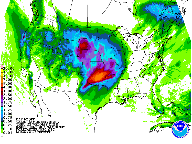
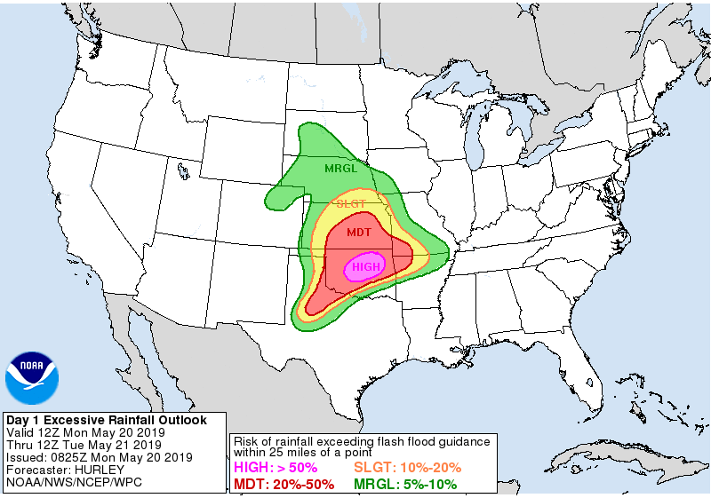
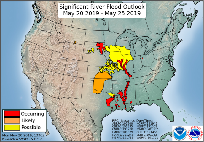
In addition, the flooding risk will be substantial. We could see 5-7 inches of
rain on an already soaked Oklahoma, with some localized areas seeing 10+ inches.
So we also have a high probability of flash flooding zeroed in on central
Oklahoma.
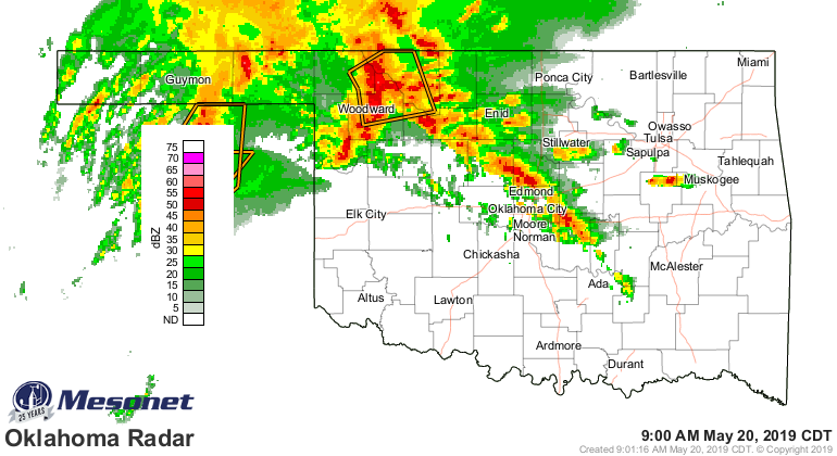
We'll have two shows (three really) today.
1. First will be that warm sector area south of the warm front, not associated
with the dryline. We're talking north central Texas into western and central
Oklahoma. With the amount of wind shear already in place, some of these storms
could become tornadic. This will be your early-mid afternoon phase.
2. Later in the afternoon, the dryline out west should fire off some bigtime
supercells, and these would likely become tornadic as they moved into that warm
sector. This will be a threat of LONG-TRACKED, VIOLENT TORNADOES. This is the
big show.
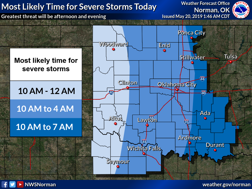
3. Then later tonight, watch for a squall line to form and march east. The
tornadic threat will remain well into the overnight hours, so your must remain
weather aware. The "AM" designation on the storm timing for today is not a
mistake. 10AM-12AM, 10AM-4AM, 10AM-7AM. Ugh.
I don't want to overwhelm you with information, but I think I've given you
enough to realize the seriousness of the situation. You have to be weather aware
today and through the overnight hours. You have to have a way to get warnings
if you lose power. You have to have a plan to protect you and your loved
ones, friends and family. Stay tuned to your local NWS office through Twitter.
Choose your favorite media source and lean on their large teams of trackers.
Pick any of them, they're all great at their jobs.
Six years ago I sat huddled in our storm cellar just south of Briarwood and
Plaza Towers elementary schools as a gigantic EF5 monster churned through our
neighborhood -- and our lives. Planning is the key. The precursor has already
begun. The big show is later.
Stay weather aware. Be safe.
Gary McManus
State Climatologist
Oklahoma Mesonet
Oklahoma Climatological Survey
(405) 325-2253
gmcmanus@mesonet.org
May 20 in Mesonet History
| Record | Value | Station | Year |
|---|---|---|---|
| Maximum Temperature | 104°F | ALTU | 2006 |
| Minimum Temperature | 35°F | EVAX | 2017 |
| Maximum Rainfall | 6.44″ | SKIA | 2019 |
Mesonet records begin in 1994.
Search by Date
If you're a bit off, don't worry, because just like horseshoes, “almost” counts on the Ticker website!