Ticker for August 19, 2020
MESONET TICKER ... MESONET TICKER ... MESONET TICKER ... MESONET TICKER ...
August 19, 2020 August 19, 2020 August 19, 2020 August 19, 2020
Septgust?
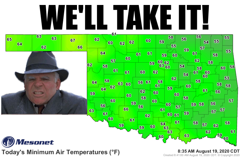
Uhhhh, lows in the 50s? We'll take it! I know it was mostly 60s, but those 50s
pop out at ya. Heck, that's almost football weather (although football weather
this season could be anything from summer, fall, winter or late spring)! That's a
far cry from what we would "normally" see for mid-August, but Oklahoma's "normal"
weather is made up of tons of normally abnormal weather. And this isn't quite
THAT amazing, considering we had a slew of 50s for lows during the first week of
August. But we have short memories when it comes to weather in Oklahoma,
especially in the dog days of summer (and winter as far as that goes) when the
heat and humidity seem to stretch on endlessly. And some of these lows actually
encroached on record territory!
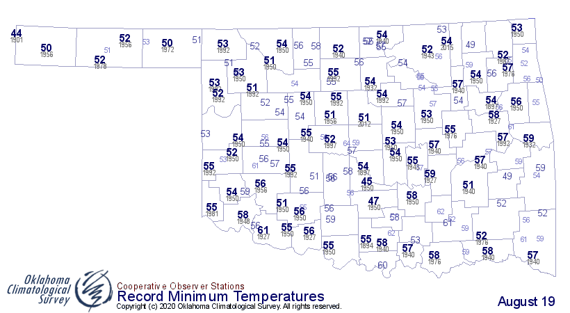
The 54 at Bristow is just one off it's record low for the day of 53, set back in
1950, and Miami's 55 is just 2 degrees off their record (again, back in 1950).
That must have been some morning back in 1950, 70 years ago. Wow, just typing
that 1950 was 70 years ago makes my bones hurt.
At any rate, we should always enjoy extremes on the cool side in the summer,
just like we should enjoy extremes on the warm side in the summer, because
the bill always comes due soon, and Mother Nature has one heck of a collection
agency. The heat will be back by this weekend. Now the key is whether that
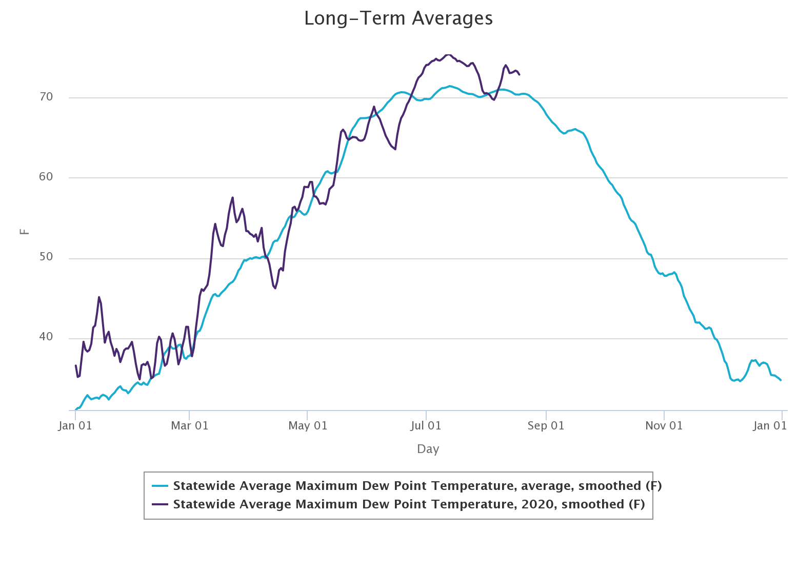
humidity will be back as well, because that sticky weather is the worst. Right
now we're sitting pretty with dewpoints in the 50s and 60s, which helped those
temperatures drop into similar territory last night.
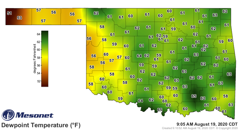
It doesn't look like we'll be getting back to those unbearable conditions we
saw earlier with dewpoints staying in the 70s with even some low 80s, and heat
index values in the 110 territory. But it will be hot nonetheless.
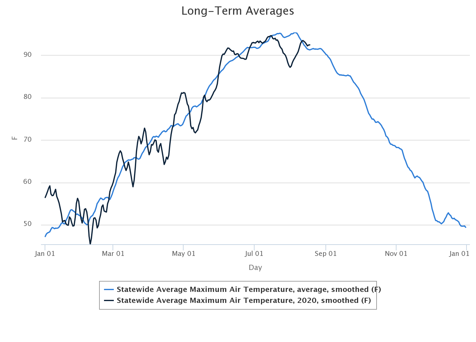
We're on the downward slide for temperatures, dewpoints, heat index, the State
Climatologist's hairline (I hear ya talking out there), but that's "normally"
speaking. It's the peaks and valleys you have to watch out for.
Gary McManus
State Climatologist
Oklahoma Mesonet
Oklahoma Climatological Survey
(405) 325-2253
gmcmanus@mesonet.org
August 19 in Mesonet History
| Record | Value | Station | Year |
|---|---|---|---|
| Maximum Temperature | 111°F | GRA2 | 2024 |
| Minimum Temperature | 51°F | ELRE | 2015 |
| Maximum Rainfall | 8.55 inches | OKMU | 2007 |
Mesonet records begin in 1994.
Search by Date
If you're a bit off, don't worry, because just like horseshoes, “almost” counts on the Ticker website!