Ticker for July 19, 2011
MESONET TICKER ... MESONET TICKER ... MESONET TICKER ... MESONET TICKER ...
July 19, 2011 July 19, 2011 July 19, 2011 July 19, 2011
Heat and drought: An update to an update of a previous update I updated
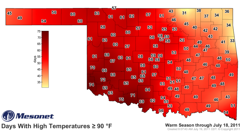
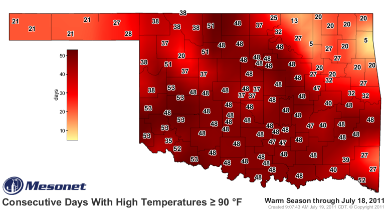
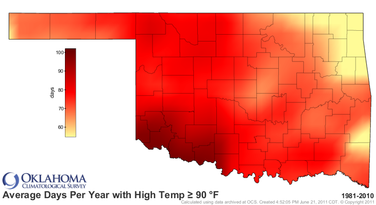
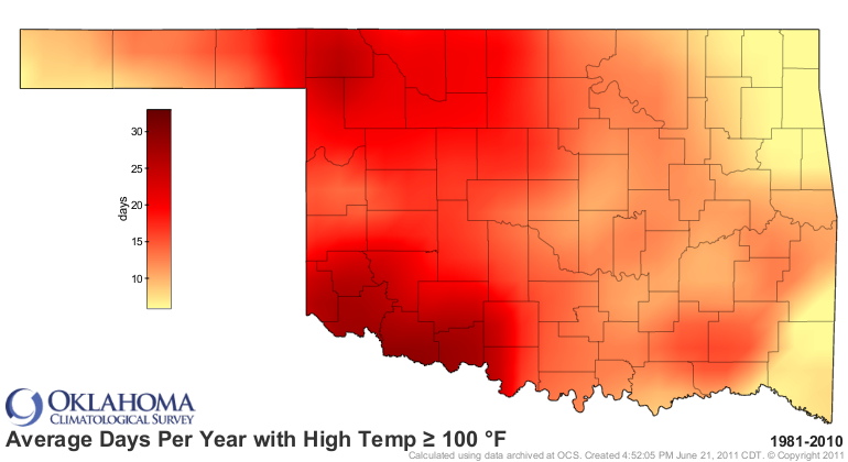
How hot has it been? OCS resident map-making guru Nathan Bain has worked his
magic (I always thought he was a Muggle) and whipped up some really cool maps
using Mesonet data. Here are the days with maximum temperatures of at least
90- and 100-degrees and also the consecutive days of the same data (through July
18). These maps should be operational on the Mesonet site later today as well so
you can follow along at home.
Days

Consecutive Days
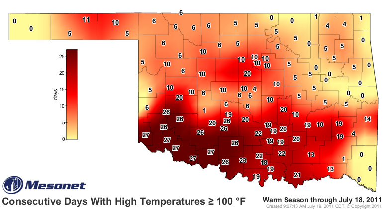
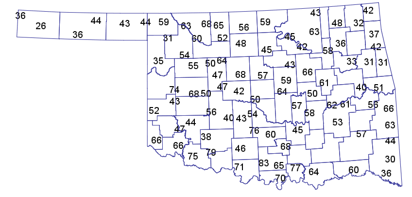
Compare the number of days above 100 map with the one from 1980 and you can see
that things are going to get very interesting over the next month or two if
the drought/heat continues. Grandfield at 55 has Healdton's total of 83 days in its
sight with half of summer remaining.
We've blown past the normal number of days above 100 for the western half of the
state and are approaching normal in the east. For days above 90, we're not there
yet but again, still much of summer left to go.
For July 1-18, the statewide average temperature was 88.4 degrees. That is 0.3
degrees warmer than the warmest July on record (1954, 88.1 degrees). If things
hold through the month, we very well could be looking at the warmest July on
record in Oklahoma.
Why stop there? How is the summer shaping up? From June 1-July 18 (climatological
summer starts June 1 and ends August 31), the statewide average temperature was
85.4 degrees. The warmest summer on record was 1934 with a statewide average of
85.2 degrees. As with July, we are ahead of the pace to finish with the warmest
summer on record. Unlike July, however, there is more time for those numbers
to start coming down. An extra 31 days, to be exact.
By the way, the average high temperature across the state so far in July is 102.6
degrees. Feel better? No, me neither.
Expelliarmus Droughtious!!
Gary McManus
Associate State Climatologist
Oklahoma Climatological Survey
(405) 325-2253
gmcmanus@mesonet.org
July 19 in Mesonet History
| Record | Value | Station | Year |
|---|---|---|---|
| Maximum Temperature | 115°F | MANG | 2022 |
| Minimum Temperature | 53°F | COOK | 2014 |
| Maximum Rainfall | 3.82 inches | BREC | 1997 |
Mesonet records begin in 1994.
Search by Date
If you're a bit off, don't worry, because just like horseshoes, “almost” counts on the Ticker website!