Ticker for October 18, 2023
MESONET TICKER ... MESONET TICKER ... MESONET TICKER ... MESONET TICKER ...
October 18, 2023 October 18, 2023 October 18, 2023 October 18, 2023
We like you
Hey now, you want a different movie reference, you need a different Ticker writer.
(I heard that)!
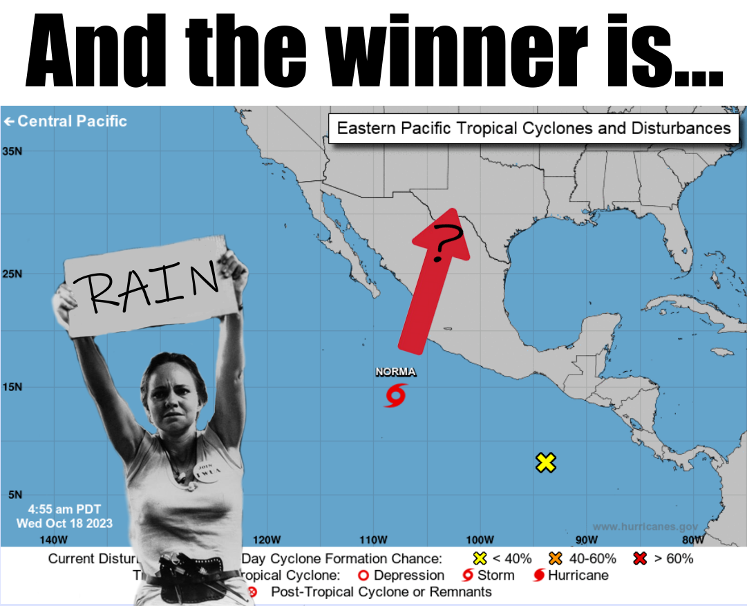
And Sally Field won her first Oscar for "Norma Rae," which makes us jealous since
the only award we won was a Pulitzer. No, not THAT Pulitzer...this Pulitzer is
given by Raymond C. Pulitzer of Gotebo, for non-distinguished writing about
weather and climate. And the "C" stands for "C(k)iller," so be careful about
telling him he can't spell.
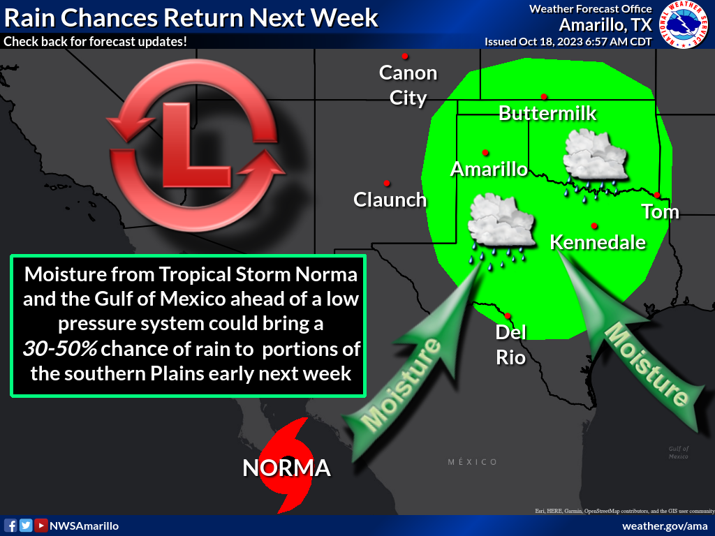
Now when it comes to these tropical storm remnants, you're in really dicey
territory, especially coming from the southwest where there's not a lot of flow.
In this case, we have a large upper-level trough approaching from the west that
looks like it will help catch the Norma and steer it towards the north/northeast,
possibly right up our way. And the resulting rain is finally showing up on the
7-day forecast.
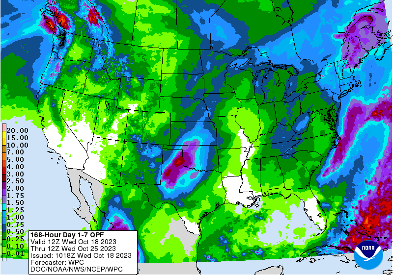
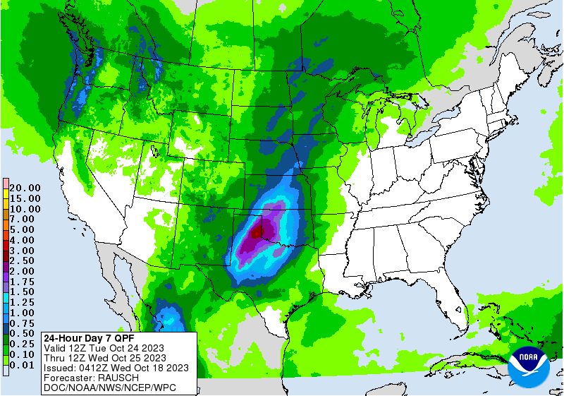
But here's the catch...nearly all of that rainfall on the 7-day forecast is
on the 7th day.
So there you're messing with fire. Well, rain, but if you don't get the rain
you could be messing with fire danger. But lots of things can happen when
those remnants travel up our way. And with the approaching storm from the west,
we should have good moisture return from the Gulf of Mexico with dewpoints
quite high for this time of year. So a lot still has to happen between now and
early next week, but we're certainly due for some luck. And rain.
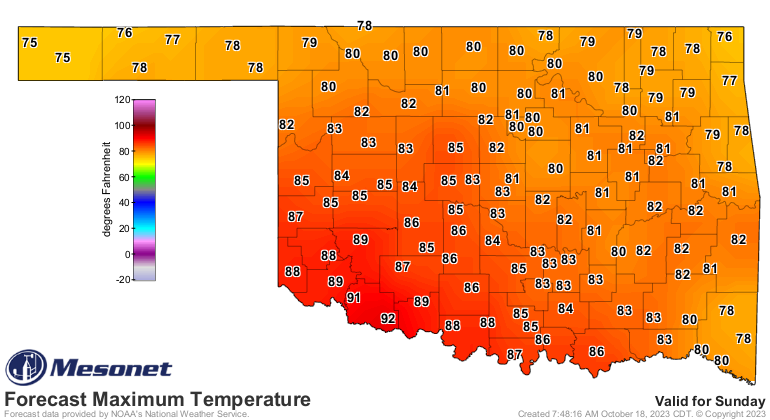
Between now and then, out temperatures are going to soar into near-record
territory across southwest OK as we go through the rest of the week into the
weekend. Sunday looks like a scorcher, at least relative to late October.
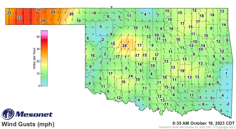
Now the odd thing is we have a cold front entering the state right now, but
it's not really a COLD cold front...more of a lukewarm cold front. You can see
it in the wind fields, but not really on the temperature map.
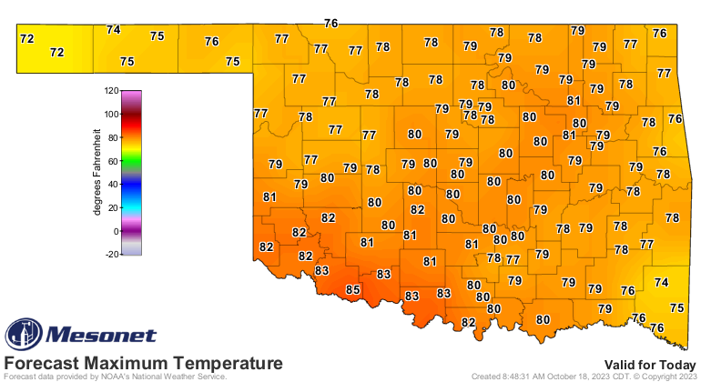
We should see minimal impacts on today's temperatures.
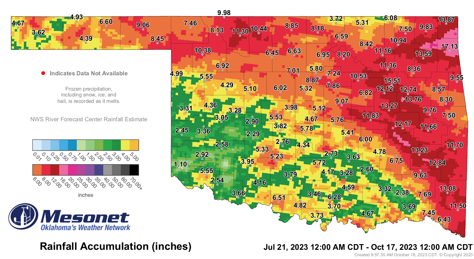
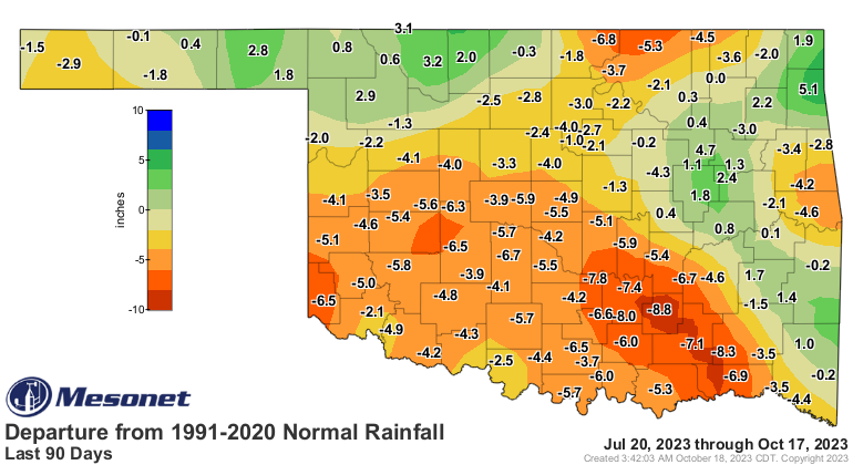
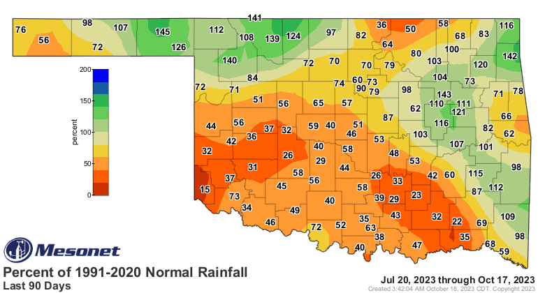
Our current flash drought is 89 days old. In the next couple of days, a lot of
this rain (whatever is on there) will fall off, and these maps will get a whole
lot uglier.
And about getting uglier, (insert proper deprecating remark about me you
see fit, but you'll hear from my law firm of Dewey, Cheatem, and Howe!).
Gary McManus
State Climatologist
Oklahoma Mesonet
Oklahoma Climatological Survey
gmcmanus@mesonet.org
October 18 in Mesonet History
| Record | Value | Station | Year |
|---|---|---|---|
| Maximum Temperature | 96°F | WEBB | 2005 |
| Minimum Temperature | 22°F | NOWA | 2022 |
| Maximum Rainfall | 2.10″ | IDAB | 2002 |
Mesonet records begin in 1994.
Search by Date
If you're a bit off, don't worry, because just like horseshoes, “almost” counts on the Ticker website!