Ticker for October 18, 2018
MESONET TICKER ... MESONET TICKER ... MESONET TICKER ... MESONET TICKER ...
October 18, 2018 October 18, 2018 October 18, 2018 October 18, 2018
Ho Ho, we don't know?
Before we get started, well, I guess we just started, so RIGHT AFTER we get
started, let me just say this...NO, WE DON'T KNOW HOW MUCH IT'S GOING TO SNOW
THIS WINTER FROM THE CONTENT OF THE OFFICIAL NOAA WINTER OUTLOOKS!
More on that later.

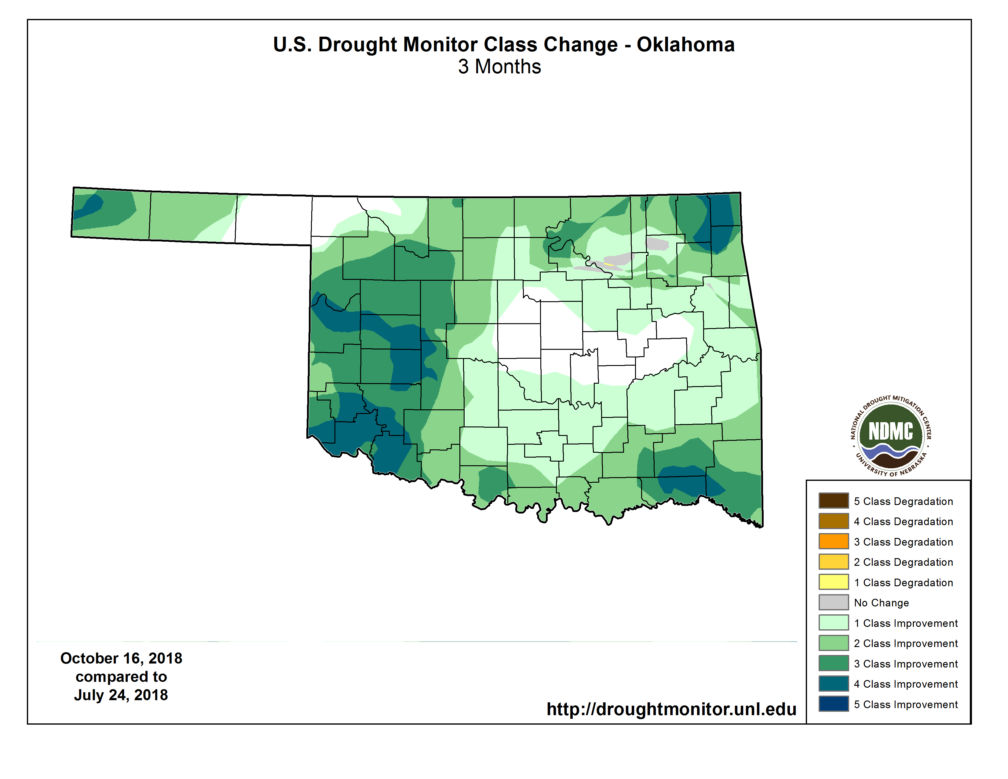
Drought has been nearly wiped out across the state, with little change since
last week. We blasted all drought from far SW OK last week and the far tip of
the NW Panhandle this week, leaving us with just 2% of the state in drought. All
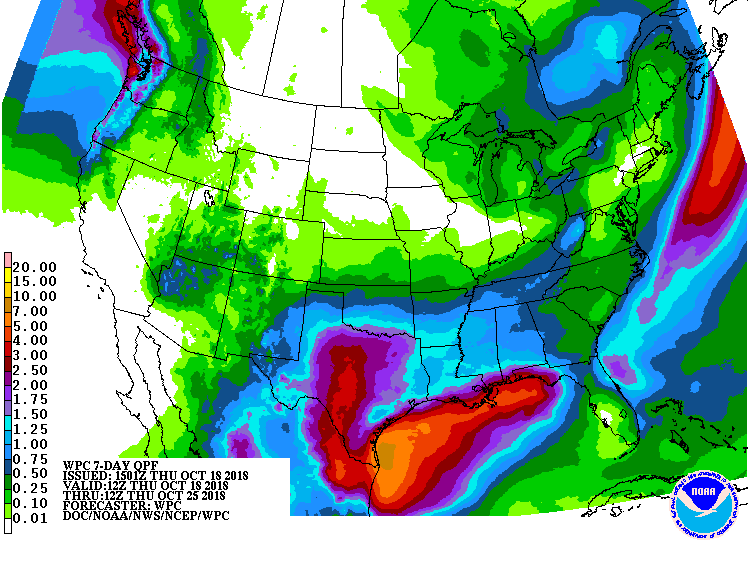
of that resides up in far NE OK. The rain we're expecting over the next couple of
days probably won't impact the NE too much, being centered across N Texas and
bleeding up into N OK mostly, but maybe the rain for early next week can push
up farther to the north and hit that remaining drought area.
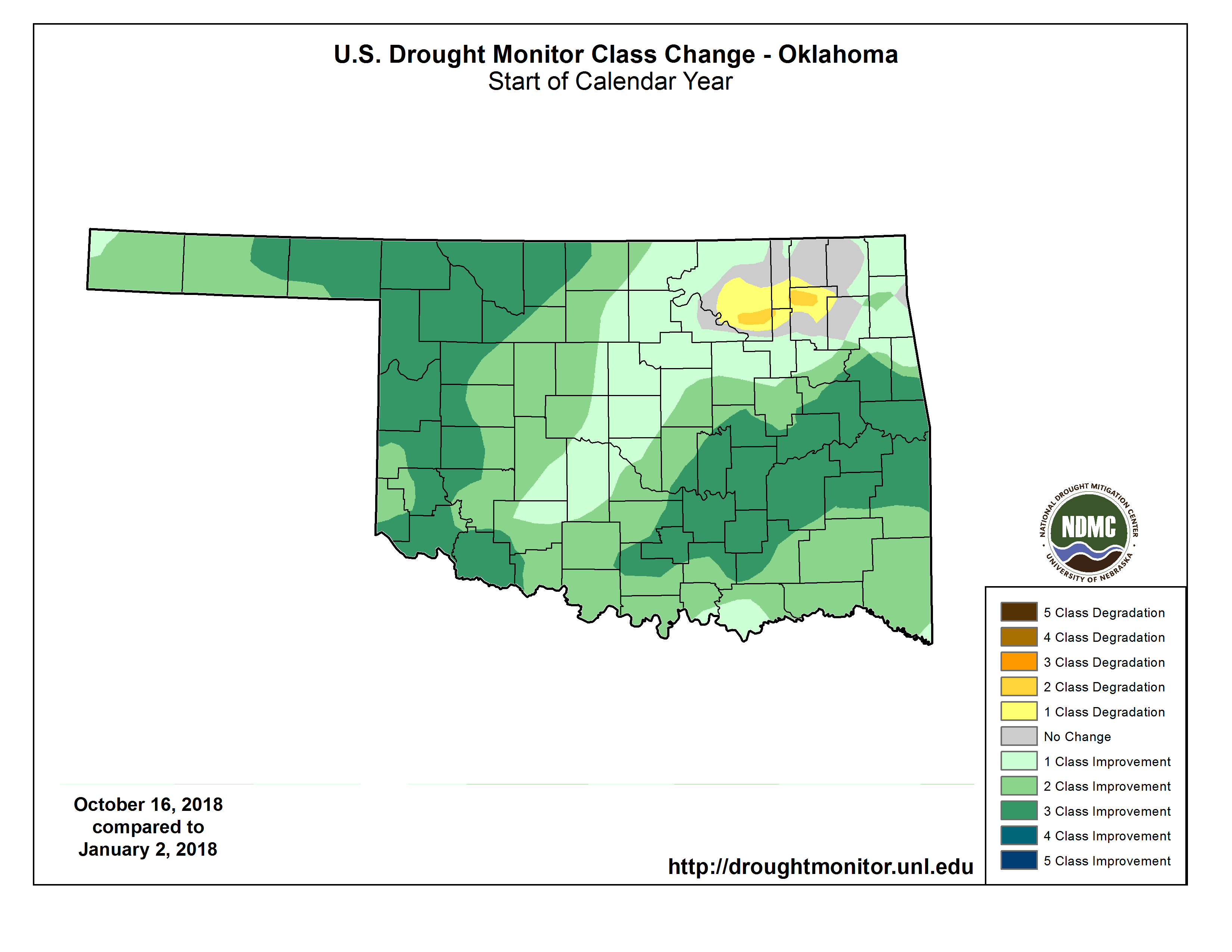
Regardless, we've made HUGE strides in the last 3 months, as well since the
beginning of the year when NW OK was horribly impacted.
But let's take a look forward, shall we? CPC released it's outlooks for November
AND the Winter 2018-19 outlook for December-February. Starting with November, we
see increased odds of above normal temperatures across the entire state, and
increased odds of above normal precipitation across the SW 2/3rds, but
especially far SW OK.
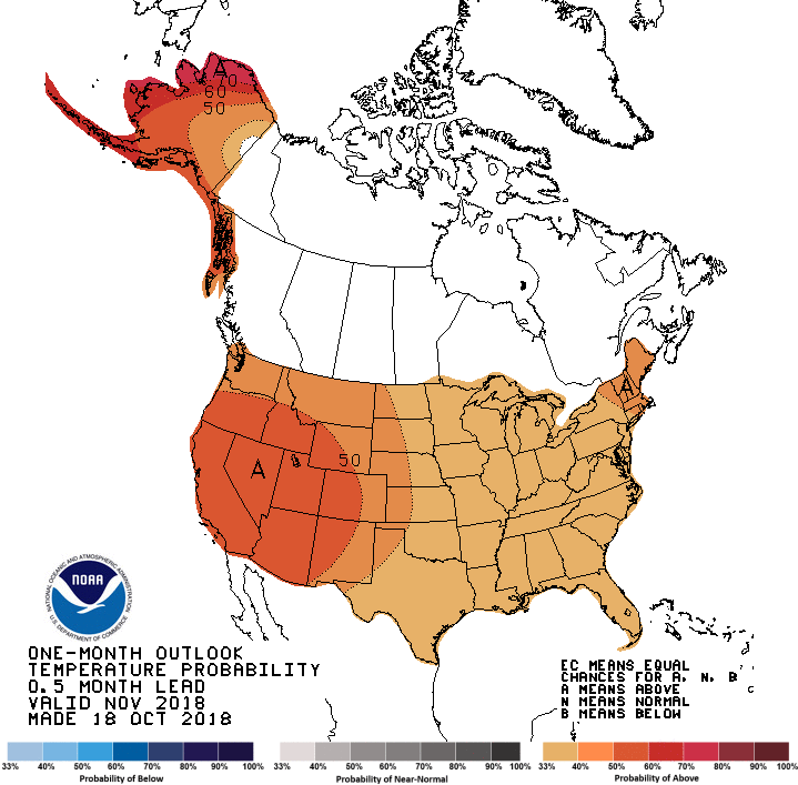
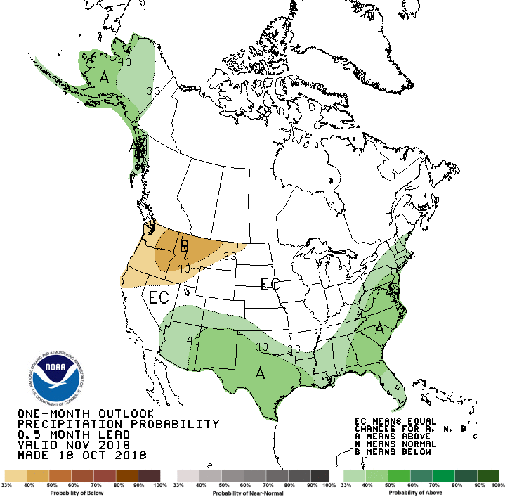
This would be a departure from what we've seen much of the fall, with mild
weather dominating August and October, and a good part of September. Above
normal precipitation would be a continuance of the wetter than normal weather
we've seen over that same time frame. The white area maked "EC" sees Equal
Chances" for Above-, Below-, or Near-normal precipitation.
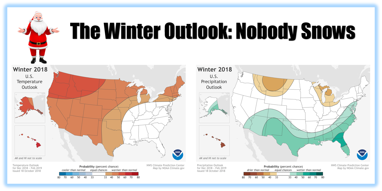
Now let's get to winter, where a weak/borderline moderate El Nino is forecast
(70% probability) to be in place by the December-February time frame.
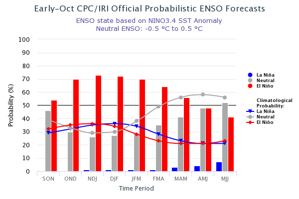
Now El Nino is famously famous for tilting the odds towards wetter and cooler
than normal weather across the southern tier of the U.S. (and warmer weather
across the northern tier, which can aid Oklahoma's natural gas industry by
increasing the need for heating fuel).
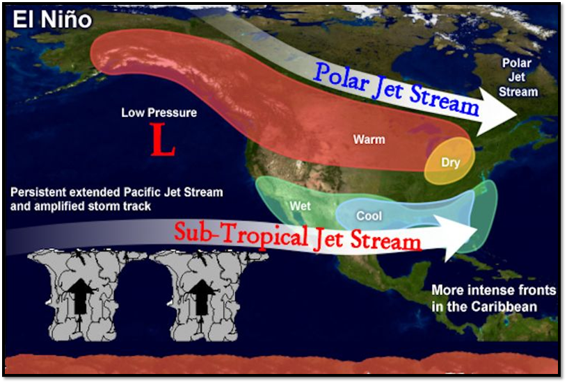
It gets a bit dicey for Oklahoma, however, since the impacts tend to diminish
as you go north from Texas into our territory. However, El Nino can still
impact the state to some degree. Given that the highest confidence is for a
WEAK El Nino, things change a bit for Oklahoma. The official outlooks show
increased odds for above normal temperatures for the entire state, and above
normal precip for the far SW and Panhandle averaged over the December-February
time frame.
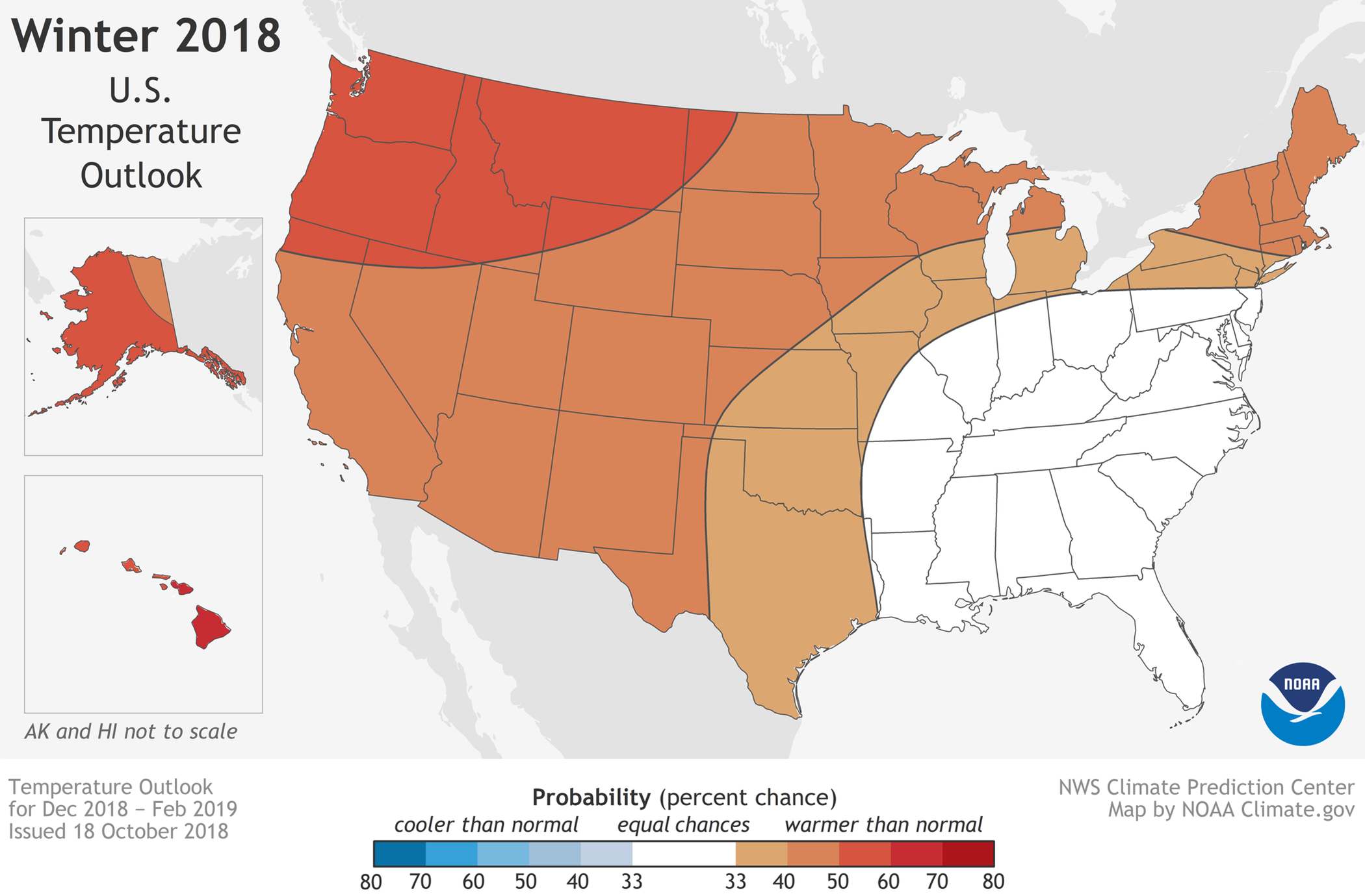
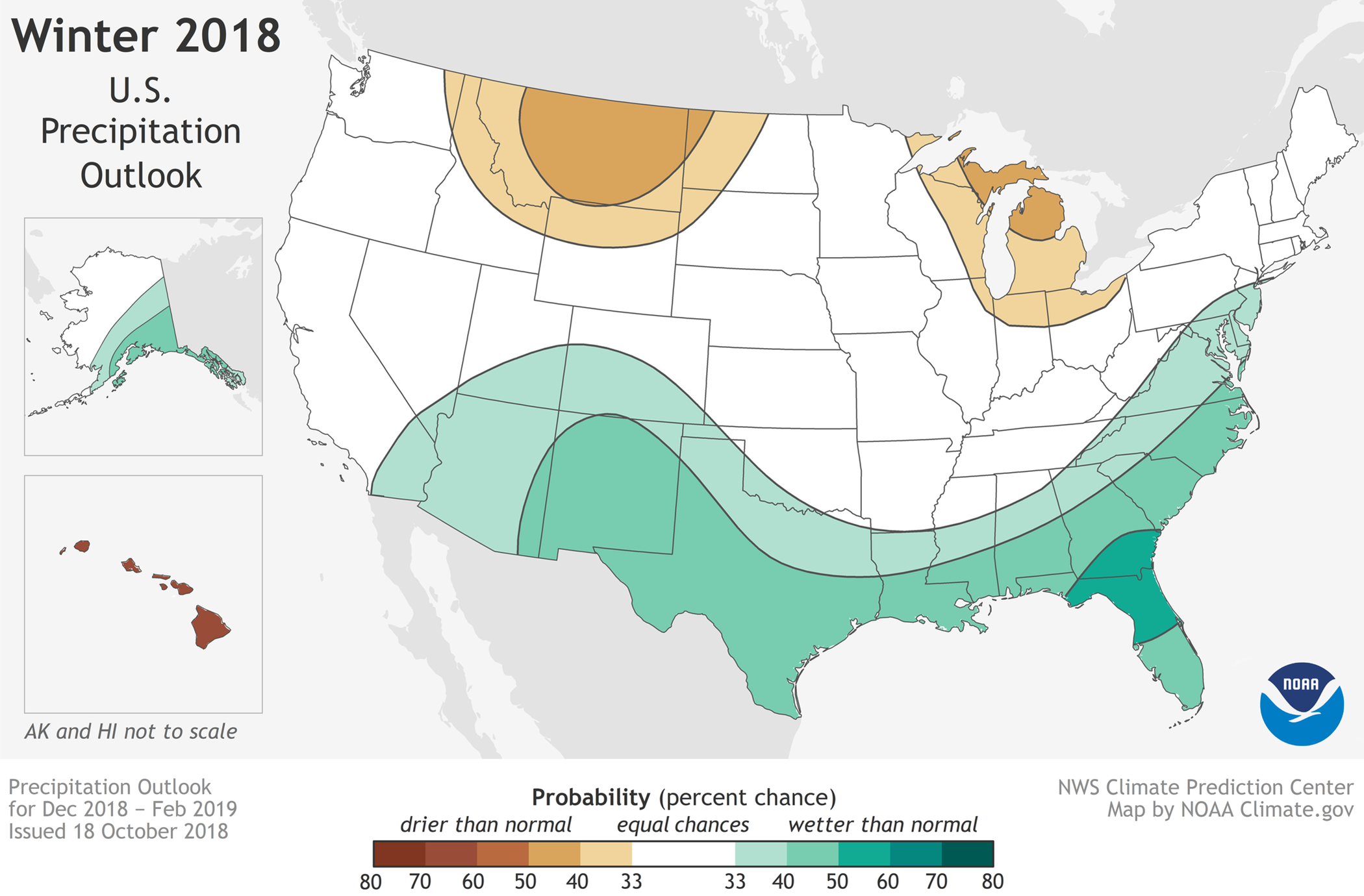
Most of the state gets the dreaded "EC" for precip, however, meaning the odds
are even at 33% for each category -- Above-, Below-, and Near-normal.
A few important caveats:
1) NO INDICATION of snow or no-snow is given by these outlooks. You can still
have the right ingredients for wintry weather (including freezing rain and
sleet) come together in singular events, even if the overall 3-month period
ends up warmer and drier than normal.
2) Extreme events can and often still occur, despite these forecasts. So
blizzards, ice storms, tornadoes, severe storms, and even extended dry weather
are still possible, despite what the overall average weather ends up being.
3) The odds are increased slightly at best in these outlooks. So even for the
Above-normal temperature odds increase over Oklahoma, that amounts to a 34-40%
chance of above normal temperatures and a 32-26% chance of below normal
temperatures. Not exactly something to take to the bank. The odds for near
normal stay the same at 33%.
4) "EC" DOES NOT TRANSLATE TO "NORMAL!" Odds are equal between the three
categories. If you had a dollar to bet, you'd put 33 cents on each category.
The remaining penny? Send it to me.
And finally, our own research here at the Climate Survey has shown a tendency
for below normal precipitation during WEAK El Nino events (1951-2005), extended
back to October and through March. The impacts of El Nino (and it's counterpart,
La Nina) usually decrease and disappear in the warm season, as does the sea
surface temperature anomaly itself.

There have been a couple of more weak events (2006-07, 2014-15) since 2005. The
2006-07 October-March precip was much above normal, and the 2014-15 period was
significantly dry, so those are a push But again, this is another of those things
that's not guaranteed by past results...just tilts the odds in that direction.
October is certainly off to a wet start, however, so maybe that's a hint towards
2006-07 instead of 2014-15? Time will tell, of course.
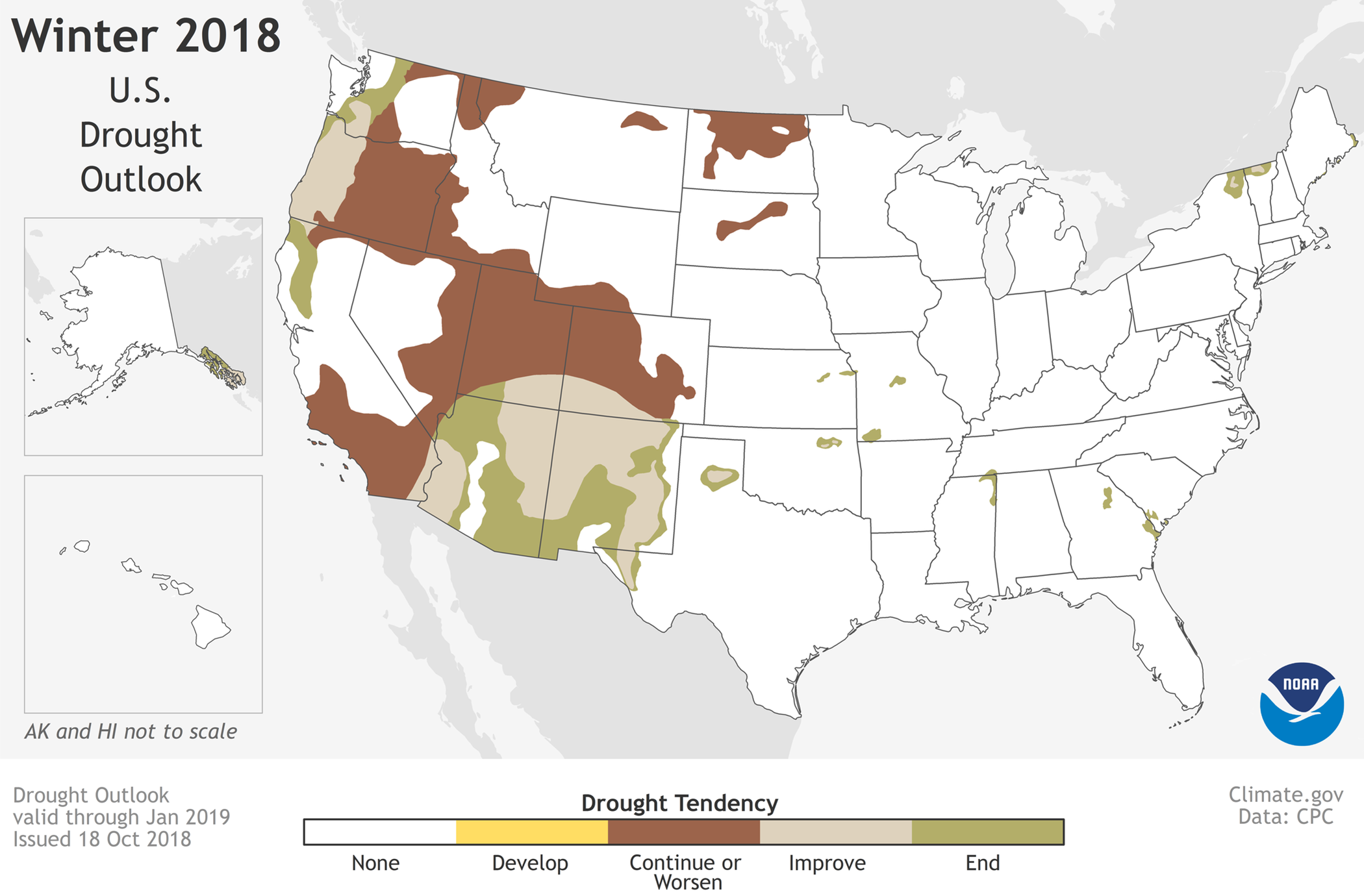
Finally finally, drought is expected to improve further in NE OK by the end
of January.
There's a lot of info in today's Ticker. Some of it actually useful! But hey,
what do you expect for a penny?
Gary McManus
State Climatologist
Oklahoma Mesonet
Oklahoma Climatological Survey
(405) 325-2253
gmcmanus@mesonet.org
October 18 in Mesonet History
| Record | Value | Station | Year |
|---|---|---|---|
| Maximum Temperature | 96°F | WEBB | 2005 |
| Minimum Temperature | 22°F | NOWA | 2022 |
| Maximum Rainfall | 2.10″ | IDAB | 2002 |
Mesonet records begin in 1994.
Search by Date
If you're a bit off, don't worry, because just like horseshoes, “almost” counts on the Ticker website!