Ticker for September 18, 2012
MESONET TICKER ... MESONET TICKER ... MESONET TICKER ... MESONET TICKER ...
September 18, 2012 September 18, 2012 September 18, 2012 September 18, 2012
Rains diminish wildfire danger
The Governor has released 22 counties from the statewide (or no-longer statewide)
burn ban that has been in place for several weeks.
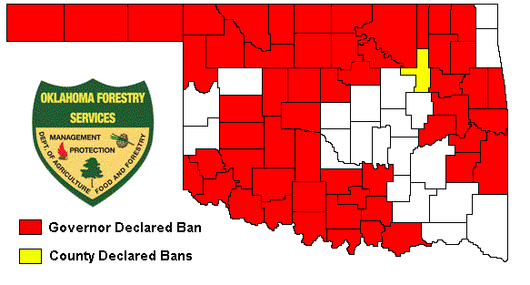
You will notice that Tulsa County immediately implemented a county-wide burn ban
after being released. That is at the Tulsa County Commissioners' discretion, and
obviously they felt conditions have not improved enough to ease burning
restrictions. But if you look at the patterns on that map, they match up fairly
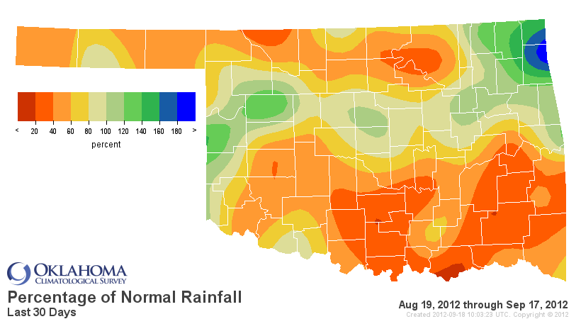
well with the 30-day rainfall maps from the Mesonet.
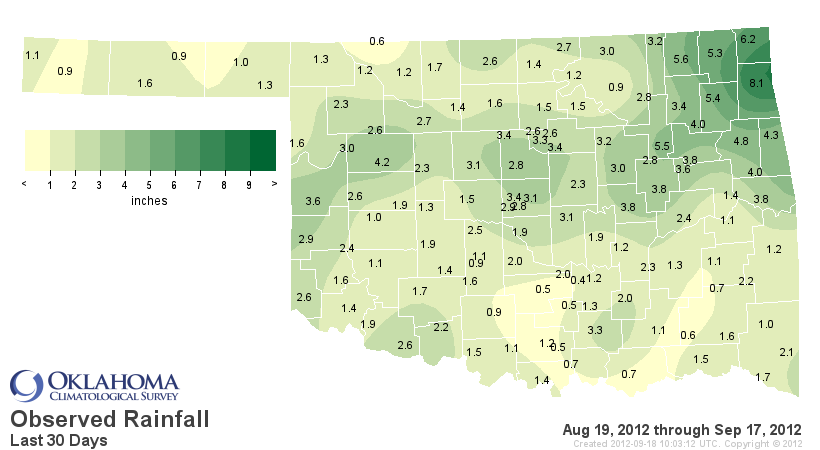
You can also see Tulsa County's dilemma there with Bixby in the southern part of
the county getting 5.5 inches of rain but Skiatook, which is right across the
northern border in Osage County, only received 2.8 inches. Even statewide, the
last 30 days remain dry with an average of 1.23 inches, 0.9 inches below normal
and the 26th driest Aug. 19-Sep. 17 dating back to 1921.
The wildfire relief also shows up on the KBDI map, which signifies the
probability of wildfires based on drought and soil moisture. The higher the
KBDI number, the higher the fire danger (basically).
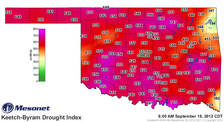
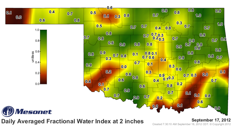
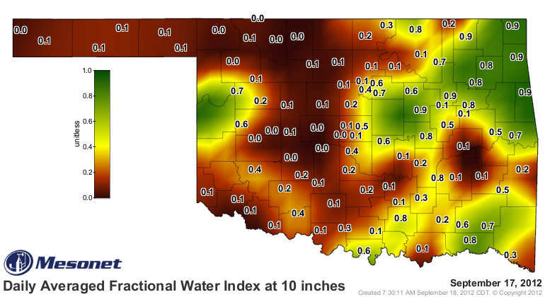
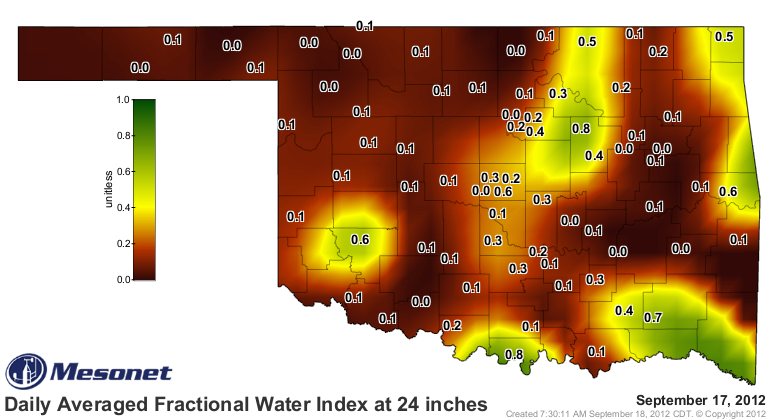
The rain has improved topsoil moisture and also greened things up, hence the
reduced fire danger. Unfortunately, the moisture hasn't reached those lower
levels just yet, at least over much of the state.
And the reason for continued fire danger and the drought woes is evidenced by
the Mesonet rainfall maps since May 1. Really I could pick any odd date to
begin from the last 6 months or so and it would come up looking dry.
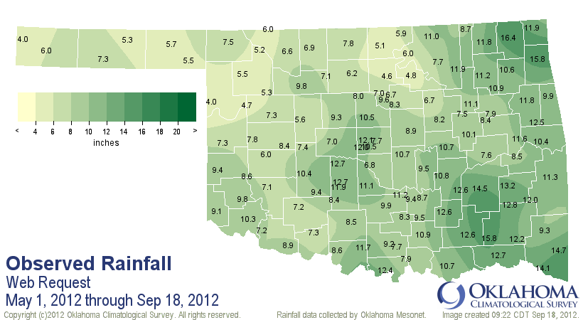
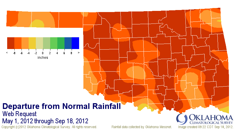
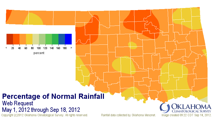
The statewide average through that period was 8.98 inches, 8.2 inches below
normal (or 52% of normal), and the driest such period at least back to 1921.
The driest May-September on record according to the official data from NCDC
was last year's 9.74 inches. We'll see how things shake out over this last 10
days of the month, and also how the NCDC numbers compare to the Mesonet numbers,
but we could be looking at the driest May-September on record in the state two
years in a row.
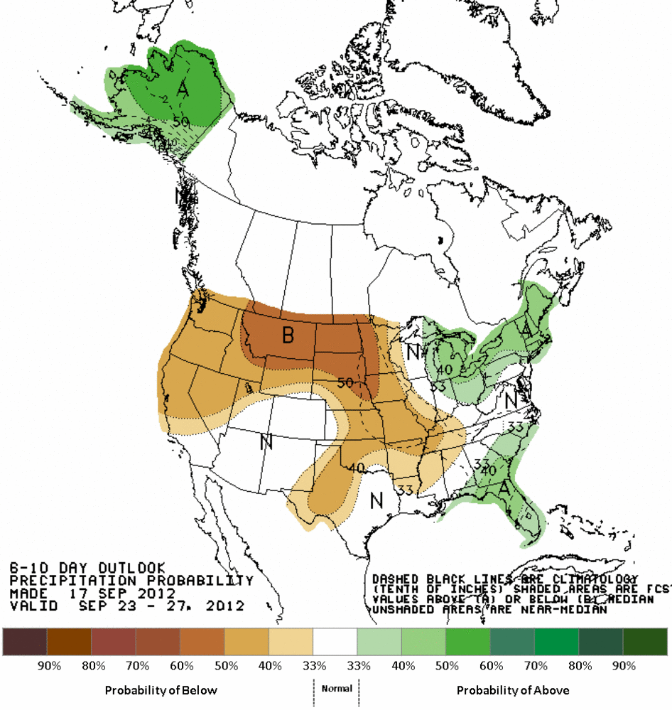
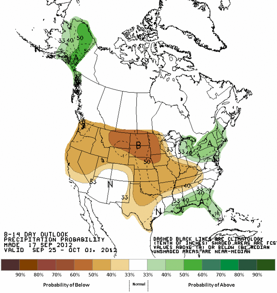
The NWS forecasts don't give us much hope for any moisture over the next week,
and the CPC outlooks for the remainder of the month are Debbie Downers as well.
Gary McManus
Associate State Climatologist
Oklahoma Climatological Survey
(405) 325-2253
September 18 in Mesonet History
| Record | Value | Station | Year |
|---|---|---|---|
| Maximum Temperature | 107°F | BUFF | 1997 |
| Minimum Temperature | 40°F | BOIS | 2012 |
| Maximum Rainfall | 3.61″ | OILT | 2015 |
Mesonet records begin in 1994.
Search by Date
If you're a bit off, don't worry, because just like horseshoes, “almost” counts on the Ticker website!