Ticker for August 18, 2023
MESONET TICKER ... MESONET TICKER ... MESONET TICKER ... MESONET TICKER ...
August 18, 2023 August 18, 2023 August 18, 2023 August 18, 2023
Flash drought cometh?
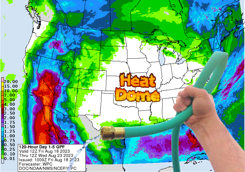
YES, flash drought IS developing across the southern third-to-half of the state.
NO, there isn't a good rain chance through the next 7-10 days, and maybe beyond.
NO, I don't know when the pattern will turn around.
YES, I am extremely awesome.
NO, I don't know when the heat wave will dissipate.
YES, I did try and sneak one in there.
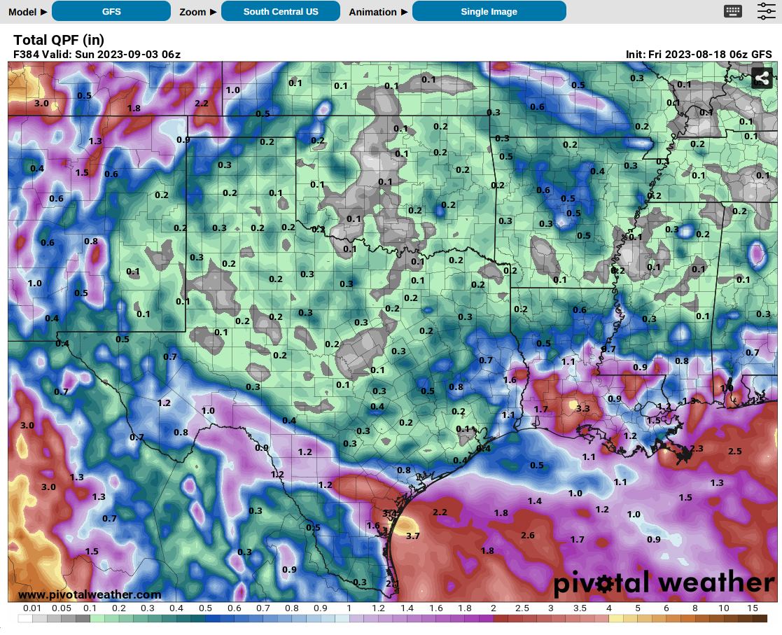
The rest of August is kaput.

Heck, I can even try the old fantasy-cast method and go out to Sept. 3, to no
avail. Avail is very hard to come by. We can ASK for avail, but still...no avail.
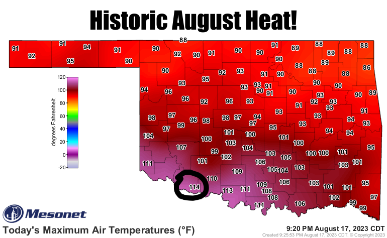
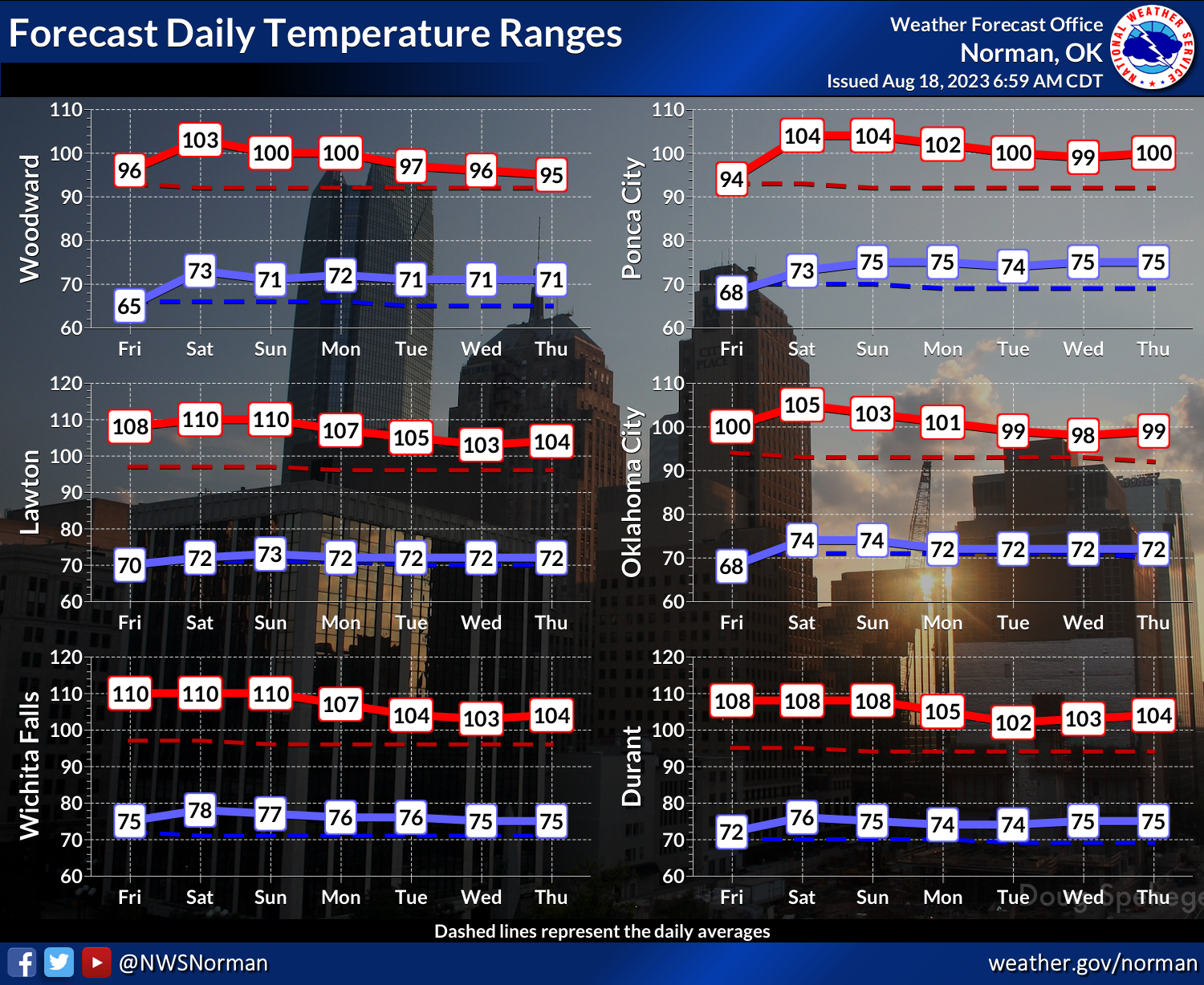
And this weekend could see the hottest days of the year. Didya know that we tied
the highest temperature ever recorded in Oklahoma on an Aug. 17 with the 114F
at Grandfield?
Didya know that we could do the same thing today, and in fact I think we might
shatter the previous record Aug. 18 Oklahoma record high of 112, set at Henessey
back in 1956 and Mutual back in 1918? Didya know I don't know how to spell
Hennessey, but I bet one of those two choices is right? Oh, it'll probably be
Grandfield, but I'm trying to give them a break.
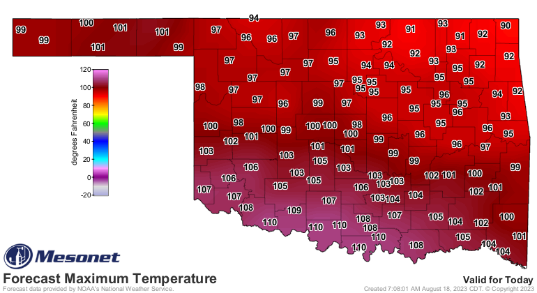
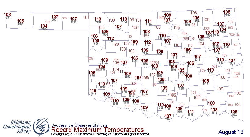
I'm picking Marietta as the culprit today. Just a hunch.
Heck, this weekend could see the hottest days of the summer! Maybe a bit of
relief next week, if upper 90s and low-to-mid 100s are relief.
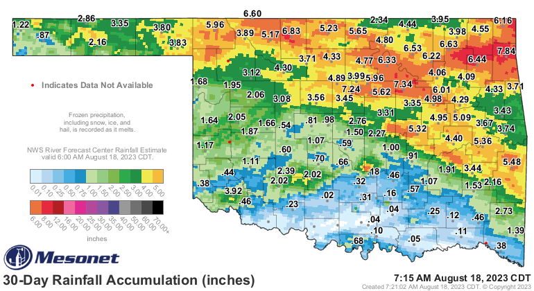
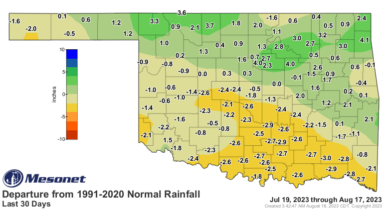
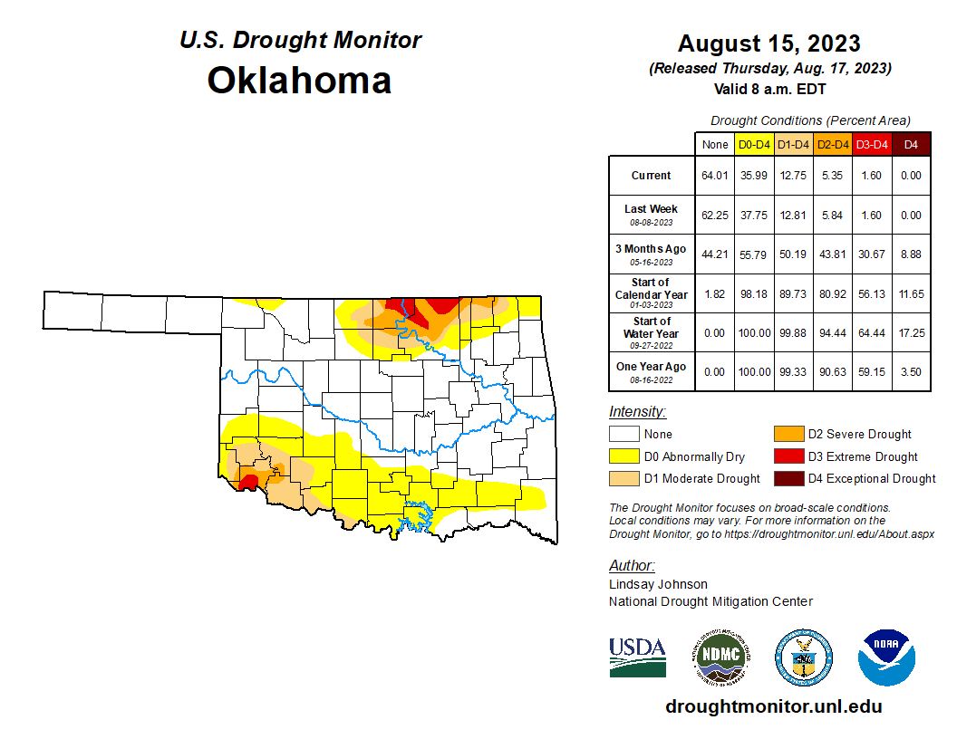
Sooooo...our dry spell has now extended to well over a month across Southern OK,
enough so that flash drought is, in my opinion...imminent.
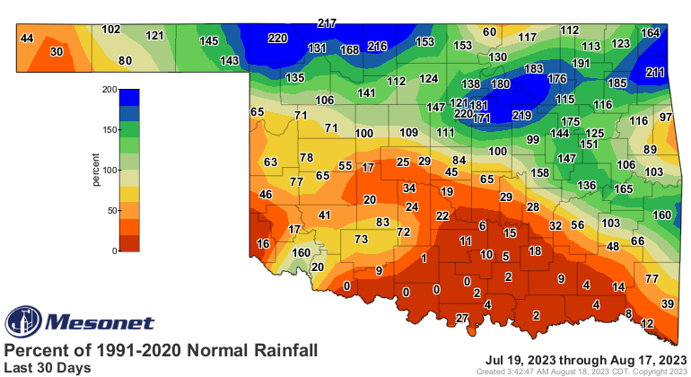
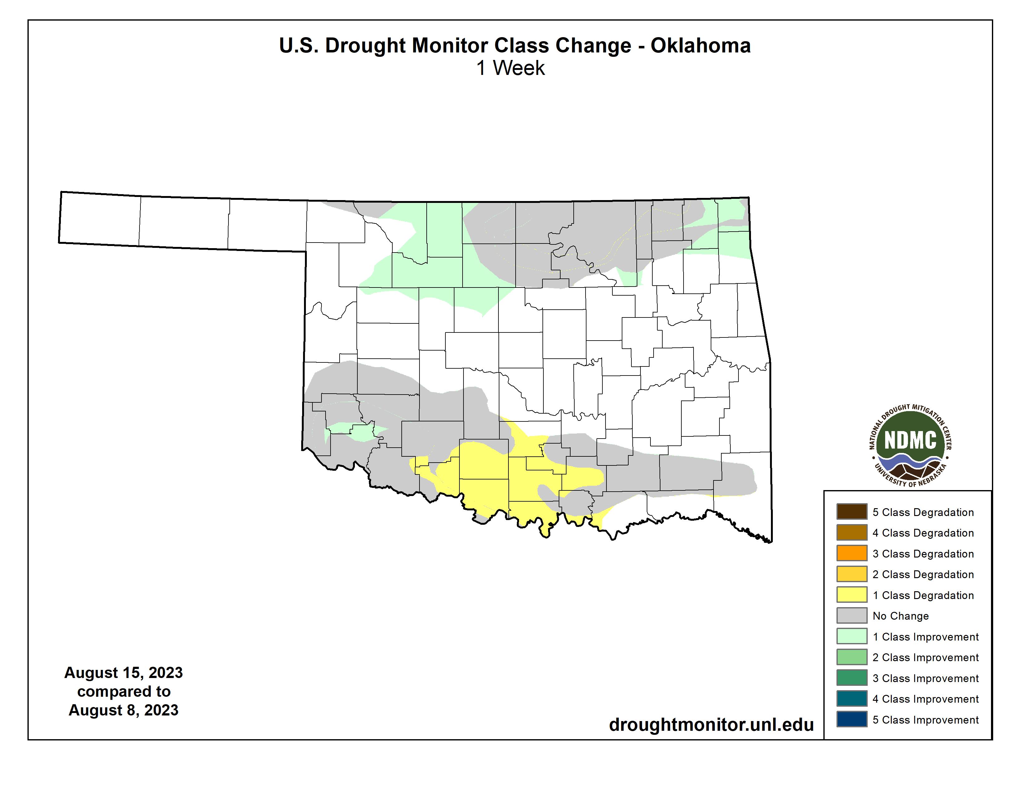
That is starting to be reflected on the Drought Monitor across Southern OK,
where we asked for a large increase in Abnormally Dry (D0--yellow color) across
the southern third of the state, a sign drought is coming sooner rather that
later IF the pattern doesn't change.
What can save us? The Tropics?

Wow, talk about waking a sleeping monster. We all know the water temperatures
have been at record levels in the Atlantic, but atmospheric conditions haven't
been as favorable for storm formation. Well that's obviously changed.
We'll see...it *IS* August, after all, and hot, dry weather is not uncommon.
However, setting all-time record highs obviously is.
All eyes on Marietta today!
Gary McManus
State Climatologist
Oklahoma Mesonet
Oklahoma Climatological Survey
gmcmanus@mesonet.org
August 18 in Mesonet History
| Record | Value | Station | Year |
|---|---|---|---|
| Maximum Temperature | 112°F | GRA2 | 2023 |
| Minimum Temperature | 53°F | EVAX | 2016 |
| Maximum Rainfall | 9.00″ | FTCB | 2007 |
Mesonet records begin in 1994.
Search by Date
If you're a bit off, don't worry, because just like horseshoes, “almost” counts on the Ticker website!