Ticker for July 18, 2023
MESONET TICKER ... MESONET TICKER ... MESONET TICKER ... MESONET TICKER ...
July 18, 2023 July 18, 2023 July 18, 2023 July 18, 2023
Hey look at us!
I watched a snail crawl along the edge of a straight razor. That's my dream.
That's my nightmare. Crawling, slithering, along the edge of a straight razor...
and surviving. The horror. The horror!
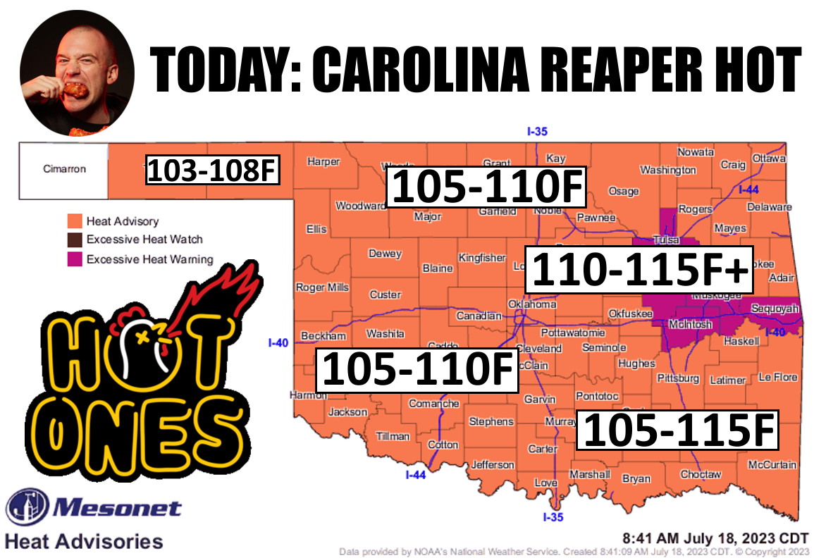
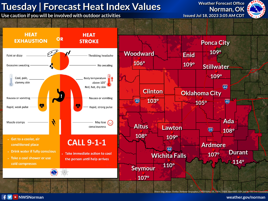
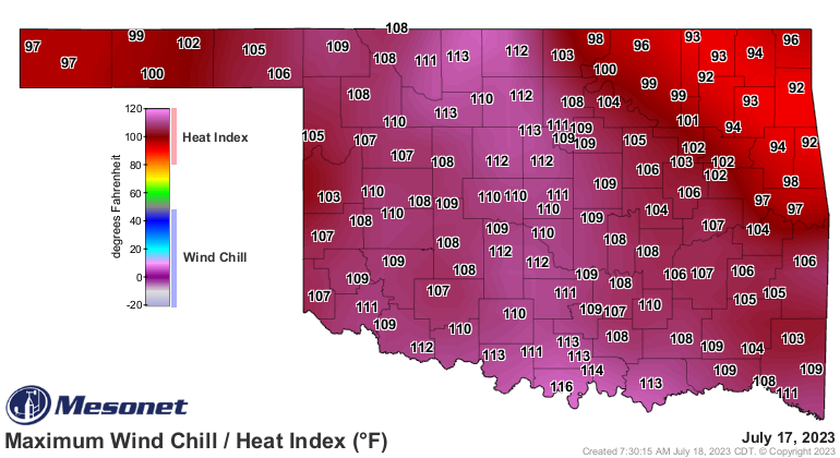
Okay, calm down Col. Kurtz! It's just a bit of heat, right? Well, sure, but what
would a Ticker be without a bunch of bellyaching? And this heat will give you
a bellyache, right after your sweat stops and you start to get chills. Check out
these graphics for some heat distress signs to watch out for, and today's expected
heat index values.
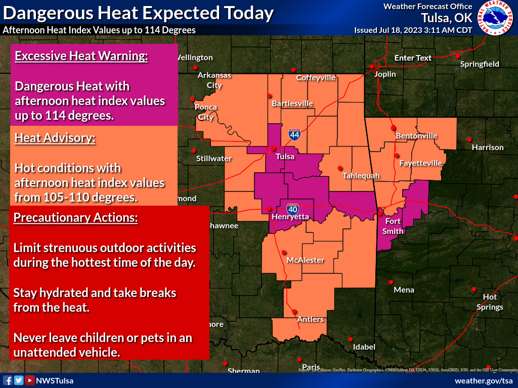
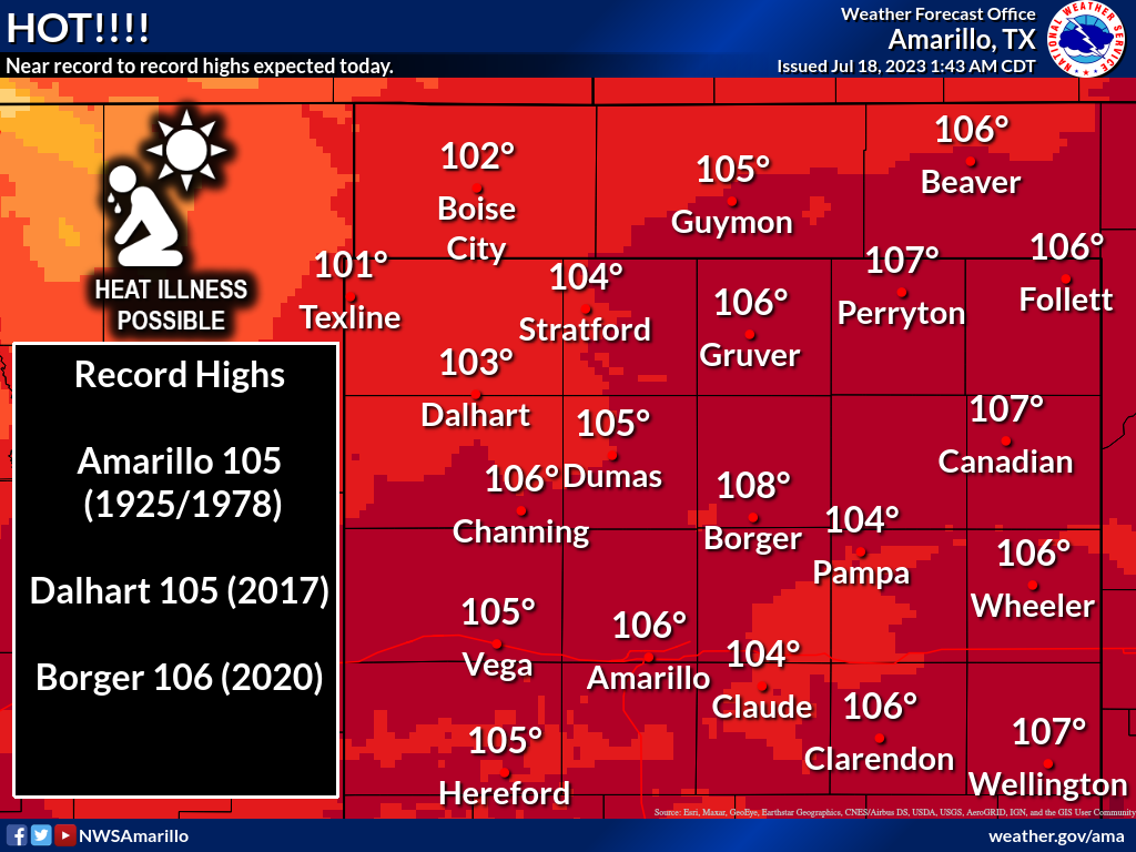
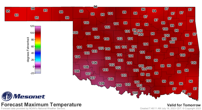
We had these same shenanigans yesterday.
And we will again tomorrow. Note that this is an actual air temp forecast, so
add in another 5-15 degrees for the heat index.
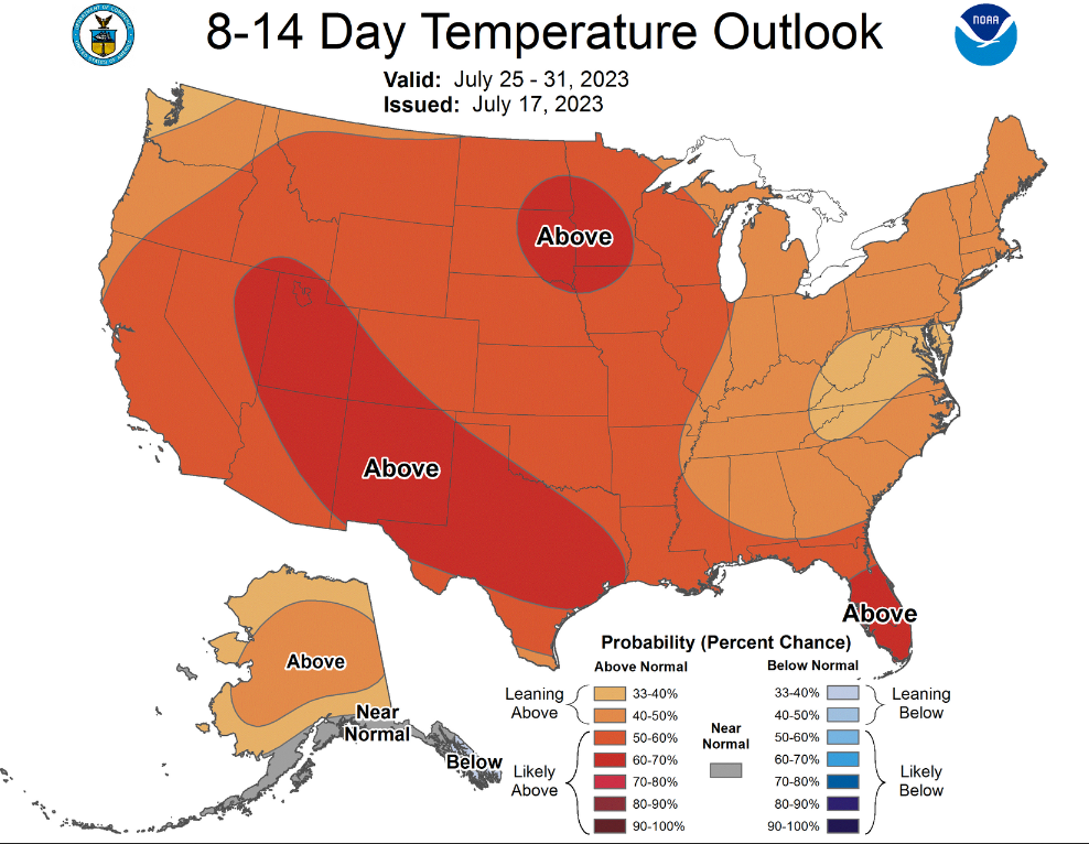
All we can do is wait until Friday, when we get relief from this moist circle
of Hades.

But before you get too comfortable, remember it's late July. The heat WILL be
back next week.
That's rather unfortunate timing, too, because we're approaching (or have
entered) the hottest part of the year for most of Oklahoma, and in reality for
most of the contiguous U.S. This figure is based off of the 1991-2020 normals
as computed by NCEI.
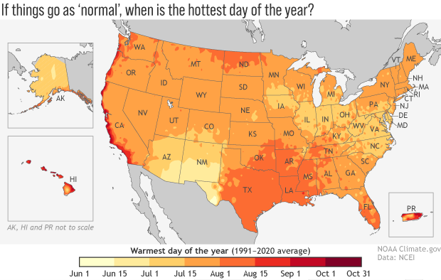
So for most of the U.S., climatologically speaking (I tried Albanian but it just
sounded like gibberish), the hottest day of the year occurs from mid-July through
mid-August. That's what we see for much of Oklahoma as well. You can get a
better look from this image with dots on the stations representing the "normal"
hottest day of the year. I done blowed up Oklahoma and put it to the side so
you can see the dots better.
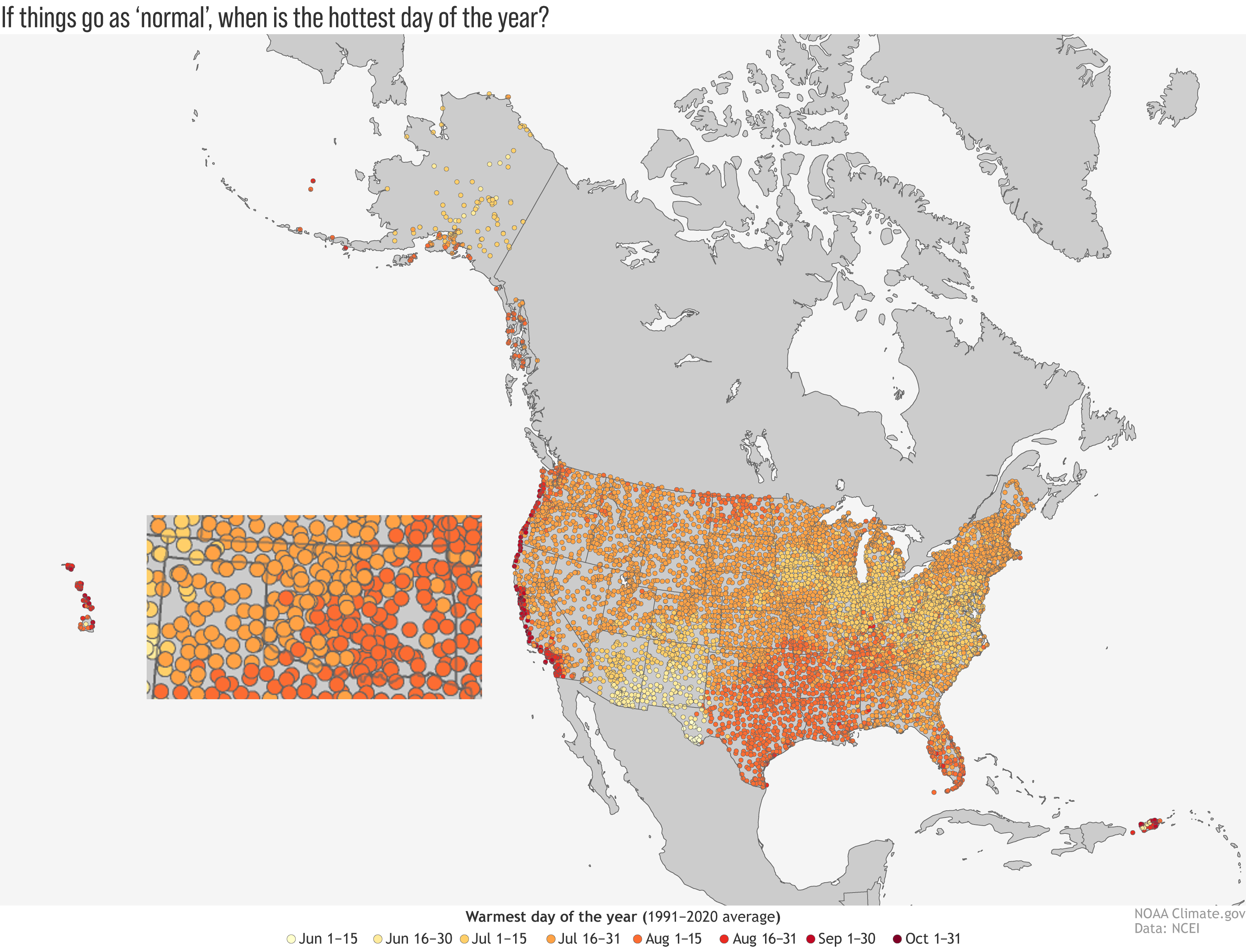
Remember, this is based on climatology. At some point, weather overwhelms the
climatology and it takes over as far as what to expect. So a month out, we look
at climatology. When we get within a couple of weeks, we can start to see what
the actual weather is looking like. In this case, it does indeed look hot!
Now you might be saying to yourself: "But Gary, why is the hottest day usually
a month past the summer solstice? Isn't that when the sun's angle is highest
(i.e., solar radiation is maximized for the Northern Hemisphere)?"
Well first, congrats on saying "i.e." to yourself, big shot! And secondly,
QUIT CALLING YOURSELF "GARY"! Do I need to start the cease and desist letters
again?
Okay, here's the deal. The heating is still gaining a bit of momentum well past
the solstice because the days (and the heat) are still much longer than the
nights (and the cooling), so the heat continues to accumulate. And NORMALLY by
this time of the year, our soil moisture is flagging due to that heat and the
therefore more of those suns rays are going towards heating the Earth's surface
and less is being used to evaporate soil moisture (which is a cooling process).
Here, check this out...this is a graph of the daily max temperatures averaged
over central OK as measured by the OK Mesonet.
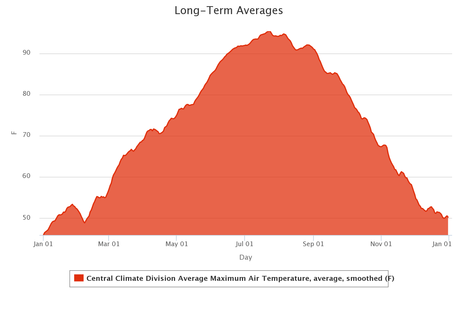
The heat peaks on July 23 at 95.4F and stays elevated at that peak to around
Aug. 7, then starts to decrease pretty rapidly. Again, climatologically
speaking. Looking at the actual weather this year, we don't have much of a
soil moisture problem right now for most of the state.
So this might actually help keep the actual air temps down, but those heat
index values high. But the way we measure how hot a summer is, is through those
actual air temperatures. So our ranking at the end of the summer could be
fairly misleading.
At any rate, it's gonna be hot today and tomorrow. The weather says so.
Gary McManus
State Climatologist
Oklahoma Mesonet
Oklahoma Climatological Survey
gmcmanus@mesonet.org
July 18 in Mesonet History
| Record | Value | Station | Year |
|---|---|---|---|
| Maximum Temperature | 110°F | BURN | 2022 |
| Minimum Temperature | 51°F | JAYX | 2009 |
| Maximum Rainfall | 3.17 inches | CHAN | 1997 |
Mesonet records begin in 1994.
Search by Date
If you're a bit off, don't worry, because just like horseshoes, “almost” counts on the Ticker website!