Ticker for October 17, 2023
MESONET TICKER ... MESONET TICKER ... MESONET TICKER ... MESONET TICKER ...
October 17, 2023 October 17, 2023 October 17, 2023 October 17, 2023
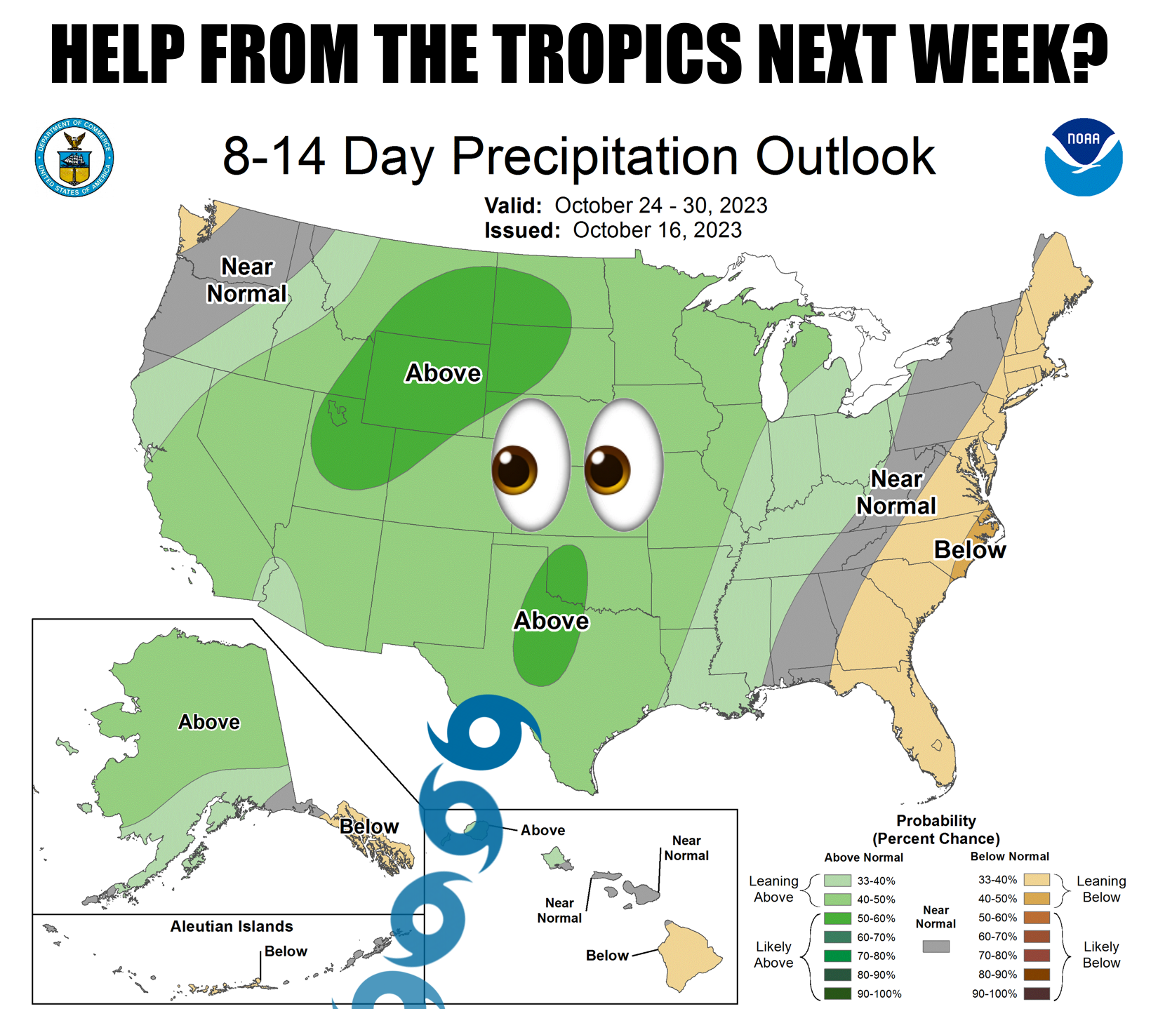
Tropical surprise?
I don't know why Mother Nature continues to taunt us like this. Or maybe she's
innocent and it's the forecast models? I just don't know.
If I knew that I could explain why we Okies like to sit and stare at each other
at 4-way stops. Or why setting the cruise control on 63 mph in the left lane of
the interstate is so enticing to so many.
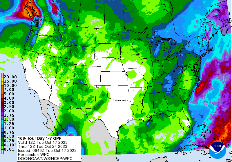
But here we go. As I mentioned yesterday, we see a system approaching from the
west (West, too), AND a tropical system approaching from the south (but not the
South). And somewhere over the Southern Plains they appear to arrive within
24 hours of each other, or even merge. However, this is still fantasy-cast
territory, but the rainfall patterns being shown from individual model runs are
showing a streak of precipitation (and we all know just how painful that can be)
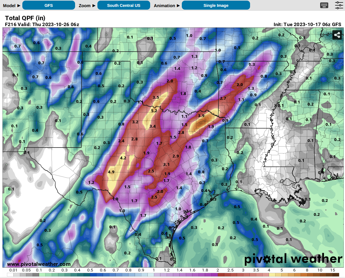
somewhere in our area. For example, the European model's forecast through next
Wednesday:

The American model:
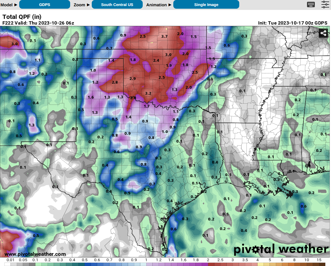
The Canadian model (a bit more widespread solution):
Last AND least, the Okie model:

I KID...I KIIIIIDDDD! None of these forecasts should be taken seriously just
yet, and CERTAINLY don't take the Ticker seriously. Ever. But at least there
is some rain showing up on the ensemble forecasts, which takes a bunch of
individual model runs and sort of averages them together, like the ensemble of
the American model.
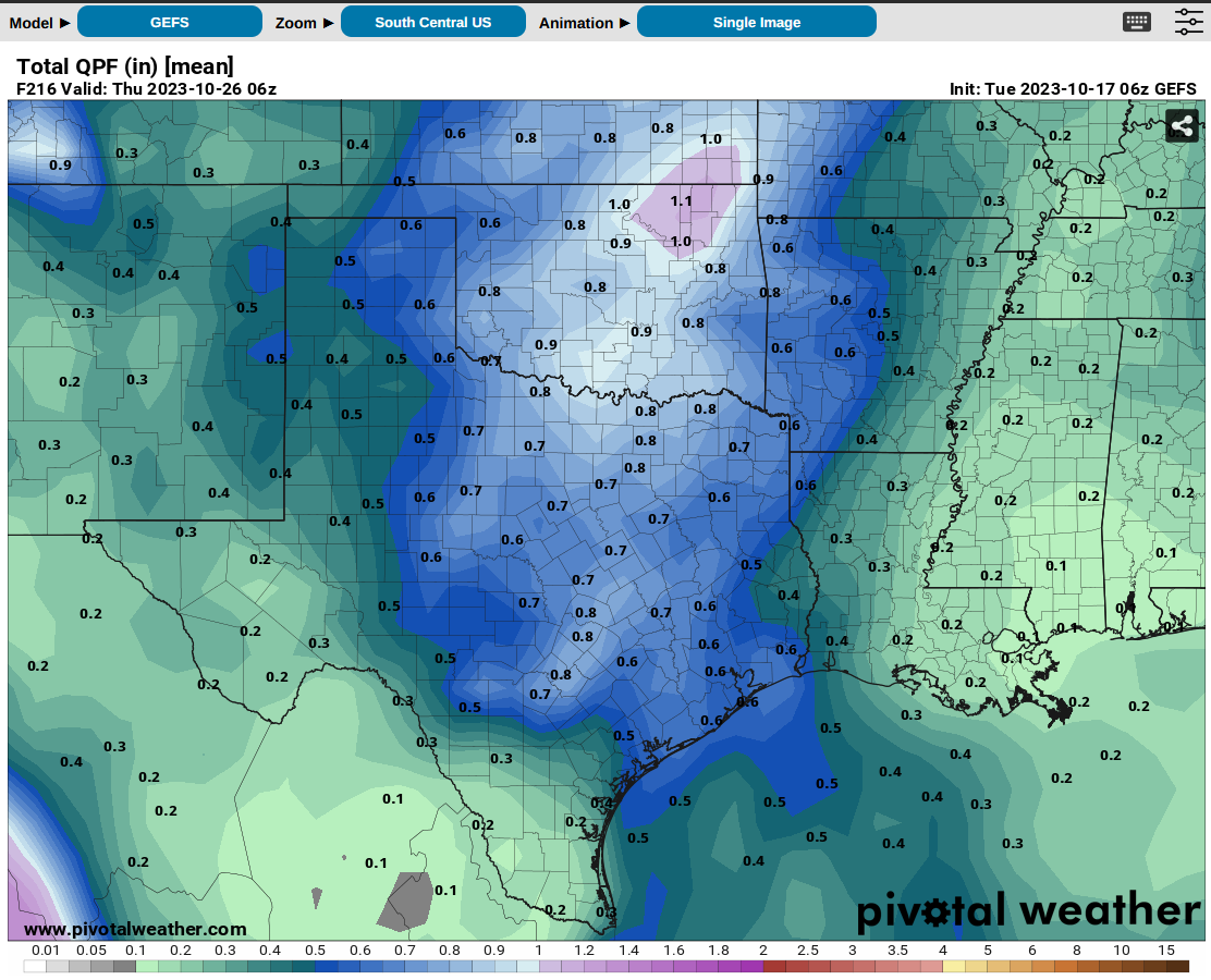
So the message there is don't take any action based on these forecasts just yet,
but have hope that we'll start to see some rain show up on the 7-day rain
forecasts shortly, and even better...on the 3- and 5-day forecasts.
Right now, there's just a hint:
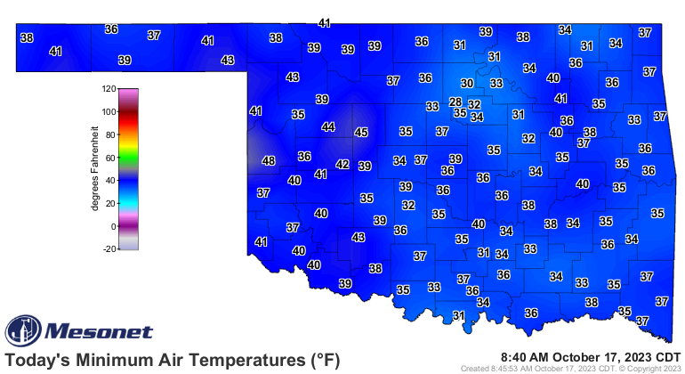
As for temperature, we continue to see that freezing threshold broken in parts
of the state. This map doesn't account for this morning.
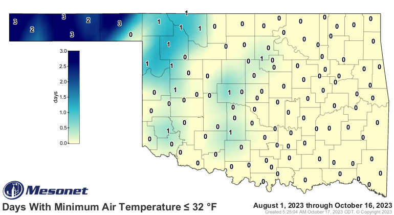
We'll have more blue on that map tomorrow? Et tu, Burneyville?? 31 degrees?
Seriously?
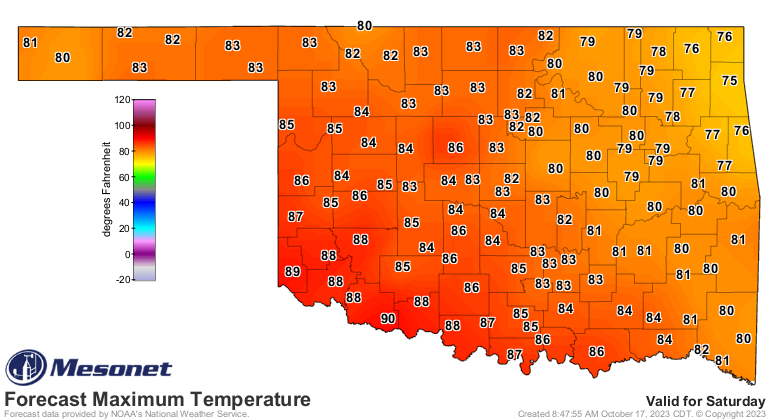
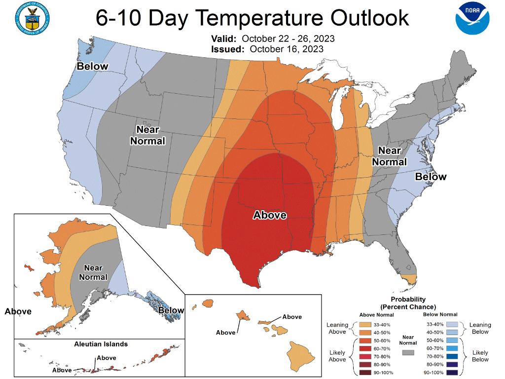
NOT so uncertain is the temperature forecast, which looks like a return to
SUMMER fall, as opposed to our WINTER fall recently. Heck, we might see some
90s this weekend, for crying out loud!
Keep hope alive...but stay out of the left lane!
Gary McManus
State Climatologist
Oklahoma Mesonet
Oklahoma Climatological Survey
gmcmanus@mesonet.org
October 17 in Mesonet History
| Record | Value | Station | Year |
|---|---|---|---|
| Maximum Temperature | 102°F | BUFF | 2016 |
| Minimum Temperature | 26°F | WIST | 2024 |
| Maximum Rainfall | 3.88 inches | NEWK | 2007 |
Mesonet records begin in 1994.
Search by Date
If you're a bit off, don't worry, because just like horseshoes, “almost” counts on the Ticker website!