Ticker for September 17, 2020
MESONET TICKER ... MESONET TICKER ... MESONET TICKER ... MESONET TICKER ...
September 17, 2020 September 17, 2020 September 17, 2020 September 17, 2020
Double Secret Probation
I told you all about La Nina yesterday, then I told you some more. I know, it was
great medicine for your insomnia problem, but here's the reason why I was
blathering on and on and on and...
As I feared, the presence of La Nina through the winter (at least as forecast)
*COULD* lead to some problems for Oklahoma and the rest of the Southern Plains.
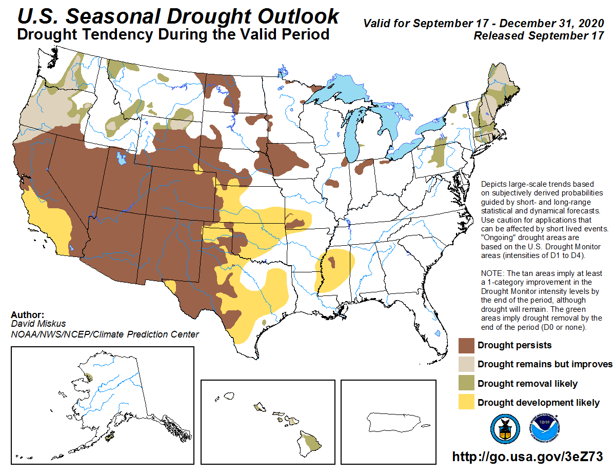
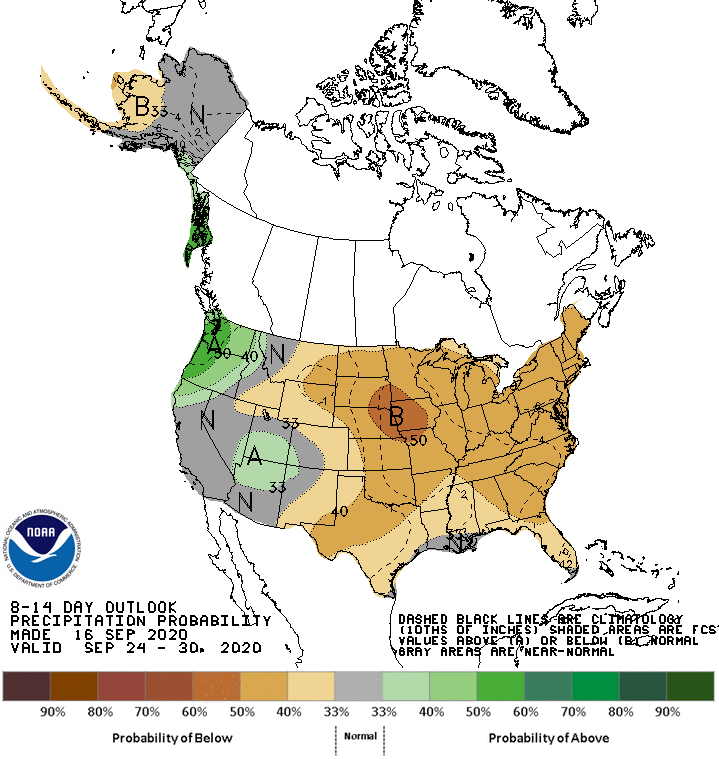
That drought outlook above from the forecasters at the Climate Prediction Center
point to the impacts of that dry La Nina signal (combined with other forecast
tools), which means possible drought persistence and intensification where it
already exists in the state, and possible spread throughout much of the rest
of Oklahoma. The forecast confidence is fairly high, but the possibility of
additional tropical impacts with our highly active Atlantic hurricane season
(again, thanks to La Nina) could mitigate some of the drought fears should
remnants of tropical systems impact the area. Other than THAT, confidence could
be considered high.
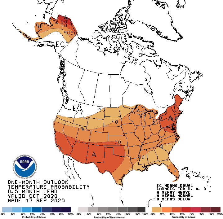
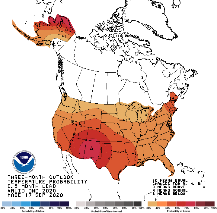
This is based off of the October and September-December temperature and
precipitation outlooks, which are again going off of a La Nina footprint,
combined with some other forecast tools. These aren't pretty, but now you know
what I deal with around mirrors.
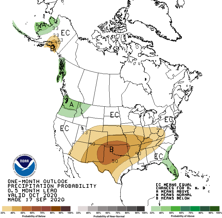
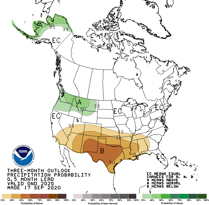
That 50% chance for below normal precipitation across nearly all of Oklahoma is
pretty significant, and not one we see for precipitation around these parts too
often. With the added signal for warmer than normal weather, that means areas
that have started to dry out will possibly accelerate towards abnormally dry
conditions and drought during October.
When we get to the outlooks for the next three months, it doesn't get much
better. The odds for below normal precipitation are still elevated over through
December, to go along with increased odds of above normal precipitation. I guess
the only bright spot in these outlooks is I don't have to try and explain the
dreaded "Equal Chances (EC)" label.
Obviously this would not be good for Oklahoma, because some areas of Oklahoma
are already in pretty significant drought.
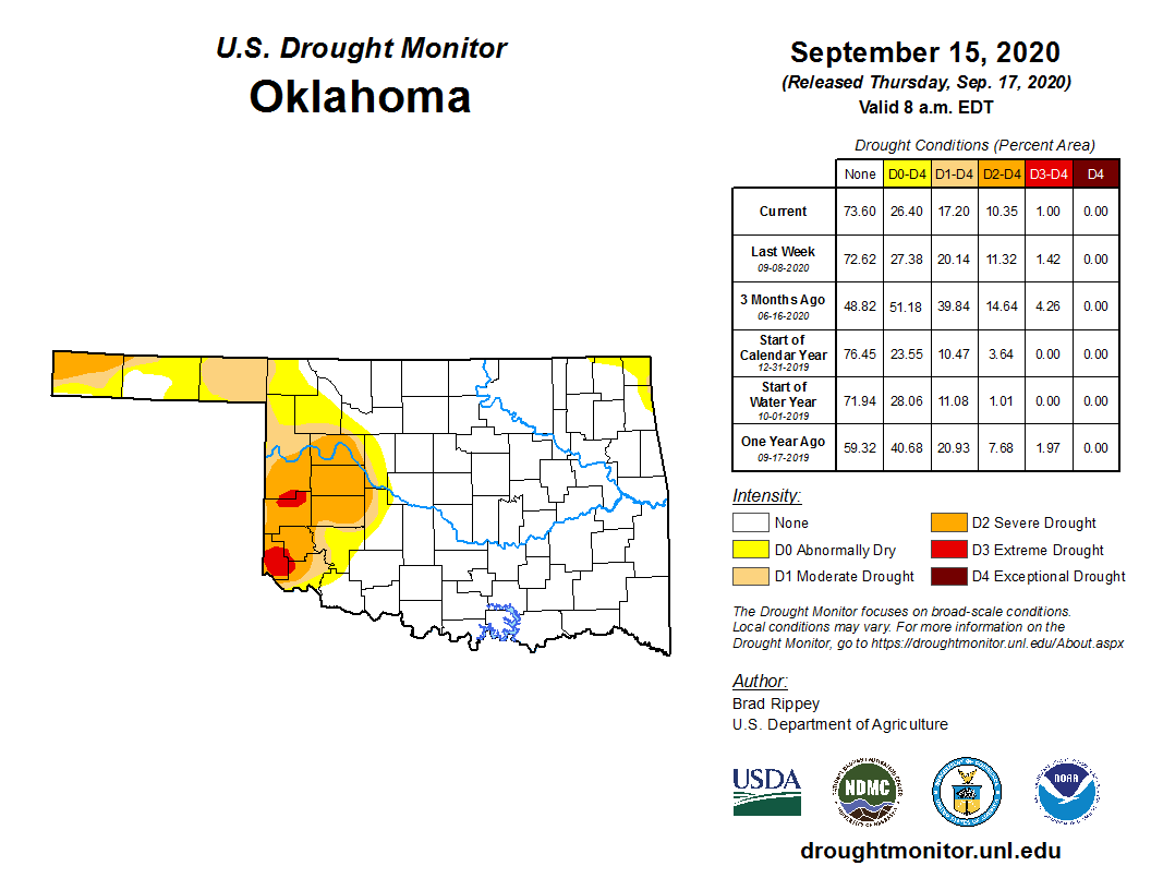
While other areas are starting to dry out again.
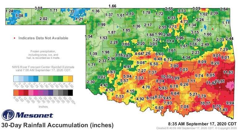
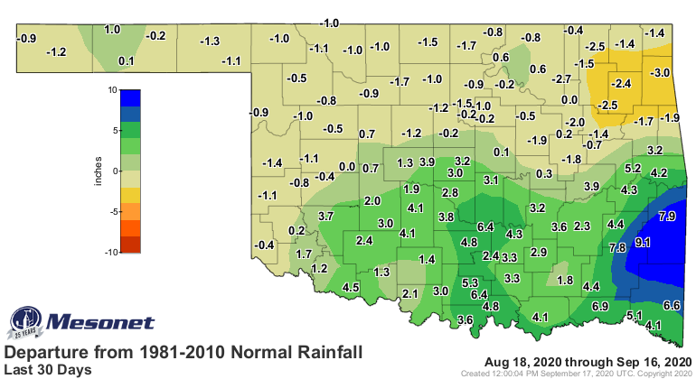
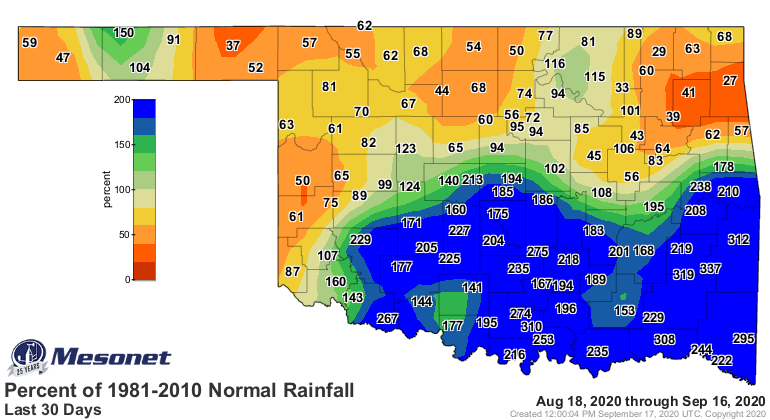
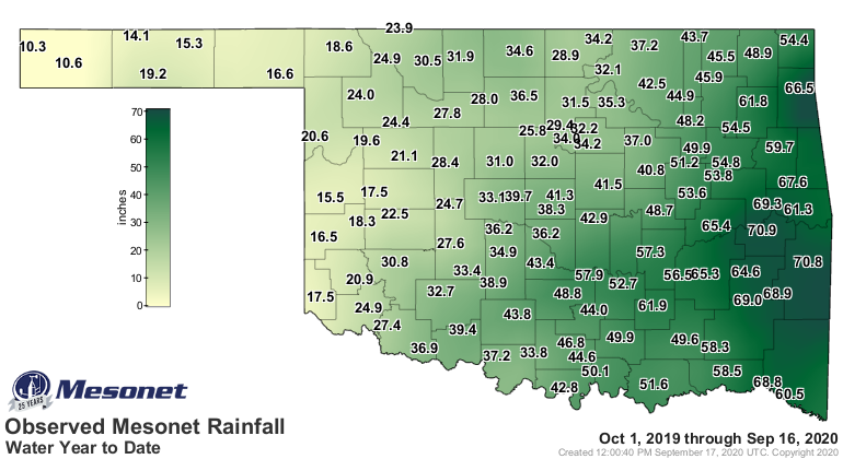
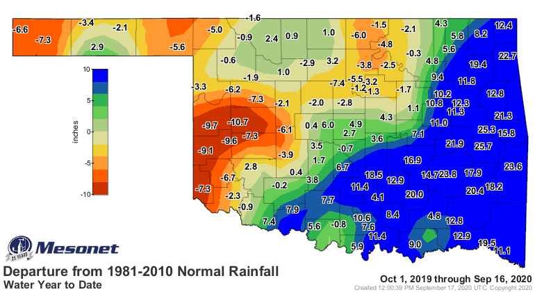
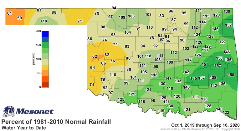
Meanwhile, other areas of the state are dealing with nearly year-long dryness,
as evidenced by the current water year (Oct. 1-Sept. 30) rainfall maps.
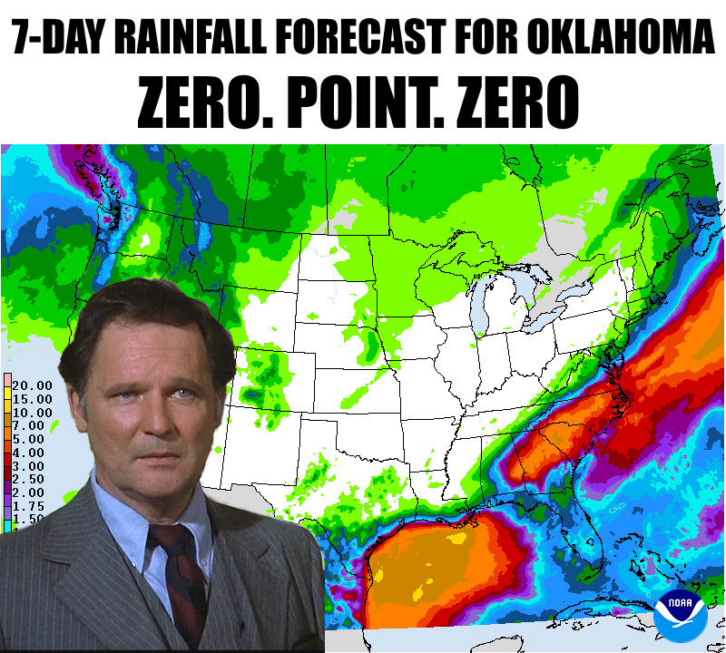
As Dean Wormer showed you above, prospects for the next week are dim. That's
good for parts of southern Oklahoma, who could use some more drying time, but
bad for much of the rest of the state. And next week doesn't look any better.
So short term? Doesn't look promising. Long-term? Doesn't look promising, EXCEPT
those long-term outlooks can change in a hurry. They sometimes have a hard time
verifying, EXCEPT in the case of a strong ENSO signal (during the cool season),
for which they become a bit more prescient. The other case is for summertime
temperatures in the presence or absence of antecedent soil moisture anomalies,
but that's a story for another season.
But, should you favor highs in the 70s and 80s, and lows in the 50s and 60s...boy
do we have a couple of weeks in store for you.
Gary McManus
State Climatologist
Oklahoma Mesonet
Oklahoma Climatological Survey
(405) 325-2253
gmcmanus@mesonet.org
September 17 in Mesonet History
| Record | Value | Station | Year |
|---|---|---|---|
| Maximum Temperature | 105°F | GRAN | 1997 |
| Minimum Temperature | 37°F | BOIS | 2006 |
| Maximum Rainfall | 4.15″ | APAC | 2006 |
Mesonet records begin in 1994.
Search by Date
If you're a bit off, don't worry, because just like horseshoes, “almost” counts on the Ticker website!