Ticker for August 16, 2023
MESONET TICKER ... MESONET TICKER ... MESONET TICKER ... MESONET TICKER ...
August 16, 2023 August 16, 2023 August 16, 2023 August 16, 2023
The Scorched Side
Oh yeah? Well know what else was fake? NO, this ain't a rug! Do you think anybody
in their right mind (AHEM!) would go into a toupee shop and say "Make me look
more bald")? So no, what else was fake was our hope for an early fall. Heck, it's
Oklahoma, for crying out loud. The hope would be for ANY fall. I guess we could
consider the last few days as our early fall, or most of June and July.

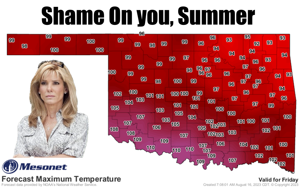
Take a good gander (and we all know just how painful that can be) at the upcoming
7-10 days. It's a summer-lover's paradise.
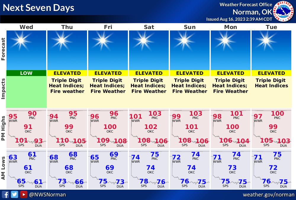

We will see triple-digit temperatures return today in SW OK, and then for most of
the rest of the state as we get into the weekend. Heck, even out to day 10 we see
odds of highs across most of the state reaching 100F+ greater than 50%.

And of course, with the Death Ridge from Hades camped over us or nearby, that
continues to kill our rain chances. For the 3rd (Okie to English translation:
"third") day in a row, we see our rain chances at nil-to-zero.

That's why I'm saying the odds of seeing flash drought erupting across south
central Oklahoma will be increasing the longer we stay in this current hot,
dry spell. Southern Oklahoma is already suffering from a month of very little
rainfall, increasing everyday. When you combine that lack of moisture with
the stifling heat, the two maladies start to feed off of each other and drought
erupts.


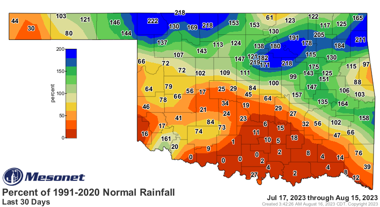
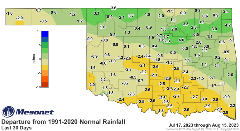
We are already in Abnormally Dry (D0) conditions down that way, and the new
Drought Monitor map tomorrow will show a bit more spread down there. D0 is the
gateway designation on the DM towards drought removal OR, as the case here,
drought addition.
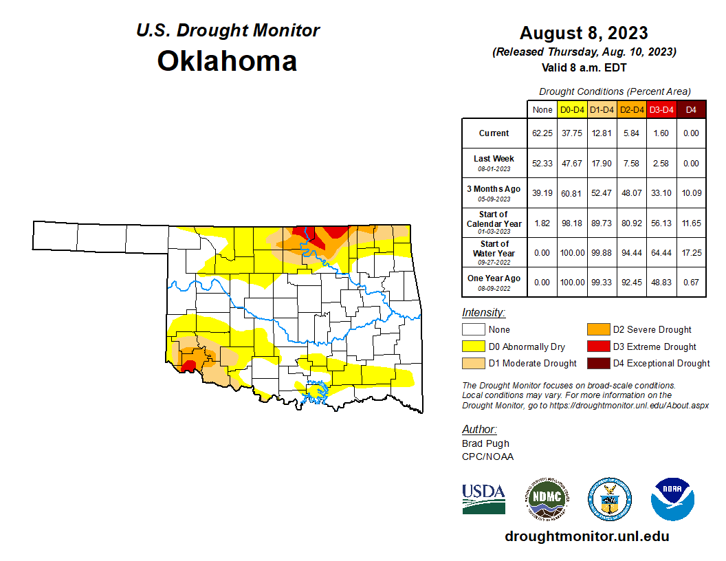
That area of D2 and D3 drought in Jackson County to the SW is very much warranted
given the pictures we have received from ag producers in that part of the
state. Check some of these out.
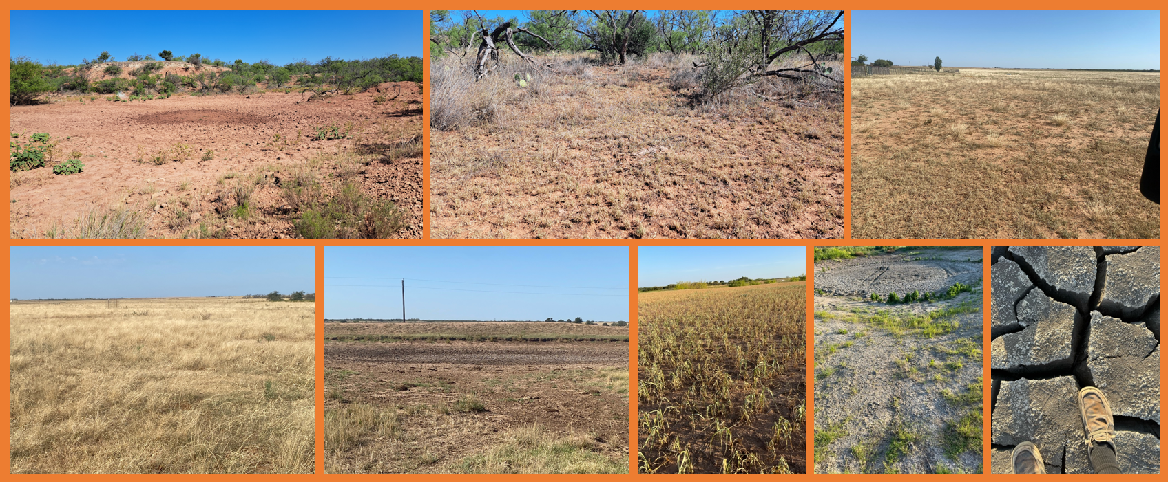
The area was D1 just a few weeks ago, but those pictures help sway the Drought
Monitor author towards D3. It's always important to have an accurate Drought
Monitor depiction, and pics go a long way towards reaching that goal.
By the way, here's the fantasy-cast rainfall totals from the American model
through the remainder of the month.
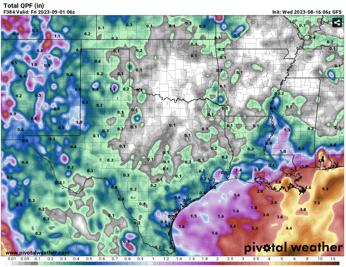
*GULP*
Gary McManus
State Climatologist
Oklahoma Mesonet
Oklahoma Climatological Survey
gmcmanus@mesonet.org
August 16 in Mesonet History
| Record | Value | Station | Year |
|---|---|---|---|
| Maximum Temperature | 108°F | MANG | 2024 |
| Minimum Temperature | 53°F | BRIS | 2016 |
| Maximum Rainfall | 3.48 inches | KENT | 2010 |
Mesonet records begin in 1994.
Search by Date
If you're a bit off, don't worry, because just like horseshoes, “almost” counts on the Ticker website!