Ticker for October 15, 2020
MESONET TICKER ... MESONET TICKER ... MESONET TICKER ... MESONET TICKER ...
October 15, 2020 October 15, 2020 October 15, 2020 October 15, 2020
Our cup runneth low
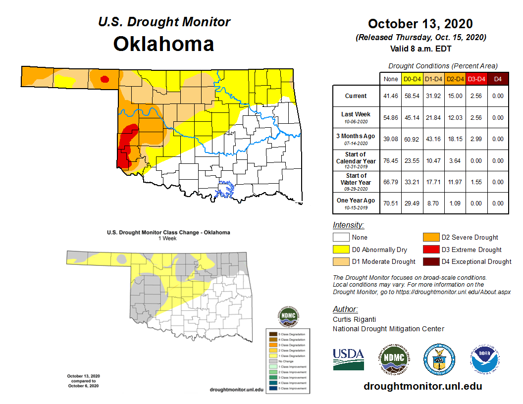
Lots to unpack here, let's cover drought first. Ugh. Ugh indeed. A more than 10%
increase in drought coverage in the last week, from 22% to 23%. The culprit is
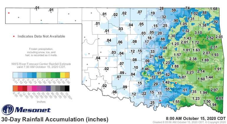
easily spotted as we look at the Mesonet rainfall maps from the last 30-60 days.
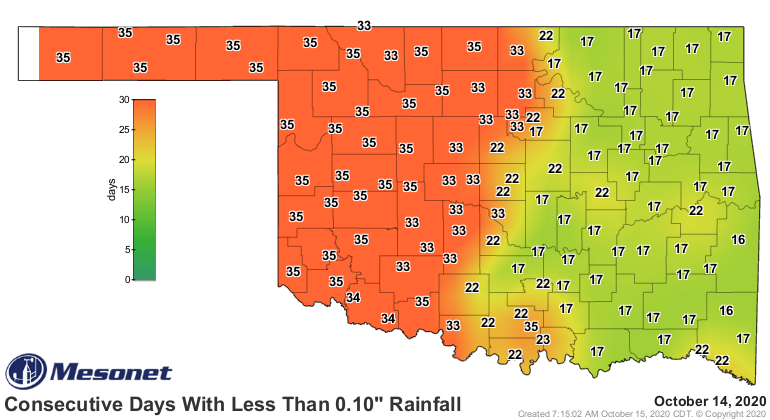
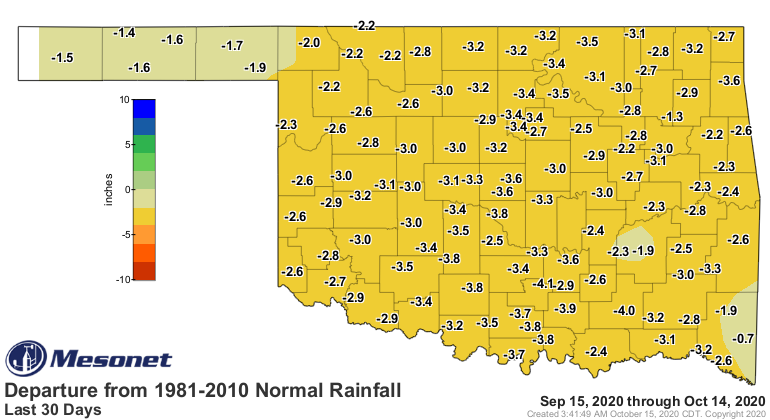
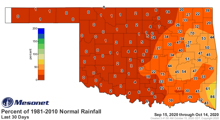
Yeah, 36 (counting today) days without a drop of moisture will definitely speed
up that drought process. Check out the stats. Not a shock we're at our driest
last 30 days in the past 100 years in the Panhandle and north central OK. There's
not much drier than Zero. Point. Zero.
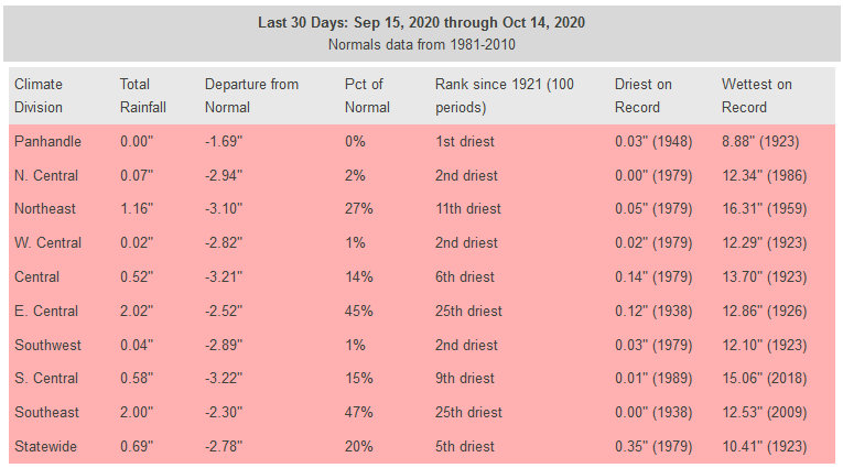
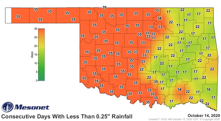
Other parts of the state are looking only slightly gruesome. Southeast and east
central OK are looking the best with their 25th driest last 30 days, but they're
still more than 2 inches down for that period.
Look at what the dry spell has done to our soil moisture, right at the key time
for planting wheat.
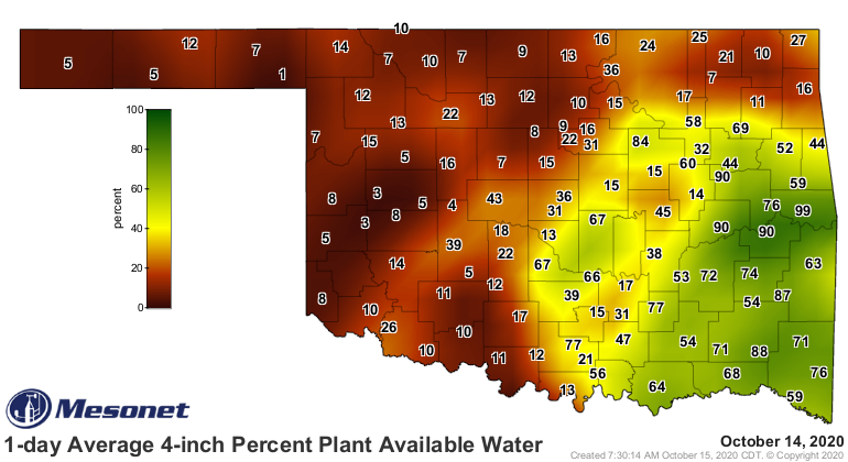
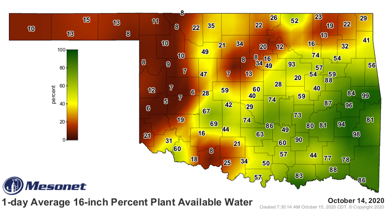
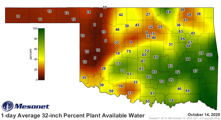
There's really no way to sugarcoat those maps, other than to say it's still
somewhat okay across SE OK...but across the rest of the state, things aren't
good at all.
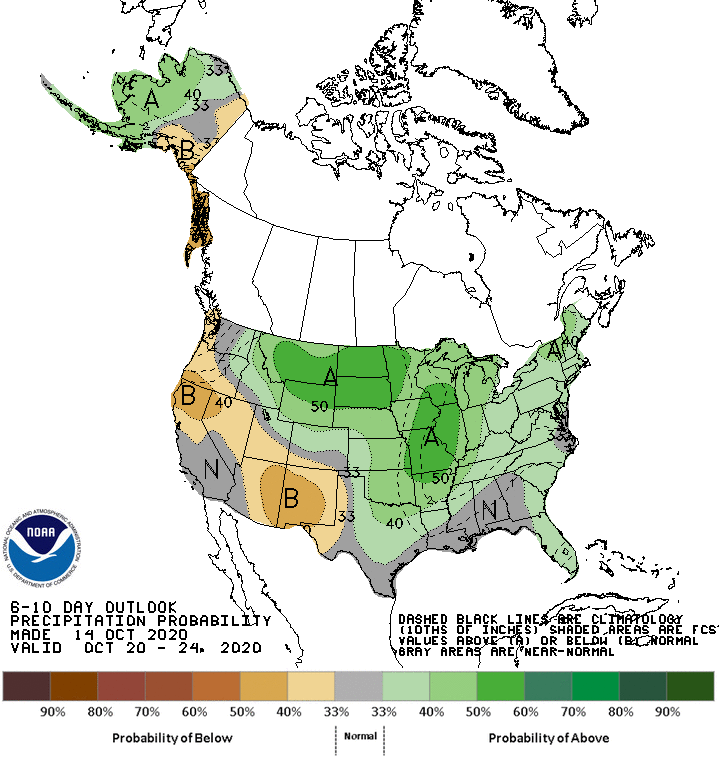
Let's take a look forward as we go through the next week and then the next few
months. First, there *might* be a chance of moisture across eastern OK as we
get later into the weekend, and then early next week. This isn't a sure thing
just yet, however. Lots of uncertainty over frontal placements and whatnot.
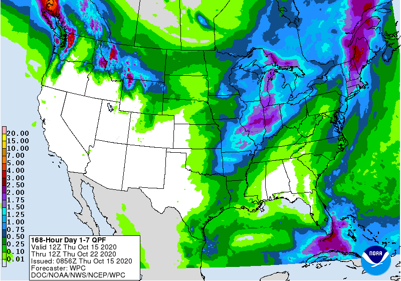
Then we get later into next week, where CPC thinks we might have a chance for
more widespread moisture. It would likely be cooler than normal as well.
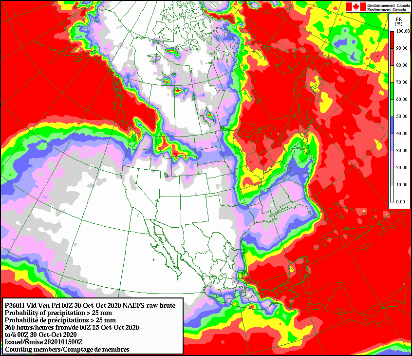
So maybe. But the Canadian forecast model shows a slim chance of accumulating at
least an inch of rain through the end of the month (well, close).
Western Oklahoma looks dry through all that. Even with slight chances of above
normal precipitation, this part of October is getting further into the dry
season, so no promises of drought-quenchers.
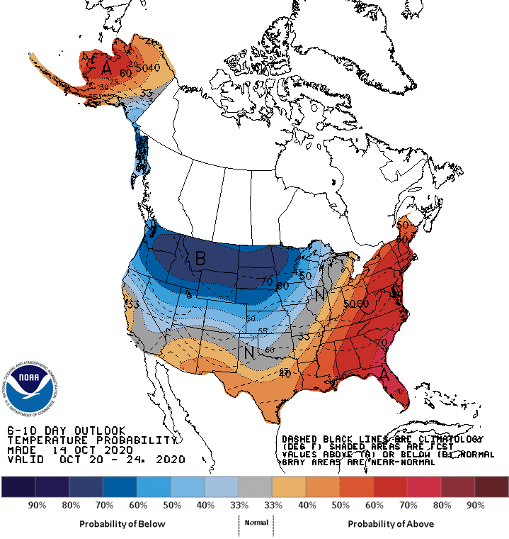
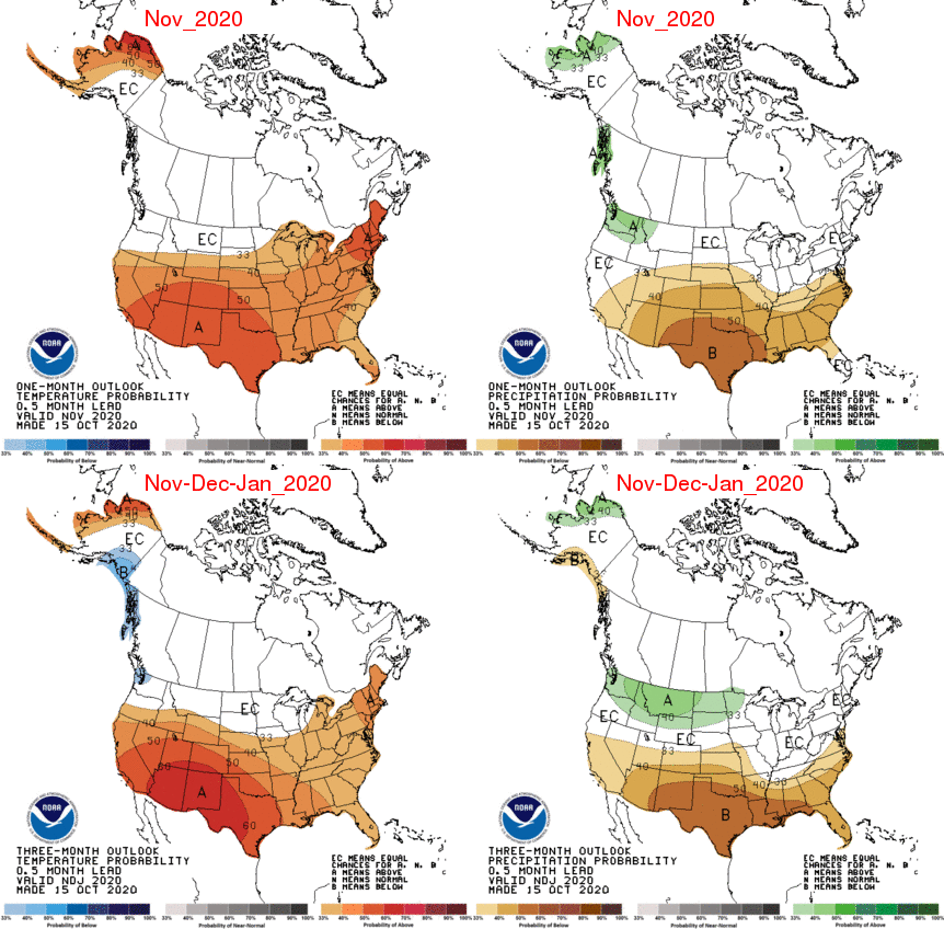
That's all weather. Those are smaller time-scale perturbations in the overall
larger pattern (i.e., climate). So what about the climate pattern? Still looks
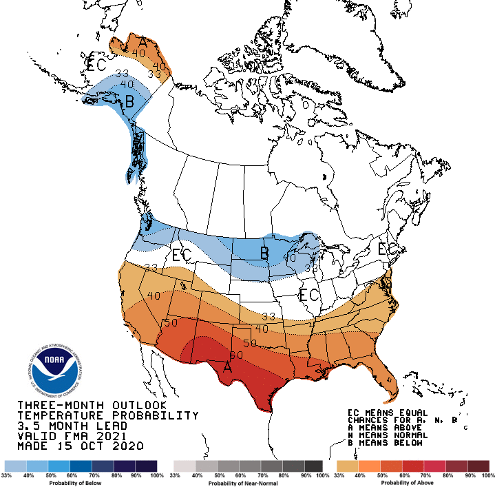
warm and dry overall, with La Nina's drying influence being felt. Here are the
outlooks for November and the 3-month November-January time frame, showing
that classic La Nina look.
I'm afraid that doesn't bode well (I'm not sure if that means it will bode bad,
but we'll talk abode that later) for the Drought Outlook through January 31.
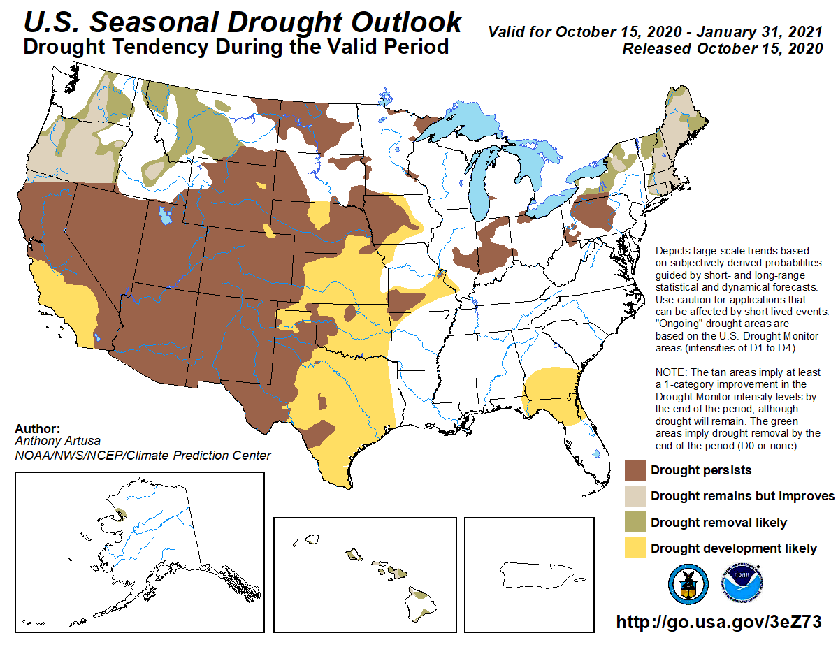
That shows drought development LIKELY through virtually the entire state by
the end of January. So in other words, if we looked at a Drought Monitor map on
January 31, CPC thinks we could see at least moderate drought across the entire
state.
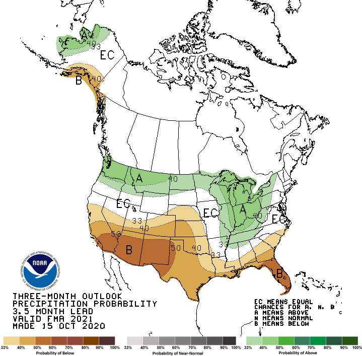
I still contend (and CPC agrees) that La Nina's influence spans the entire cool
season, not just winter. And its impacts have momentum that can last into
spring, through April. Here are the outlooks for Feb-April 2021, which also
show La Nina's influence.
A new look at the impacts from the International Research Institute for Climate
and Society (IRI) at Columbia University now pinpoints that drier than normal
signal October-April for the Southern Plains, using data from updated ENSO
events (including the strong La Nina of 2010-11 and El Nino of 2015-16).
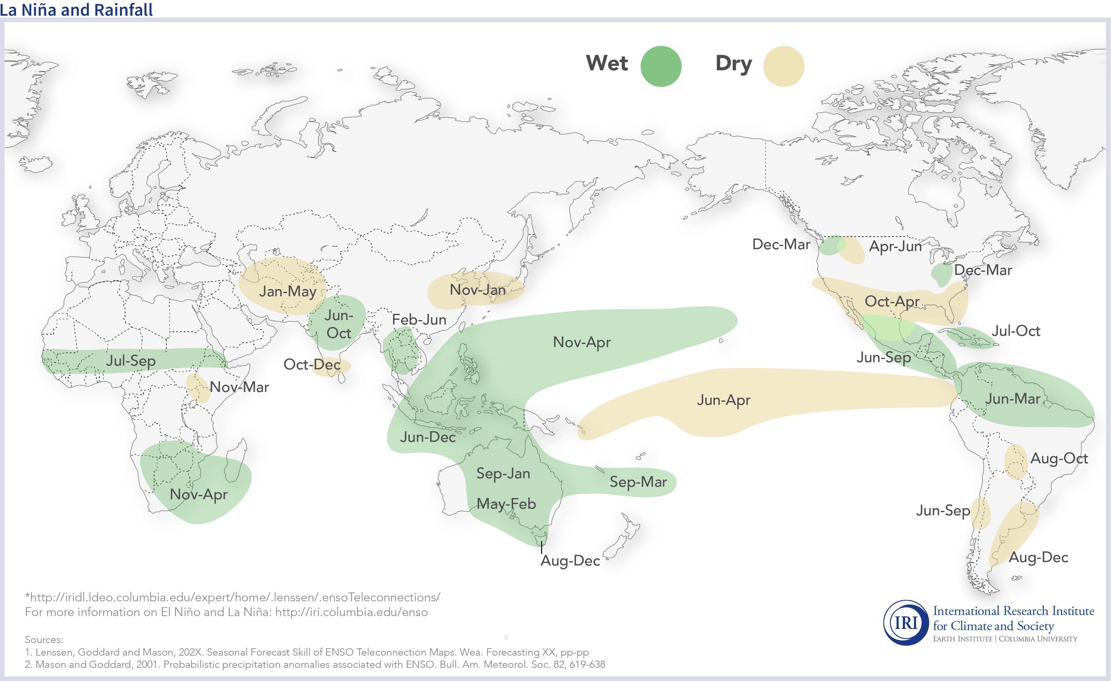
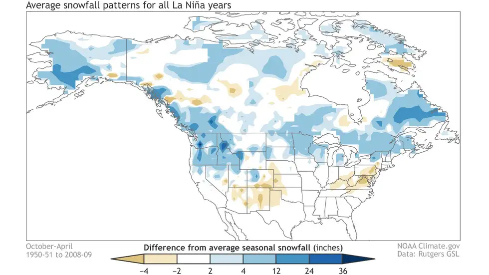
For snow lovers, especially those that like to drive to the southern Rockies
of CO and NM, we have to mention that La Nina's influence can impact the snow
season for that region. If you drive a bit more NW, you could be in business.
Now for our necessary cautionary language. La Nina is but one influence on
our weather. And quite frankly (or Garyly), it's influence is stronger to our
south. And not every La Nina brings the same impacts, if at all. There are a
myriad other influences on our weather along with ENSO. You have a blocking
pattern develop in the jet stream, then you get a big jet stream kink that
dips down or bulges up over the U.S., you can see long-lasting weather patterns
that aren't conducive to La Nina's usual impacts. And then there is always the
threat of an extreme event or five disrupting the overall pattern as well
(think our 27-inch snowfall event in Spavinaw, OK, during the 2010-11 La Nina).
For now, though, we'll continue to gently nudge folks to remember that La Nina
has been in place since September, is expected to continue through early spring
at least, and can (and more often than not, will) have deleterious impacts on
our overall weather pattern.
Speaking of deleterious impacts, folks in the Panhandle and NE OK need to
prepare for a possible frost tomorrow morning as temperatures are forecast to
dip down close to freezing, prompting a frost advisory for those areas.
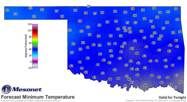
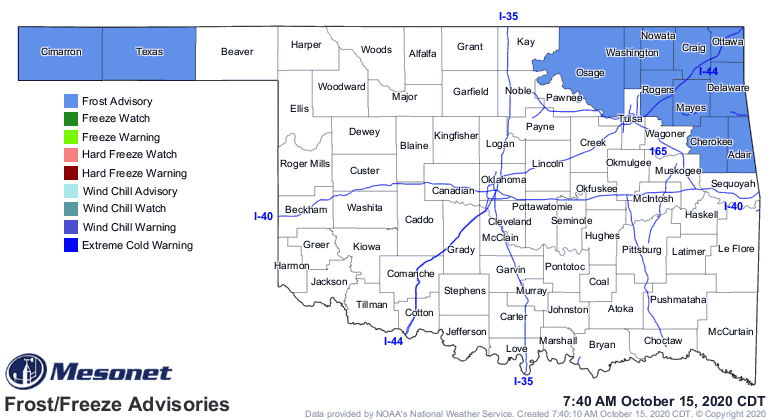
A bit late in the Panhandle, which has already seen a momentary freeze earlier
this week, but more widespread frost could occur tomorrow.
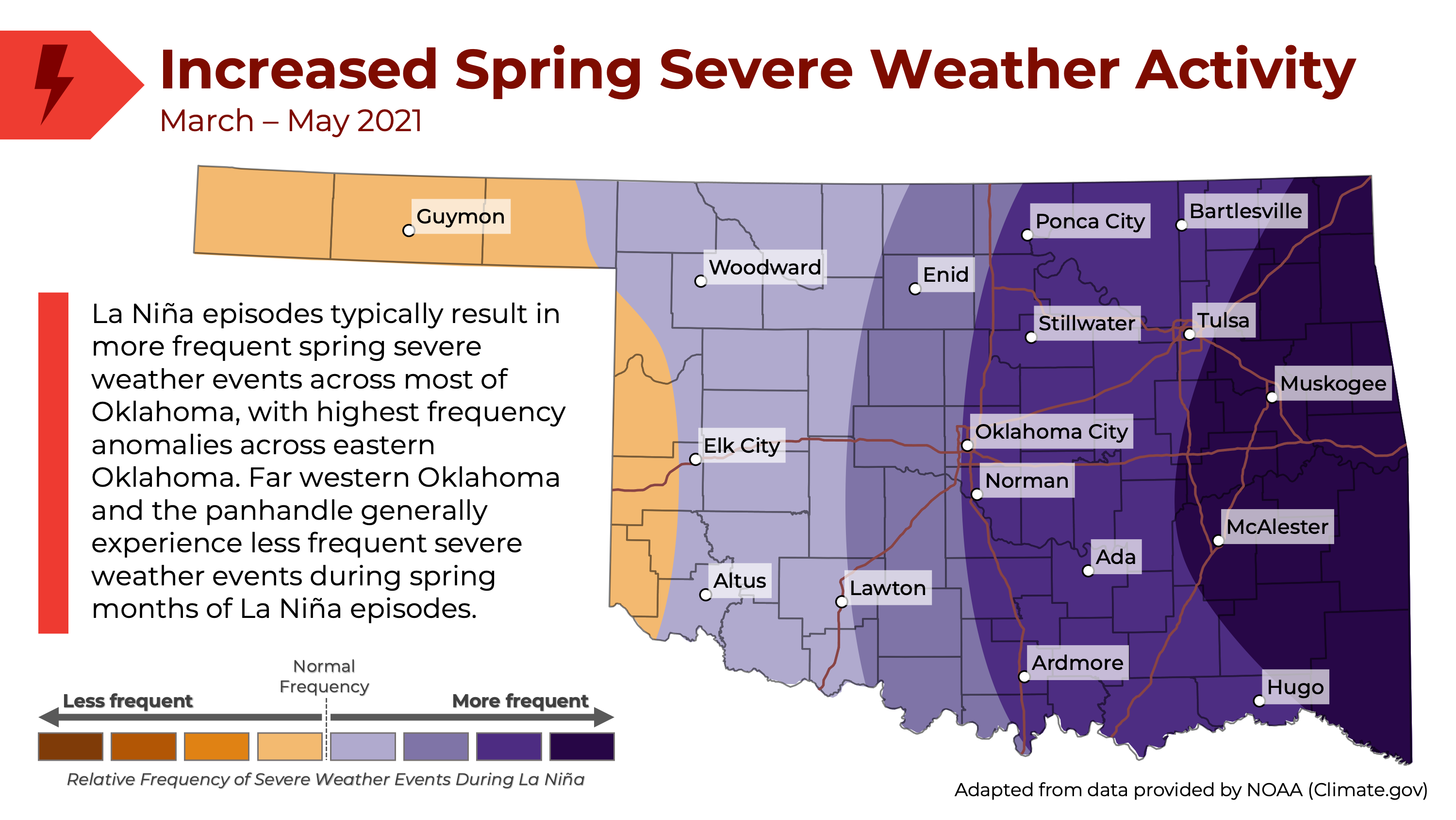
Okay, lots unpacked. Now time to pack it all up again. Before I go, and I
hesitate to mention this, but La Nina might have an impact on our severe weather
season next spring. Research suggests an increase in severe weather events for
most of Oklahoma, save for far western sections of the state, including the
Panhandle. Check out this graphic from a report issued by Oklahoma's Department
of Emergency Management and Homeland Security concerning La Nina.
You can view that report in its entirety here. We contributed to this report,
along with several other state and federal agencies.
https://content.govdelivery.com/accounts/OKDEM/bulletins/2a259fb
Gary McManus
State Climatologist
Oklahoma Mesonet
Oklahoma Climatological Survey
(405) 325-2253
gmcmanus@mesonet.org
October 15 in Mesonet History
| Record | Value | Station | Year |
|---|---|---|---|
| Maximum Temperature | 97°F | TIPT | 2015 |
| Minimum Temperature | 26°F | EVAX | 2018 |
| Maximum Rainfall | 5.41″ | WALT | 2006 |
Mesonet records begin in 1994.
Search by Date
If you're a bit off, don't worry, because just like horseshoes, “almost” counts on the Ticker website!