Ticker for July 15, 2011
MESONET TICKER ... MESONET TICKER ... MESONET TICKER ... MESONET TICKER ...
July 15, 2011 July 15, 2011 July 15, 2011 July 15, 2011
Last 365 days driest since back to 1921 / July heat has records in its sights
According to data from the Oklahoma Mesonet, the last 365 days were the driest
July 15-July 14 period on record in Oklahoma. In other words, the July 15, 2010
through July 14, 2011 statewide average precipitation total of 22.99 inches is
drier than any other July 15-July 14 period dating back to 1921. The ugly truth
is found in the table below.
Climate Division Total Dep from Normal Pct of Normal Rank since 1921
Panhandle 11.43" -9.67" 54% 2nd driest
N. Central 18.54" -13.11" 59% 2nd driest
Northeast 32.37" -9.60" 77% 17th driest
W. Central 14.03" -15.06" 48% 1st driest
Central 20.62" -17.37" 54% 1st driest
E. Central 36.17" -9.92" 78% 20th driest
Southwest 15.09" -15.71" 49% 1st driest
S. Central 23.71" -17.25" 58% 2nd driest
Southeast 35.75" -15.19" 70% 5th driest
Statewide 22.99" -13.70" 63% 1st driest
Here's the uglier truth in pictures (no, not my picture ... real funny, now
aren't you ashamed of yourselves?).
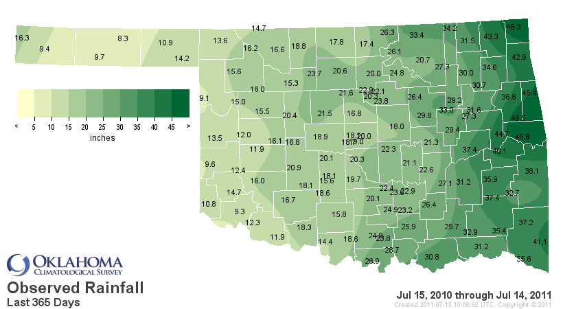
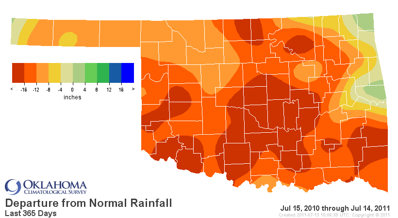
Apologies to Arnett and Hooker, but 8.3 inches and 9.1 inches of rain is no
way to run a climate! They're just not as lucky as the water-logged eastern
parts of the state that are ONLY around 70 percent of normal.
Those statistics will actually get worse in a few days when the last of the
good rains from last summer start dropping off. While this drought started in
the fall, it has its roots all the way back in mid-summer when the rainy first
half of summer gave way to a hot and dry second half (which set up our flash
drought situation last August).
********************************************
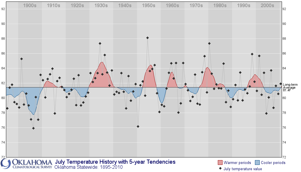
Amazing July Heat
The statewide average temperature from July 1-14 was 87.9 degrees, 6.8 degrees
above normal. The average high temperature across the state over that time
was 102.3 degrees, which is more than 9 degrees above normal.
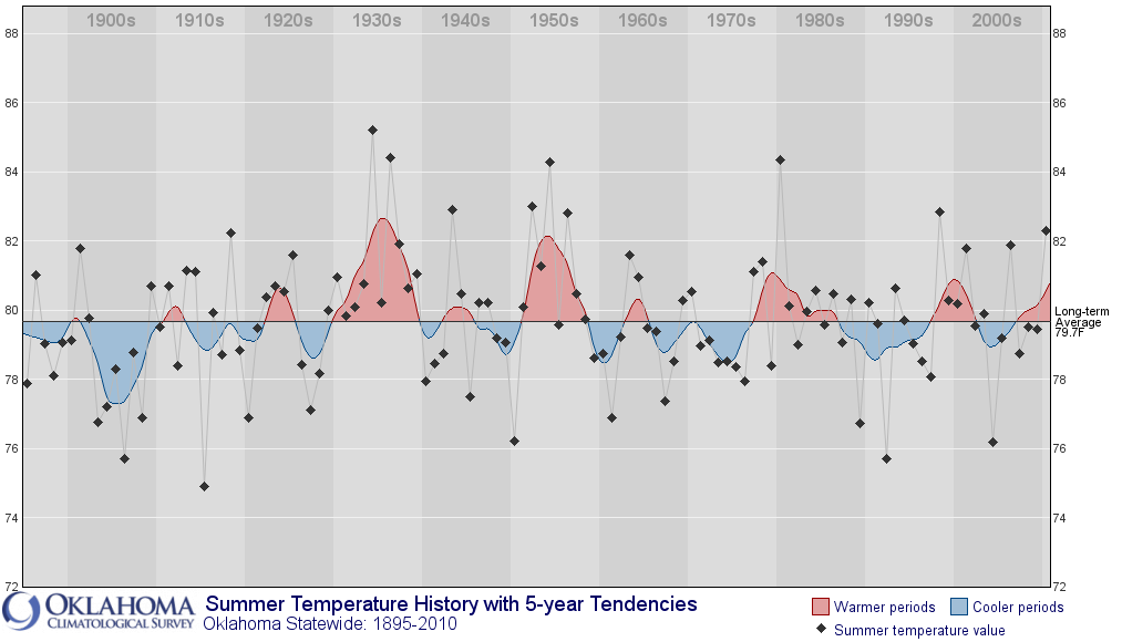
Now I don't want to alarm anybody here, but I will anyway. The hottest July on
record (since 1895) across the state occurred in 1954 with an average
temperature of 88.1 degrees. So we're a couple of tenths of a degree behind
that with traditionally the hottest part of the summer fast approaching.
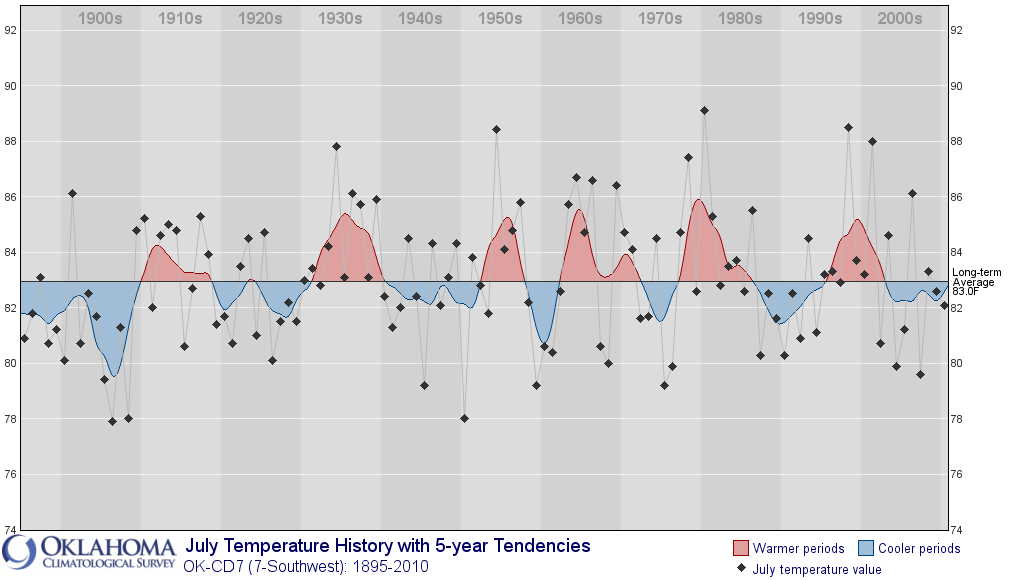
Southwestern Oklahoma's average temperature in July has been 90.1 degrees with an
average high temperature of 104.4 degrees. YIKES! Their warmest July on record
occurred during the infamous summer of 1980 with an average of 89.1 degrees,
so they are on their way to shattering that record by a full degree thus far.
Remember, this is coming off the second warmest June on record, so how is the
summer shaping up halfway through? The average statewide temperature for June
1-July 14 was 85 degrees. The record for summer (climatological summer runs
from June 1-August 31) across the state is 85.2 degrees in 1934.
The ugly truth indeed!
Gary McManus
Associate State Climatologist
Oklahoma Climatological Survey
(405) 325-2253
gmcmanus@mesonet.org
July 15 in Mesonet History
| Record | Value | Station | Year |
|---|---|---|---|
| Maximum Temperature | 111°F | FREE | 2011 |
| Minimum Temperature | 52°F | FORA | 2014 |
| Maximum Rainfall | 3.28 inches | KENT | 2017 |
Mesonet records begin in 1994.
Search by Date
If you're a bit off, don't worry, because just like horseshoes, “almost” counts on the Ticker website!