Ticker for June 15, 2011
MESONET TICKER ... MESONET TICKER ... MESONET TICKER ... MESONET TICKER ...
June 15, 2011 June 15, 2011 June 15, 2011 June 15, 2011
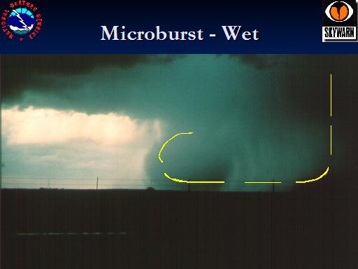
Microburst City
Norman did-not-enjoy its second microburst in as little as 10 months yesterday.
Like the event last August 21 (again in Norman), this microburst was a "wet"
microburst. Here's a recap of last year's event from the NCDC storm events
database:
A wet microburst caused a fairly concentrated area of wind damage
between 1850 and 1900 CDT. The damage was reported from near Tecumseh
Road and 24th Avenue Northwest, southeast toward Main Street and 12th
Avenue Northeast. Many tree limbs greater than four inches in diameter
were downed (along with several smaller limbs), power poles were snapped,
tree trunks greater than a foot in diameter were snapped, shingles were
blown off of roofs, and several fence panels were blown down. Rainfall
totals from the event ranged from one to two inches, most of which fell
in about 30 minutes.
That is very similar to yesterday's event. A wet microburst comes with lots of
precipitation (hint: wet) and that rain and hail sort of "drags" the air
parcels towards the ground due to friction. The air gains momentum and spreads
out as it flattens on the ground.
A dry microburst, on the other hand, occurs when precipitation falls into dry
air. As the precipitation falls into the dry air, that air cools and sinks
towards the ground due to negative buoyancy. Again, the air accelerates towards
the ground and spreads out as it strikes the surface.

Obviously these are very simplified descriptions but I'm a climatologist ...
I'm allowed.
The Norman Mesonet site captured this microburst event quite well. Here is a
look at the meteogram for the 1-minute data from the Norman site.
TA1M -- Air temperature at 10 meters
PRMN -- Minimum air pressure
PR1M -- 1-minute averaged air pressure
WD1M -- Wind direction (degrees) at 10 meters
WS1M -- 1-minute averaged wind speed at 10 meters
WX1M -- Maximum wind gust at 10 meters
RT1M -- Rainfall
The highest gust recorded by the Mesonet site was 70 mph. OCS Director Kevin
Kloesel's backyard wind instrument (we're not talking saxophones here) in east
Norman was destroyed after measuring a wind gust of 82 mph before being
destroyed by hail.
From looking at video of the event, I'd say wind speeds approached 100 mph or
greater in some areas. That is unofficial, by the way, and I should probably
not even be guessing.
But, I'm a climatologist ... I'm allowed.
Gary McManus
Associate State Climatologist
Oklahoma Climatological Survey
(405) 325-2253
gmcmanus@mesonet.org
June 15 in Mesonet History
| Record | Value | Station | Year |
|---|---|---|---|
| Maximum Temperature | 104°F | ALTU | 2022 |
| Minimum Temperature | 42°F | KENT | 2001 |
| Maximum Rainfall | 5.22″ | BYAR | 2007 |
Mesonet records begin in 1994.
Search by Date
If you're a bit off, don't worry, because just like horseshoes, “almost” counts on the Ticker website!