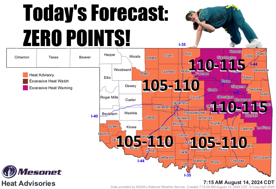
Ticker for August 14, 2024
MESONET TICKER ... MESONET TICKER ... MESONET TICKER ... MESONET TICKER ...
August 14, 2024 August 14, 2024 August 14, 2024 August 14, 2024
Code Blaze
Here's me playing Colonel Nathan R. Jessup from "A Few Good Men":
"Code Red? No, I didn't order the Code Red. You must have mistaken me for somebody
else. Maybe it was Markinson. Or you, Lieutenant Weinberg? At any rate, I didn't
order the Code Red. Hey, are those doughnuts??"
Aaaaand, scene!
See, I ordered summer a long time ago, but what I DIDN'T order is the continual
"making your own gravy" heat that we've been seeing since our Fall Preview over
the weekend. Yesterday was ridiculous, of course.
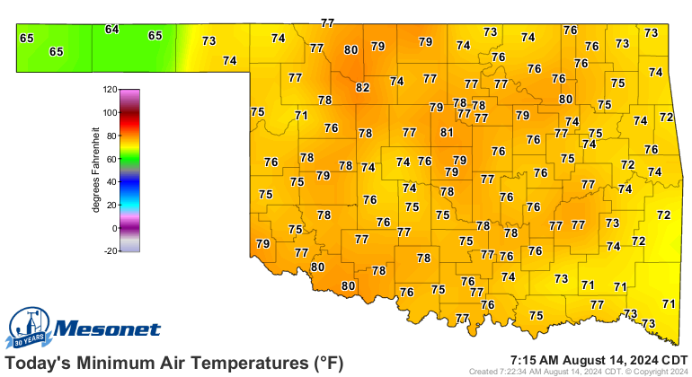
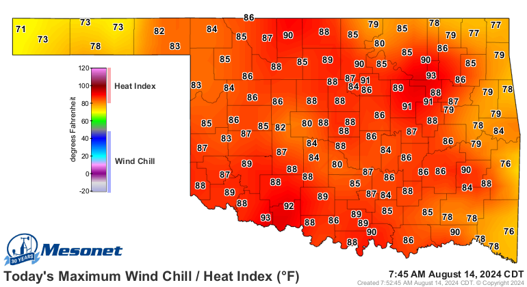
And even today's low temperatures were in the dangerous category in the upper-70s
and low-80s. Those types of lows don't allow relief from the heat of the day, and
the impact of heat is cumulative (English to Okie dictionary: "adds up") over
time.
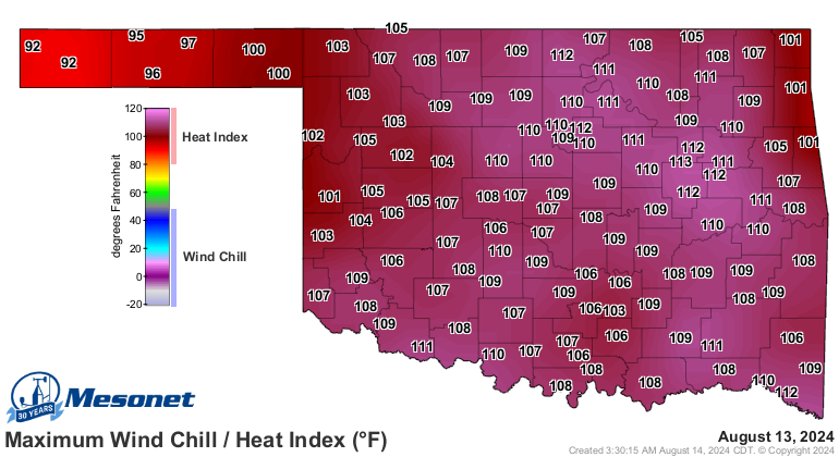
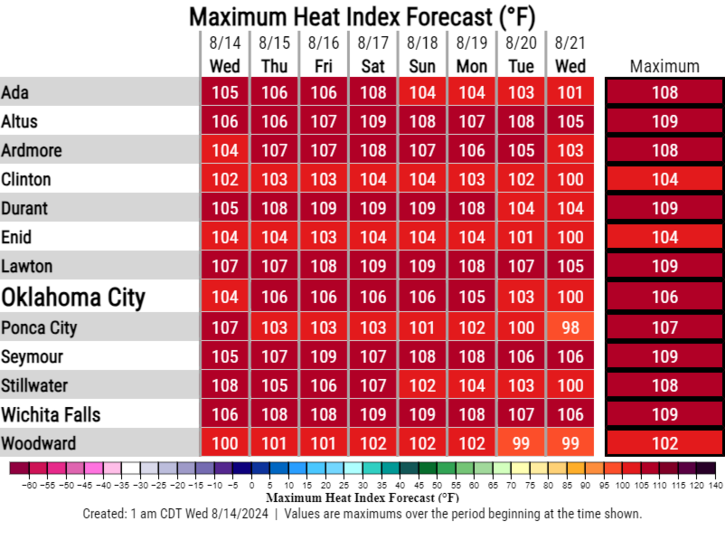
So imagine you go out last night at midnight (what are you...young??) for some
relief and this is what you find (these heat index values were obviously
recorded at or near midnight):
And accumulate this heat shall, if talk like Yoda I might for a moment, as the
current heat wave looks like it could extend through much of August, with some
minor relief points thrown in here and there.
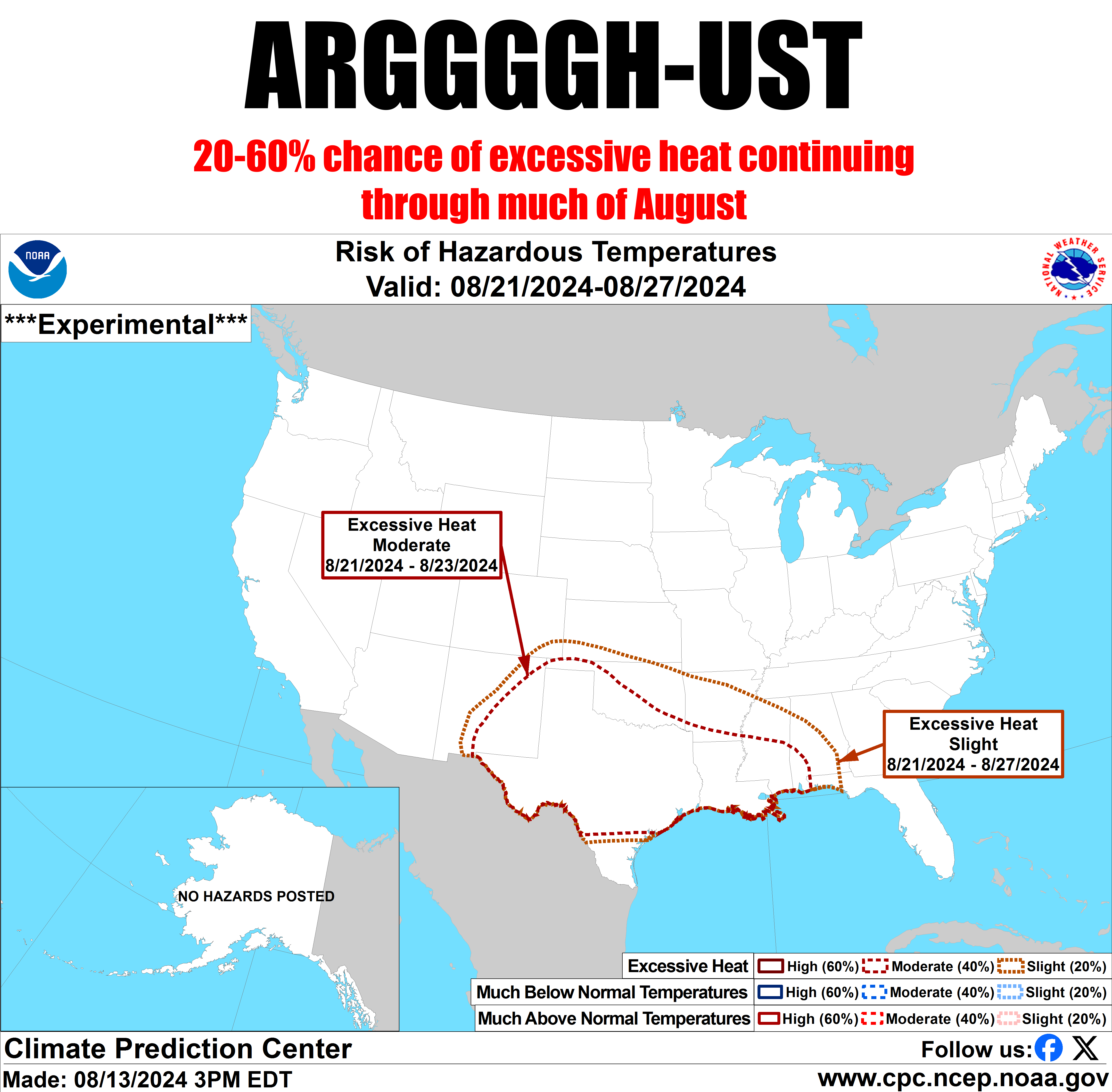
There might be a chance to flatten the heat dome out a bit and move it to the
west and allow a cool front or two to approach from the northeast, but that
remains to be seen.
So order a Code Blue. Or head west, where the air is drier (like it's been
through a dryer), the heat index is lower, but the actual air temps are higher.
Blame it on the dewpoint!
Or just hide inside until November.
Gary McManus
State Climatologist
Oklahoma Mesonet
Oklahoma Climate Survey
gmcmanus@ou.edu
August 14 in Mesonet History
| Record | Value | Station | Year |
|---|---|---|---|
| Maximum Temperature | 107°F | KIN2 | 2010 |
| Minimum Temperature | 50°F | WIST | 2004 |
| Maximum Rainfall | 5.37 inches | BOWL | 2005 |
Mesonet records begin in 1994.
Search by Date
If you're a bit off, don't worry, because just like horseshoes, “almost” counts on the Ticker website!