Ticker for March 14, 2019
MESONET TICKER ... MESONET TICKER ... MESONET TICKER ... MESONET TICKER ...
March 14, 2019 March 14, 2019 March 14, 2019 March 14, 2019
Still windy?
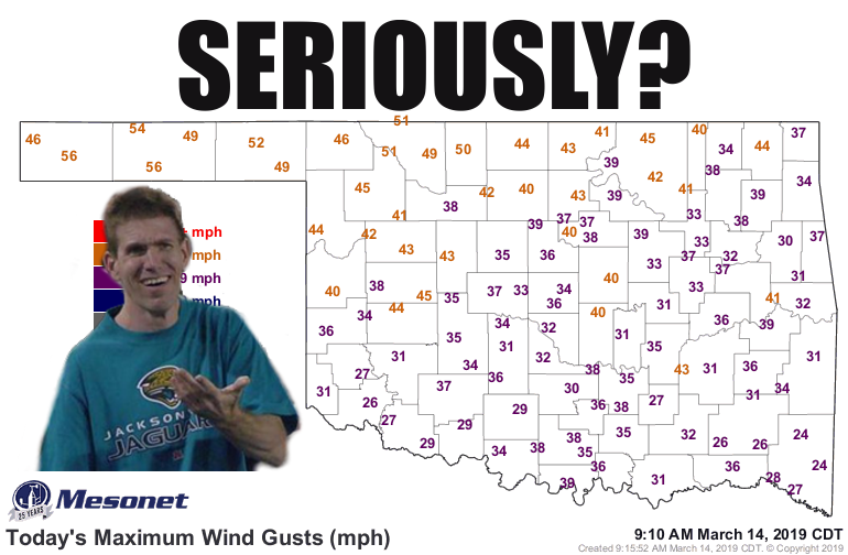
WHY? Wasn't yesterday enough? Why do we need more 40-50 mph winds today?
The Ticker's going on spring break next week. The Moose out front should have
told ya. But before we disappeared for a week, we wanted to talk about all that
wind we had yesterday. No, not that kind. We didn't eat beans for lunch. We're
talking the 60-70 mph scattered across the western half of the state, and the
40-60 mph across the rest of the state. The maximum gust map from yesterday
doesn't tell the entire story.
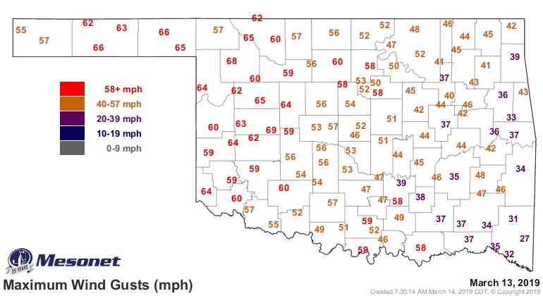
Those were just the highest gusts at each Mesonet station. So while Weatherford
led the Mesonet with a 69 mph gust at 9:15pm last night, they had a 67 mph gust
at 8:30pm, and a 64 mph gust at 2:40pm. And so on and so forth. We had SUSTAINED
winds of 50 mph at five different Mesonet sites (Elk City, Freedom, Goodwell,
Hooker, and Weatherford). Think about that. If you went outside and stood facing
a 49 mph wind for 5 straight minutes, this would be 1 mph greater than that!
Yeah, that comparison wasn't as monumental and descriptive as I thought, but
I'll be darned if I'm going to erase it. In the last 2 days, the Oklahoma
Mesonet has measured 304 wind gusts that if they occurred in a thunderstorm
would qualify that storm as severe (58 mph). Only one of those has come today,
thankfully, but today's blast in the face is just gravy on Mother Nature's
wind-blown meat loaf. And remember, that's just the Mesonet, and just for
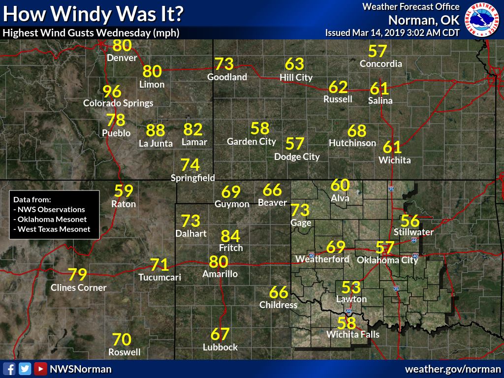
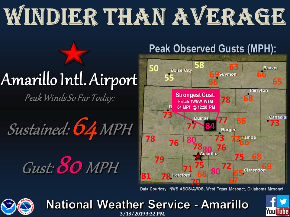
the OKLAHOMA Mesonet. The Gage Airport measured a 73 mph gust, and Guymon
recorded a 69 mph gust. To top that, the Texas Panhandle saw gusts up to 84
mph, for crying out loud!
Luckily the storm came with some rain before it, and even though I famously said
at least the rain would prevent a dust storm (HAHAHA!!), it DID soak into the
soil a bit and relief just a bit of the dry conditions across western Oklahoma.
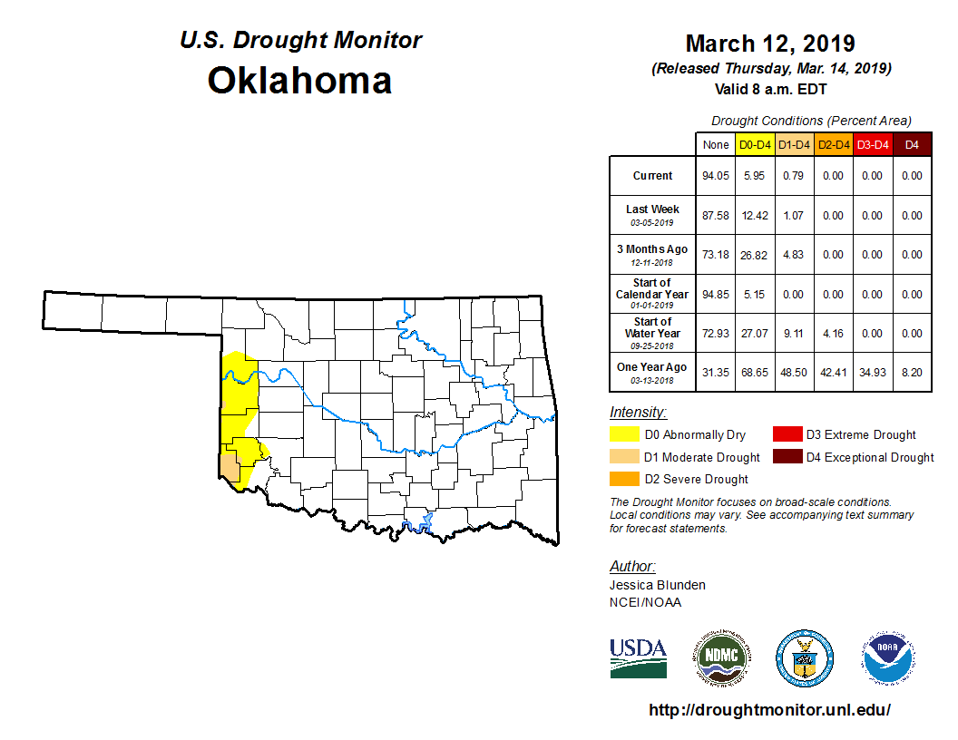
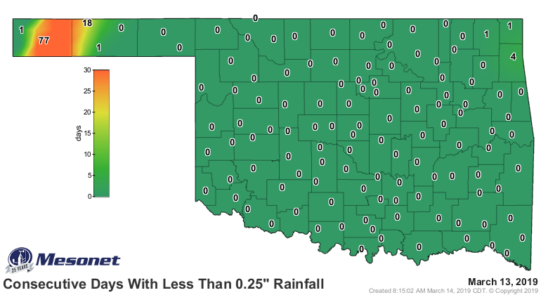
A bunch of the rain fell after the 7am Tuesday cutoff point in which we can
consider precipitation for the Drought Monitor during the week, so expect some
more improvements off of this week's rain NEXT week. And our rainfall maps are
starting to look better for sure.
Enjoy tomorrow and the "light" winds gusts up to 25 mph!
Gary McManus
State Climatologist
Oklahoma Mesonet
Oklahoma Climatological Survey
(405) 325-2253
March 14 in Mesonet History
| Record | Value | Station | Year |
|---|---|---|---|
| Maximum Temperature | 90°F | WAUR | 2002 |
| Minimum Temperature | 10°F | HOOK | 1999 |
| Maximum Rainfall | 2.45″ | BYAR | 2020 |
Mesonet records begin in 1994.
Search by Date
If you're a bit off, don't worry, because just like horseshoes, “almost” counts on the Ticker website!