Ticker for October 13, 2020
MESONET TICKER ... MESONET TICKER ... MESONET TICKER ... MESONET TICKER ...
October 13, 2020 October 13, 2020 October 13, 2020 October 13, 2020
First freeze...check
I'll be darned if I didn't fall (not autumn) for one of Mother Nature's oldest
tricks in the book. When I started writing yesterday's Ticker, I first checked
the low temperatures at the time for a first freeze. Yeah, climatologists lead
exciting lives! When I looked, generally I glance at the Panhandle first, I saw
low 40s. Okay, good to go, no first freeze, I'll point folks towards our possible
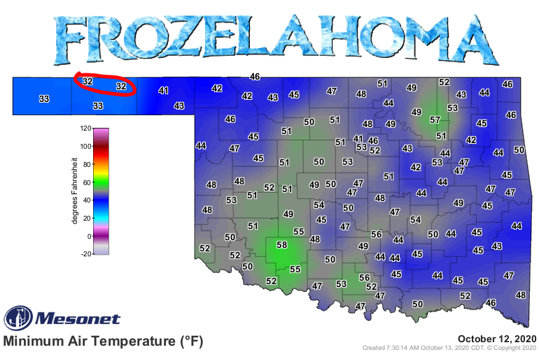
first freeze Friday morning. Another glance later in the day showed 32 degrees
at both Hooker and Eva. What's up with that! Well, as the air goes still after
sunrise on a clear day, and the earth continues to radiate stored infrared heat
energy up into the atmosphere, that temperature often drops another few degrees
in those early daylight hours. That freeze at both locations was momentary,
relatively speaking, but the 32 degrees threshold was broken nevertheless, and
now that frozen cat is out of the bag.
We are still looking at Friday for another possible freeze, but big deal now,
right? Well, if'n you're in one of the locations that might freeze...yeah, it is.
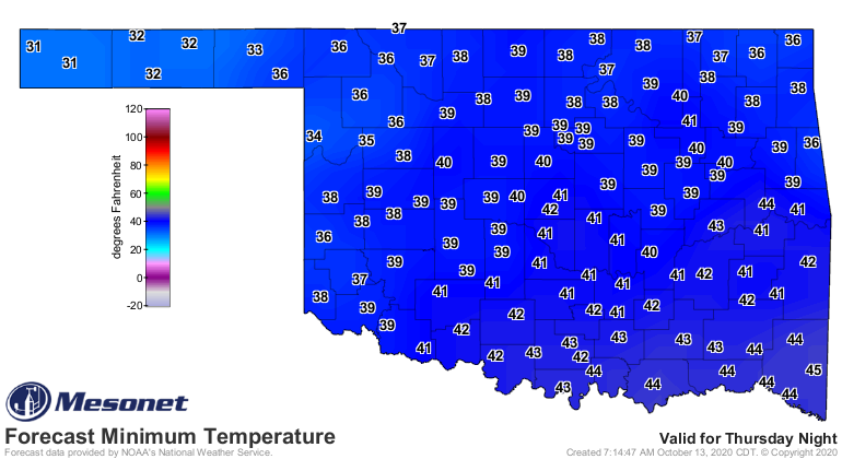
Don't be shocked if several locations have seemingly "out of place" freezes,
where the surrounding stations are nowhere close to freezing. Geographical
differences can create lots of micro-climates more apt to freeze (or not freeze)
than others.
The freeze yesterday was a bit earlier than the average date for those Panhandle
locations, but it was pretty close nonetheless (wow, I used "nevertheless" and
"nonetheless" in a single Ticker...Gary McManus, Esquire!). Check out these
maps of the earliest fall freeze and average first fall freeze. The earliest
freeze map is based on the historical period of record for each location,
while the average fall freeze dates are based on the 1981-2010 normals from
NCEI. That map will change when the 1991-2020 normals come out next year.
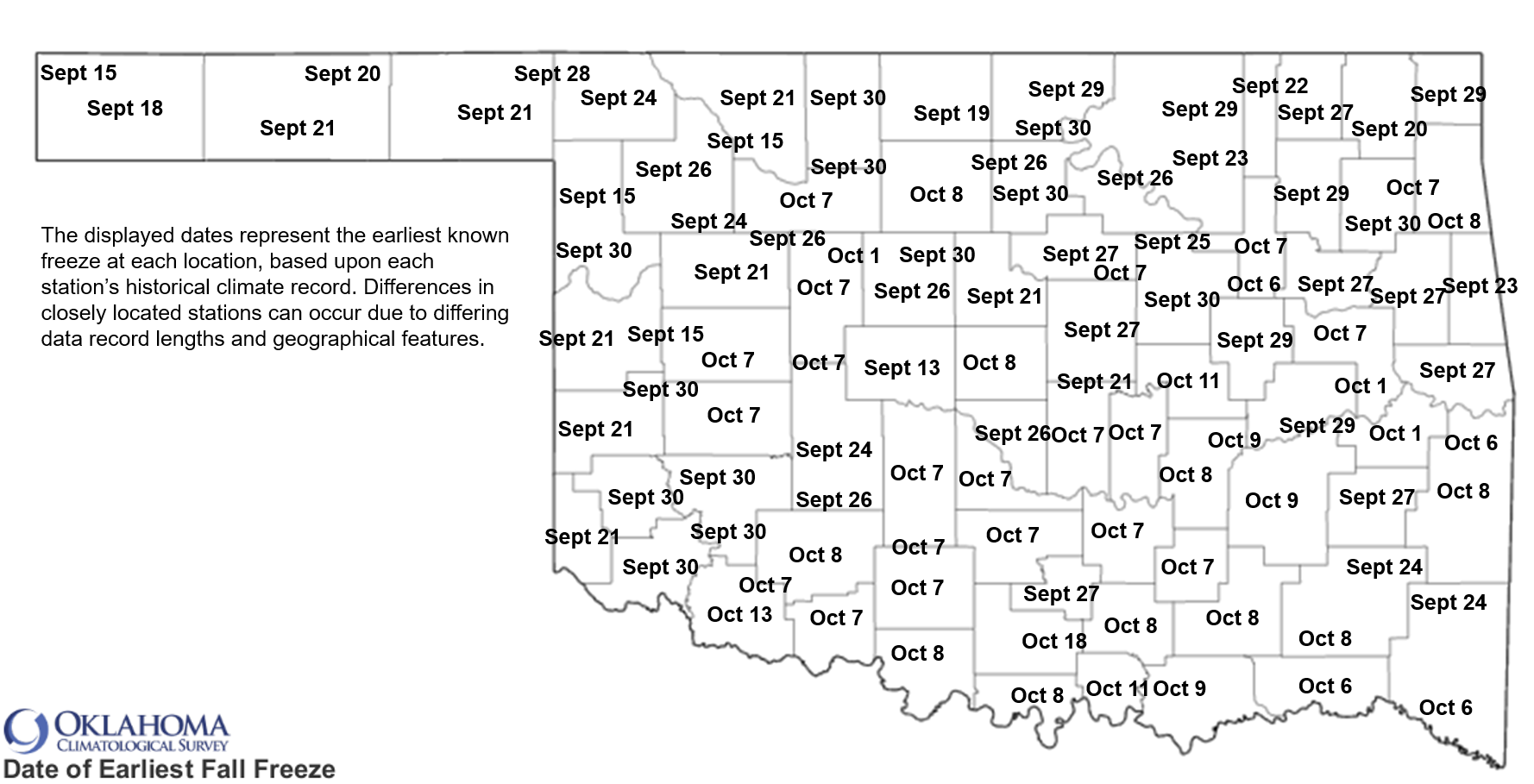
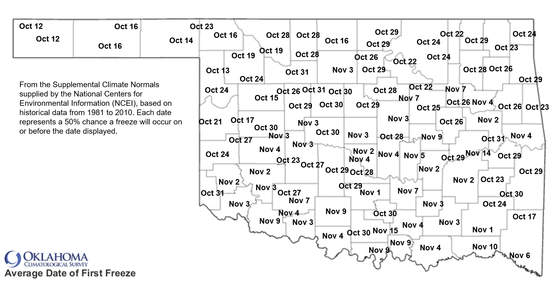
We're by virtually all of the earliest freeze dates, so file that map away for
next year. The average dates are coming up for most of the state over the next
2-3 weeks, so a freeze yesterday and then another possible one on Friday is in
line with what could be expected.
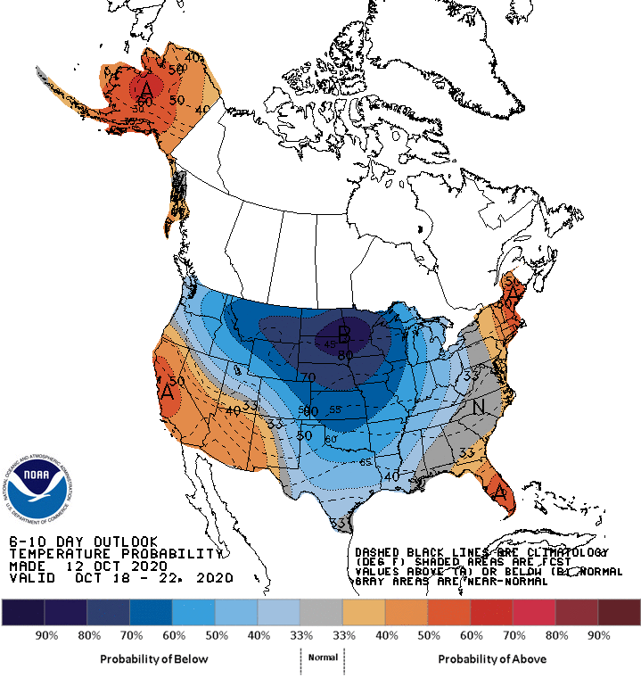
Next week might see another big cold front that could bring the coldest air of
the season thus far.
For example, check out the 7am forecast temperatures for next Monday from the
GFS forecast model.
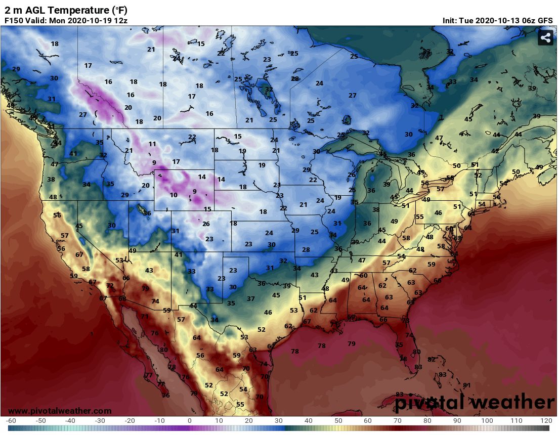
That'll put some frost on the ol' pumpkins.
Don't worry, summer ain't done yet! Tomorrow we should see a pretty significant
compressional heating surge ahead of that cold front coming in tomorrow night.
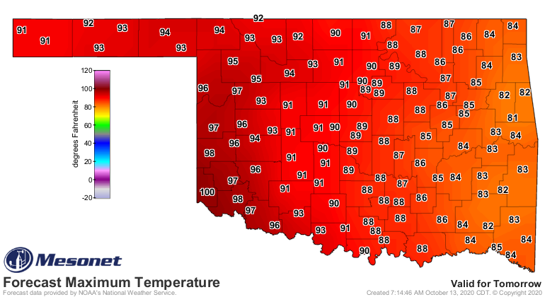
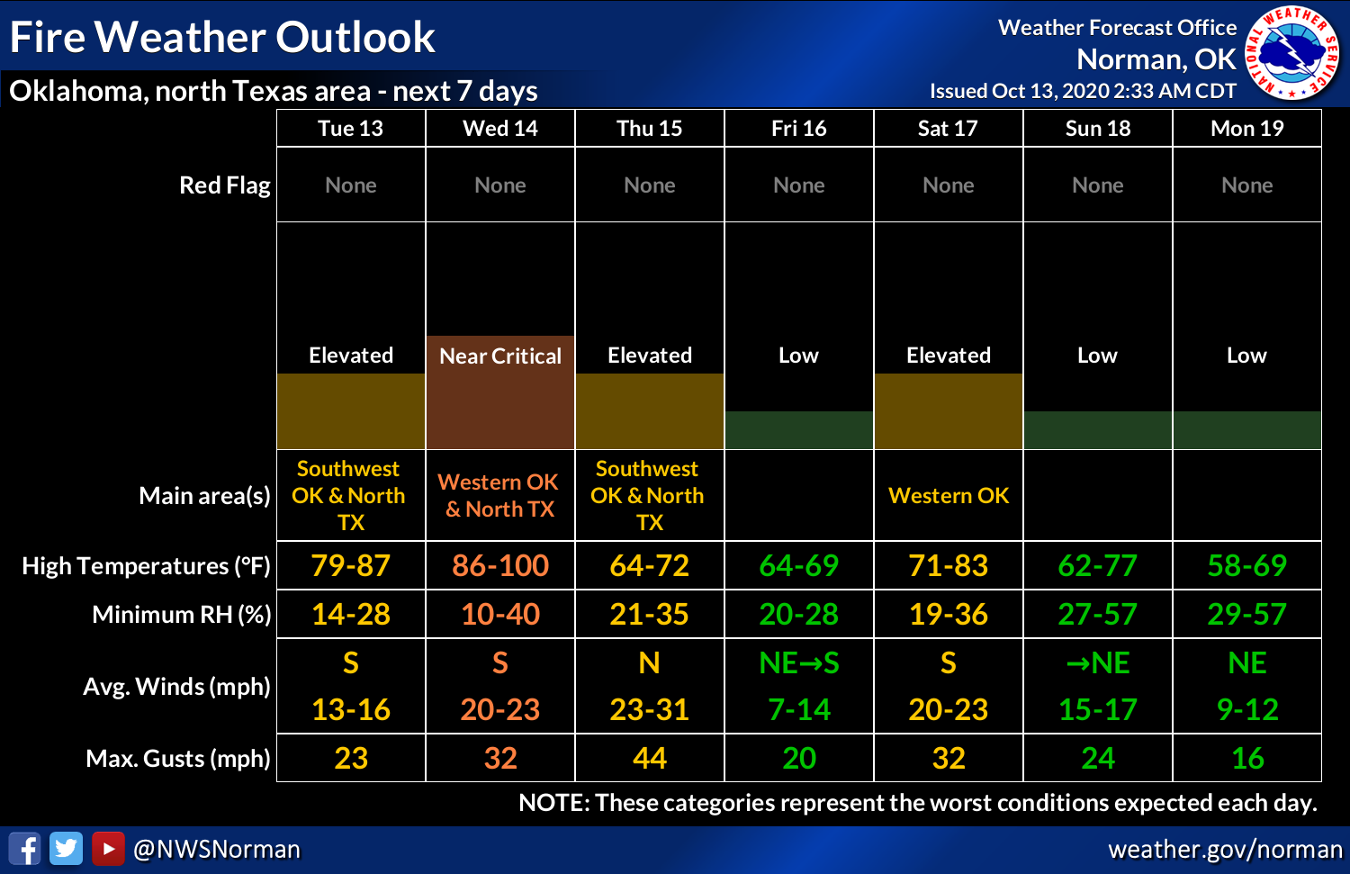
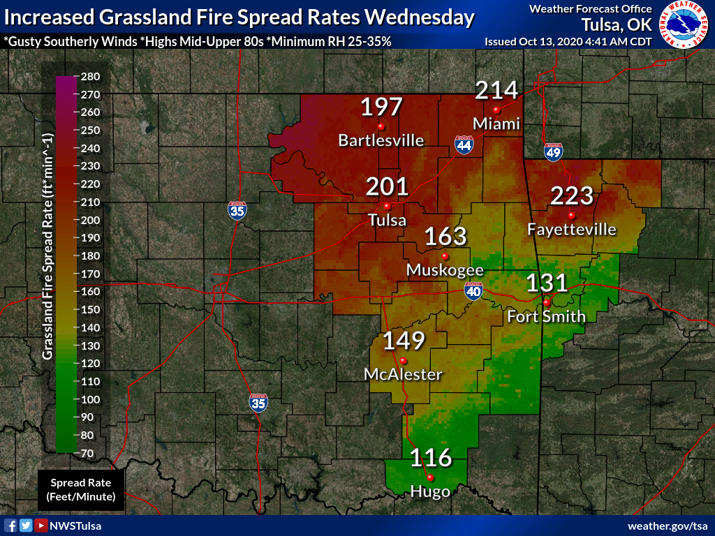
Still a few days away from the latest 100 on record in Oklahoma, but a nice
last gasp for those of us dreading the cold weather. Unfortunately, it comes at
a cost in increased fire danger.
It's 2020...anything is possible (except an earliest freeze record).
Gary McManus
State Climatologist
Oklahoma Mesonet
Oklahoma Climatological Survey
(405) 325-2253
gmcmanus@mesonet.org
October 13 in Mesonet History
| Record | Value | Station | Year |
|---|---|---|---|
| Maximum Temperature | 93°F | FREE | 2015 |
| Minimum Temperature | 24°F | KENT | 2019 |
| Maximum Rainfall | 4.60 inches | OILT | 2012 |
Mesonet records begin in 1994.
Search by Date
If you're a bit off, don't worry, because just like horseshoes, “almost” counts on the Ticker website!