Ticker for August 13, 2012
MESONET TICKER ... MESONET TICKER ... MESONET TICKER ... MESONET TICKER ...
August 13, 2012 August 13, 2012 August 13, 2012 August 13, 2012
Drought relief is a process
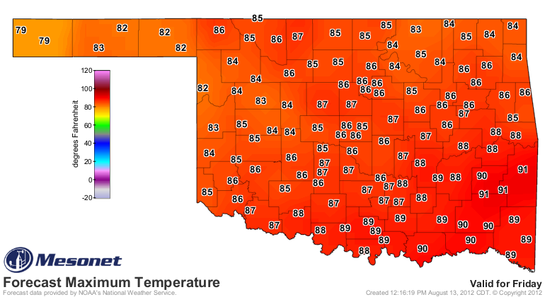
Are you like me ... whoa whoa whoa, let me finish (you were a bit quick and loud
with the "NO" there, weren't ya?). Okay, again, are you like me and awaiting the
forecast highs in the 80s like a kid awaits Christmas? Friday's forecast looks
especially awesome!
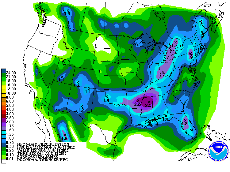
More importantly, there is moisture in the offing over the next few days. This
5-day rainfall total forecast is now dated since it came out early this morning,
but even it shows 1-2 inches in parts of the state. Let's hope that stays that
way (or even increases) when the new one comes out tonight. A front in August
can unload a ton of rain over a short period of time in localized areas.
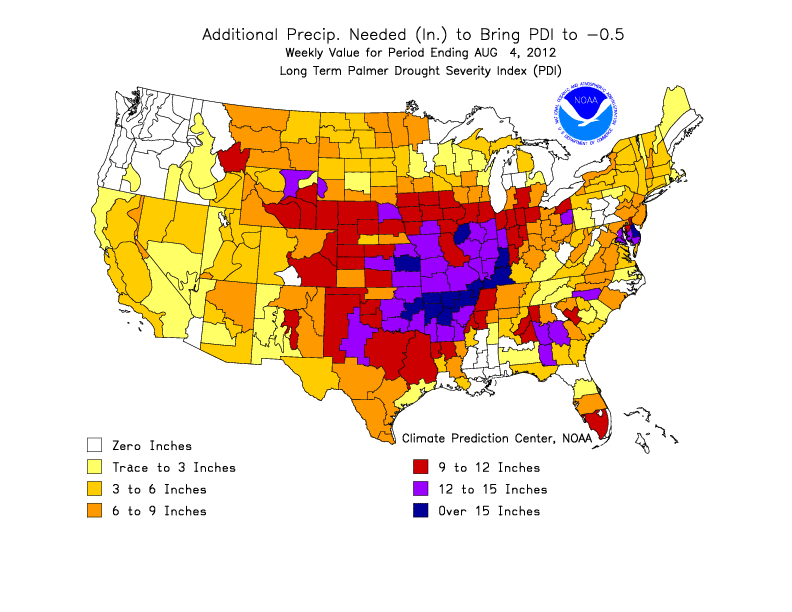
So will this rainfall help the drought? Most certainly! Will it end the drought?
Probably not. As we showed last week, we do need lots of rainfall to actually
end the drought (at least according to one drought index).
So this rain could help saturate some topsoils and the mid-depth soils. A
fortifying rainfall in a week could add to that, soak down farther to the deeper
soils and even create some runoff for ponds and lakes. Each succeeding rainfall,
if frequent enough and in the absence of extreme temperatures (COME ON, FALL!),
will further ding the drought. The fact this rain will be falling with highs
in the 80s afterwards is extremely beneficial.
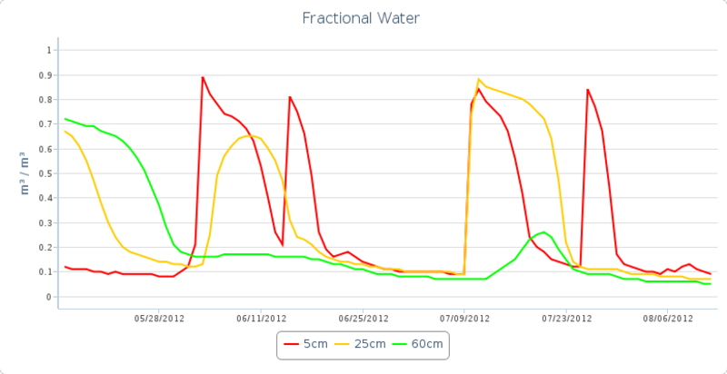
But let me show you what singular rainfalls do. Here's the soil moisture time
series from our Stuart Mesonet site in Pittsburg County.
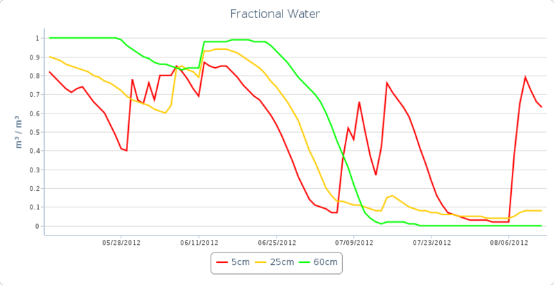
They began with a decent soil moisture profile at all levels about 90 days ago
with a few ups and downs, but then a sharp decline through June. Light-to-moderate
rains a few times during July kick the 5cm (red line) soil moisture up for a
bit, with a small upwards tick in the 25cm (gold line). The rain had very
little effect on the lower depth of 60cm (green line). Another rain in August
had the same effect.
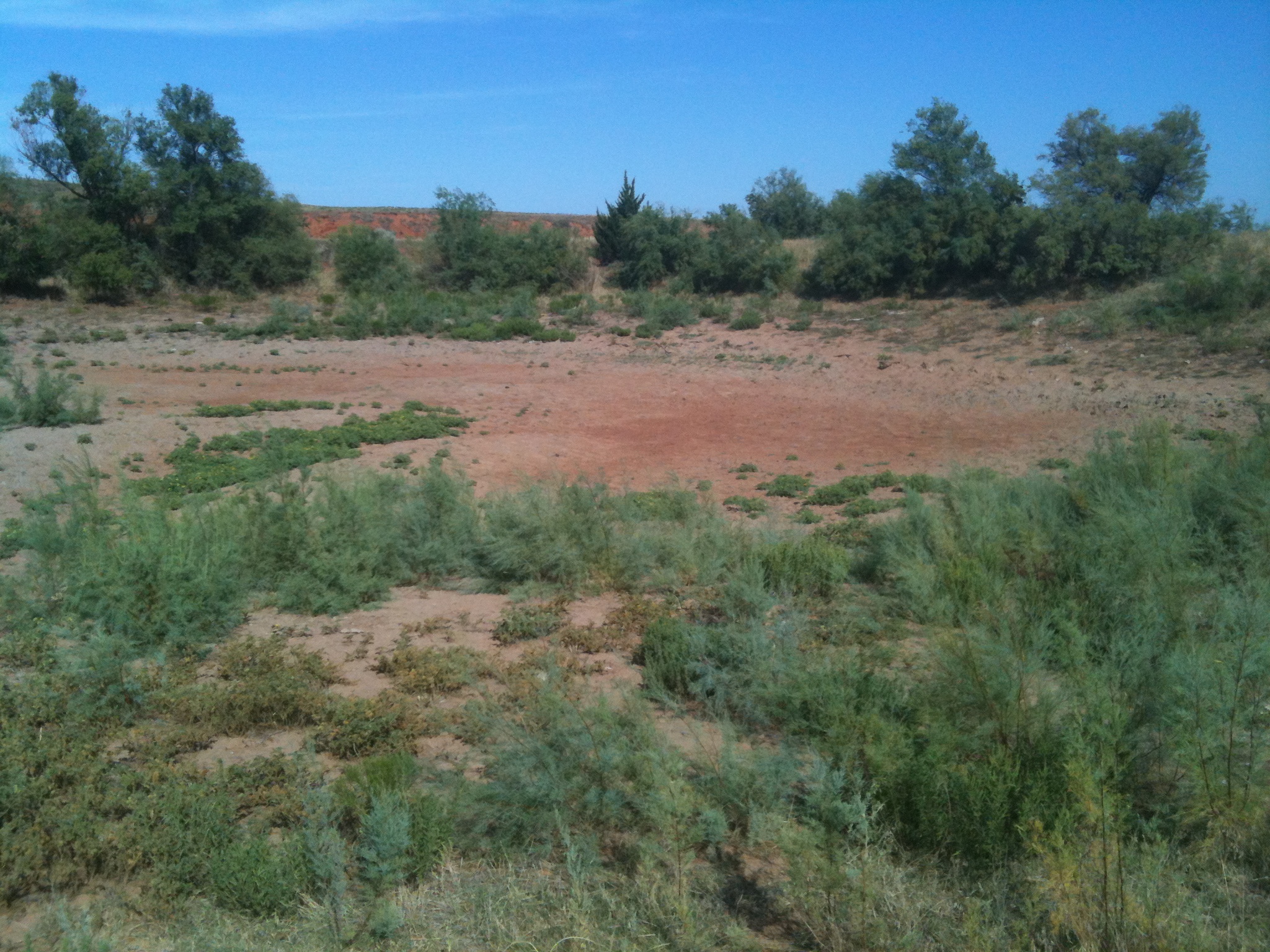
Another good example of this would be from Buffalo (best place in Universe).
Each rainfall is noted on the 5cm curve with an accompanying bump-up a couple
of times in the 25cm curve. Very little impact on the lowest level at 60cm.
These were not wimpy rains for summer, either. That was an inch in early June,
0.6" in mid-June, a 2-inch rain in mid-July and 0.9" in late July. The problem
was (other than they were not enough) they came too far apart and had to battle
too much sun, wind and heat. All that rain (5.4" since June 1) and the final
result is still this, a very desolate and dry fishing hole.
So why wait? Let the process begin!
Gary McManus
Associate State Climatologist
Oklahoma Climatological Survey
(405) 325-2253
gmcmanus@mesonet.org
August 13 in Mesonet History
| Record | Value | Station | Year |
|---|---|---|---|
| Maximum Temperature | 110°F | GRA2 | 2023 |
| Minimum Temperature | 48°F | MIAM | 2004 |
| Maximum Rainfall | 5.89 inches | SALL | 2017 |
Mesonet records begin in 1994.
Search by Date
If you're a bit off, don't worry, because just like horseshoes, “almost” counts on the Ticker website!