Ticker for June 13, 2024
MESONET TICKER ... MESONET TICKER ... MESONET TICKER ... MESONET TICKER ...
June 13, 2024 June 13, 2024 June 13, 2024 June 13, 2024
Gary Ohio Rizz
Yes, this is our attempt to be cool, on a day where it will be pretty darned hard
to be cool. Heck, I was just getting the bare ability to decipher Gen Z-speak,
then this Gen Alpha stuff comes along. I knew something was up when my teenagers
kept trying to get me to say "Skibidi Toilet Rizz."
Ha! I'm too smart for that...they're not gonna get me to look faux hip to them.
No, I'm just gonna blast it out there for tends of thousands of folks to see.
Who's smart now, huh? HUH?
BTW, from what I understand, Upgraded Titan TV Man is the GOAT.
If you have no clue about all of the above...join the club.
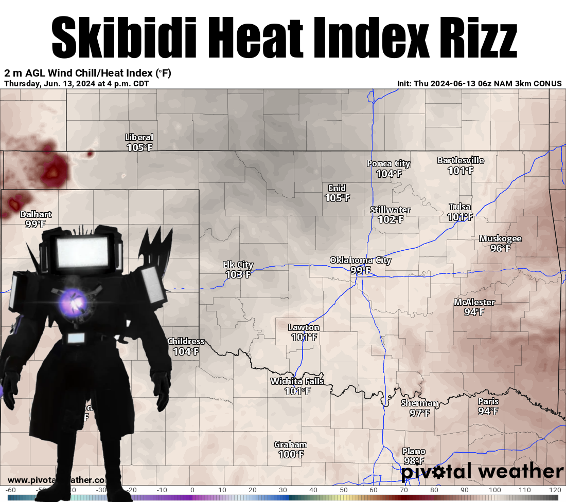
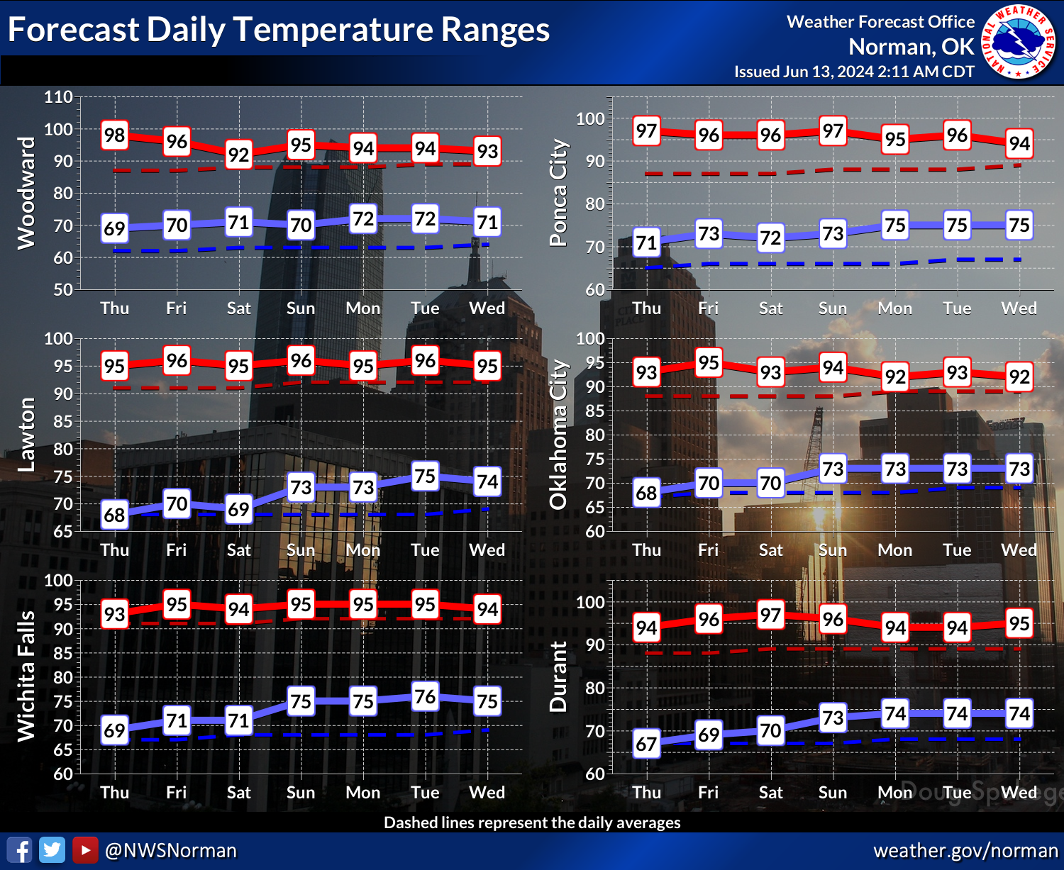
Well...whatever. The real summer heat starts anew today after a somewhat hottish
day yesterday (If it isn't hottish, IT'S CRAP!).
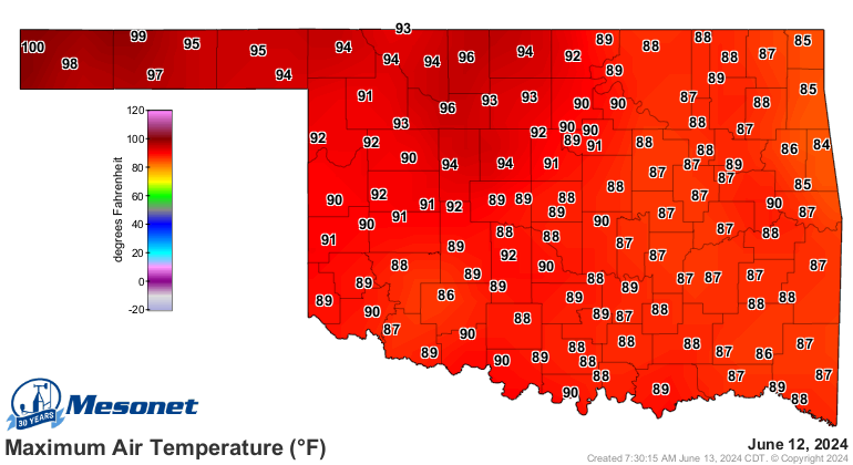
So our current heat streak is just getting started, really.
But here it comes anyway. Expect well above normal temps for awhile, with slight
disturbances upwards in the heat index. Average highs this time of year are in
the mid-80s, after all.
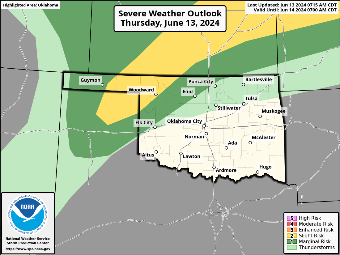
With all this heat and humidity, some storms can be expected along the periphery
of the heat dome up in NW OK, with mainly a hail and wind threat. Certainly not
welcome for those folks waiting to harvest wheat, but the rain might come in
handy later on. NW OK is the main area expecting rain over the next week as well.
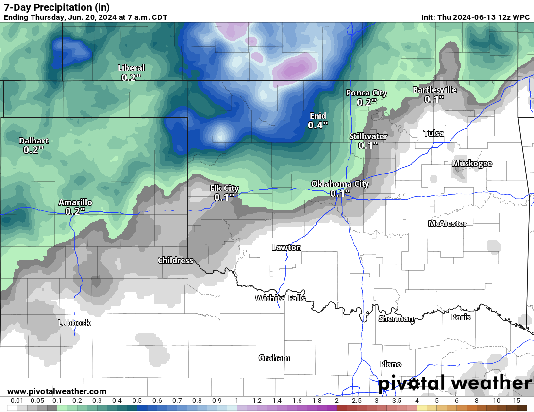
That rain might come in handy because that's also the area where drought is
persisting, but we have seen some spread to west central OK as well.
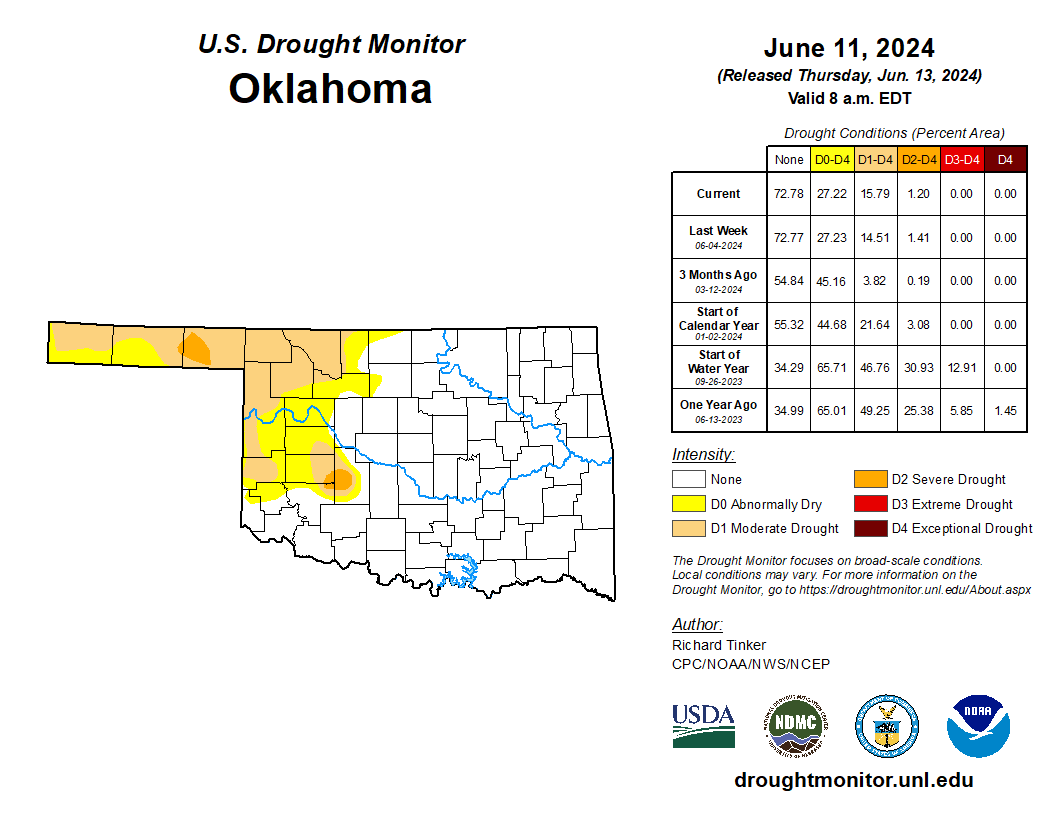
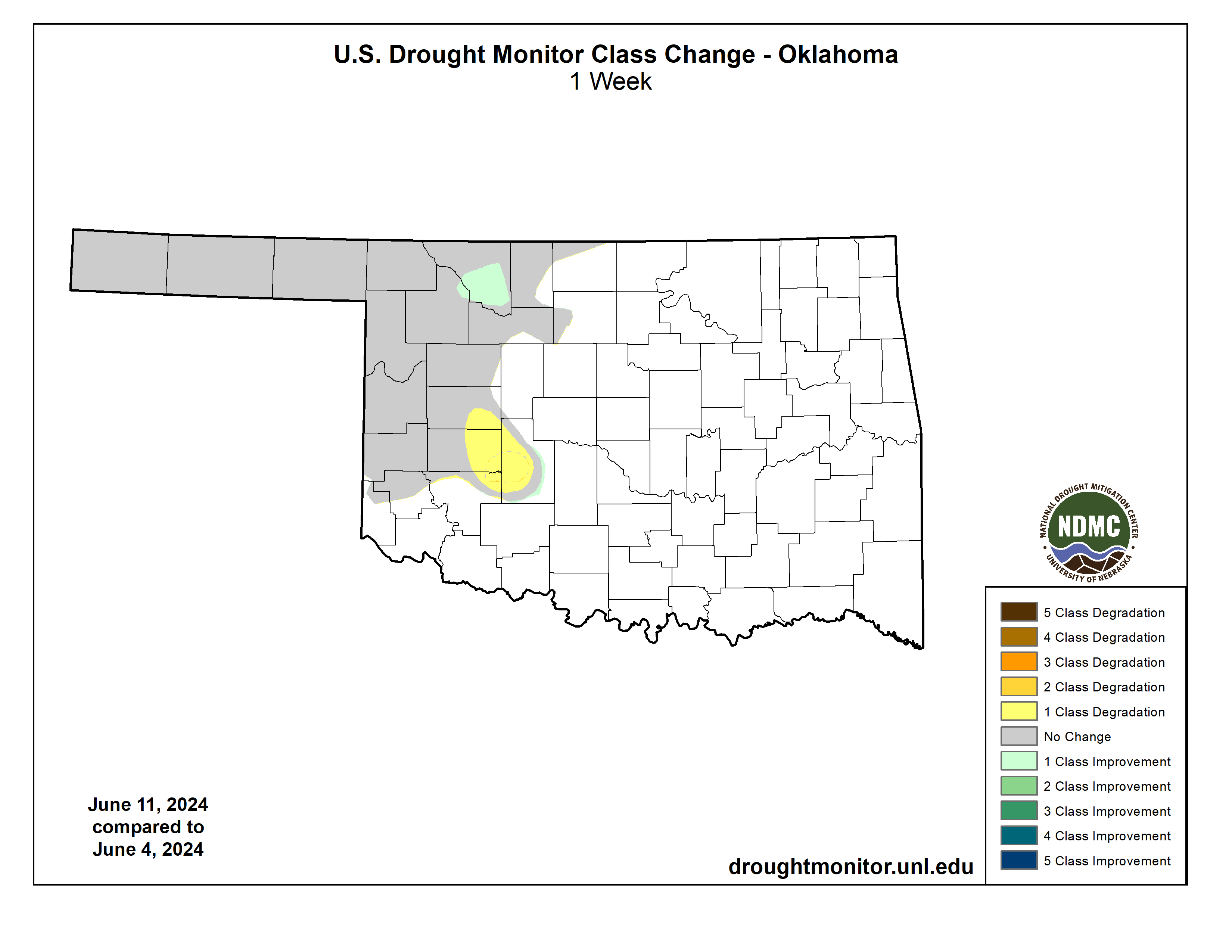
But with drought already in place across northern and western Oklahoma (what
some folks would call "Northwestern Oklahoma"...ahem!), this switchover to
summer places that region in a bit of a precarious footing. Heat and drought
tend to work together, so something we'll need to watch.
This is me watching...okay, not watching, back to writing.
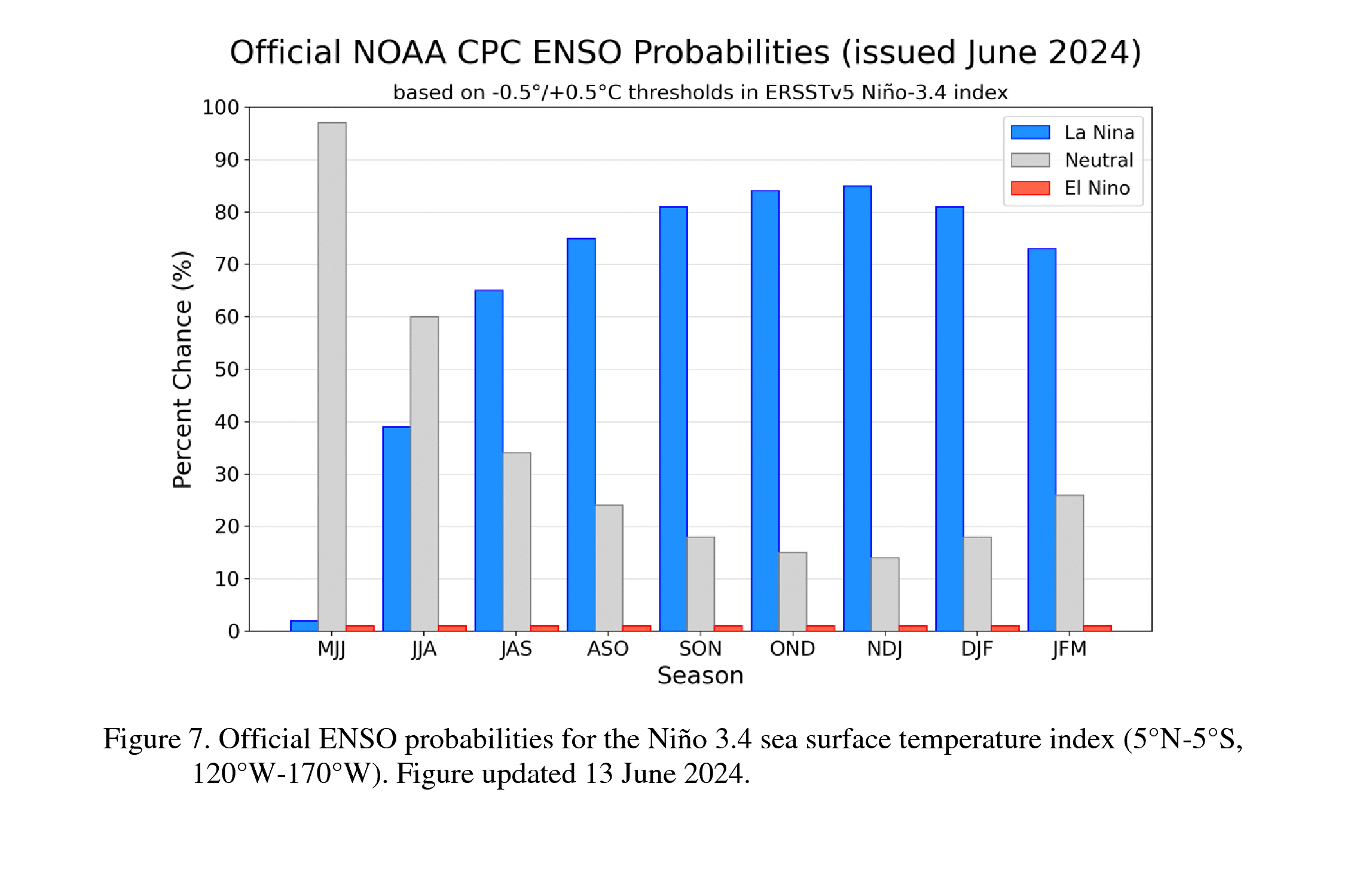
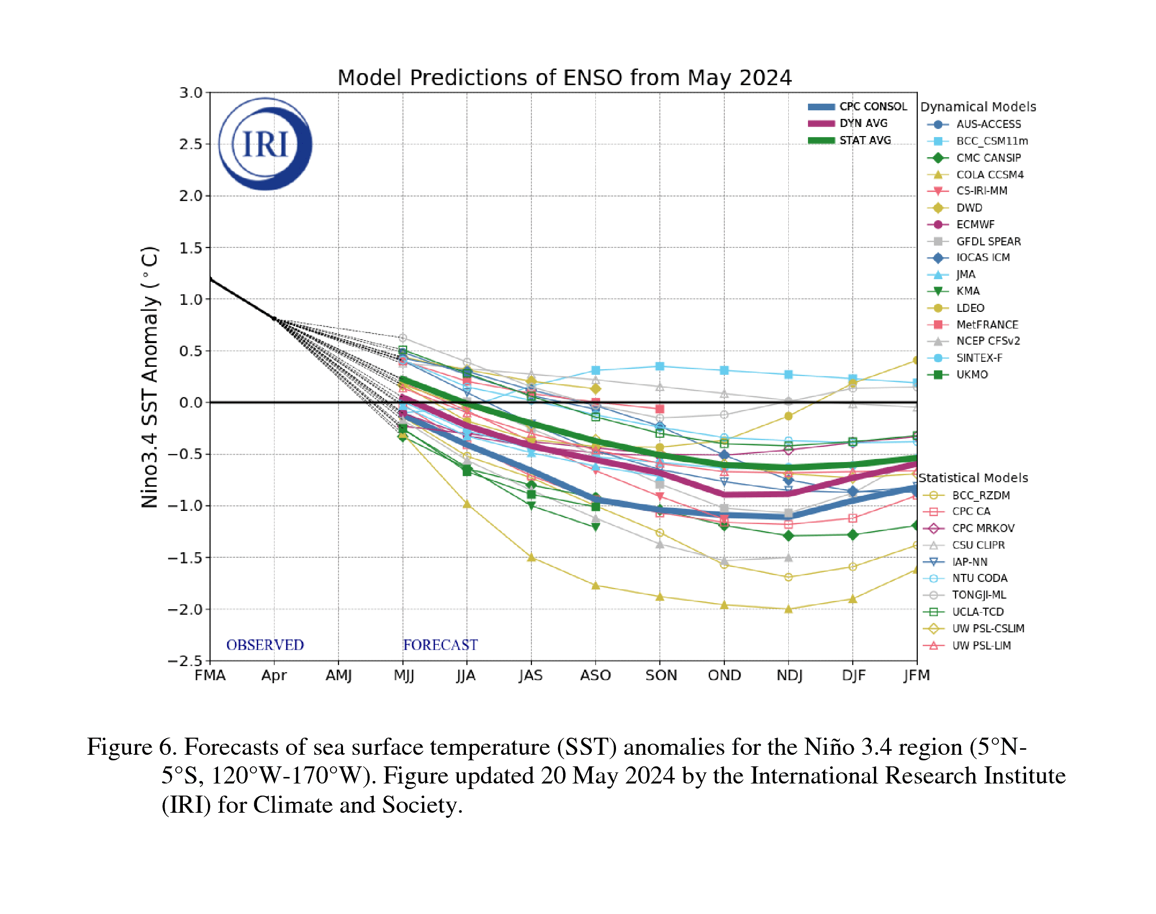
And then we'll need to WATCH those Equatorial Pacific waters, because we're now
in ENSO-Neutral conditions, and La Nina is expected to develop as we go further
into summer and the fall.
Ding-Dong, El Nino is dead.
Remember, La Nina (or El Nino) doesn't really impact us here during the summer
months. ENSO impacts us through changes in the jet stream, and the jet stream
retreats far to the North during the summer months as the temperature differences
between the Arctic region and the sub- and extra-tropical regions diminish (i.e.,
those temperature differences are actually responsible for the jet streams'
existence). In other words, if ENSO impacts us through changes it causes to the
jet stream, and there is no jet stream in our area to impact...it shouldn't
impact us.
So keep that in mind, drought chances will be increased if and when that La Nina
forms in the equatorial pacific waters AND atmosphere (ENSO is a atmospheric-
oceanic coupled system). Drought is certainly not guaranteed, of course, but
La Ninas have famously been drought starters in Oklahoma over the last few
decades.
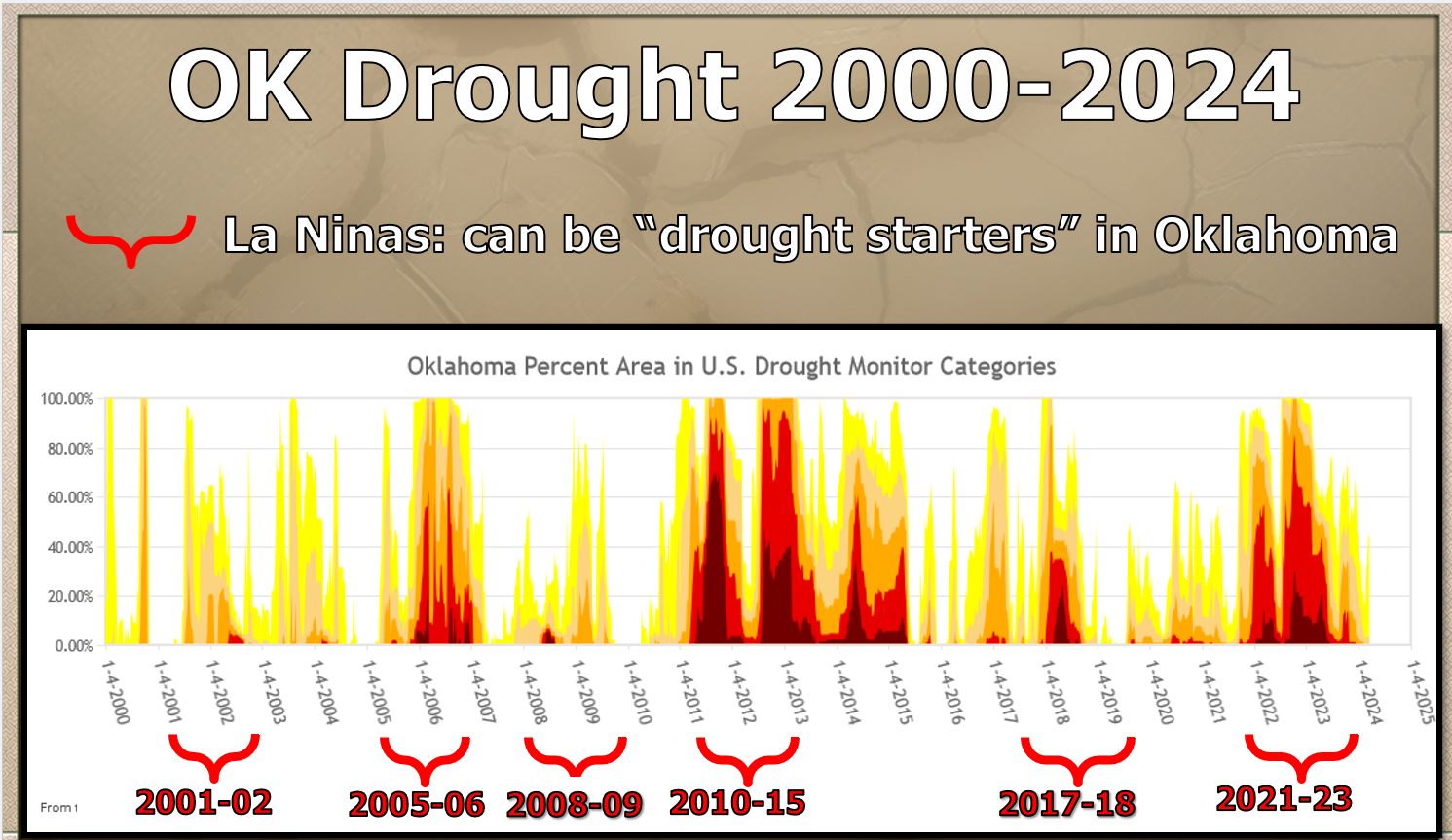
Certainly not the only way we see drought in Oklahoma, but it can "seed the
ground" for drought development. And remember also too...the strength of the
La Nina matters as well. The stronger the La Nina, the more likely the impact.
Just something to keep in mind.
BOOM! Skibidi that, Alphas!
Gary McManus
State Climatologist
Oklahoma Mesonet
Oklahoma Climatological Survey
gmcmanus@ou.edu
June 13 in Mesonet History
| Record | Value | Station | Year |
|---|---|---|---|
| Maximum Temperature | 110°F | BUFF | 2011 |
| Minimum Temperature | 47°F | BOIS | 2005 |
| Maximum Rainfall | 4.15 inches | HOBA | 2007 |
Mesonet records begin in 1994.
Search by Date
If you're a bit off, don't worry, because just like horseshoes, “almost” counts on the Ticker website!