Ticker for October 12, 2023
MESONET TICKER ... MESONET TICKER ... MESONET TICKER ... MESONET TICKER ...
October 12, 2023 October 12, 2023 October 12, 2023 October 12, 2023
Hold the beans
Hey, you didn't even know you were missing it, did ya? NO, no hemorrhoids. The
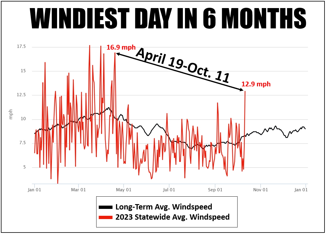
Oklahoma wind! I remember back in May one of my neighbors (one that will still
talk to me...like having a full-size statue of Ernest Borgnine in your yard
should be considered offensive!) asked me "where's all the wind??" Darned if he
wasn't right. We have had a distinct lack of wind since mid-spring. Take a look
at another graph that shows it a bit better. Here we see the departure from the
long-term average windspeed for 2023 thus far. Look at all the color BELOW the
long-term average line.
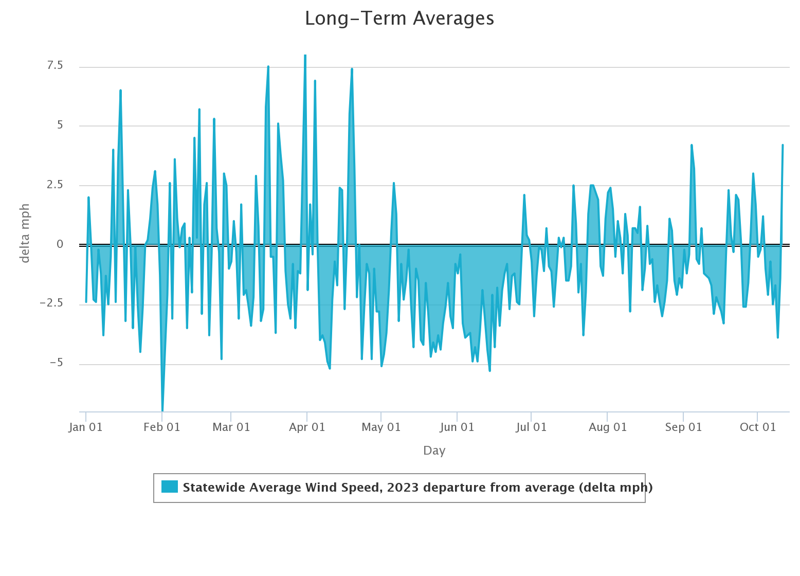
That's a really below-average windy spring we had there, and that carried
through much of the summer. Then, as if the entire state ate Taco Bell for lunch,
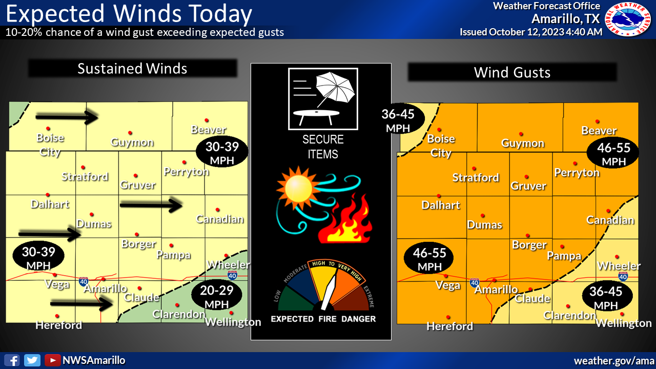
the wind came blasting back yesterday. And it will be here again today, with
widespread gusts of 25-35 mph, but up to 50 mph in northern OK.

Okay, it might not be a toot-factor...we normally see our winds kick back up
in the fall as the jet stream starts meandering back our way and we start to
see more cold fronts and storm systems, as shown by the black line on that top
graph. Unfortunately, today's storm system is mostly dry, given the lack of
available moisture for it to work with. That means fire danger will be up
across western OK, especially those areas that are still plagued by drought
(experts will tell ya that a drought of plague is much better).
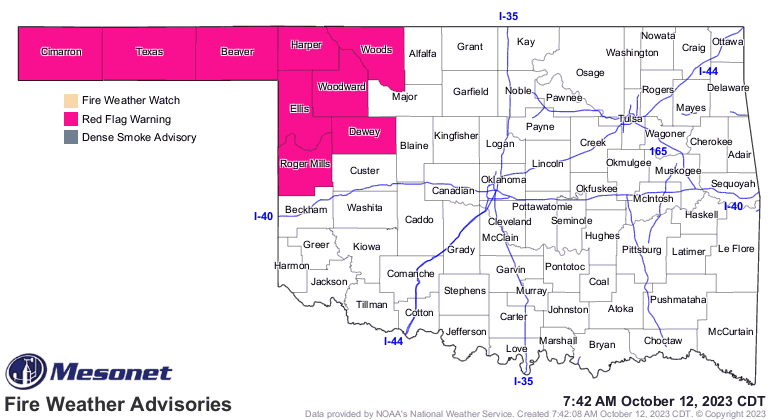
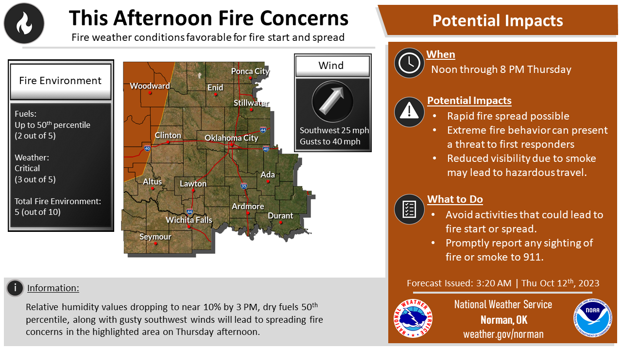
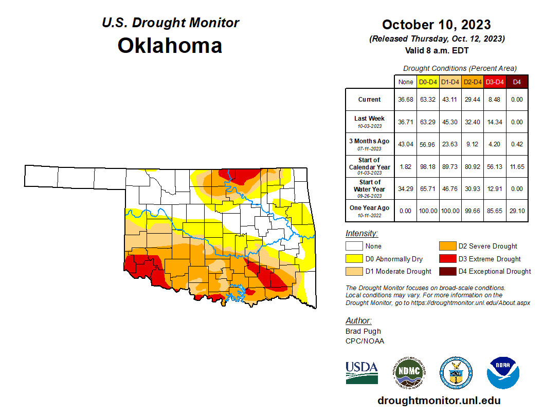
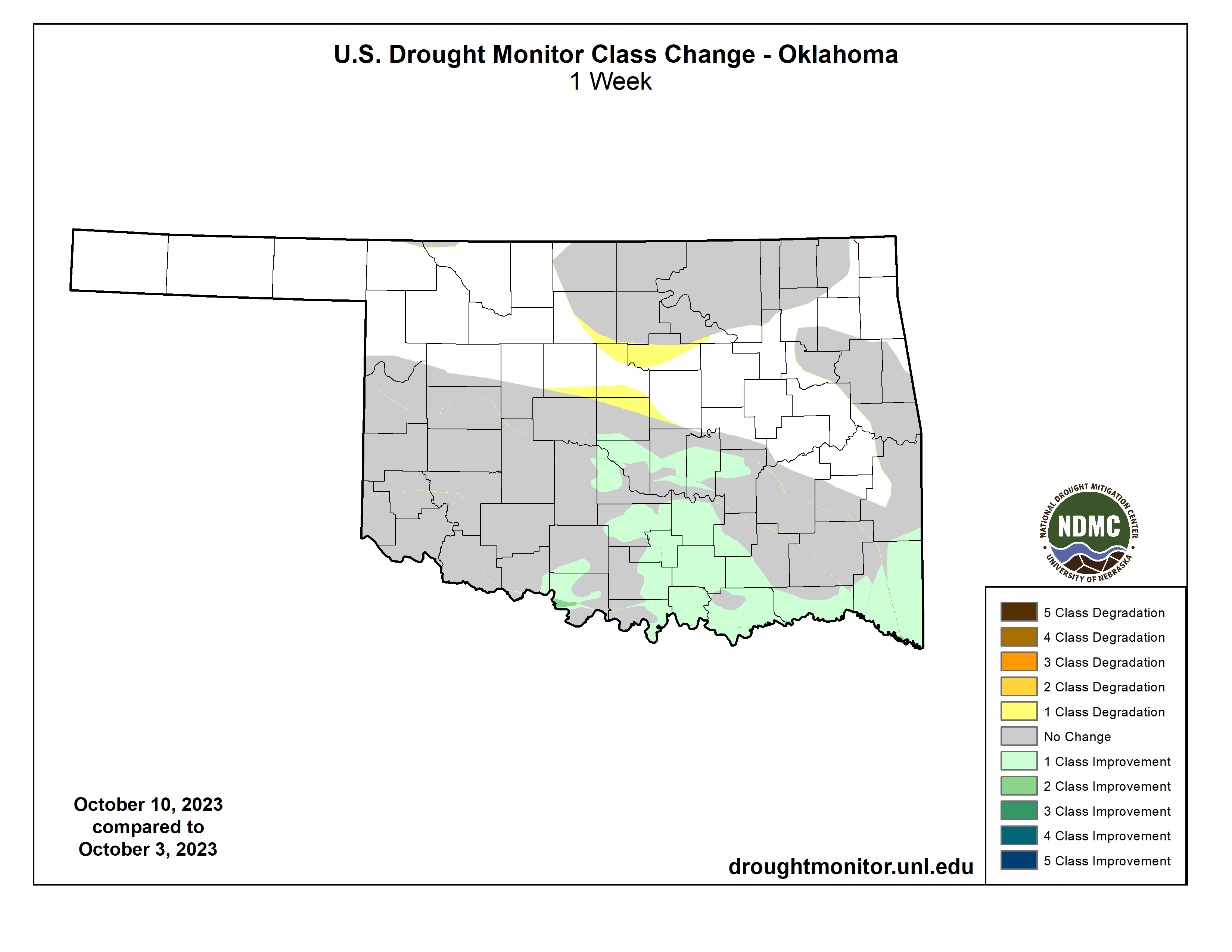
Rains in the last 10 days have provided improvements across southern OK, but
drought is starting to try and spread in northern OK once again.
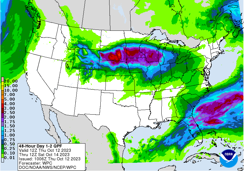
Very low chance of rain today with maybe a few marginally severe storms, so
don't get your hopes up (it's easy...same thing I remind myself every morning
when I look in the mirror).
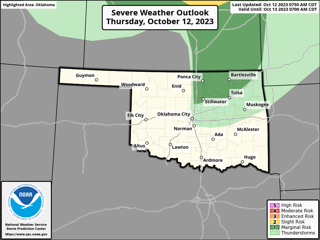
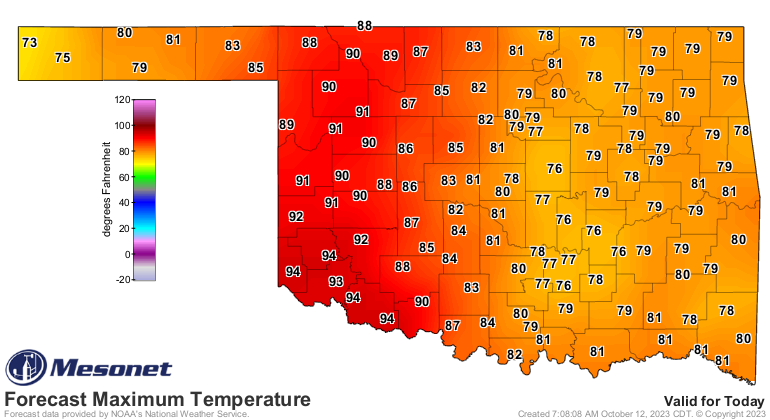
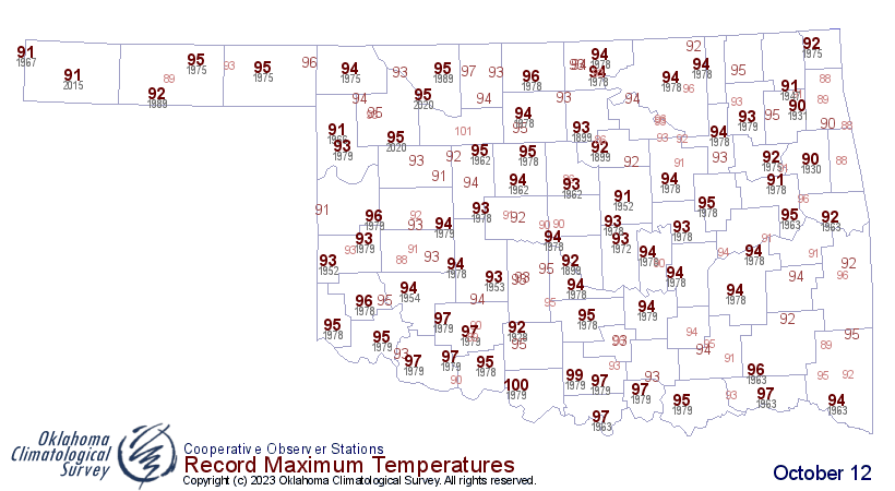
Hey, how about one last burst (and we all know just how painful that can be)
of summer? We could see record highs today across western OK ahead of that
cold front in the dry air behind a dryline.
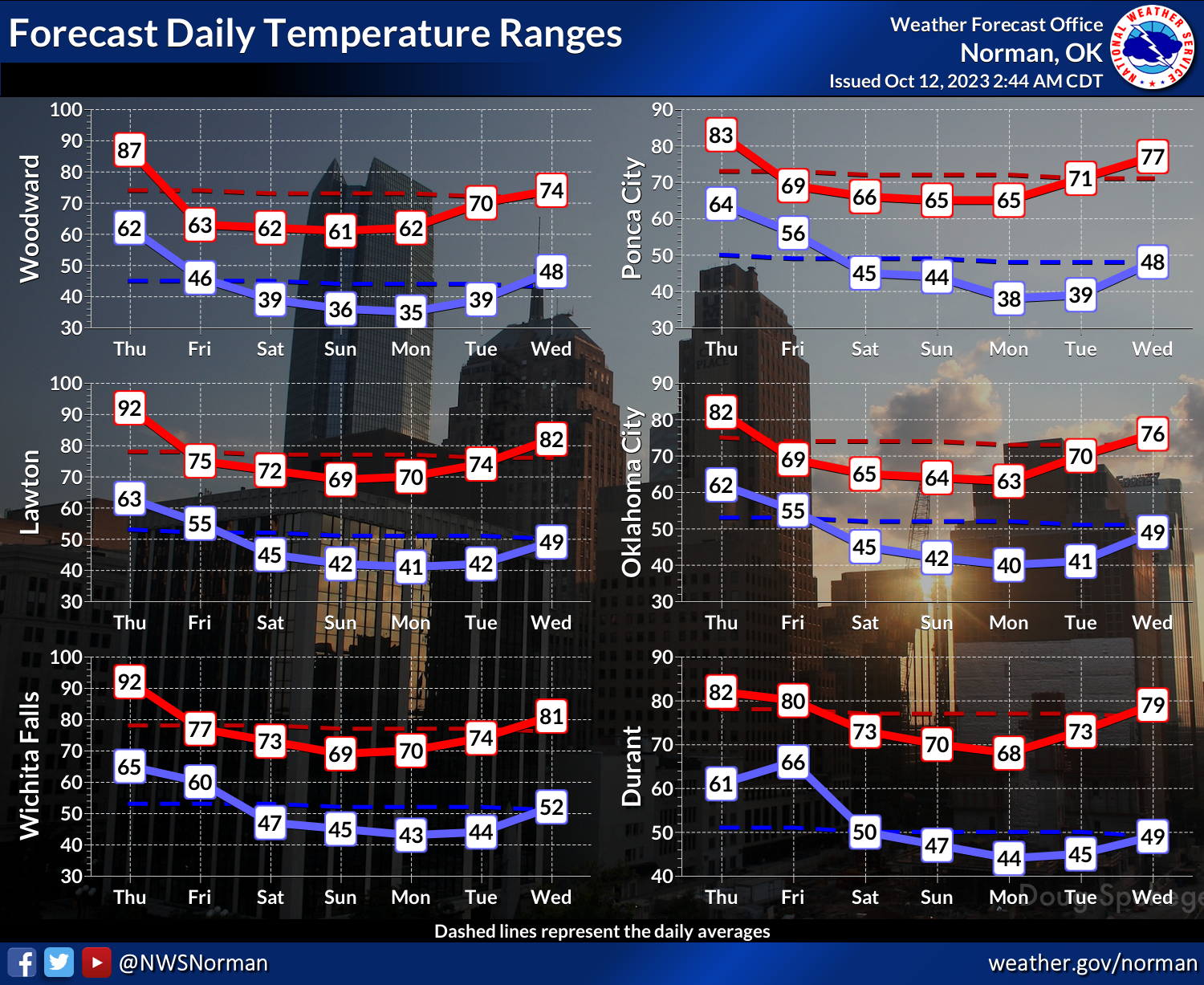
Back to fall, though.
Gary McManus
State Climatologist
Oklahoma Mesonet
Oklahoma Climatological Survey
gmcmanus@mesonet.org
October 12 in Mesonet History
| Record | Value | Station | Year |
|---|---|---|---|
| Maximum Temperature | 99°F | MANG | 2024 |
| Minimum Temperature | 23°F | EVAX | 2019 |
| Maximum Rainfall | 2.92 inches | MIAM | 2016 |
Mesonet records begin in 1994.
Search by Date
If you're a bit off, don't worry, because just like horseshoes, “almost” counts on the Ticker website!